Extreme Critical Fire Risk in Colorado Friday

As wind intensifies once again across the Front Range with a dry, downsloping wind, fire weather conditions have dramatically increased. In fact, the Storm Prediction Center has issued a somewhat rare Critical Fire Risk from Boulder to Cheyenne (above).
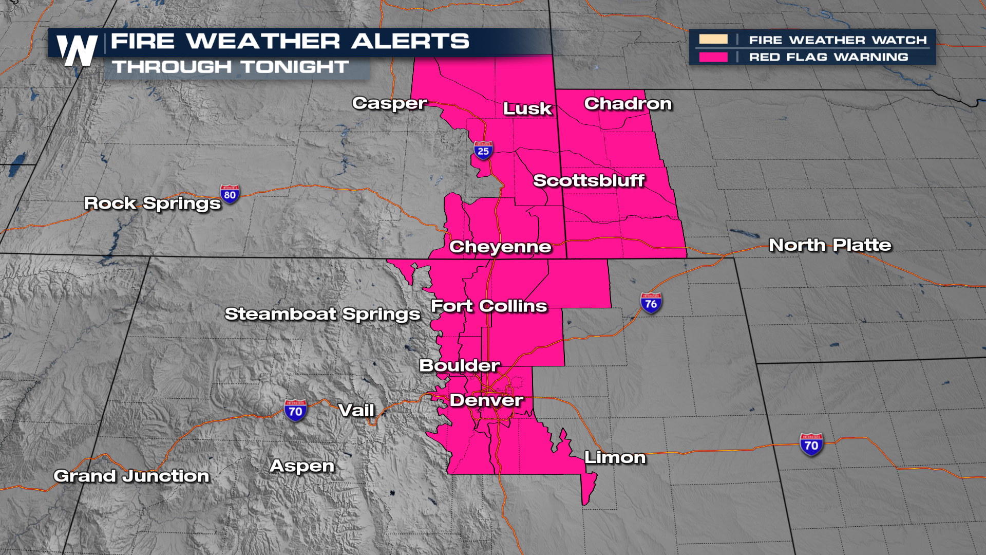
Red Flag Warnings will remain in place across the Denver metro area, northward into the High Plains of Wyoming, for the rest of the night.
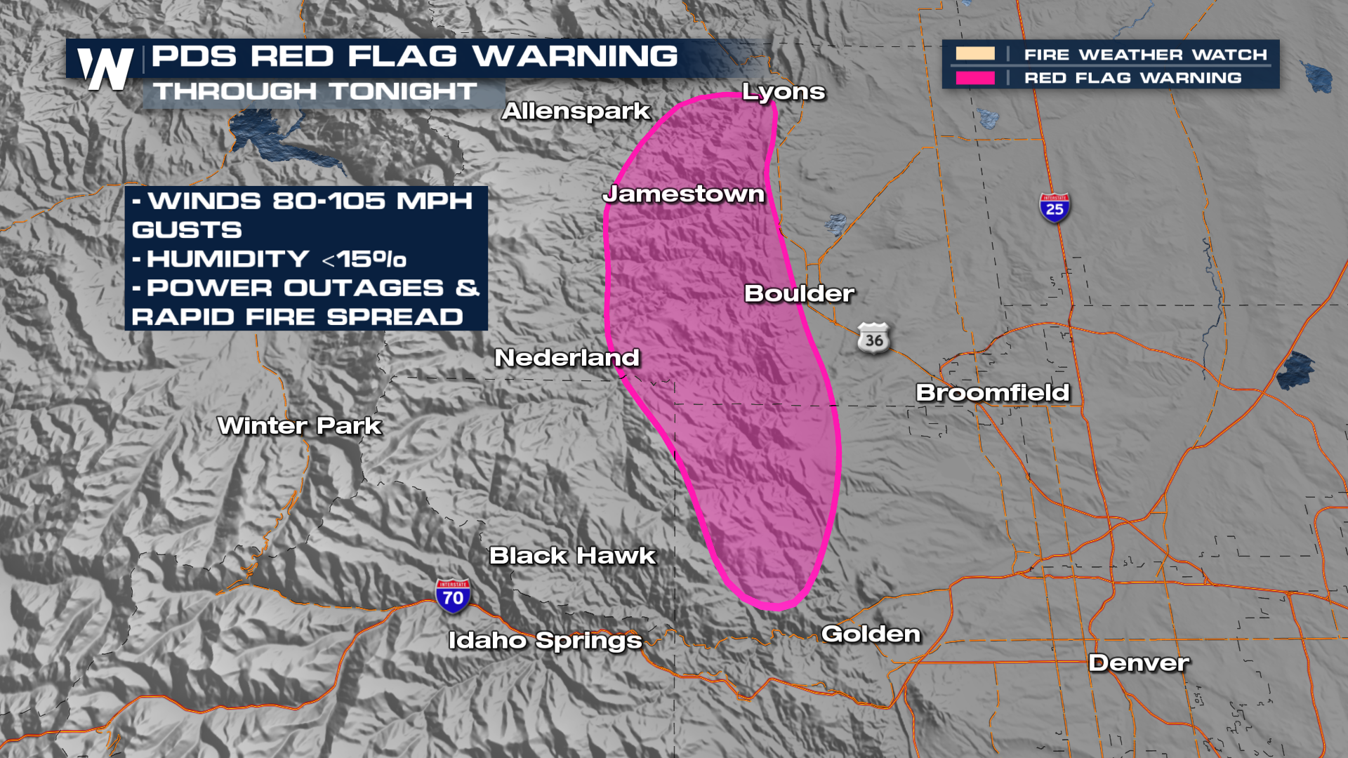
In addition, within the Red Flag Warning is a higher-end, PDS (Particularly Dangerous Situation) Warning. Here, to the west of a line from Golden to Boulder to Lyons, wind gusts could exceed 100mph! With down-sloping winds, relative humidity will be low, possibly dropping into the single digits at times.
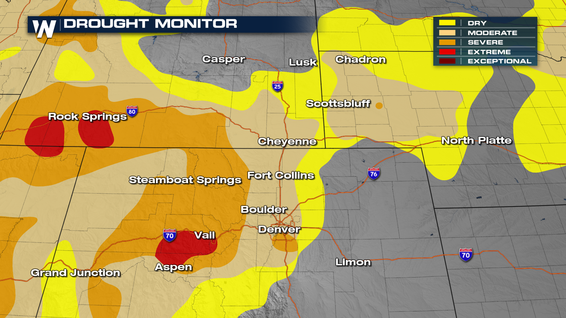
Enhancing the wildfire potential is the amount of fuel. The Front Range of northern Colorado into Wyoming has been very dry as of late. A Moderate to Severe Drought remains highlighted across the entire Red Flag Warning area.


