Eyes on the Gulf for Potential Tropical Development

For the first time in a long time, we've got an area of tropical development to watch in the Atlantic basin. Specifically, out in the Gulf. These always catch our eye, as any system that forms in the Gulf has a high chance of making impact to land.
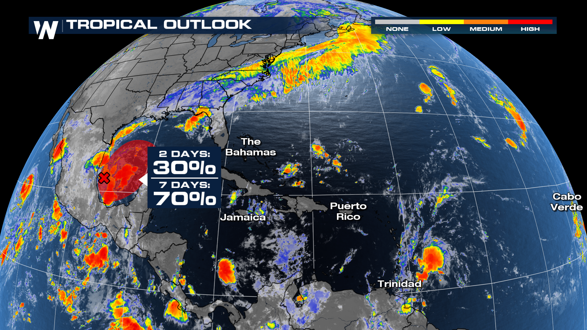
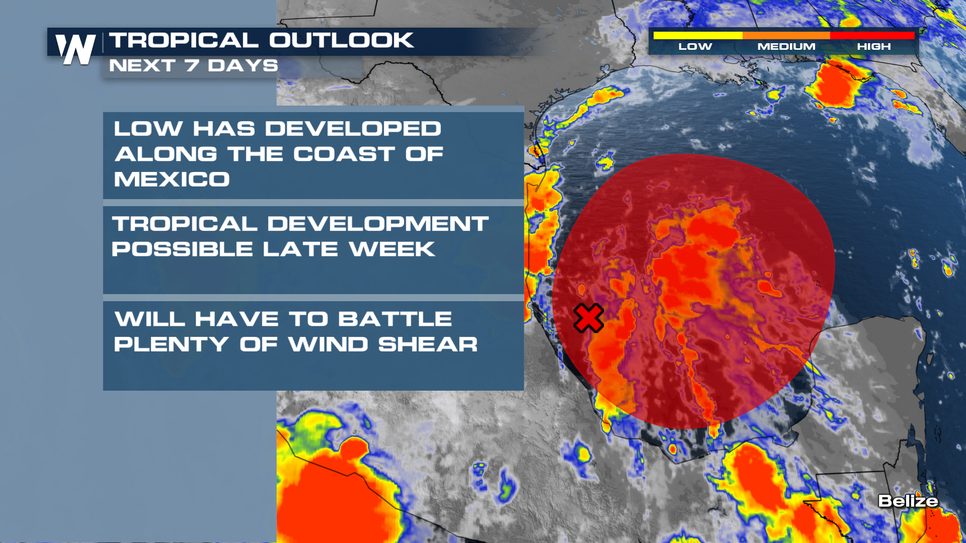
With regards to timing, the National Hurricane Center forecasts this tropical system forming later this workweek. Chances for development into the next few days are low. This system will also have to fight through a TON of shear in the Gulf, limiting it's development.
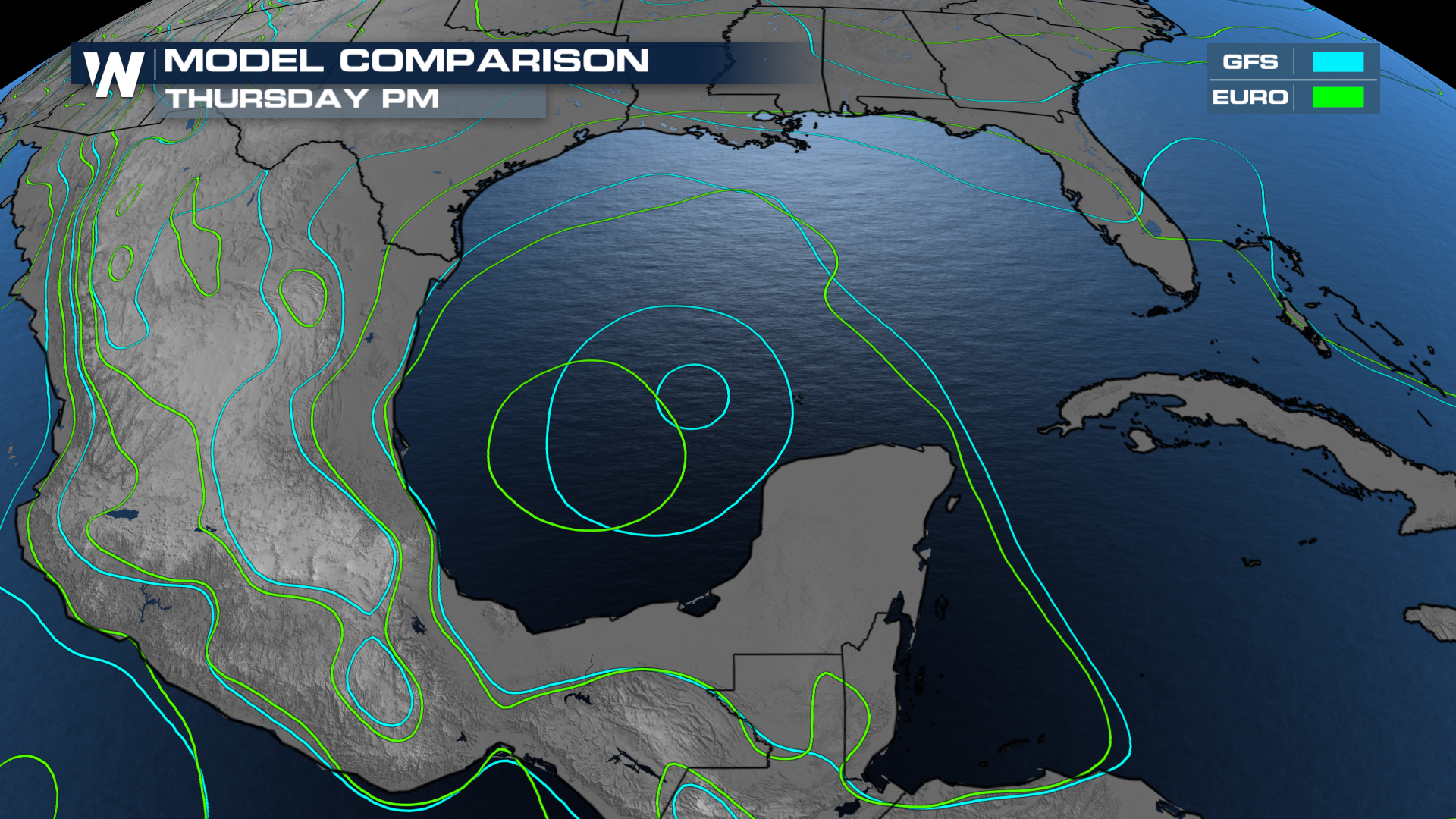
The GFS American model, has this system forming around Thursday. You can tell by the tightening of the isobars closer to the Yucatan Peninsula. The EURO European model also shows some formation. However, the GFS is a little more generous on intensity at this point in time.
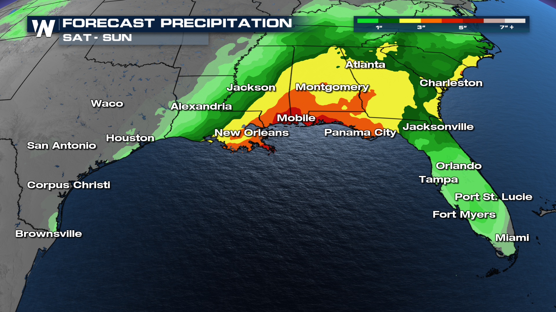
With regards to land impacts, the exact track of this potential system and it's intensity, it's far to early to tell. However, regardless of these details, we can expect heavy rain along some of these Gulf Coast states headed into the weekend!
Stay tuned to the forecast here on WeatherNation. We'll bring you the details you need, and cut out all the hype.


