Fall Fronts Spark Hail and Wind Threat

Top Stories
7 Oct 2024 2:25 AM
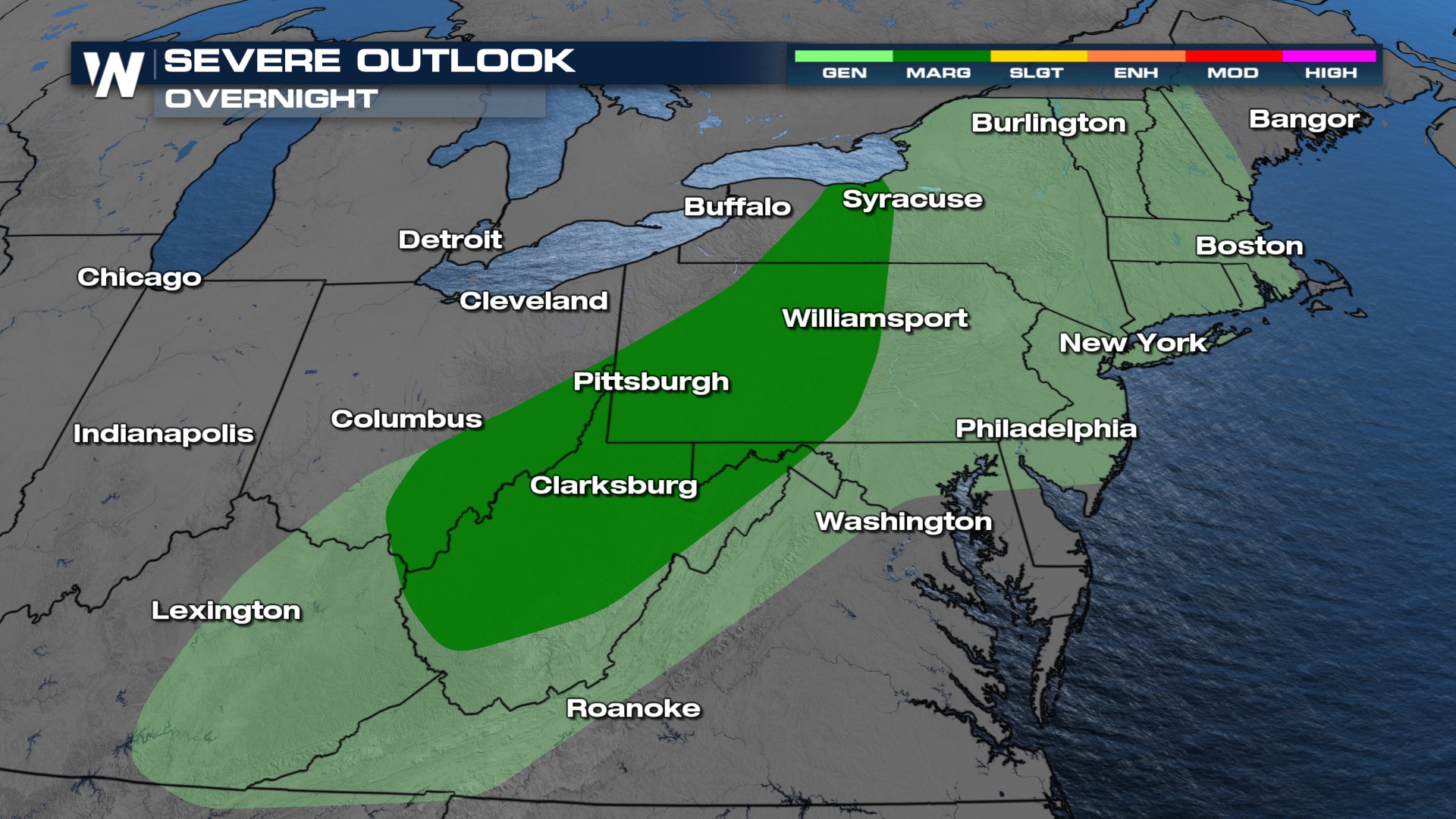
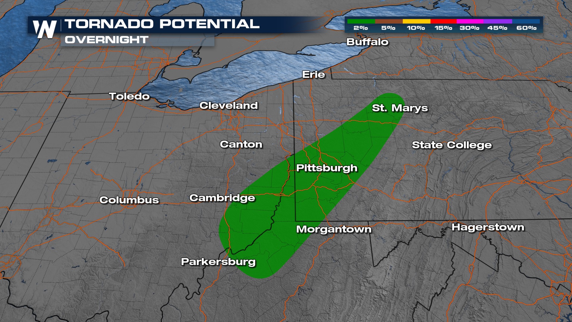
Lingering isolated severe storms are possible across the Ohio Valley and Northeast. The severe risk will be isolated overall, but a few strong storms can't be ruled out for the Monday morning commute.
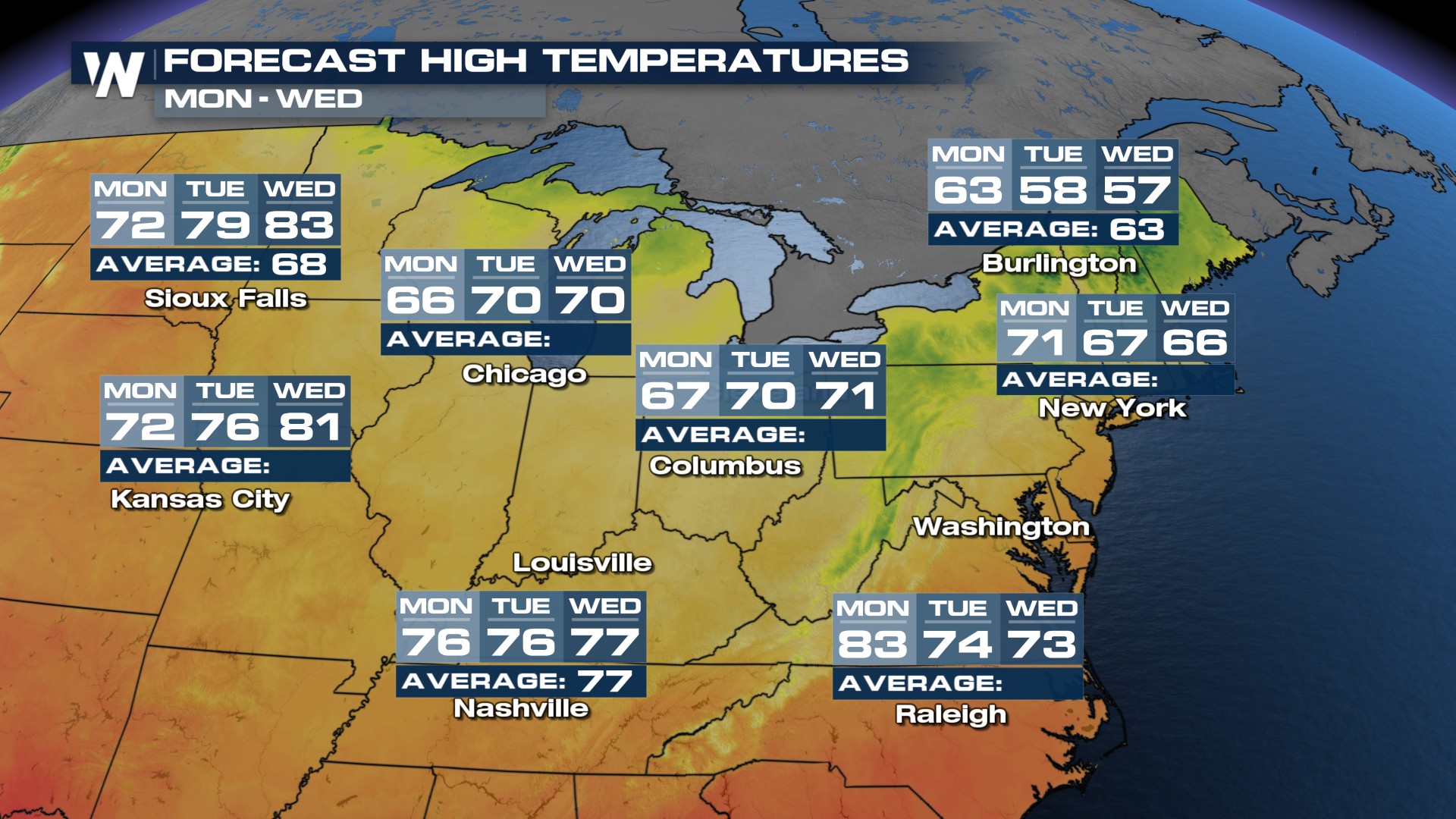
 As the cold front passes the Great Lakes it may pick up on some moisture across the region and produce rainfall and storms starting in the afternoon through nightfall.
As this cold front continues moving east, temperatures are expected to drop closer to, and in some cities slightly below, seasonable for many of us for the upcoming weekend. Notice Nashville, going from 90° today to 74° for the start of the work week!
All Weather News
More
East Gears Up for Stormy, Wet Weekend
A low pressure system crashing through the Mi
1 Aug 2026 9:15 PM


Flooding, Severe Storms Target the Midwest Again
After an active week of storms across the nor
1 Aug 2026 1:40 AM

After Reaching Category 5, Genevieve Weakens in the Pacific
PacificFausto is now a post-tropical cyclone.
31 Jul 2026 1:30 AM

Flooding Risk Increases as Heavy Rain Targets the Tri-State Area
Tuesday, heavy rainfall moved across the Nort
30 Jul 2026 12:25 AM

Severe Weather: Energy From the Midwest Now in the Southeast
UPPER MIDWEST - Through Monday, dangerous tor
29 Jul 2026 10:30 PM