Fire Danger Continues Through the Weekend Across Central States

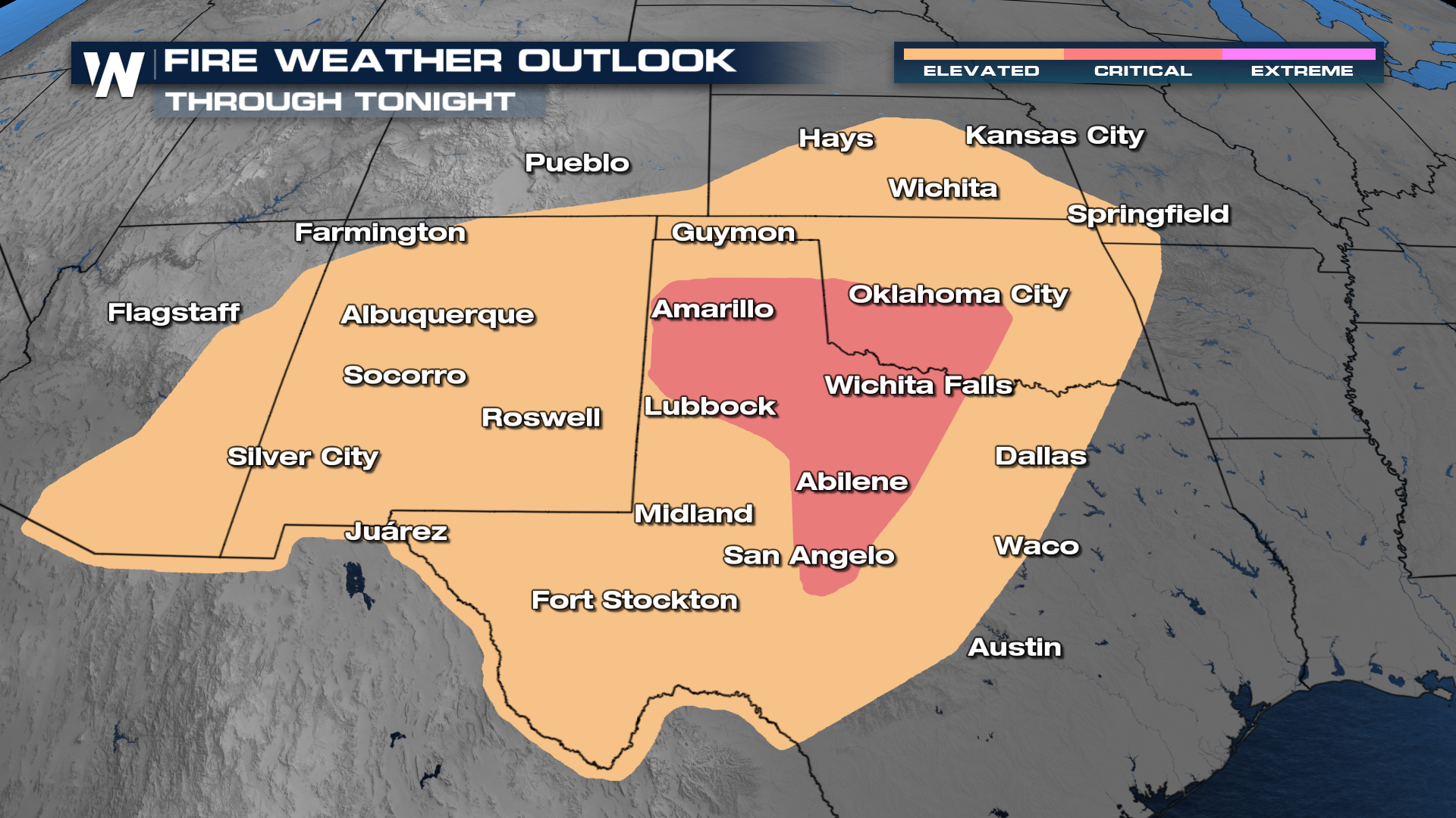
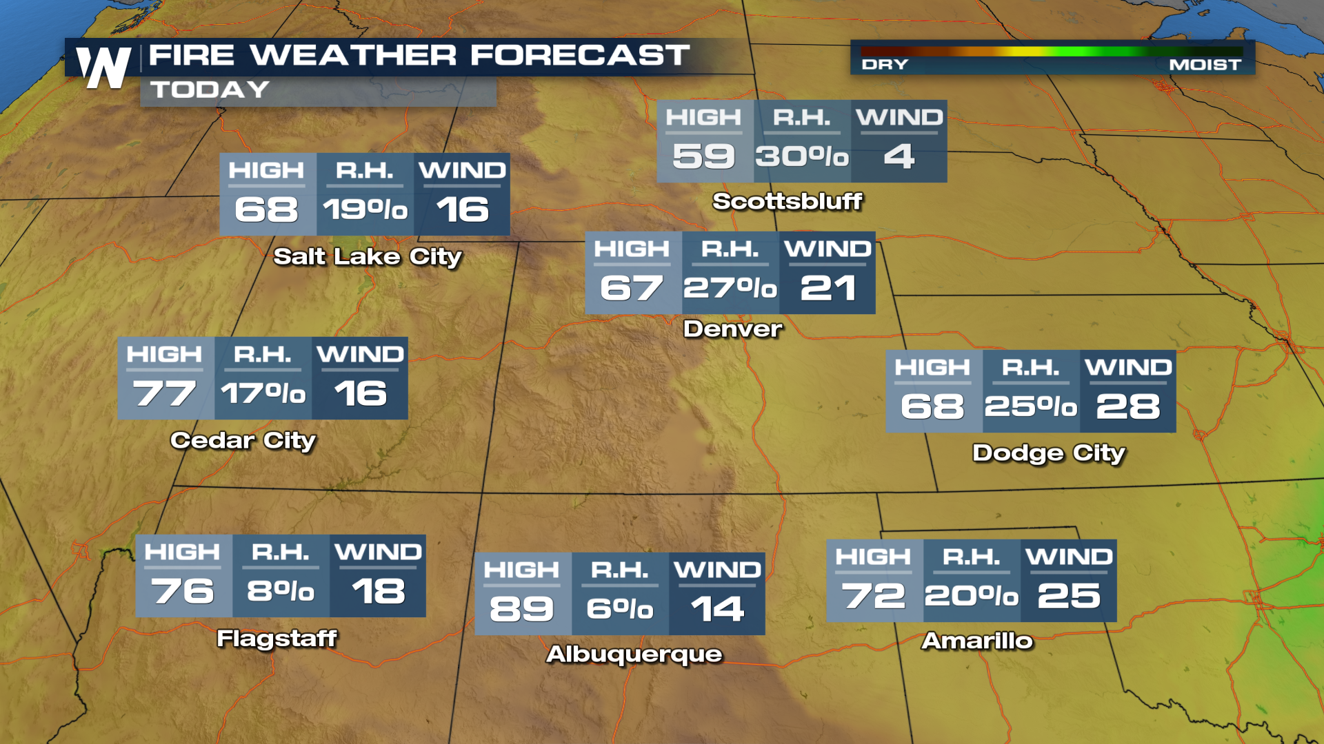
Wildfire activity is ramping up across the United States, as a dangerous combination of dry air, gusty winds, and above-average temperatures creates ideal conditions for fires to ignite and spread. From the Rockies to the Plains, fire weather alerts have been issued frequently, with low humidity and strong winds allowing even small sparks to quickly turn into fast-moving wildfires. The next several days will be concerning across central parts of the country, where dormant grasses act as fuel and can carry flames over large distances in a short amount of time. Precipitation will be limited over the next few days, and cold front will brings gusty winds. Red Flag warnings are in place.
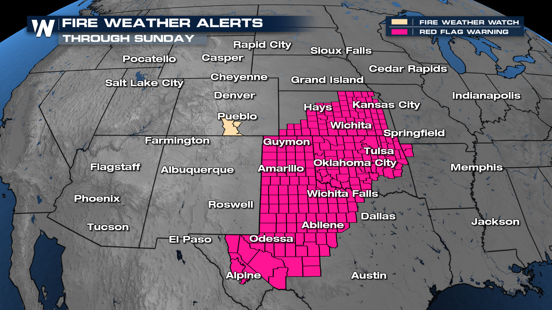
For Sunday, fire alerts have been issued from Kansas down through the Texas Panhandle. While the actual temperatures of this heatwave have been the main focus, increasing temperatures lead to low relative humidity. Winds will kick up at times, too, in response to systems riding around the periphery of the upper-level heat dome.
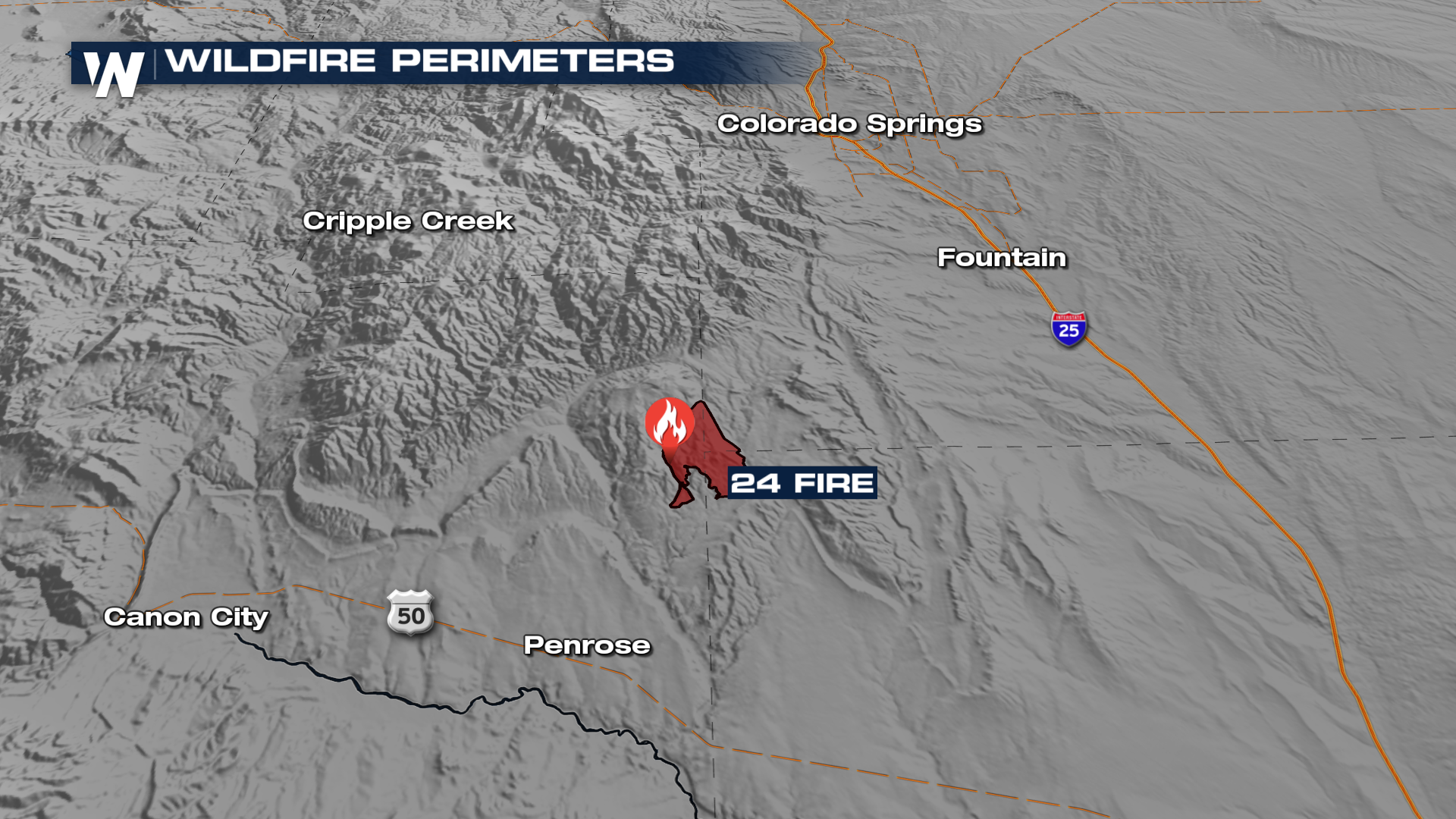
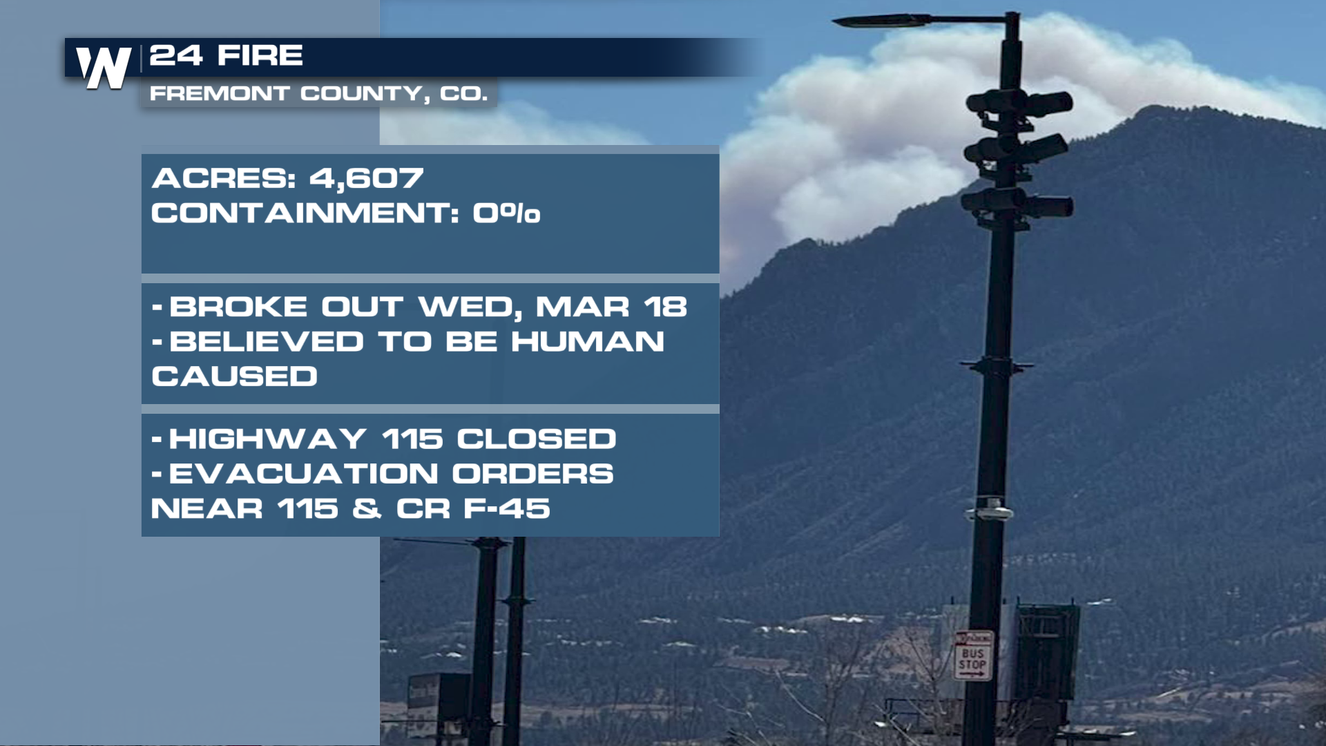
Unfortunately, some fires have already sparked and continue to grow. The 24 Fire, located to the southwest of Colorado Springs, has has grown to over four and a half thousand acres and remains uncontained, prompting evacuation orders for nearby communities. Crews on the ground, along with aerial support, are working to slow the spread, but shifting winds and dry fuels continue to pose challenges. Smoke from the fire has been visible across the region, a reminder of how active the situation remains.
Frequent wind events, dry air, and limited moisture are all contributing to an elevated fire risk heading into spring. As a result, follow evacuation orders if necessary, and take extra precautions to avoid starting new fires. With the current pattern in place, the potential for additional wildfire outbreaks will likely continue in the weeks ahead.
Stay tuned for WeatherNation for more details.


