Fire Threat Forecasts: Spring 2024
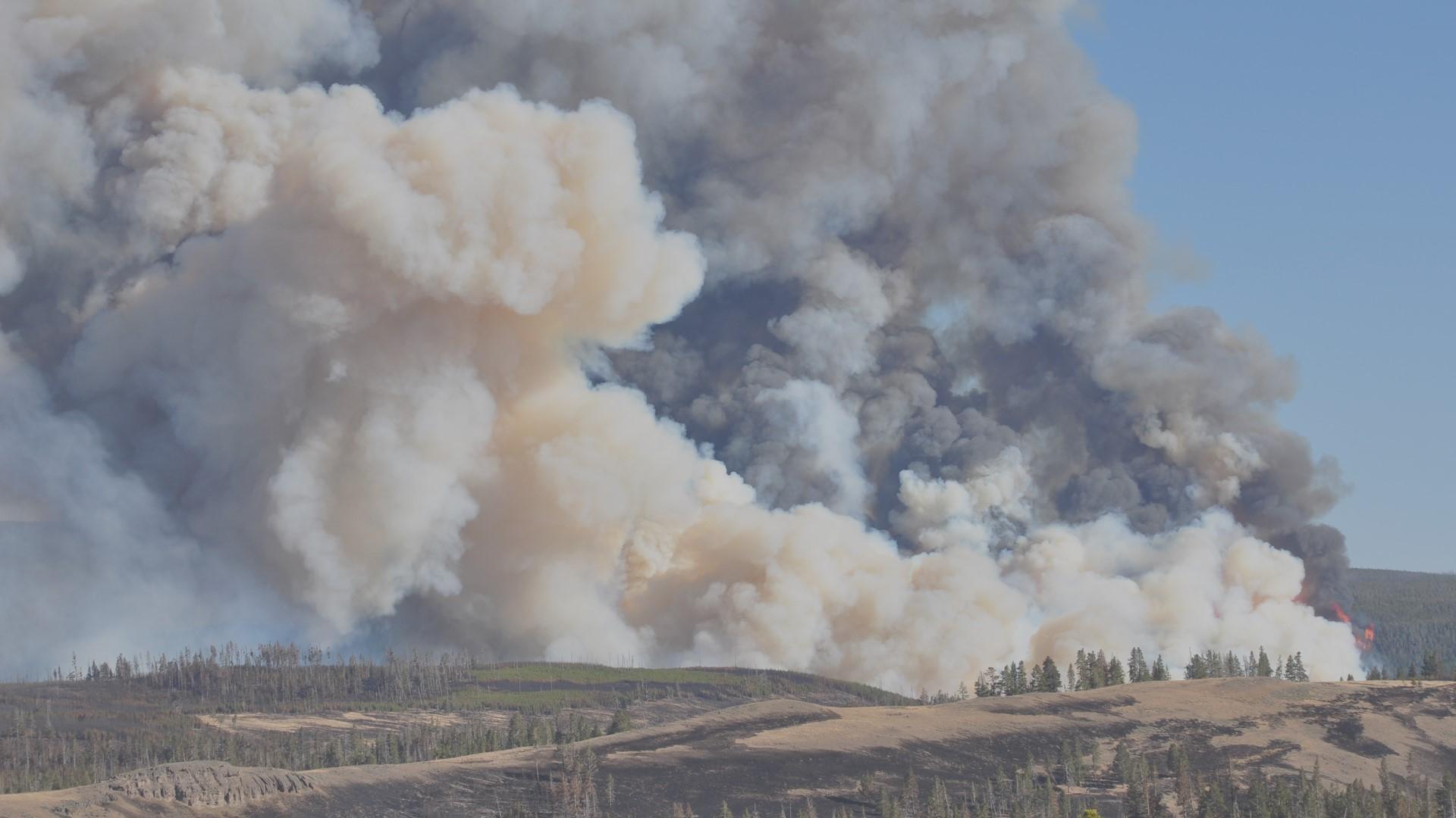
The National Interagency Fire Center [NIFC] has released its significant wildland fire potential forecasts for the next four months, following a very active February for wildfires across the central and southeast U.S. The outlooks are based on historical averages, current precipitation, and drought conditions along with climatological patterns (like El Nino) that could impact conditions. According to NIFC, "the transition from El Niño to ENSO neutral conditions will be the main driver" as conditions become warmer and drier than average in the South and Southwest.
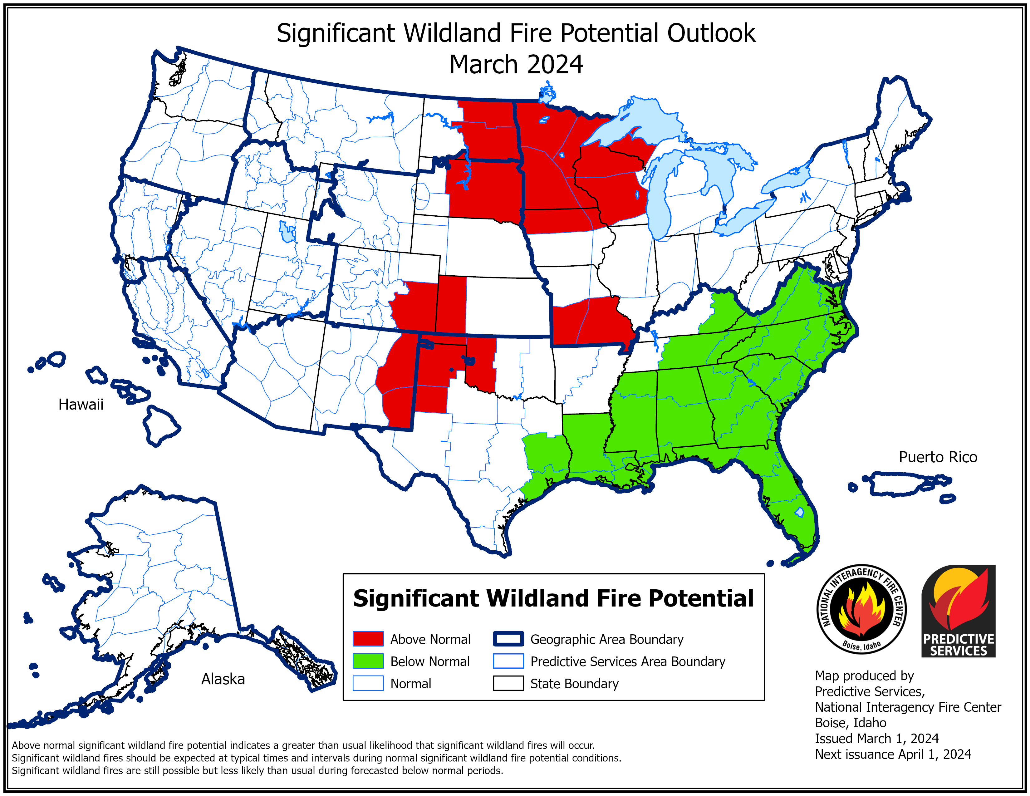
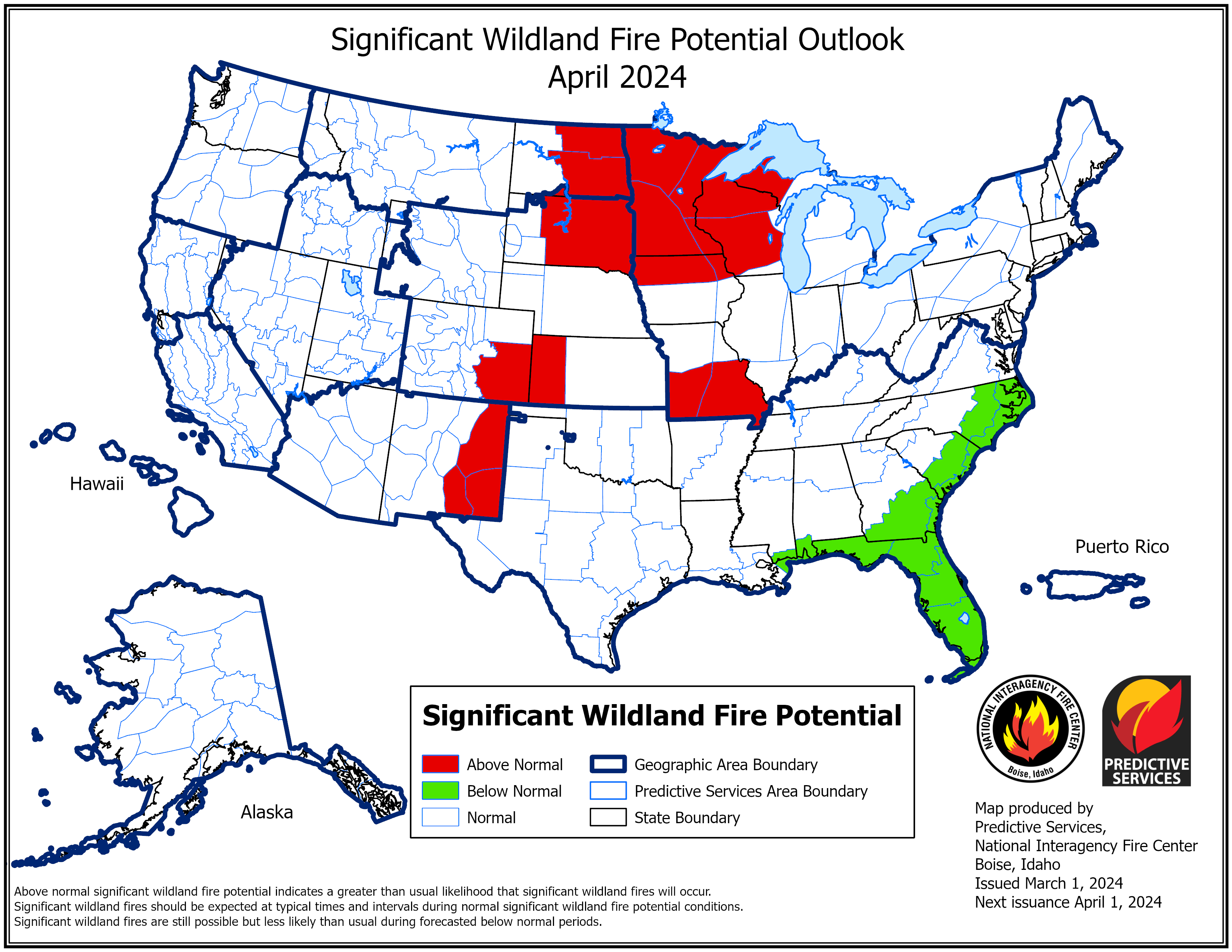 Fire danger is expected to remain high through March and April for the southern Plains and Northern Plains. Part of the reason is due to above-average temperatures and below-average precipitation in these regions over the last few months.
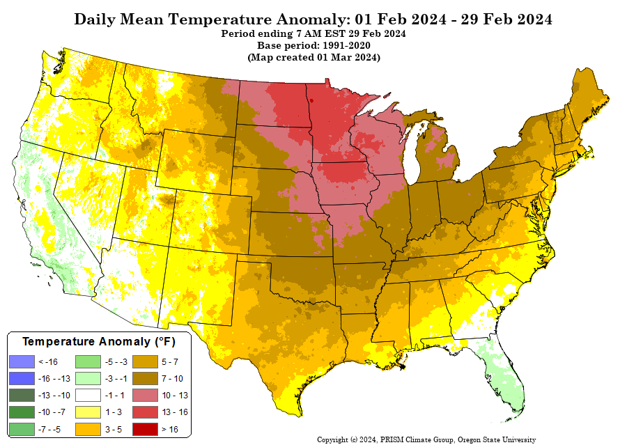
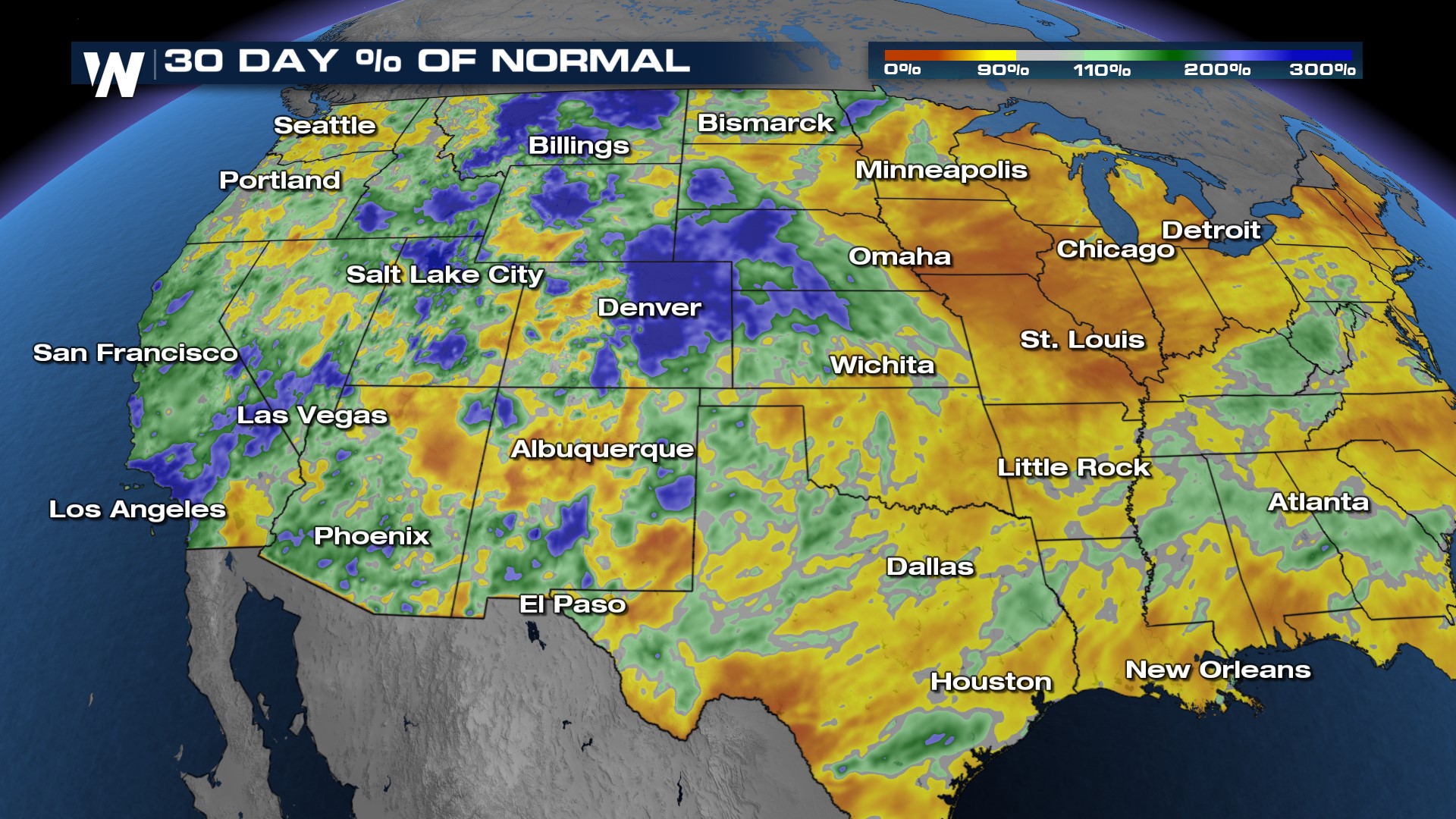 According to the NIFC, "Periods of well above normal temperatures were common across the Plains, with the northern Plains as much as 30 degrees above normal February 1-8 and 25 degrees above normal February 19-25. Well above normal temperatures spread into the southern Plains as well February 23-26, with dozens of record high temperatures set February 25 and 26 as temperatures rose above 90°F across portions of Texas. With the warmer than average temperatures, winds increased at times as well, particularly across the High Plains."
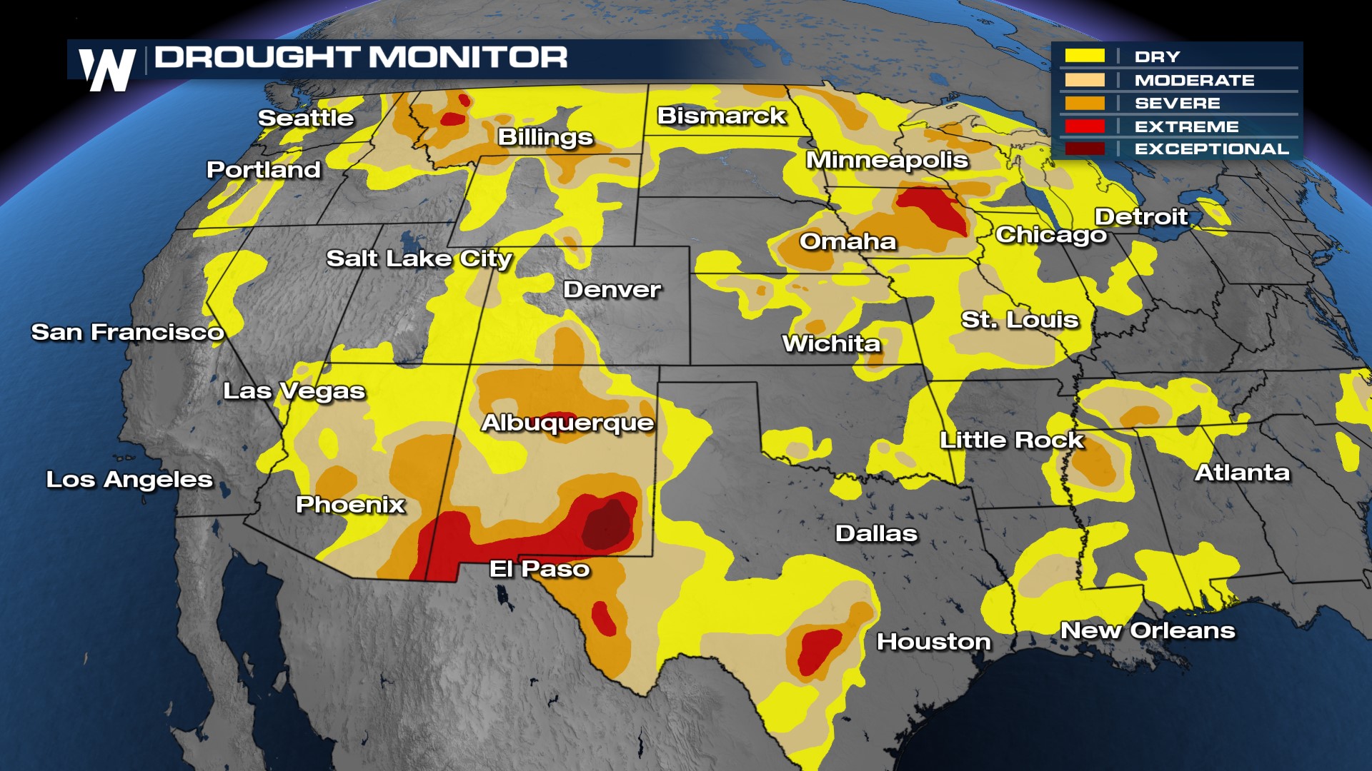
Though the drought has vastly improved for the Lower Mississippi River Basin and East Texas, there are still pockets of extreme and exceptional drought for the Big Bend of Texas, southern New Mexico along with eastern Iowa. These are the areas to watch where grasses and trees are particularly "flashy" or will burn quickly.
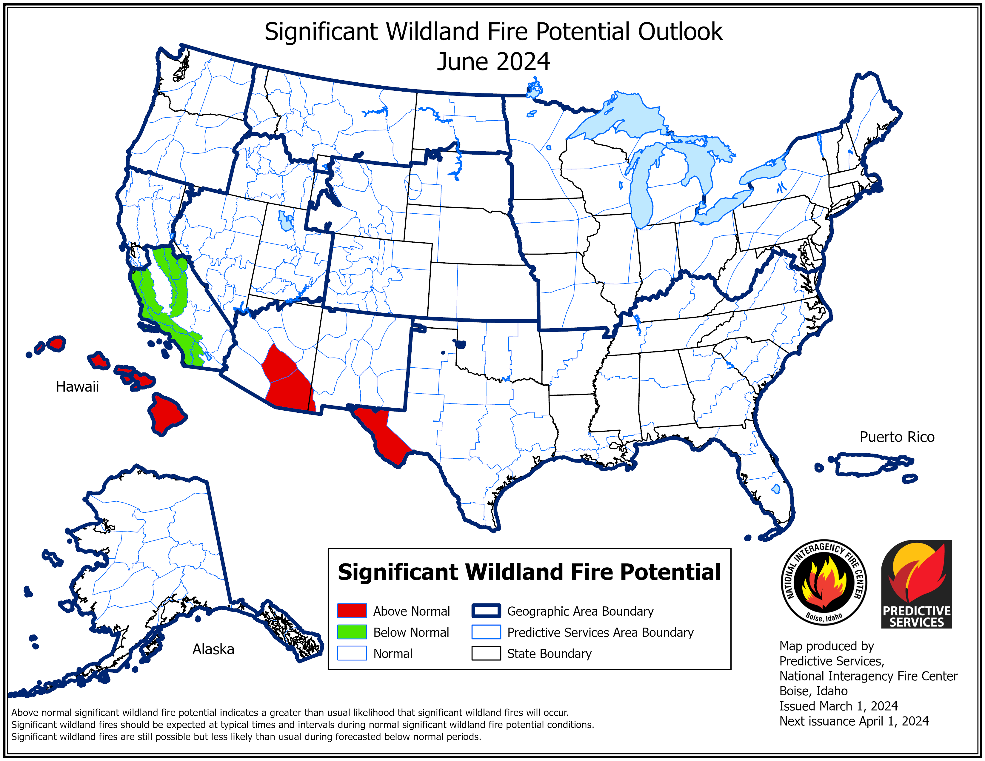
 By this summer the NIFC expects the fire threat to shift into the Southwest as temperatures rise and grasses are in full bloom. Monsoonal thunderstorms start in June, but the outflow winds from thunderstorms can fan flames across the Desert Southwest. Fire activity is expected to be below average in California thanks to a wet winter so far in 2024. However, the wet winter months can sometimes lead to a super-bloom, or above-average grasses and flowers which in turn can elevate the fire threat.
 Bottom line, it is essential to prepare for your wildfire risk and stay alert if you live in a fire-prone area!


