Breaking Out the Shovels in the Northeast

So far this winter season, the major cities along Interstate 95 haven't seen much snow! Some areas of New York and West Virginia have picked up over a FOOT of snow from this weekend's system.
As we head into the work week, the National Weather Service has left lingering lake effect snow warnings in place for the snowbelt regions of the northeast for additional snowfall through Monday. In fact, another system drops through the Great Lakes early Monday to add to some snowfall totals in these regions.
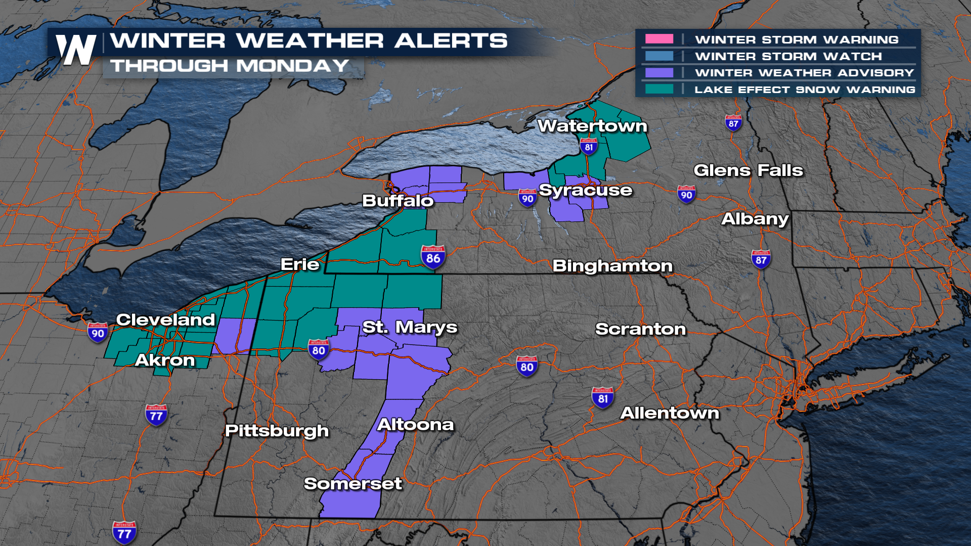 Snowfall totals through Monday look to be locally heavy, but widespread the heaviest of the snowfall has already happened. Be cautious on the roads as it may take a minute to plow all of the secondary and tertiary streets in your region.
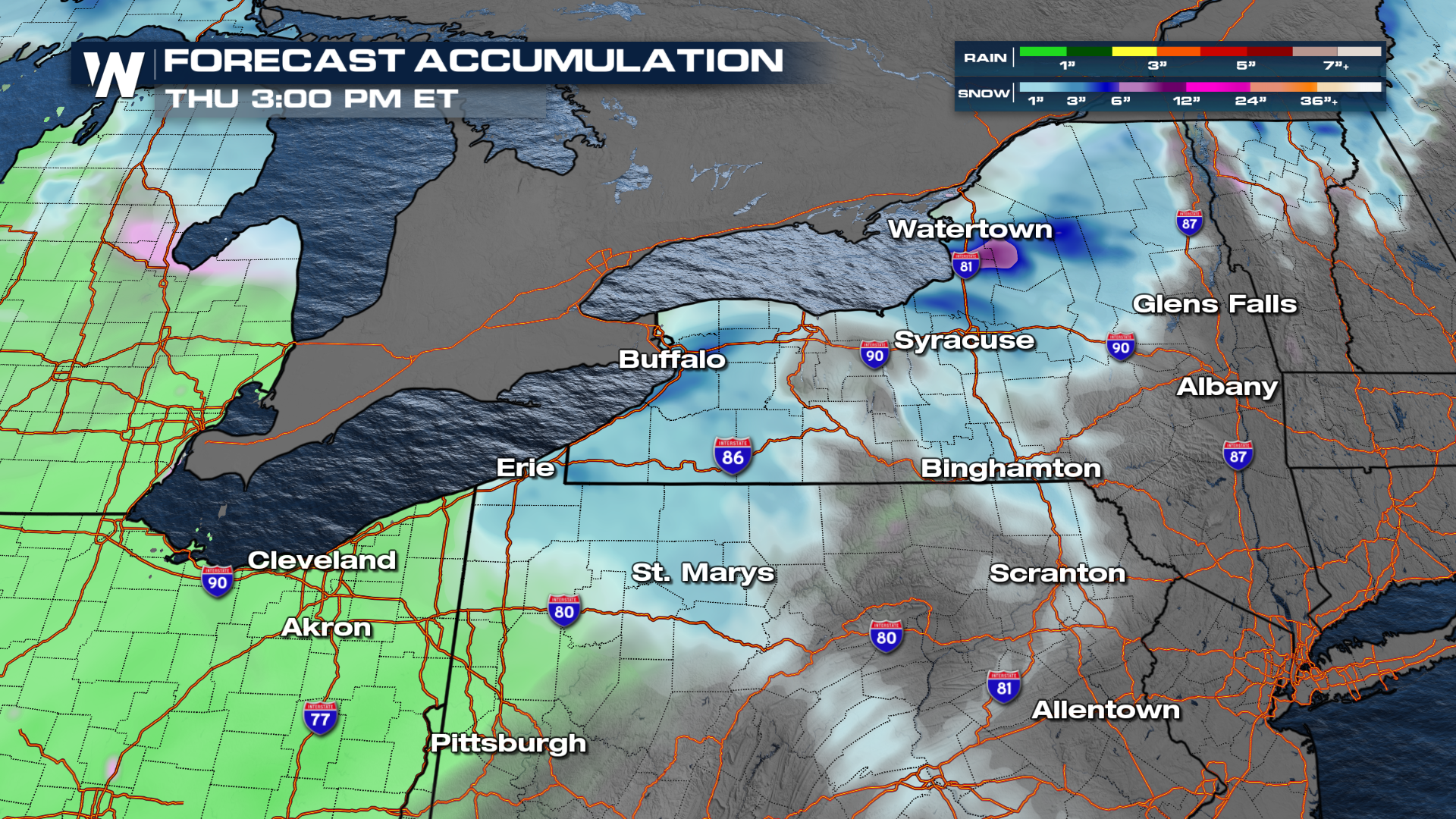 Here's a look at the timing of the quick moving clipper before our next system comes zooming in later into the week. The next one appears to be warmer, so be prepared for slushy conditions where the snow has not melted later this week.
Be sure to join us on WeatherNation at :10 past the hour for your eastern regional forecast, where we discuss temperature swings throughout the last full week of work and school before the holidays!


