Flood Concerns in the Mississippi and Tennessee Valleys
Special Stories
27 Feb 2018 5:37 PM
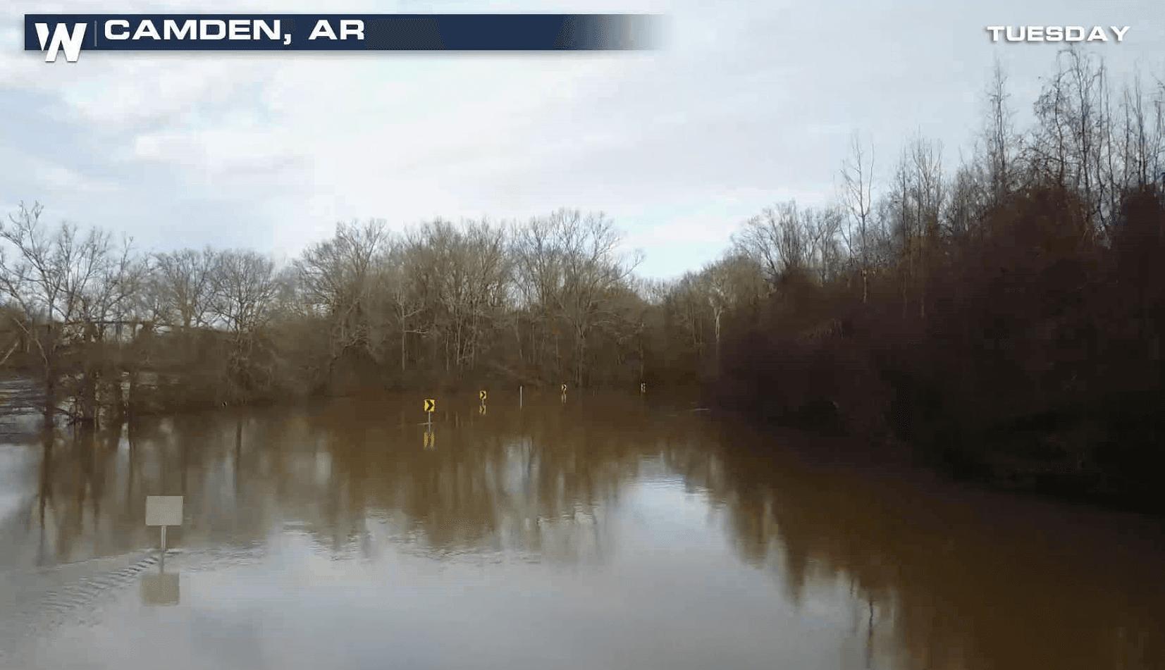
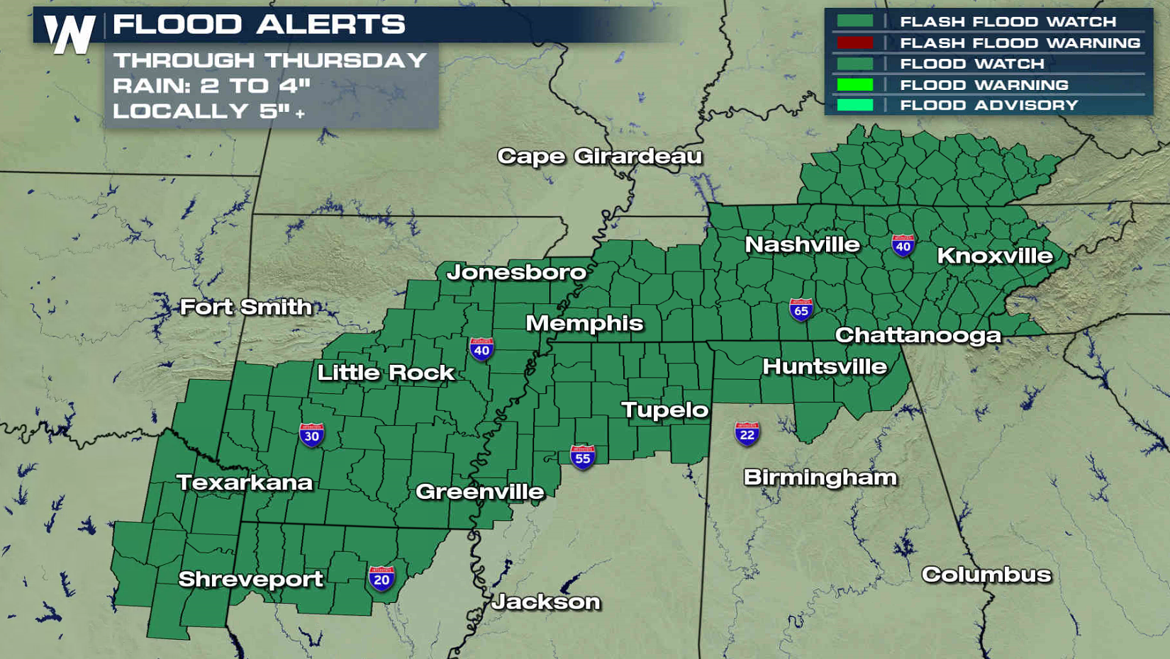
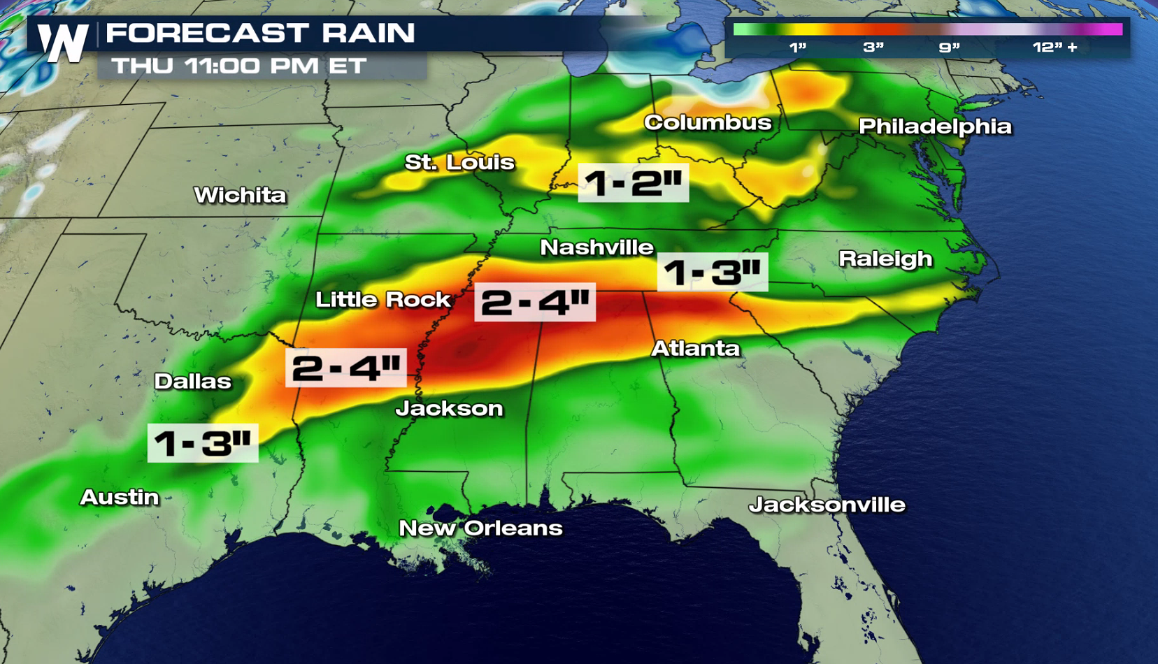
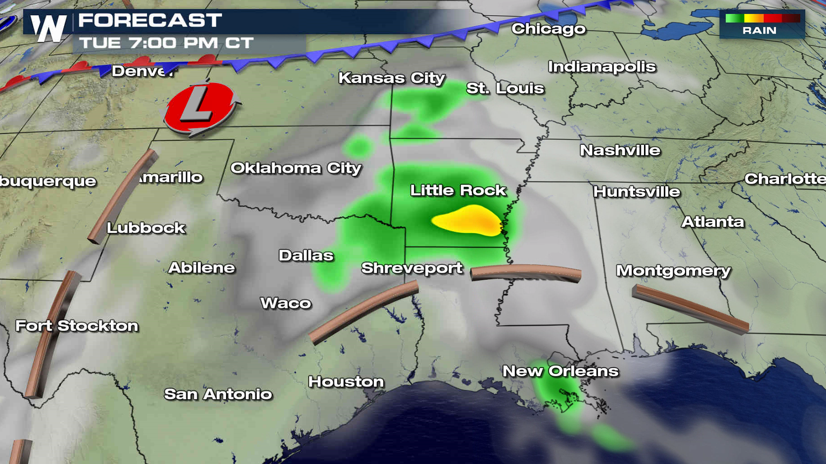
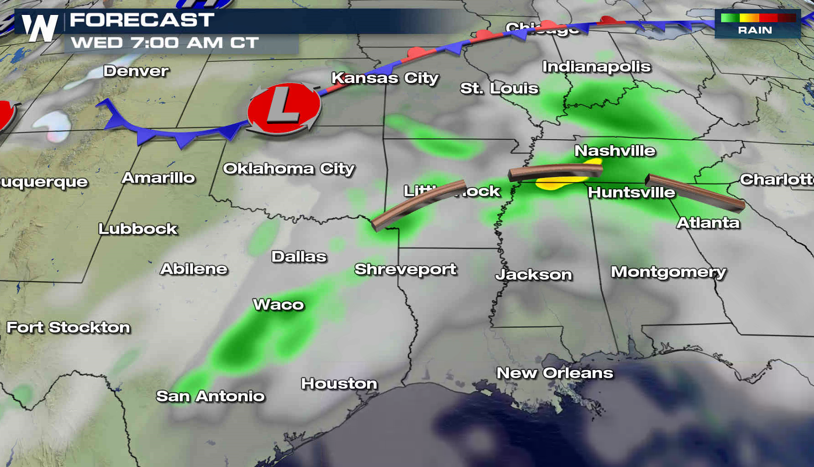
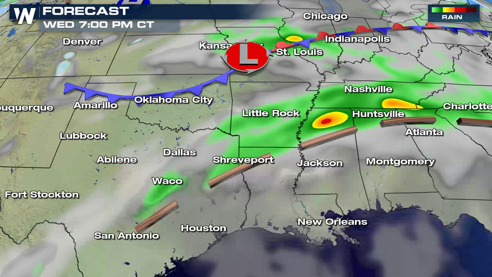
More rain is on the way from the Tennessee Valley to the Arklatex through Thursday with a continued concern for flooding. Flood Watches remain in effect from Kentucky to Texas. Rainfall totals of 2" to 4" are likely with some areas possibly seeing up to 5".
 Humidity remains high as air pushes in from the Gulf of Mexico, raising dew points. Aloft, the sub -tropical Jet Stream remains strong and moist.
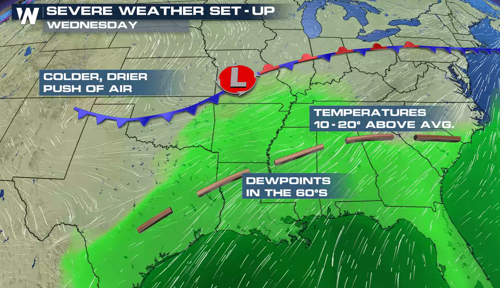
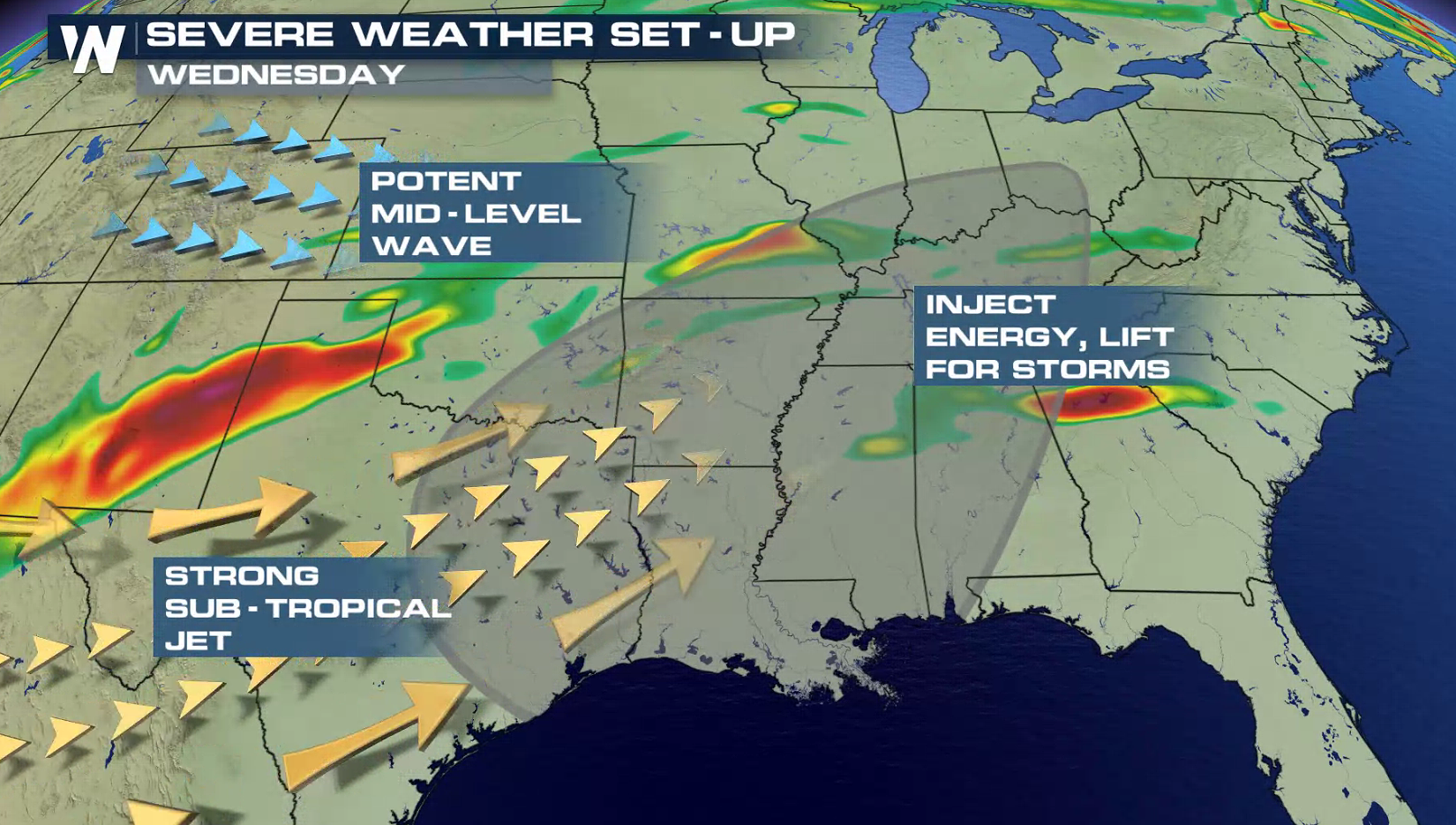 A trough remains draped over the region, providing energy for thunderstorm development. As a cold front and low pressure center sinks southward, additional thunderstorms will pop-up with the potential for heavy rainfall.
 For WeatherNation: Meteorologist Mace Michaels
Humidity remains high as air pushes in from the Gulf of Mexico, raising dew points. Aloft, the sub -tropical Jet Stream remains strong and moist.
A trough remains draped over the region, providing energy for thunderstorm development. As a cold front and low pressure center sinks southward, additional thunderstorms will pop-up with the potential for heavy rainfall.
For WeatherNation: Meteorologist Mace MichaelsAll Weather News
More
Catastrophic Flooding in the Texas Hill Country
Multiple Flash Flood Emergencies were issued
5 Jul 2025 10:20 PM

Severe Storms in the Midwest Continue To Spoil the Holiday Weekend
NORTHERN PLAINS - A frontal system continues
5 Jul 2025 10:15 PM

Tropical Storm Chantal Forms This Morning
Tropical Storm Chantal has formed, with winds
5 Jul 2025 4:35 PM


Near Seasonal Temperatures for Many Come July 4th!
AAA is expecting over 70 million travelers to
4 Jul 2025 10:15 AM


Northwest Heat Met With Thunderstorm Risk
NORTHWEST - Today, portions of Montana are un
3 Jul 2025 12:00 AM