Friday Severe Weather Update
Special Stories
1 Jun 2018 4:36 AM
Another day and more severe storm chances. It seems like everyday were are talking about severe storms, but this a very active time of the year. Here is the very latest on today's storm threat.
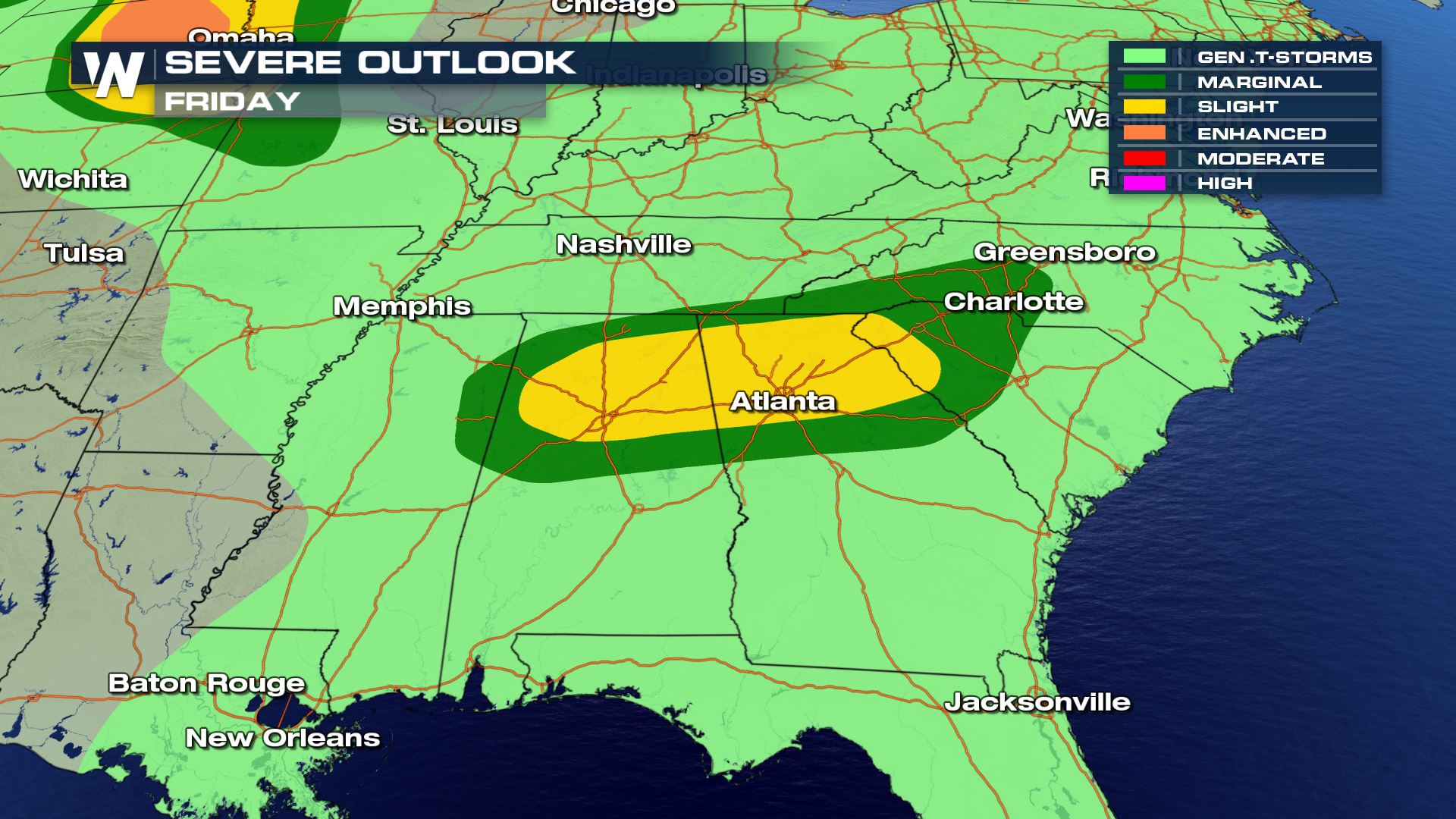
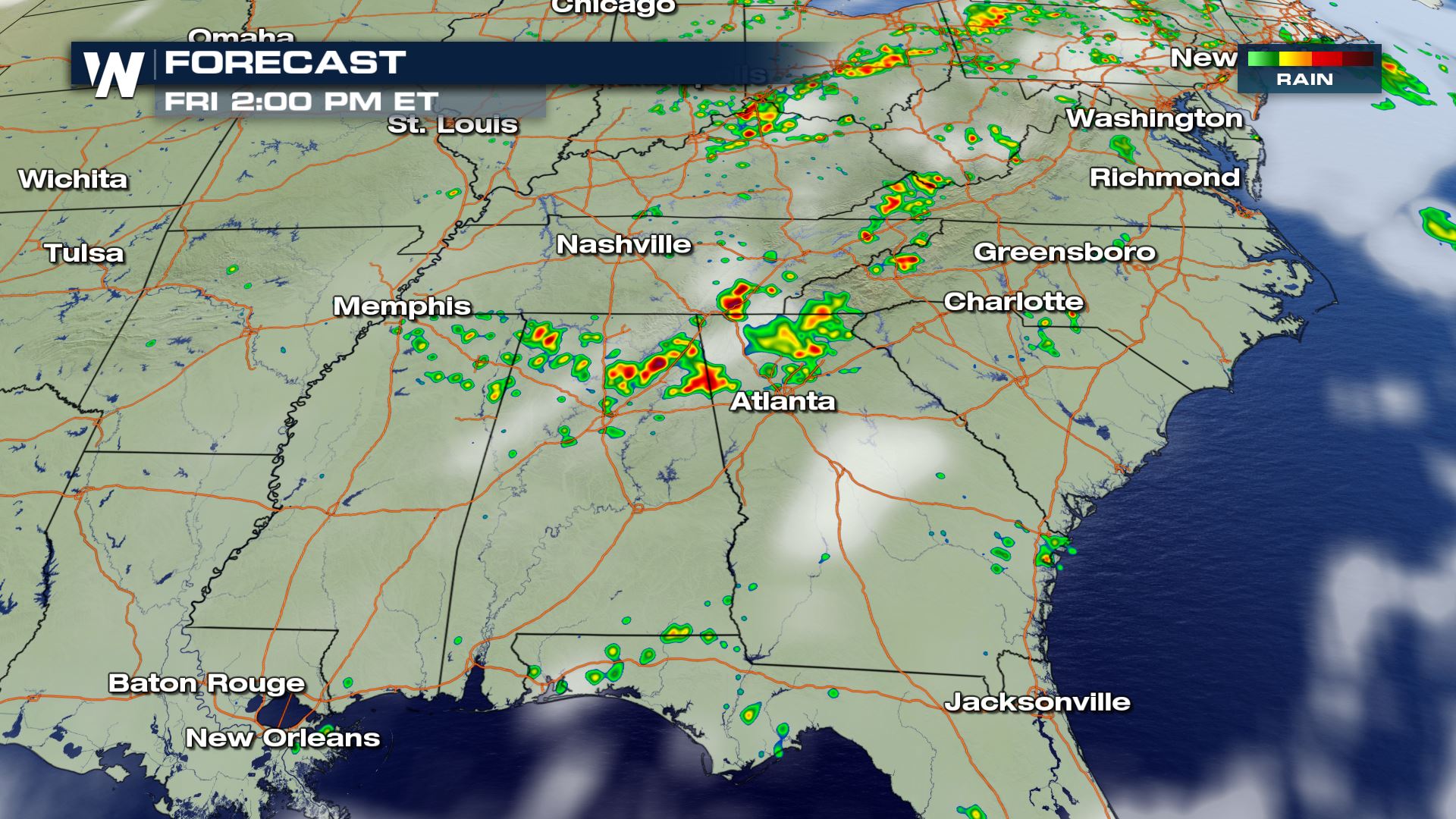
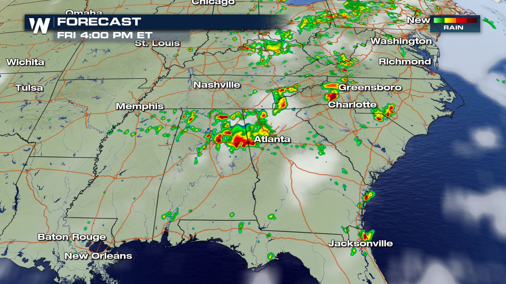
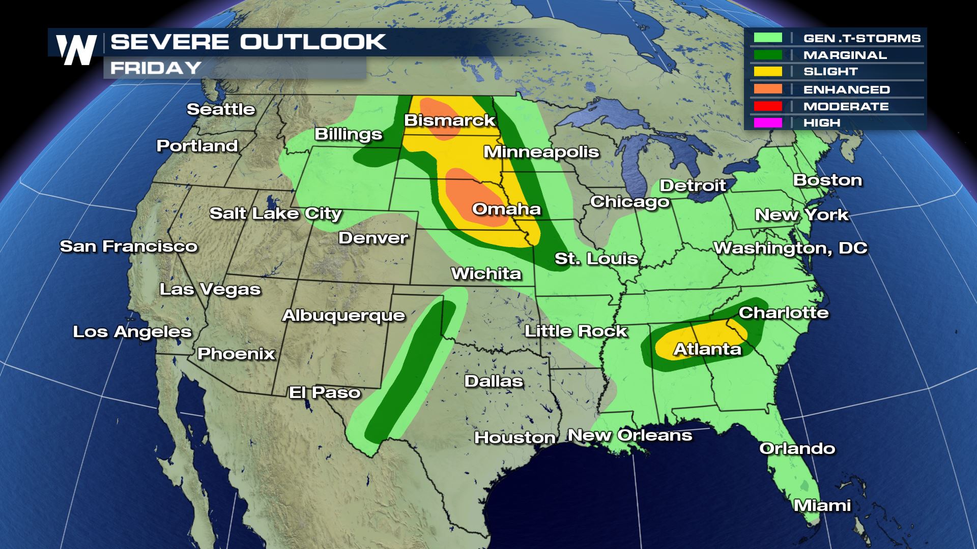
The 2 main areas of focus for severe weather today will be in the High Plains and the Southeast (Northern Alabama, Northern Georgia and western South Carolina).
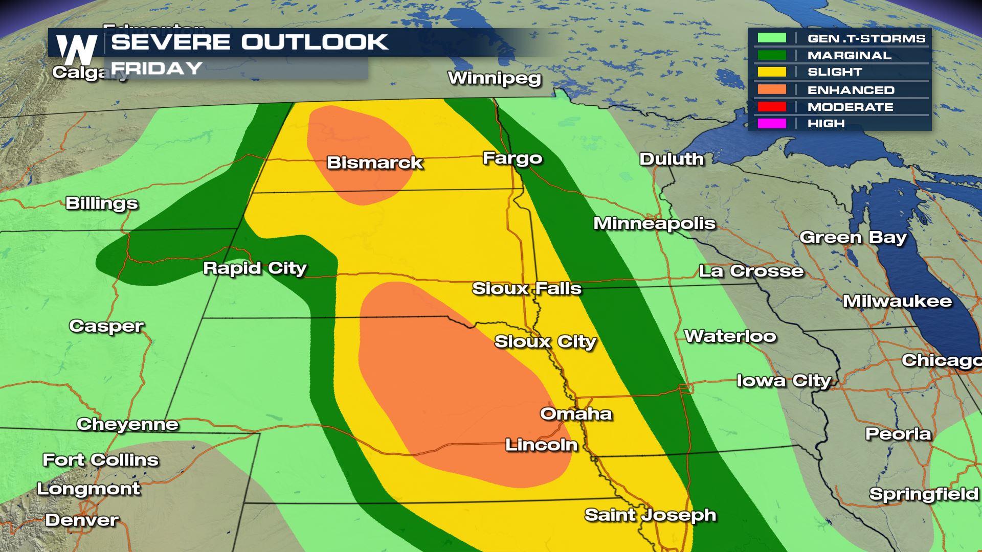
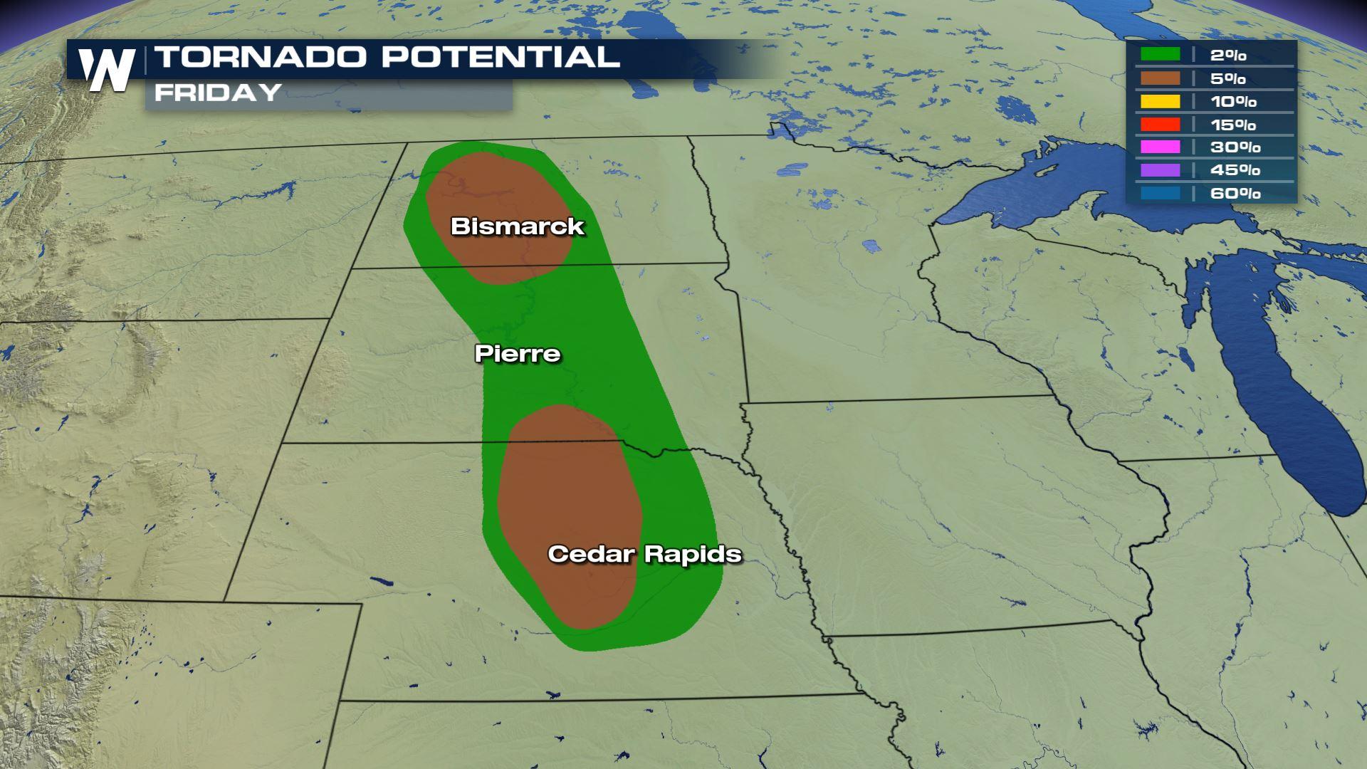
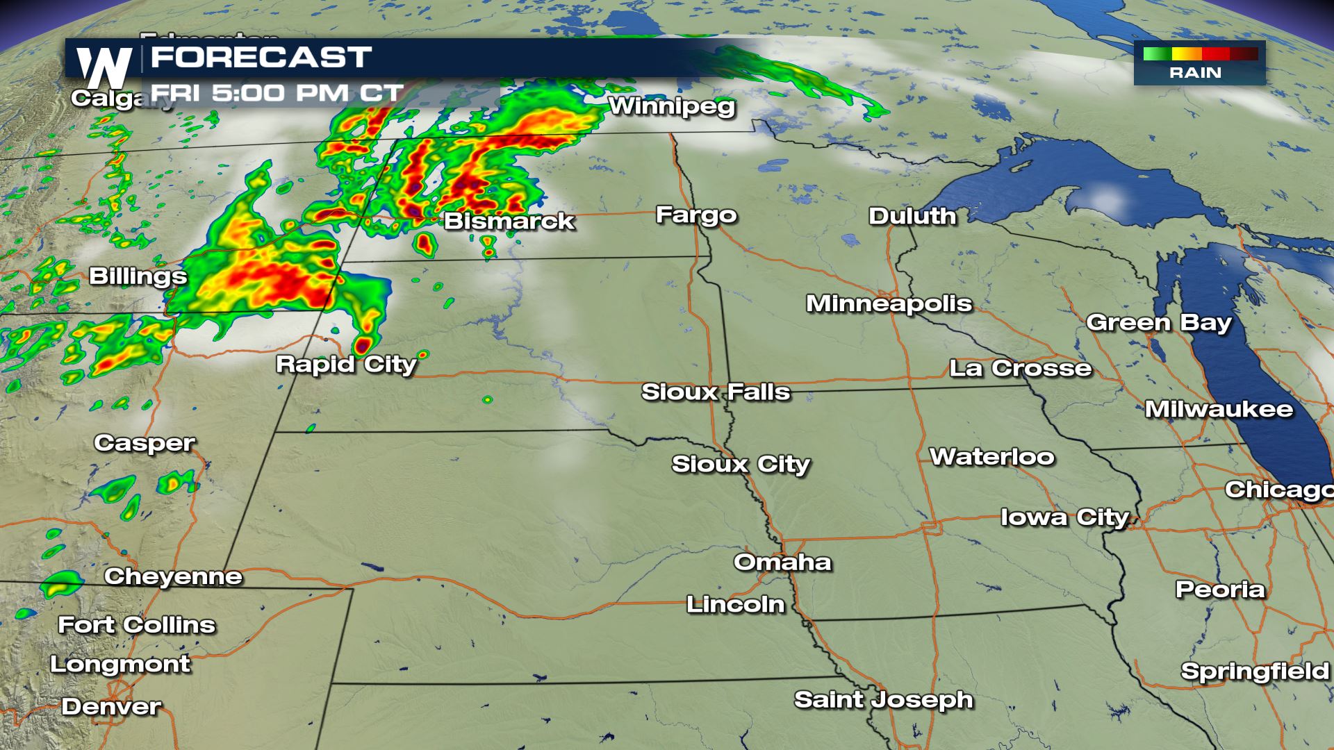
 The highest risk for tornadoes will likely be across the High Plains. Especially for North Dakota and Nebraska where there is a 5% tornado risk today.
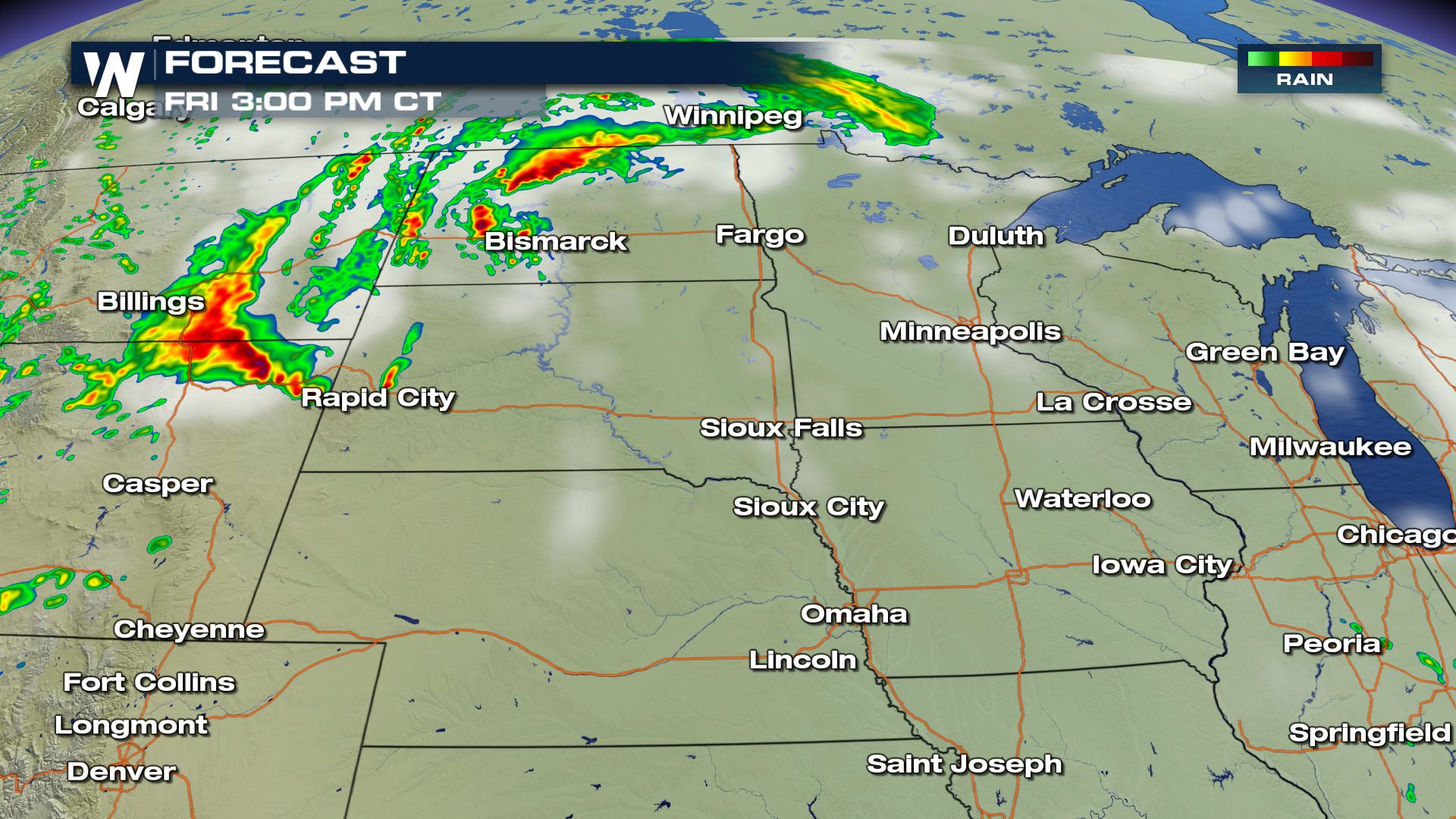
 The strongest storms will likely be during the afternoon and evening hours. Here is the latest timing for today's storm chances.
 Keep checking with WeatherNation for more updates on today's severe weather chances.
Meteorologist Patrick Crawford
Keep checking with WeatherNation for more updates on today's severe weather chances.
Meteorologist Patrick Crawford
Severe Outlook
 The highest risk for tornadoes will likely be across the High Plains. Especially for North Dakota and Nebraska where there is a 5% tornado risk today.
The strongest storms will likely be during the afternoon and evening hours. Here is the latest timing for today's storm chances.
The highest risk for tornadoes will likely be across the High Plains. Especially for North Dakota and Nebraska where there is a 5% tornado risk today.
The strongest storms will likely be during the afternoon and evening hours. Here is the latest timing for today's storm chances.
High Plains
Southeast
Keep checking with WeatherNation for more updates on today's severe weather chances.
Meteorologist Patrick CrawfordAll Weather News
More

More Storms for the East Through Monday
A low-pressure system that moved through the
3 Aug 2026 12:20 PM


After Reaching Category 5, Genevieve Weakens in the Pacific
PacificGenevieve formed last Friday south of
3 Aug 2026 12:30 AM

Flooding, Severe Storms Target the Midwest Again
After an active week of storms across the nor
1 Aug 2026 1:40 AM

Flooding Risk Increases as Heavy Rain Targets the Tri-State Area
Tuesday, heavy rainfall moved across the Nort
30 Jul 2026 12:25 AM