Drier Weather for the Front Range This Weekend

Friday was a less active day across much of the Front Range than Thursday, when intense storms produced large hail and a few tornado warnings. An EF-1 tornado with winds of 108 mph was confirmed by the National Weather Service near Green Mountain Falls in Teller County, very close to Pikes Peak. It was on the ground for 2.18 miles, with a width of 75 yards! You can see the tree damage above from this confirmed tornado.
There is still some energy lingering overnight and a few severe storms are possible, especially in eastern New Mexico. A MARGINAL risk for severe storms continues for the eastern Plains of Colorado through to the western Texas panhandle, mostly to account for the potential for damaging winds and hail. A SLIGHT risk is in place for eastern New Mexico for the higher concentration of storms.
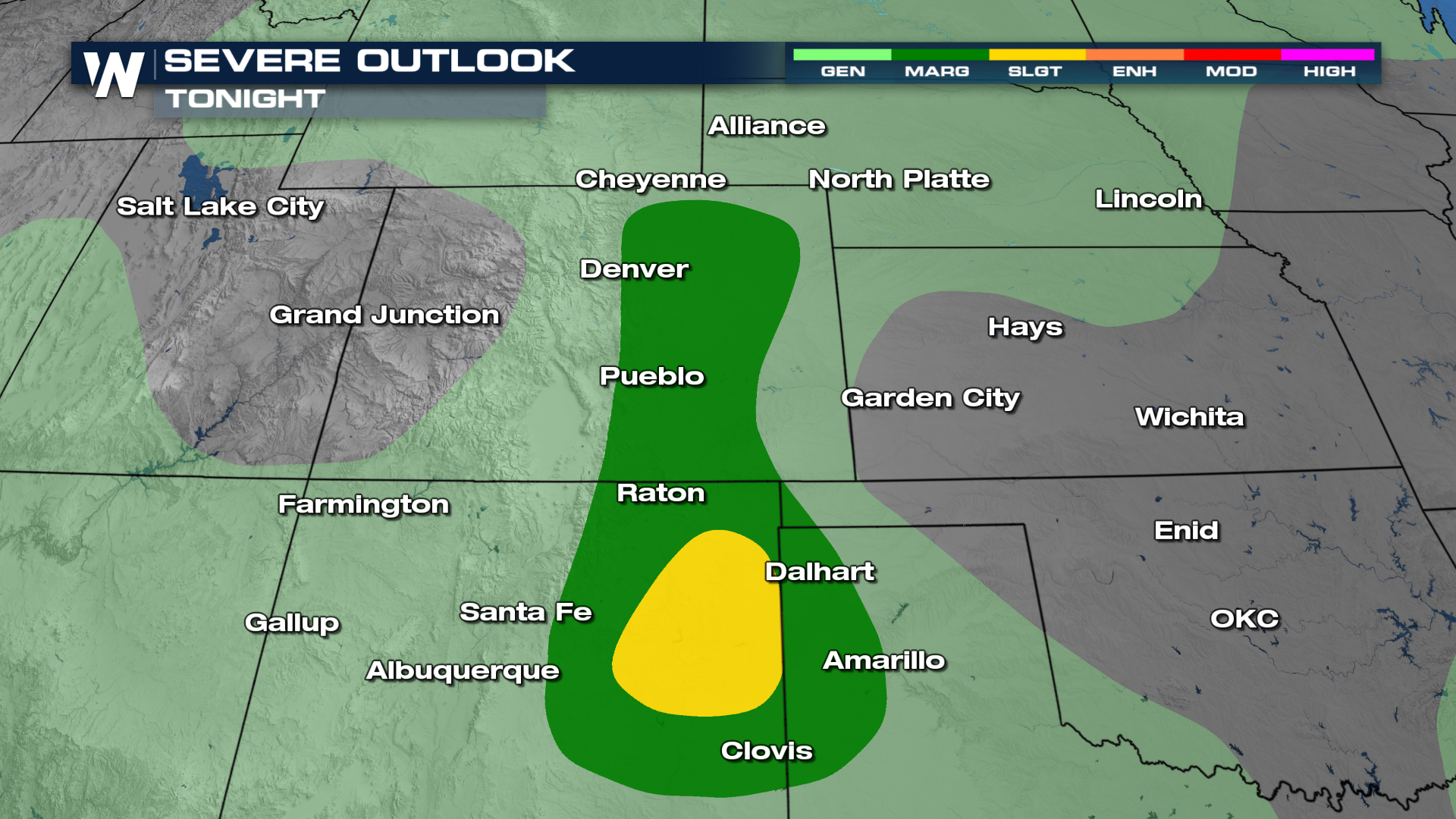
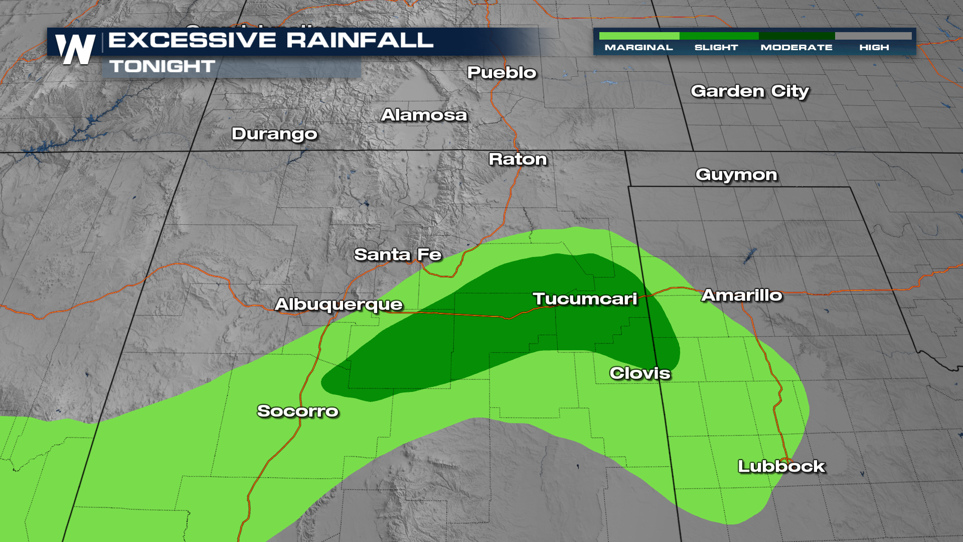
Rainfall accumulation won't be anything wild - most will see less than 0.5". Even so, this amount of rainfall over saturated soils and recent area burn scars will lead to the risk for flash flooding. As a result, the Weather Prediction Center has highlighted areas in eastern New Mexico for the potential of flash flooding.
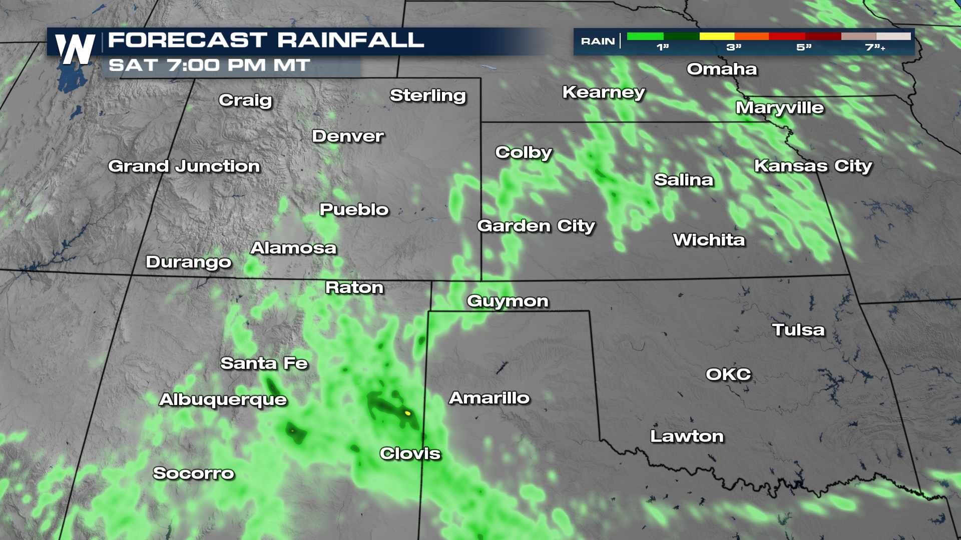
Storms initiating over the higher terrain will push southeast into the Plains tonight. More storms will develop Saturday afternoon but they will be isolated in nature and severe weather chances are low.
Stay with WeatherNation for the latest in the severe weather potential this week from the Front Range to the Great Plains.


