Great Lakes Lake Effect Snow into Wednesday
Special Stories
11 Dec 2019 7:45 AM
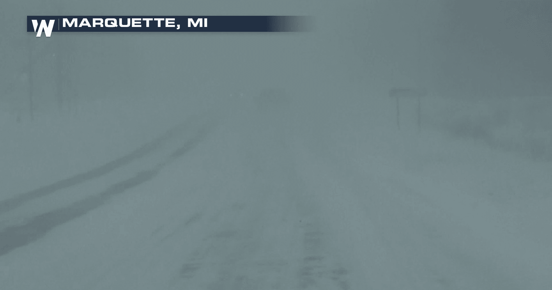
[Whiteout conditions from Marquette, Michigan from Tuesday morning]
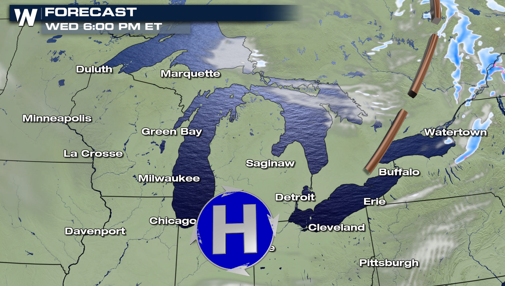
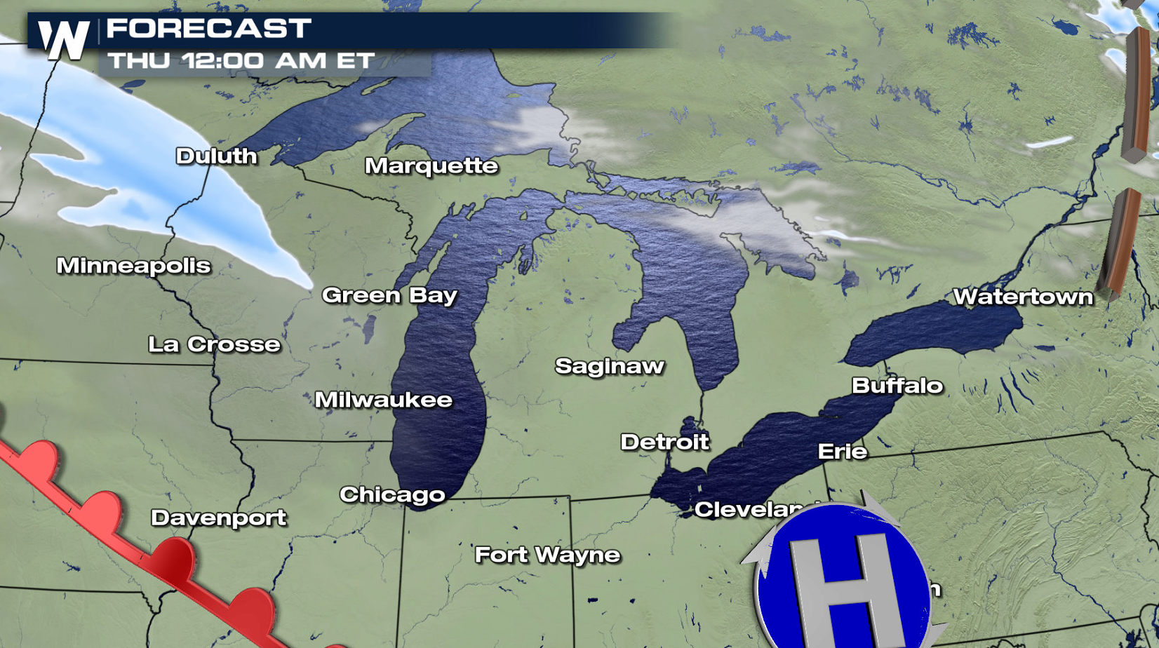
Cold Arctic air plunging across the Great Lakes is producing bands of heavy, localized lake effect snow. Alerts extend from Lake Superior in Michigan's Upper Peninsula to Lake Ontario in Western New York.
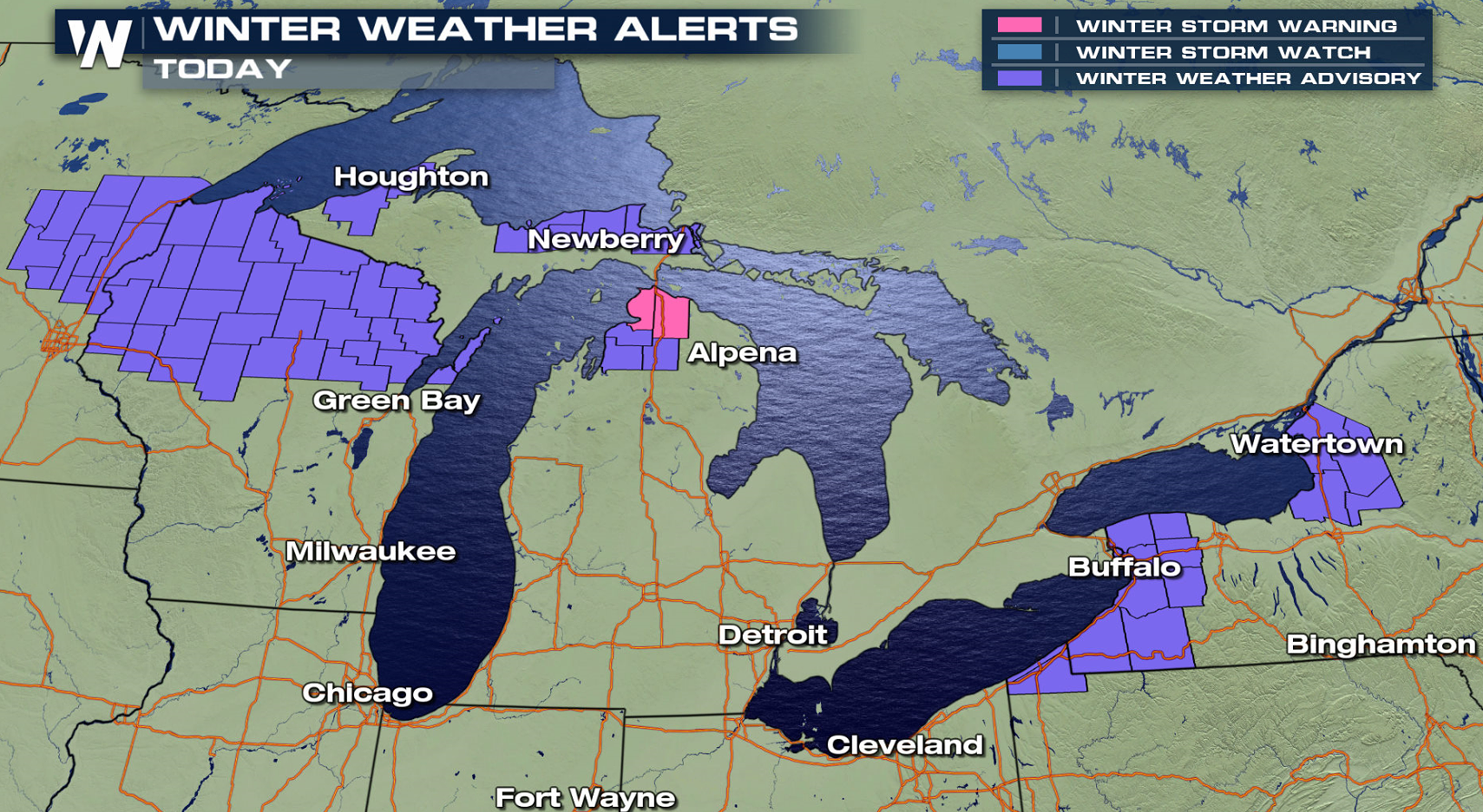
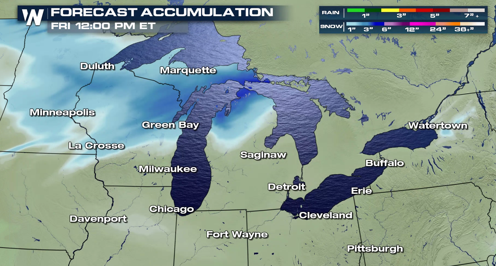 By this evening (Wednesday), many areas will see at least 6" of lake effect snow. The bands are not expected to be widespread, but they will be heavy and intense at times.
https://twitter.com/NWSBUFFALO/status/1204691610921062401
https://twitter.com/NWSGaylord/status/1204779113191329793
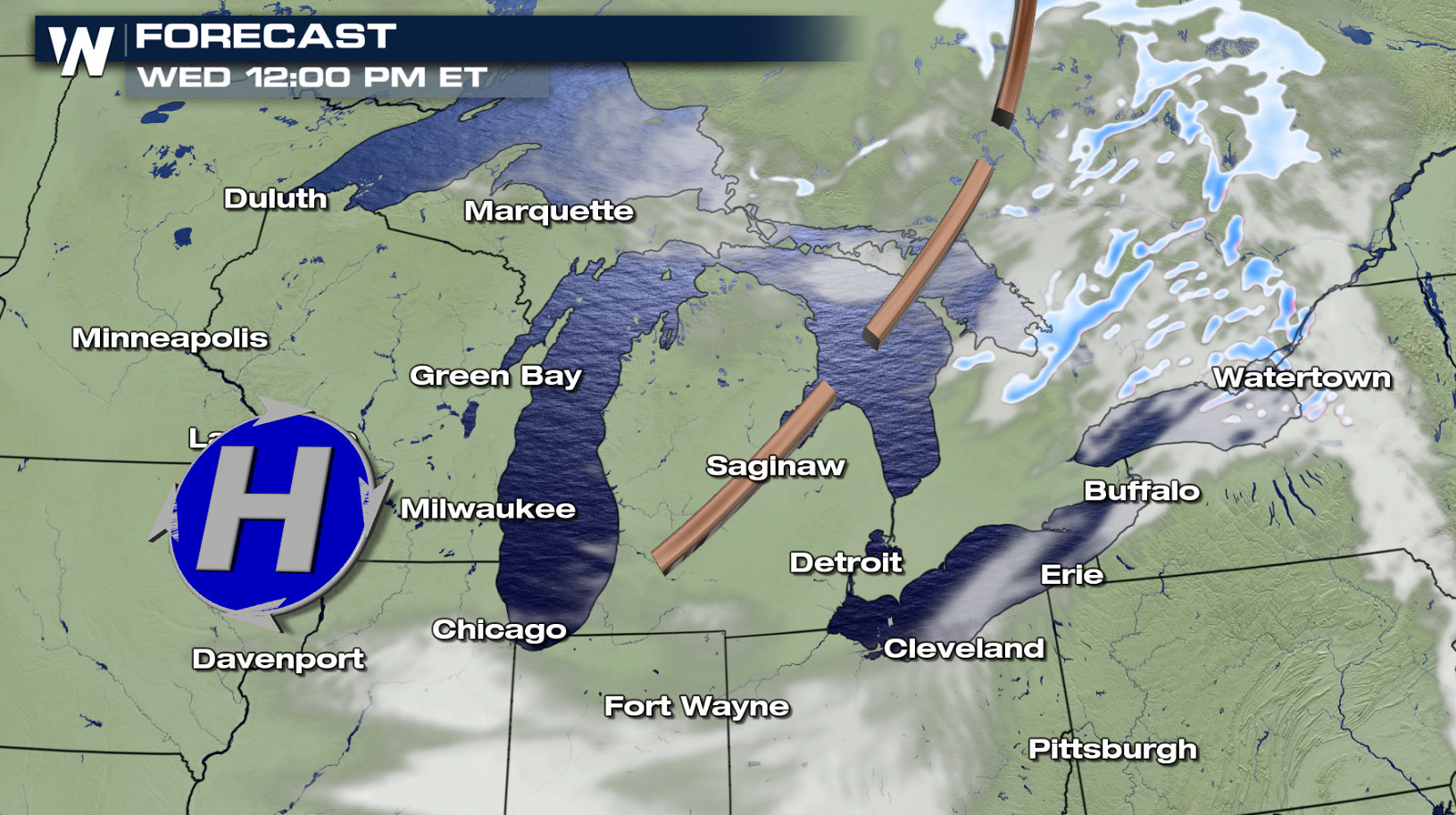
Arctic air has been dropping southward behind a cold front, now in the Northeast. A trough will move across the Great Lakes today (Wednesday), enhancing lake effect bands. Lake effect snows will diminish as another system approaches from the west, warming temperatures and changing wind directions.
By this evening (Wednesday), many areas will see at least 6" of lake effect snow. The bands are not expected to be widespread, but they will be heavy and intense at times.
https://twitter.com/NWSBUFFALO/status/1204691610921062401
https://twitter.com/NWSGaylord/status/1204779113191329793
Arctic air has been dropping southward behind a cold front, now in the Northeast. A trough will move across the Great Lakes today (Wednesday), enhancing lake effect bands. Lake effect snows will diminish as another system approaches from the west, warming temperatures and changing wind directions.
All Weather News
More

After Reaching Category 5, Genevieve Weakens in the Pacific
PacificFausto is now a post-tropical cyclone.
30 Jul 2026 12:00 PM

Flooding Risk Increases as Heavy Rain Targets the Tri-State Area
Tuesday, heavy rainfall moved across the Nort
30 Jul 2026 12:25 AM

Severe Weather: Energy From the Midwest Now in the Southeast
UPPER MIDWEST - Through Monday, dangerous tor
29 Jul 2026 10:30 PM


Southeast Flood Risk Lingers Near Stalled Front
A stalled boundary over the Southeast will ke
25 Jul 2026 10:55 AM

Another Round of Storms Targets the Northeast
Tuesday brought severe weather again across p
23 Jul 2026 1:15 AM