Gulf-Effect Snow Possible This Weekend

You've been warned, iguanas. We've had glancing blows of cold weather recently, stunning a few cold-blooded reptiles. This one's going to be more widespread and could even bring the threat of snow as far south as Tampa.
COLD
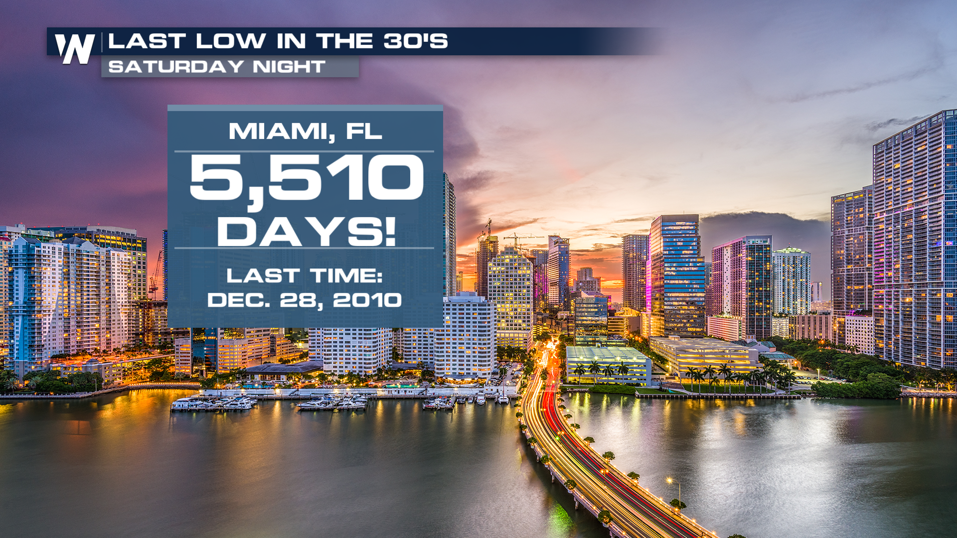
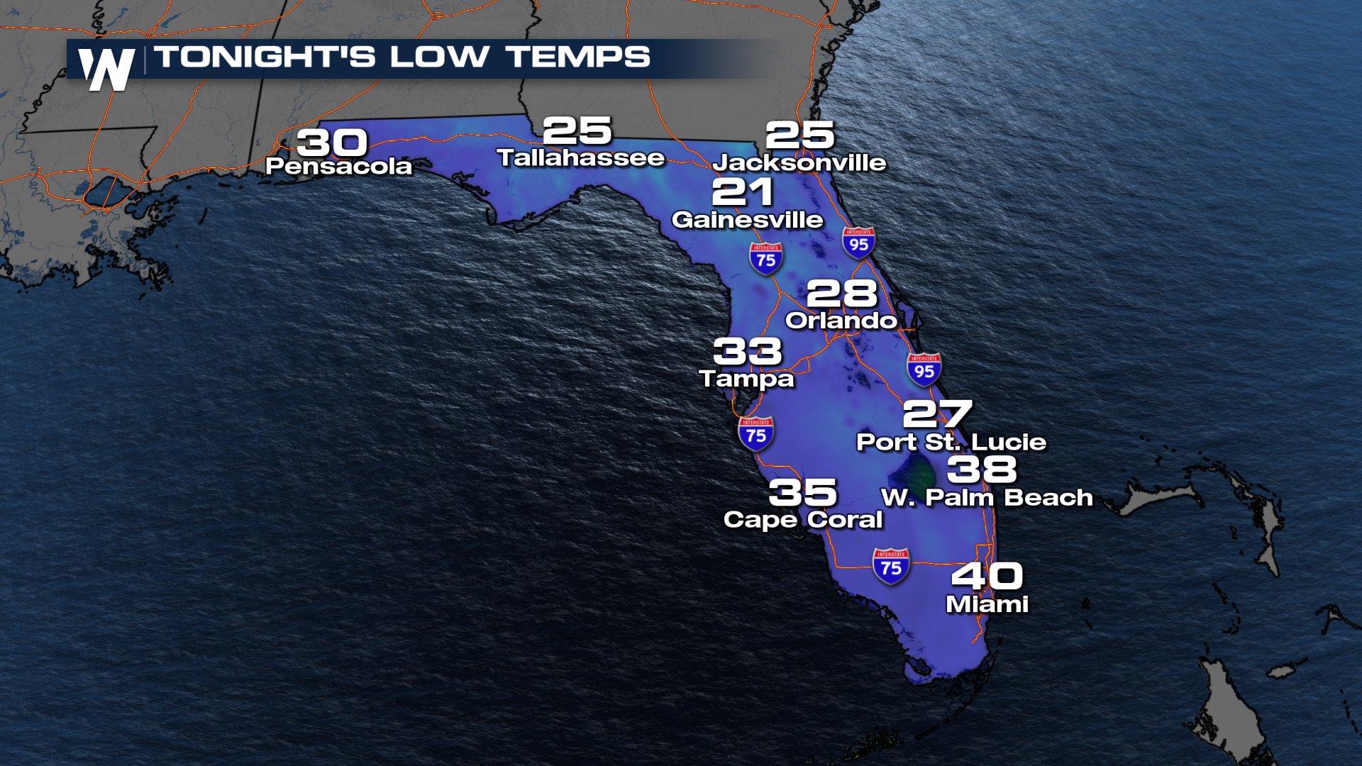
A developing low-pressure will cutted across the Gulf Friday. This system did bring some impressive snow to the Carolinas before moving up the coast. That system will leave the door WIDE OPEN behind it, letting the Arctic air flow much farther south than it has been recently. Overnight lows in the 30's will make it as far south as Miami, where they haven't seen the 30's for more than a decade!
 Even areas like the Tampa area will slip into the freezer by Sunday morning. That's where things might get interesting...
GULF-EFFECT SNOW
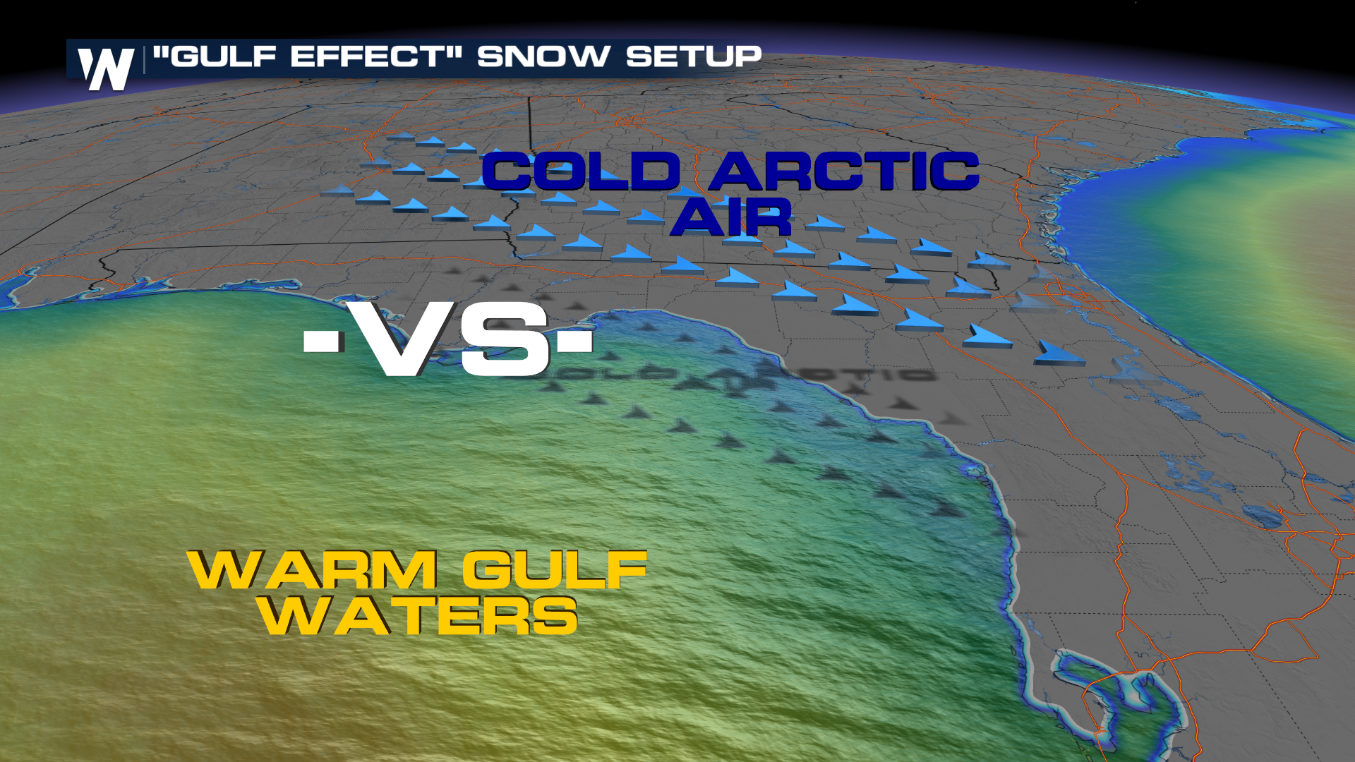
We've started shutting down the lake-effect machine a little bit--it's been that cold recently. Great Lake ice coverage has rocketed way above average for the time of year. Let's find another body of water. The Gulf won't freeze over!
For any sort of "-effect" to happen (rain or snow) there just needs to be a sizable difference in temperatures. Some lesser-known include ocean-effect snow that can sometimes affect places like Nantucket, MA. This is similar, where cold, Arctic air will flow over warmer waters of the Gulf around the Big Bend this weekend.
 The difference in temperatures will drive persistent showers onshore into Sunday. The thinking is that temperatures could catch up to the showers, turning the rain over to snow. This won't be a long-lived setup, so is expected to be more novelty than anything. It's still wild that Florida could pick up snow twice in the same Winter, though! For the record, the last time Tampa picked up measurable snow was January 19, 1977.


