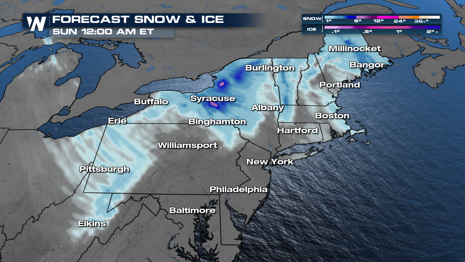
Lingering Snow in the Northeast

NORTHEAST - As this next clipper system continues through, we can see snow and some lake-effect snow. A high-pressure system will move in, and things will taper off on Thursday night.
When all is said and done, the heaviest snow ends up in upstate New York and most of the New England area. With a few of these lake effect bands cranking well into late week, we can see some totals top out at 6"!
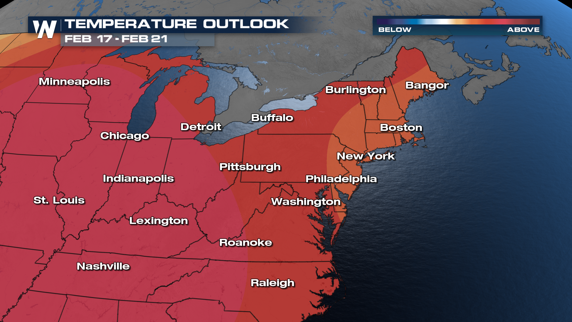
But what about those temps after the fact? Well, judging by the Climate Prediction Center's (CPC) 6-10 day outlook, we're likely to continue with these above-average temperatures even after Valentine's Day weekend. It'll also do a good job thawing out some of that snow left behind by this week's clipper!
Make sure to stay locked in on WeatherNation! We'll cover this system for you all day, as well as break it down in depth in your east regional every :10 past the hour!


