Fake Spring Hits the Southeast

More record highs fell across parts of the Southeast with temperatures well above average in the 70s and 80s. With the high pressure ridge sticking around the Southeast, the above average warmth continues into the weekend.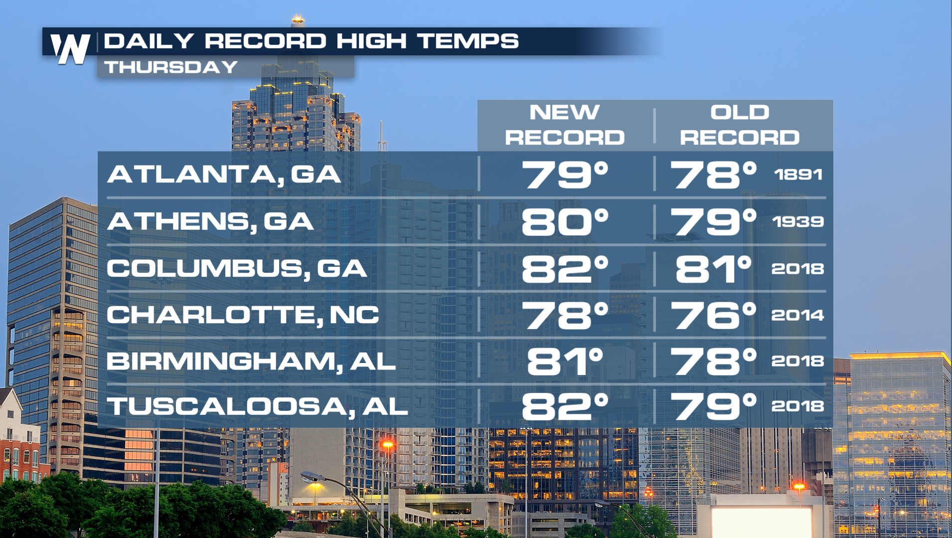
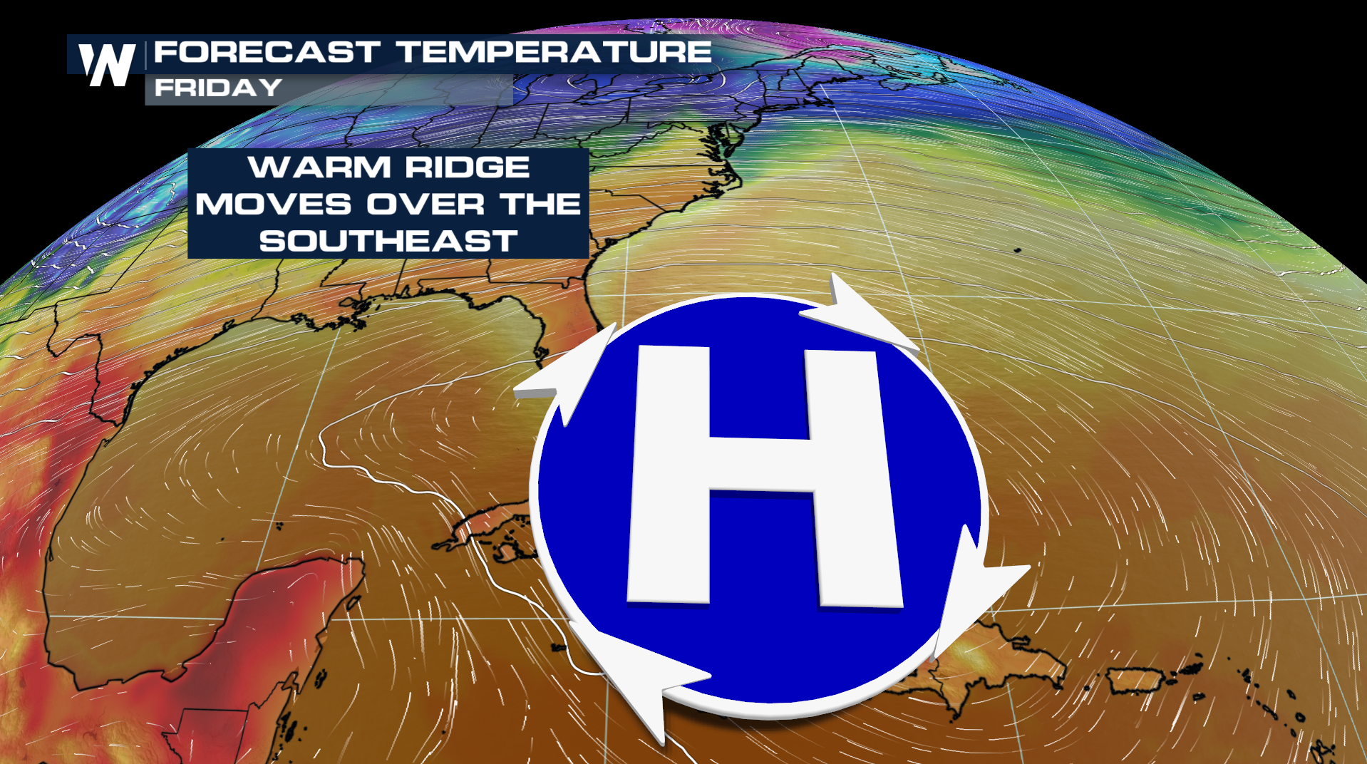
More record high temperatures will be possible through Saturday as the heat builds east.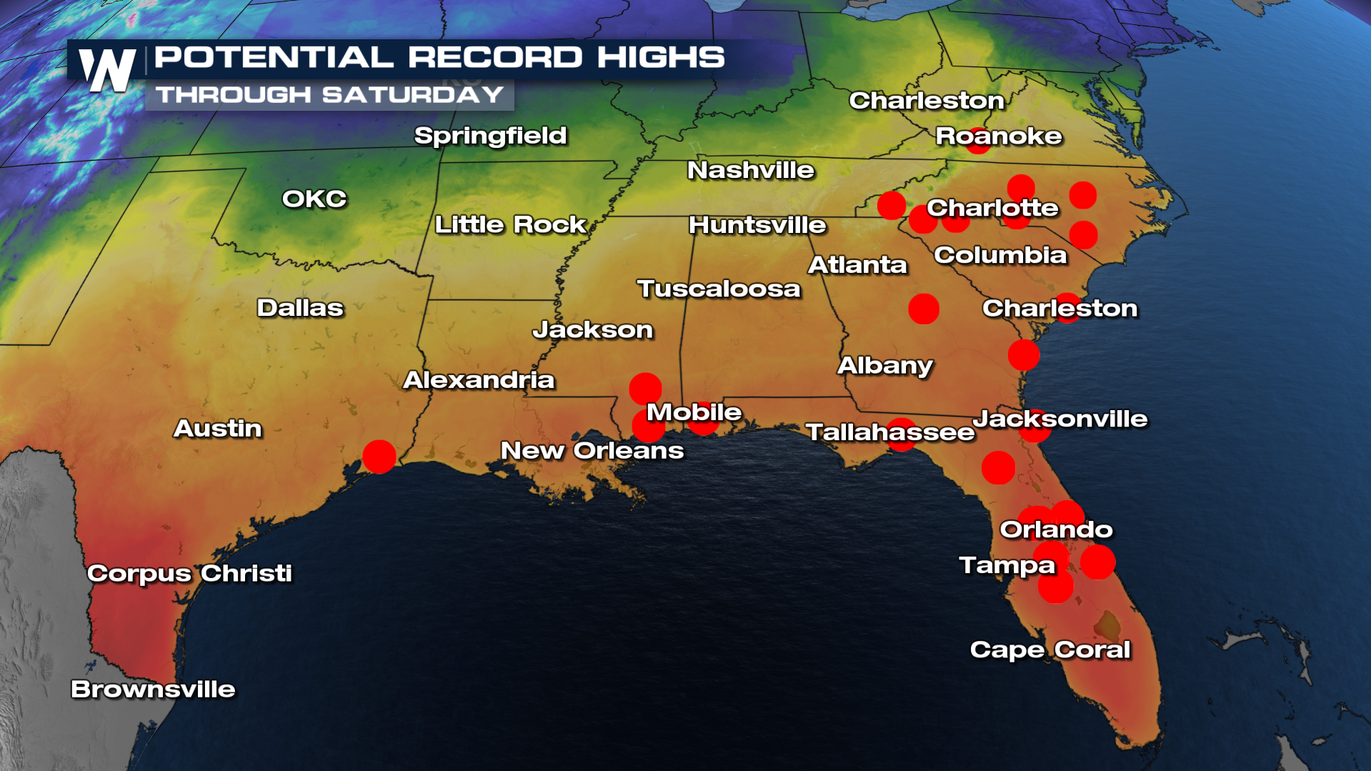
Before a cold front knocks temperatures down this weekend, the above average warmth continues, but it will change very quickly. A handful of cities in Florida will go from Record Warm potential to Record low potential for their daytime max temperature.
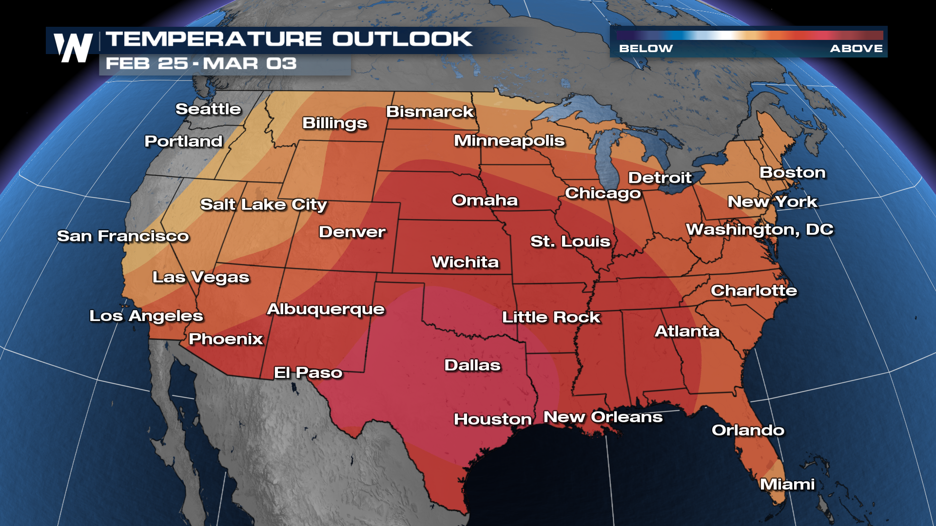
Southern Plains anomalous warmth will help to increase the severe weather threat over the next couple of days. Confidence is very high in spring-like warmth sticking around as we wrap up the month and head into March. The chance for thunderstorms in a more spring-like pattern will continue along with it!