Rocky Mountains Receive Much Needed Snow

Top Stories
20 Feb 2026 2:00 PM
ROCKIES - Widespread winter alerts remain in place across the Four Corners, with additional snowfall expected in the region. Some parts of Utah and Colorado have already seen over a foot of snowfall in the last few days! An additional amount of snowfall is on the way for the Four Corners through the weekend.
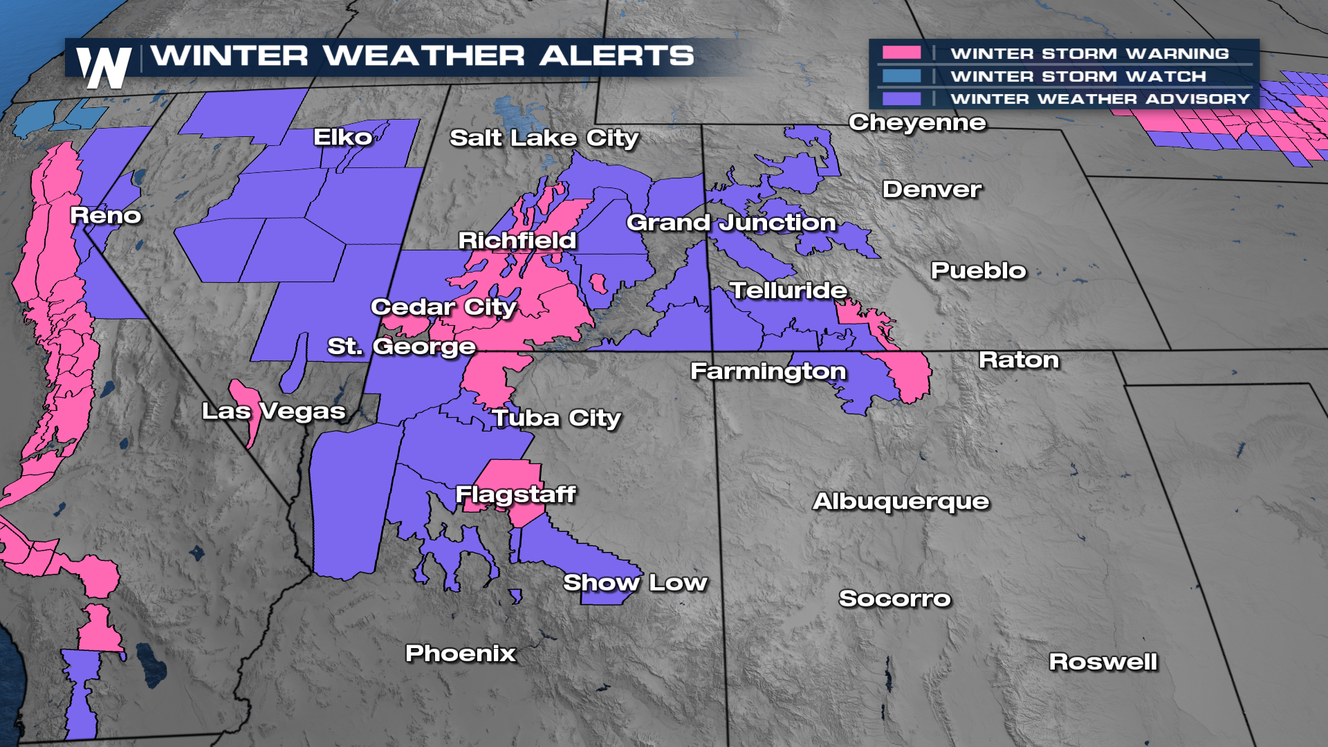
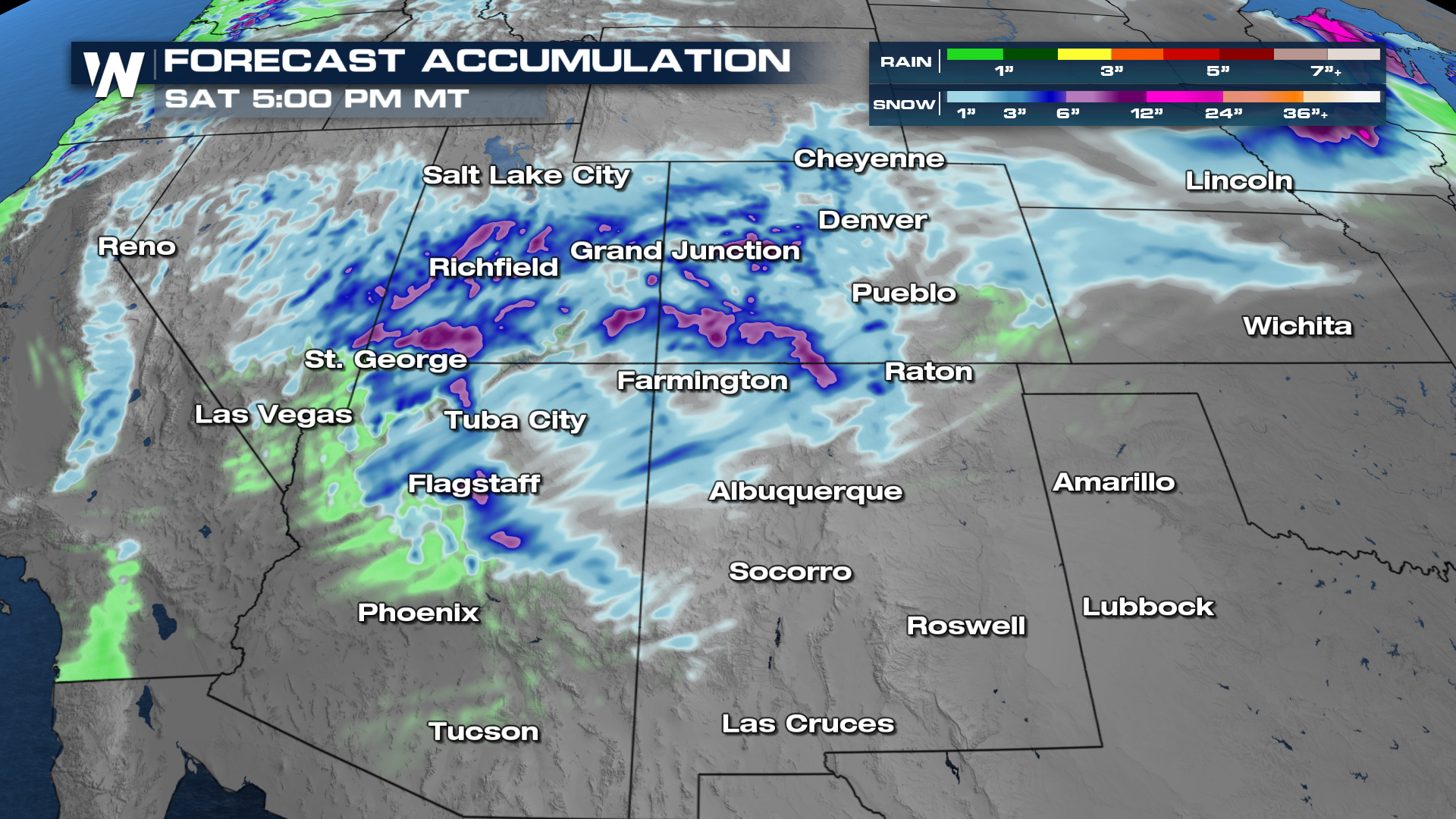
An additional 6-12" will be possible in favored mountain areas of northern Arizona, Utah, and western Colorado.
Stay tuned to WeatherNation for the latest updates.
All Weather News
More

Severe Storms, Flash Flooding Overnight In Midwest
WHAT TO EXPECTIt was a very active day across
22 Jun 2026 1:50 AM


Summer Solstice Kicks Off Father's Day Sunday
Fathers across the country will have to share
21 Jun 2026 5:20 PM

Flood Risk Continues This Weekend for the Gulf Coast States
Numerous flash flood warnings were issued as
21 Jun 2026 1:15 PM

Dry T-Storms & Fire Danger in the West
A weak low-pressure system moving through the
20 Jun 2026 1:40 PM

Tornadoes Tear Through The Midwest, Isolated Severe Storms in the South
EARLIER THIS WEEKMONTROSE, IL - A dangerous t
20 Jun 2026 1:30 AM