Looking Back at the Historic Snowstorm Last Week

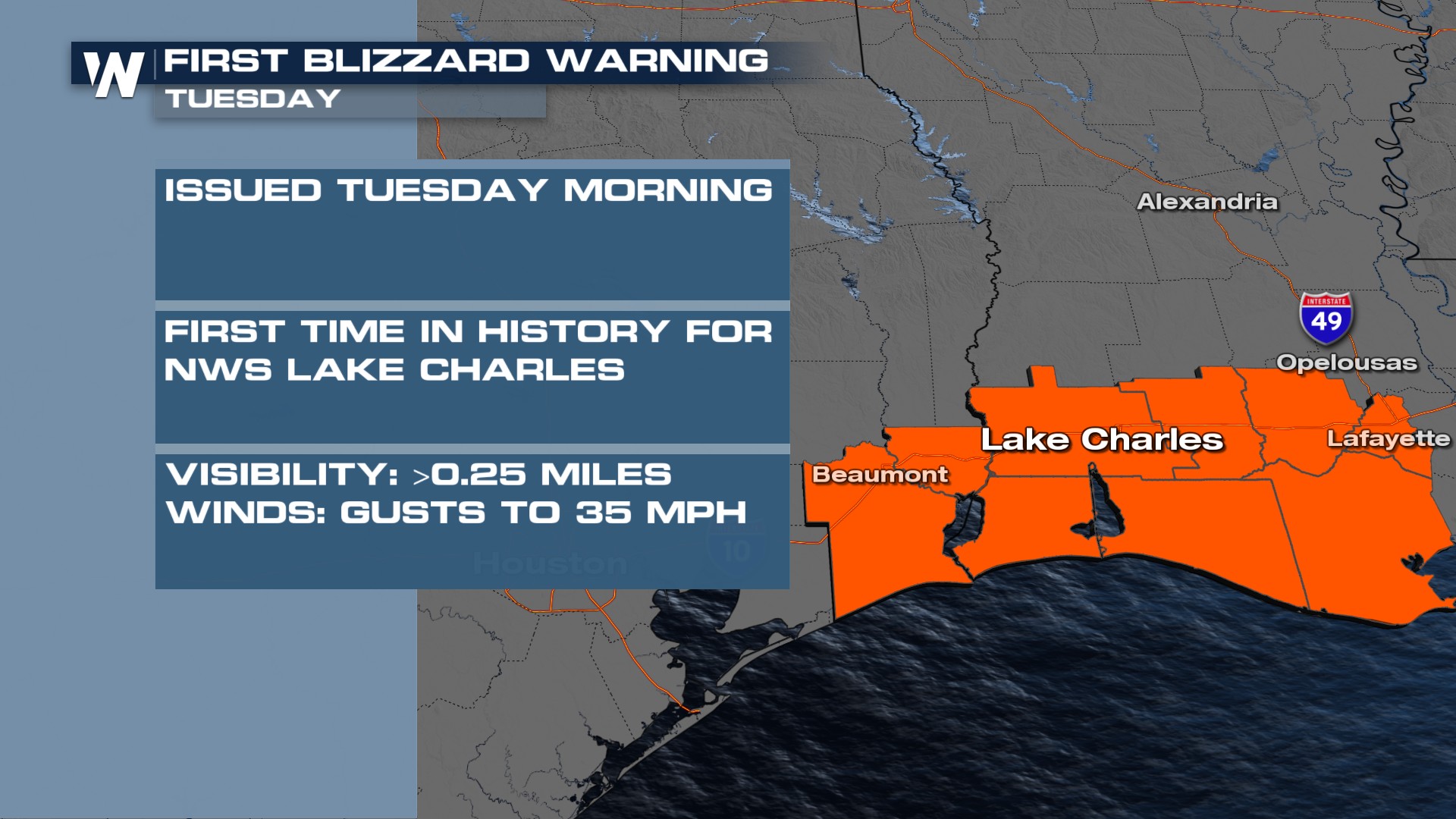
The historic Winter Storm brought the first Blizzard warnings along coastal Louisiana, and once-in-a-lifetime snowfall totals to the South. Roads and schools in some parts of the Gulf Coast remain closed through Thursday because of the icy roadways!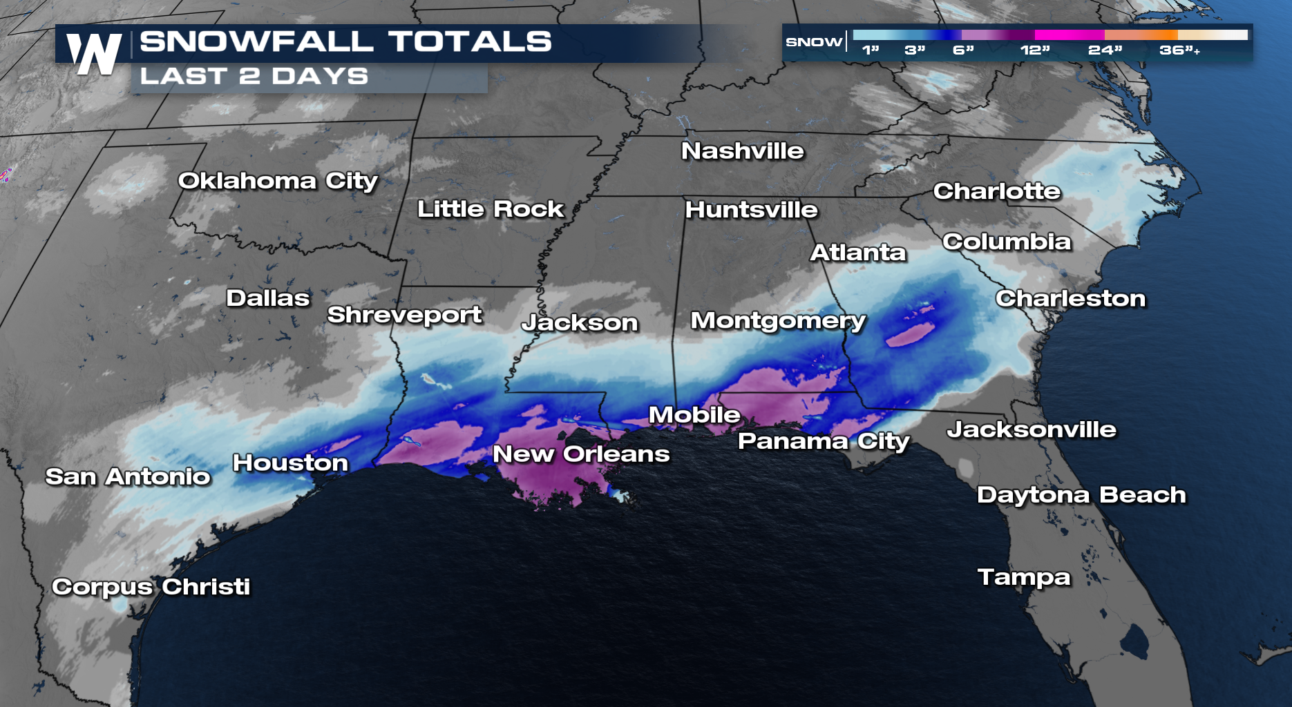
 RELATED ARTICLE: Dangerous Wind Chills Likely Into Next Week
While some places didn't quite see all-time records, anytime it snows this far south is impressive. Areas like Houston reached 4 inches of snowfall, which broke snowfall records for the day. Since the official snowfall is measured at George Bush Intercontinental Airport, the all-time record of 3" is safe. Many locations on the east and south side of town reported 3+" however.
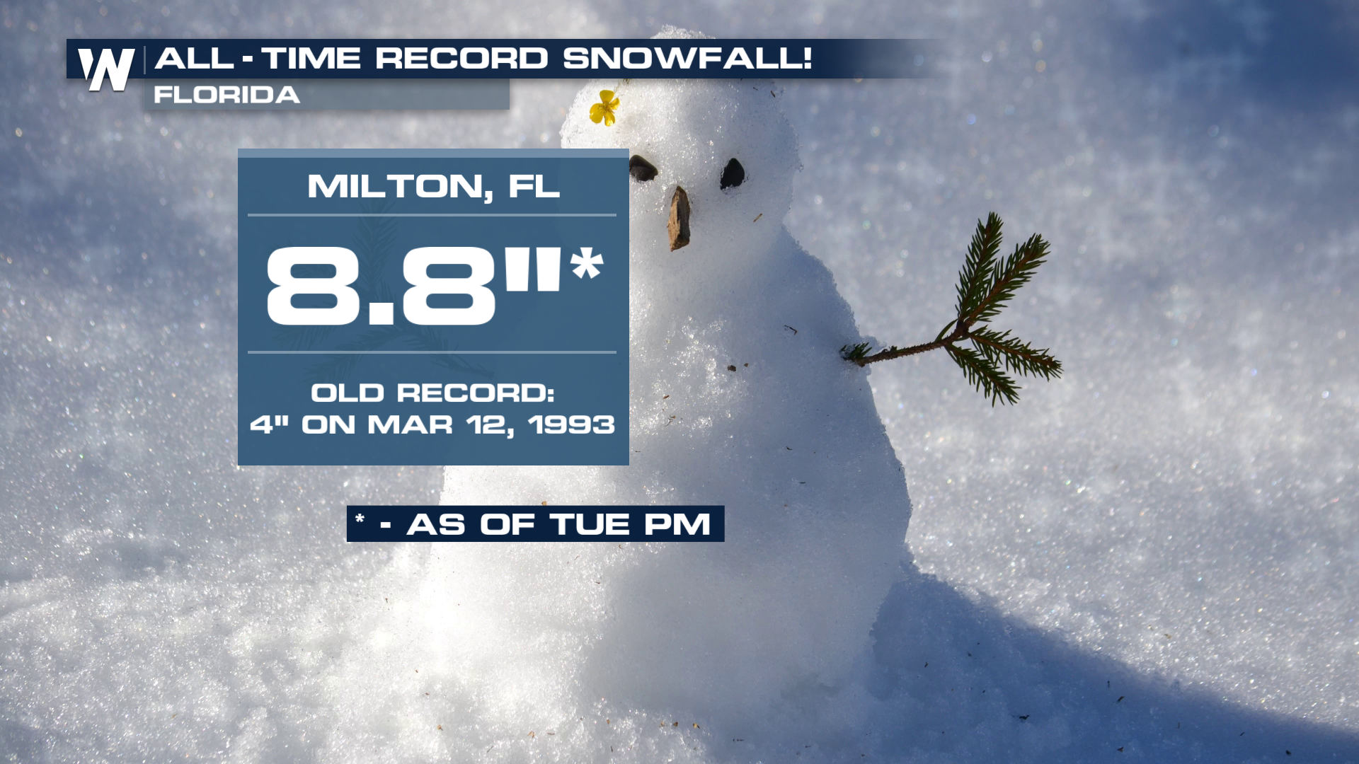
 Even more amazingly, Florida recorded its record highest accumulated snowfall total. This obliterated the old record of 4", set back during the Superstorm of March 1993.
 With such a cold airmass behind all of the wintry weather, the snow might stick around for a little while. Here's what it looked like as the sun rose Wednesday morning. The clouds are moving east while the snowpack slowly melts.
The highest snowfall totals coming out of the South are from Rayne, Louisiana measured, which measured 10.5" of snow. Additional inches of snow across the Southeast will be possible through Wednesday. Freezing rain and sleet will also mix in for areas just to the south. Prepare for travel impacts and potential power outages where heavy ice occurs. A gradual warming trend is likely heading into the weekend!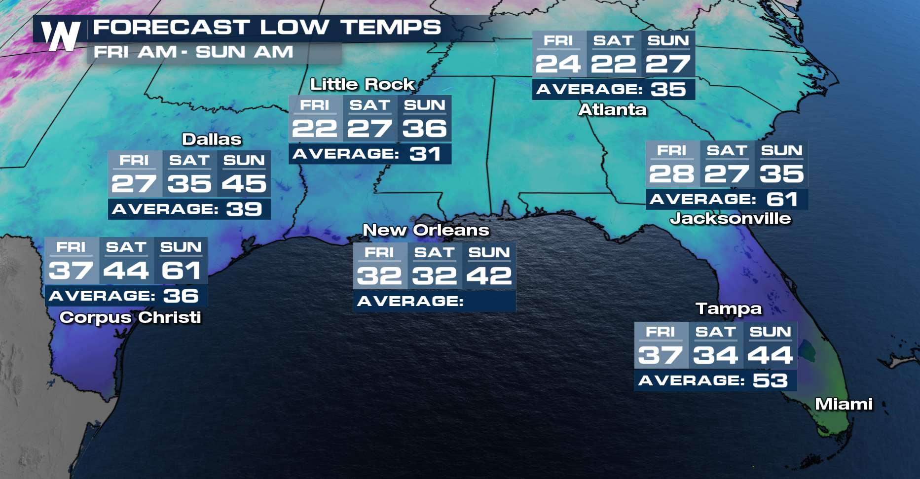 Make sure to tune into to Weather Nation for the latest details.


