Gusty Winds Sunday Ahead of Big Cool Down in the West
Top Stories
22 Oct 2022 3:40 PM
Related Articles: PNW Temperature Cool Down & Snow, N. Rockies Weekend Snowfall and 4 Corners Snowfall
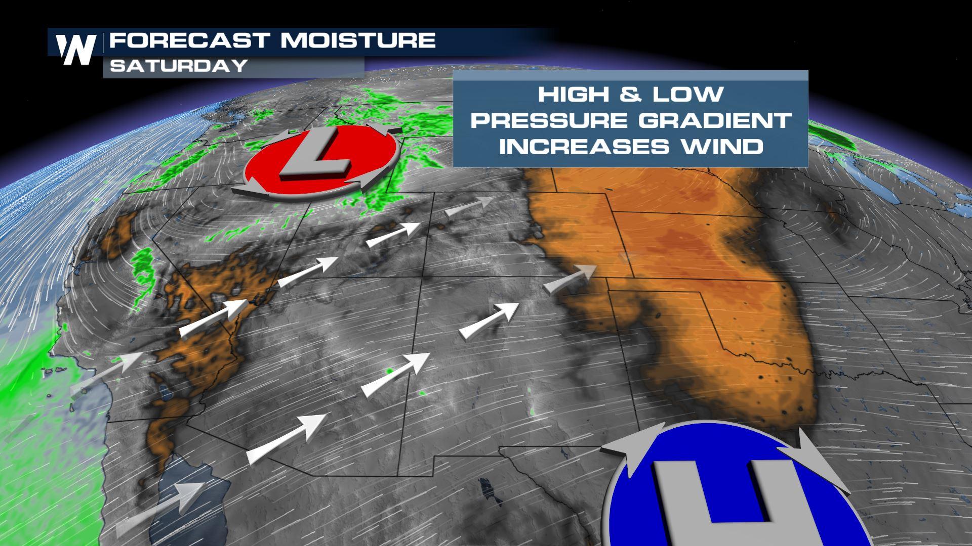
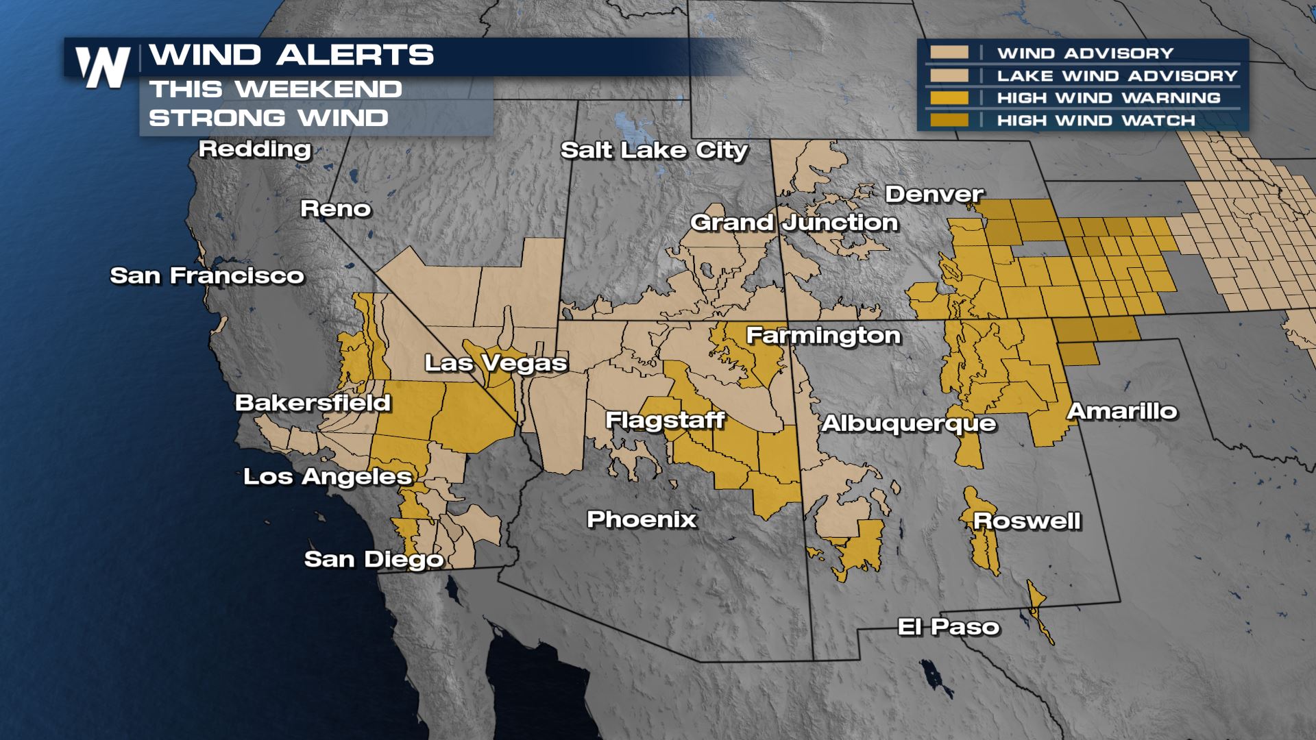
An area of high pressure in the southwest will bring westerly dry winds and the low pressure system dropping out of the Pacific Northwest will tighten the wind gradient throughout the Southwest. Most of the region is under wind alerts through the remainder of the weekend, with winds that could gust up to 70 mph.
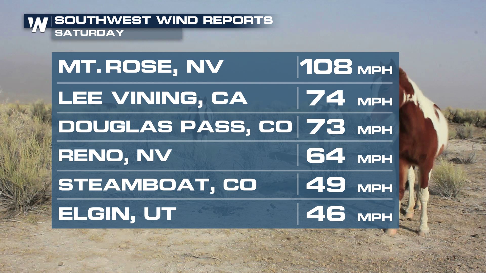
Wind reports from Saturday throughout the Southwest topped 100 mph on Mt. Rose, Nevada!
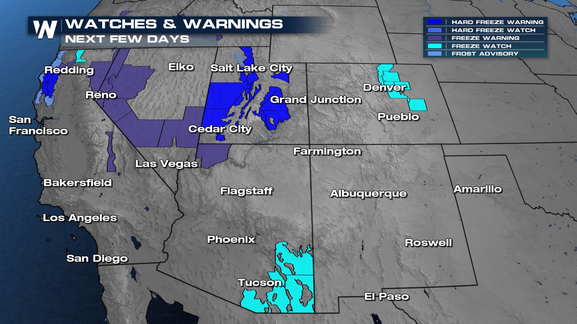
 Temperatures will drop into the 20s and 30s during the overnight hours the next several mornings, certainly cold enough to support even snow at lower elevations. There are hard freeze warnings for Southern Humboldt Interior and Southern Trinity Counties in California with temps expected to fall in the upper 20s, along with much of Utah. Freeze watches and warnings have been issued for the Denver and Tucson metros, for Monday and Tuesday mornings, respectively.
 Cover plants that are outside or bring them inside, and make sure outdoor animals have a warm place to go.
Stay with WeatherNation for the latest on all the impacts of this Fall Storm System!
Cover plants that are outside or bring them inside, and make sure outdoor animals have a warm place to go.
Stay with WeatherNation for the latest on all the impacts of this Fall Storm System!
Wind
Expect widespread gusts in the range of 40- 50 MPH in the beige areas, with stronger gusts up to 70 mph are possible in the areas shaded darker gold. A High Wind Warning is in effect for the Greater Las Vegas area along with the southern Sierra Nevada and much of the Laramie range in Wyoming. Take in any outdoor Halloween decorations that can blow away!
Cold Air
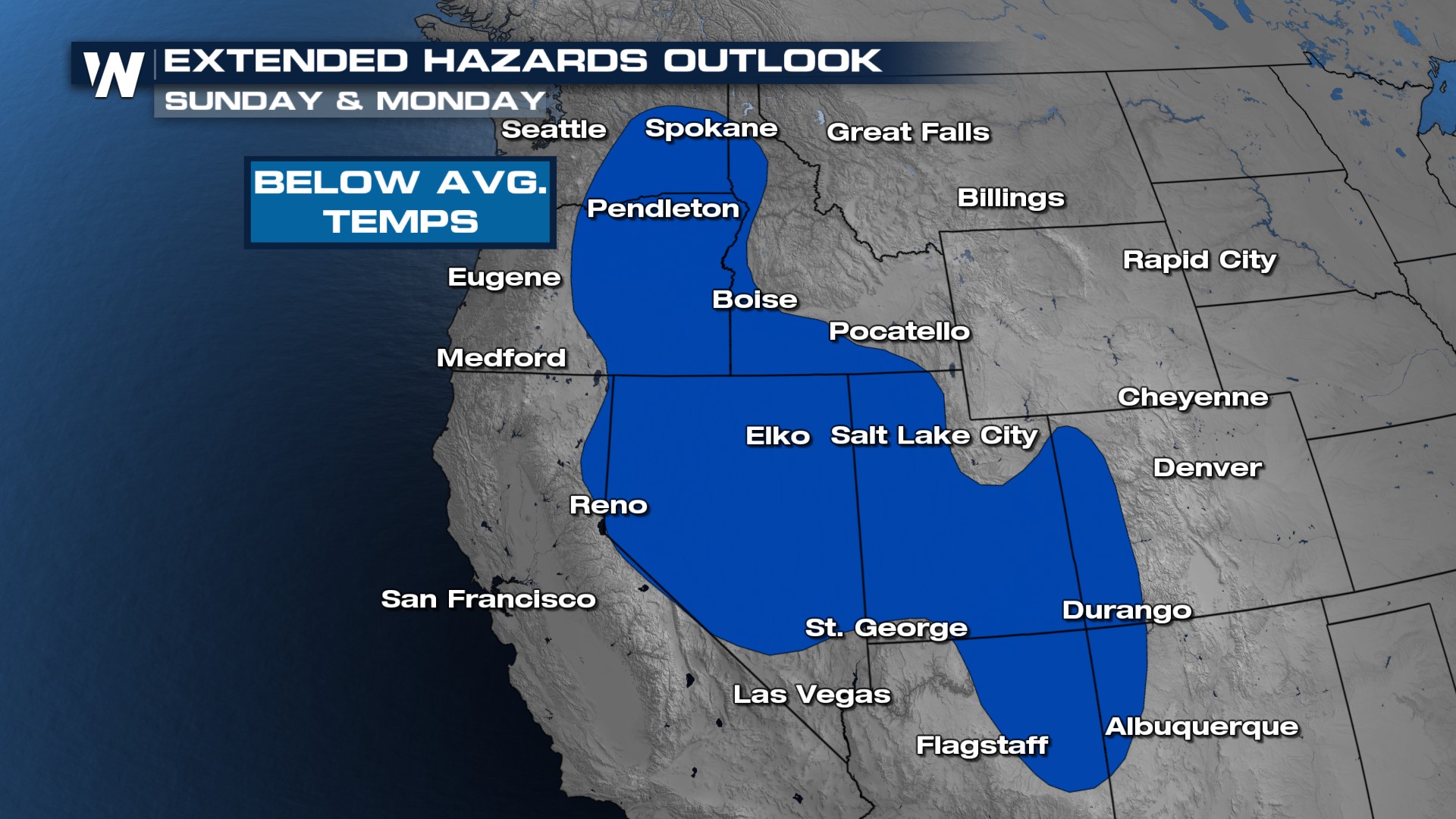
The Weather Prediction Center has highlighted extensive colder than average temperatures Sunday through Monday as cold Canadian air follows the upper level low and is dragged all the way into Southern California!
Temperatures will drop into the 20s and 30s during the overnight hours the next several mornings, certainly cold enough to support even snow at lower elevations. There are hard freeze warnings for Southern Humboldt Interior and Southern Trinity Counties in California with temps expected to fall in the upper 20s, along with much of Utah. Freeze watches and warnings have been issued for the Denver and Tucson metros, for Monday and Tuesday mornings, respectively.
Cover plants that are outside or bring them inside, and make sure outdoor animals have a warm place to go.
Stay with WeatherNation for the latest on all the impacts of this Fall Storm System!All Weather News
More
More Storms for the East Through Monday
A low-pressure system that moved through the
2 Aug 2026 10:40 PM

Wildfire Outbreak in the Pacific Northwest
SPOKANE, WA - On Saturday, August 1st, the Ol
2 Aug 2026 10:35 PM


After Reaching Category 5, Genevieve Weakens in the Pacific
PacificGenevieve formed on last Friday south
2 Aug 2026 6:25 PM

Flooding, Severe Storms Target the Midwest Again
After an active week of storms across the nor
1 Aug 2026 1:40 AM

Flooding Risk Increases as Heavy Rain Targets the Tri-State Area
Tuesday, heavy rainfall moved across the Nort
30 Jul 2026 12:25 AM

Severe Weather: Energy From the Midwest Now in the Southeast
UPPER MIDWEST - Through Monday, dangerous tor
29 Jul 2026 10:30 PM