Hail And Wind Threat for Northern Plains Sunday

Special Stories
4 Aug 2019 4:19 AM
A cold front moving through the Northern High Plains today will bring a chance for strong to severe storms. Damaging winds and large hail will be the main weather risks. Here is the very latest forecast.
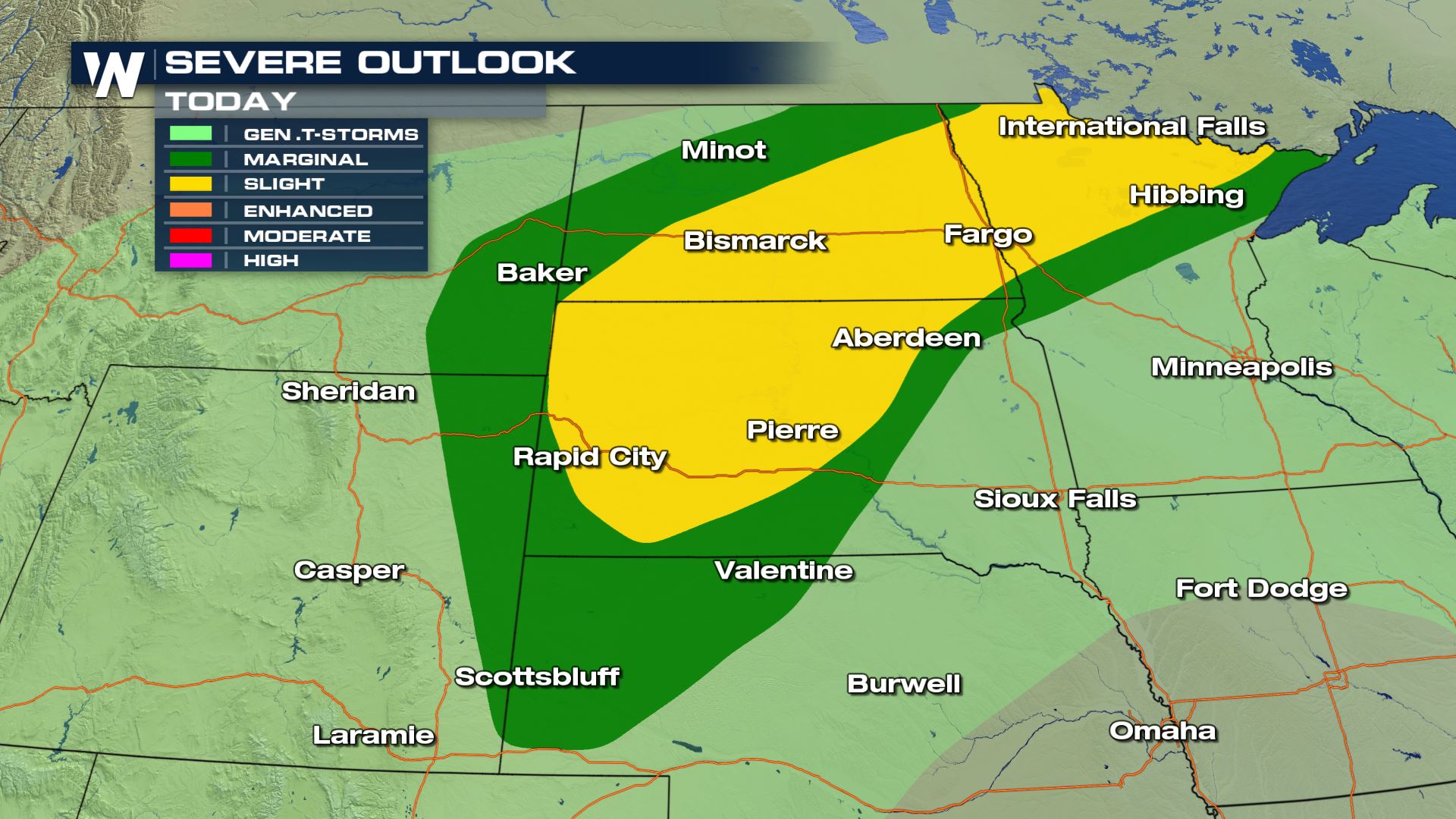 Areas of the Dakotas and northern areas of Minnesota will have the highest chance for severe storms today. A slight risk has been issued for cities like Rapid City, Bismarck and Fargo. This means scattered severe storms are in the forecast.
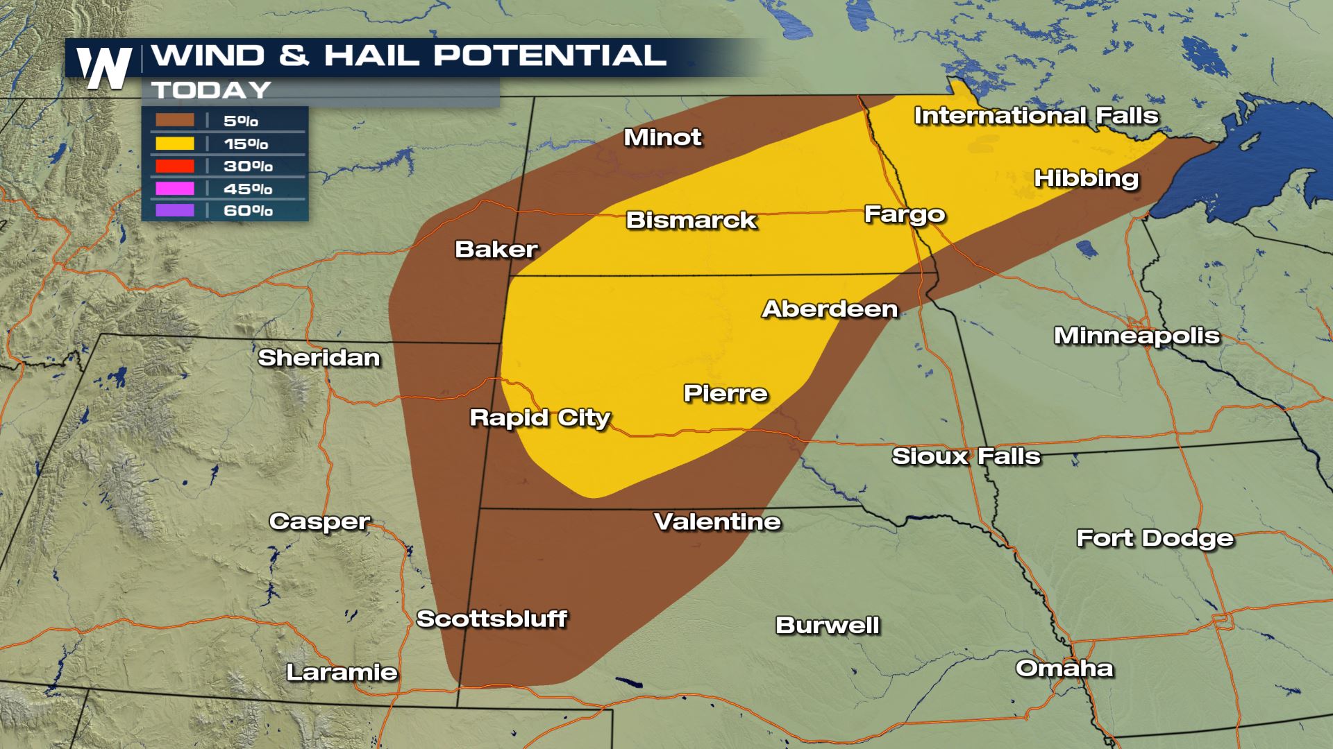 Large hail and damaging winds will be the primary threats. Hail could be up to 2" in diameter and wind gusts could be over 70 mph within some of today's storms. You will want a backup plan in place if you have any outdoor activities.
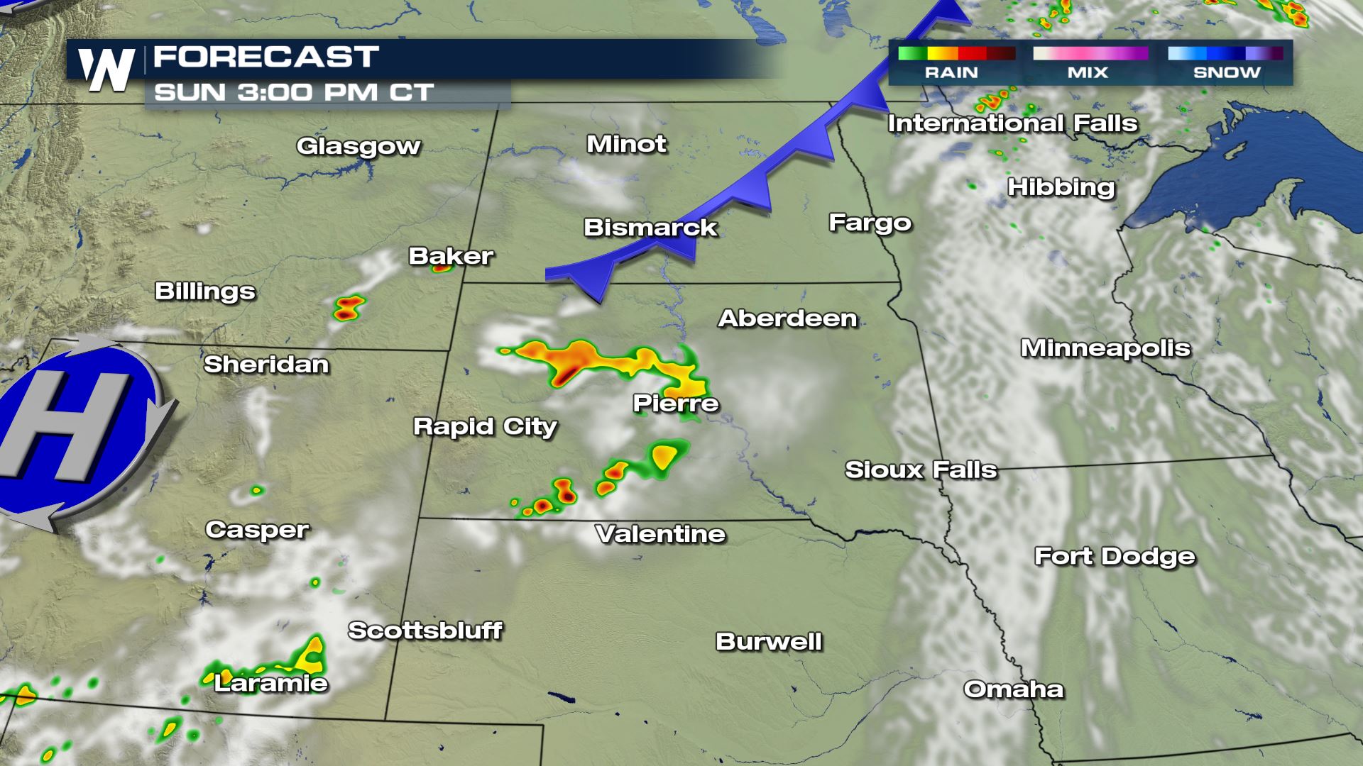
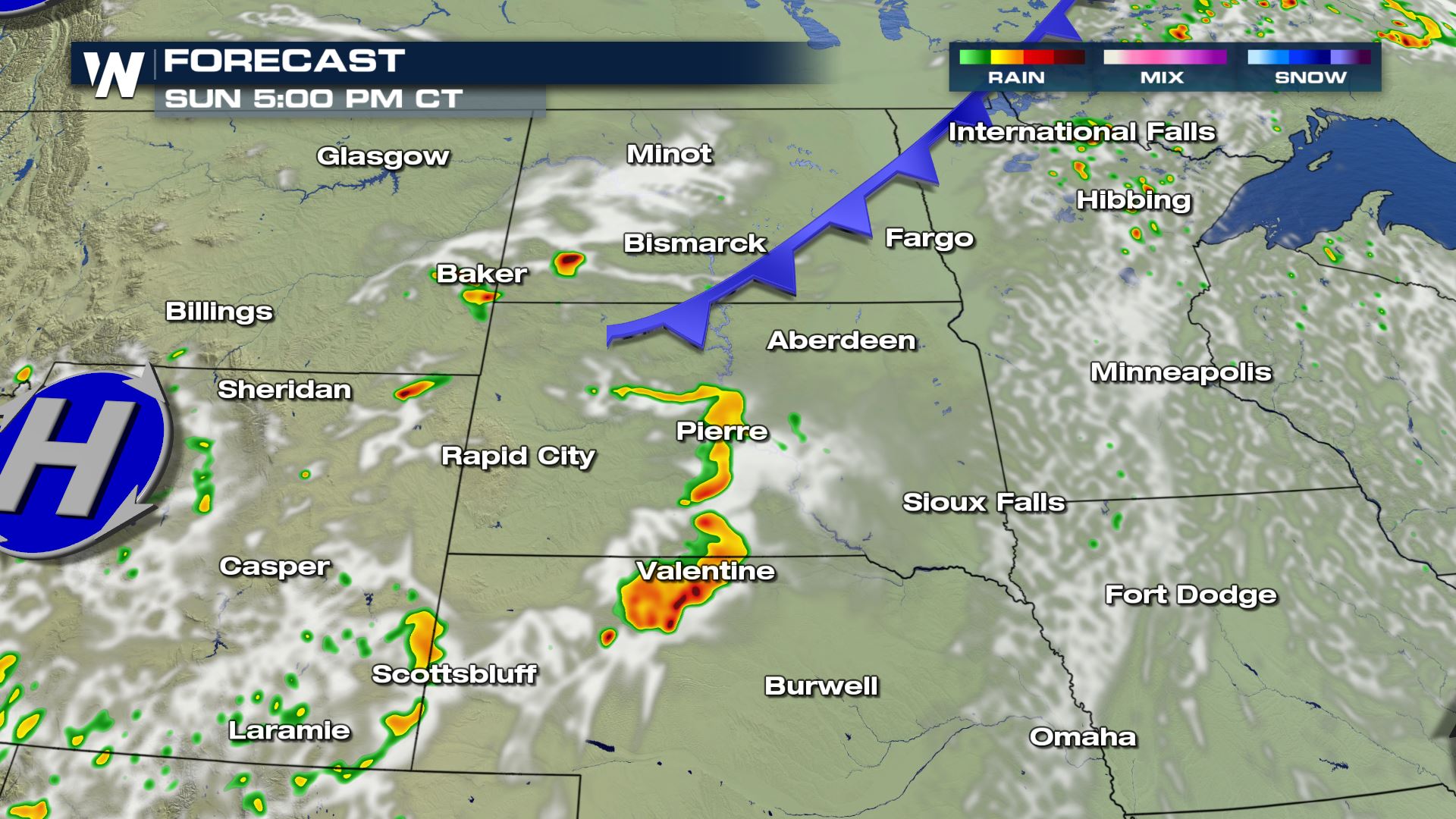
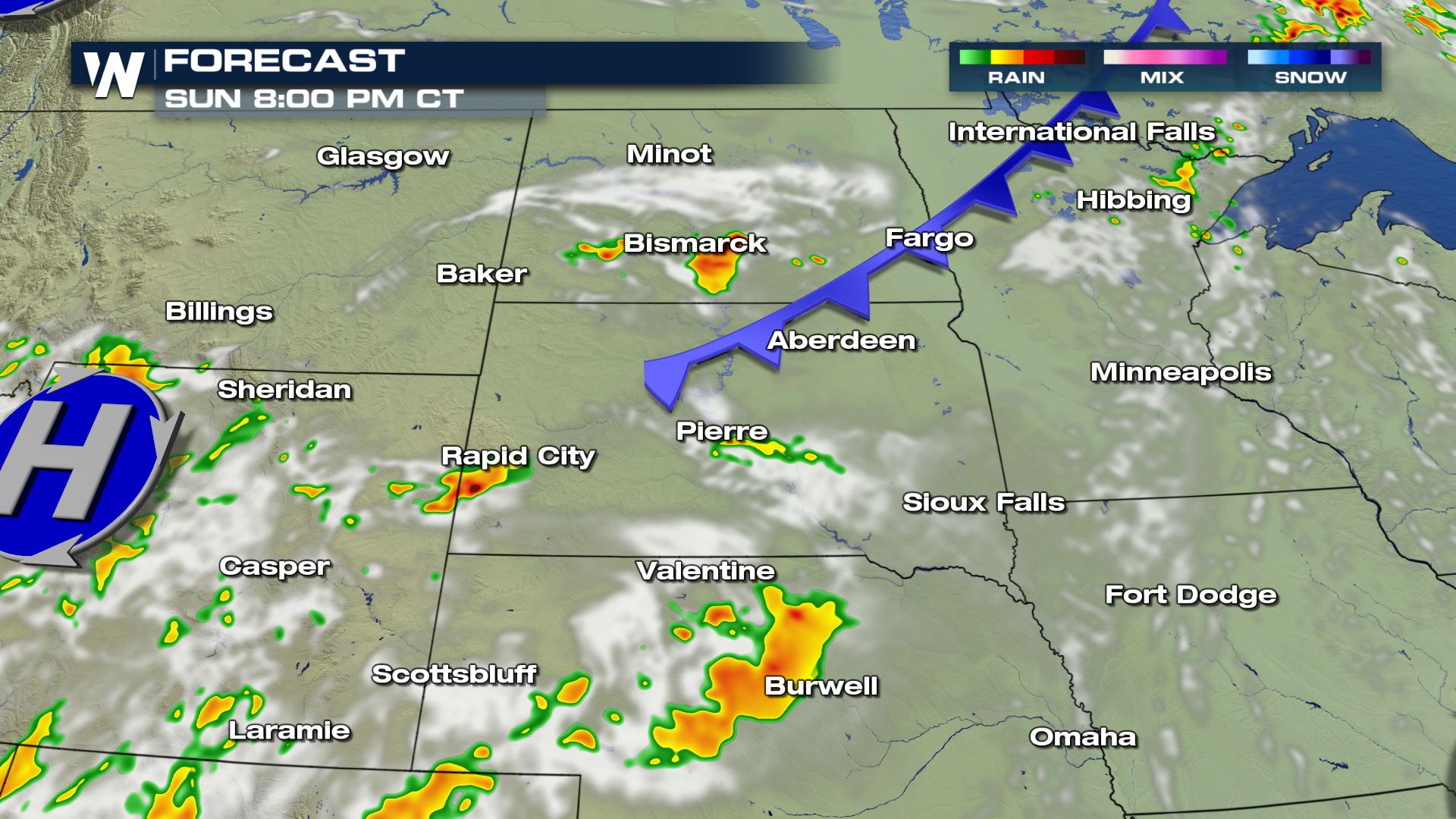 The timing of today's storms will be this afternoon and evening. We could see a few storms in the morning, but the severe risk will be highest during the peak heating hours of the afternoon. Keep checking with WeatherNation for more updates.
Severe Outlook
Areas of the Dakotas and northern areas of Minnesota will have the highest chance for severe storms today. A slight risk has been issued for cities like Rapid City, Bismarck and Fargo. This means scattered severe storms are in the forecast.
Severe Risks
Large hail and damaging winds will be the primary threats. Hail could be up to 2" in diameter and wind gusts could be over 70 mph within some of today's storms. You will want a backup plan in place if you have any outdoor activities.
Forecast
The timing of today's storms will be this afternoon and evening. We could see a few storms in the morning, but the severe risk will be highest during the peak heating hours of the afternoon. Keep checking with WeatherNation for more updates.
All Weather News
More
More Storms for the East Through Monday
The threat for flooding rain continues across
3 Aug 2026 6:00 PM


After Reaching Category 5, Genevieve Weakens in the Pacific
PacificGenevieve formed last Friday south of
3 Aug 2026 12:30 AM

Flooding, Severe Storms Target the Midwest Again
After an active week of storms across the nor
1 Aug 2026 1:40 AM

Flooding Risk Increases as Heavy Rain Targets the Tri-State Area
Tuesday, heavy rainfall moved across the Nort
30 Jul 2026 12:25 AM