Saharan Dust Blankets Florida, More Heat Ahead Too

Have you noticed the hazy skies over southern Florida the past few days? It is all thanks to Saharan Dust, which traveled all the way from Africa! The Saharan Air Layer (or SAL) is typical for June and July when trade winds pick up large plumes of Saharan dust and sand, carrying it across the Atlantic. If you'll remember, we had a significant SAL event in June that kept Puerto Rico hazy, hot, and dry. SALs suppress tropical development because thunderstorms struggle to form in relatively stable air. For Floridians, and the rest of the Gulf Coast this week, we shouldn't see much impact due to the SAL other than hazy skies. The plume migrates from Florida into Texas over the next few days with Florida seeing haze clearing by the weekend.
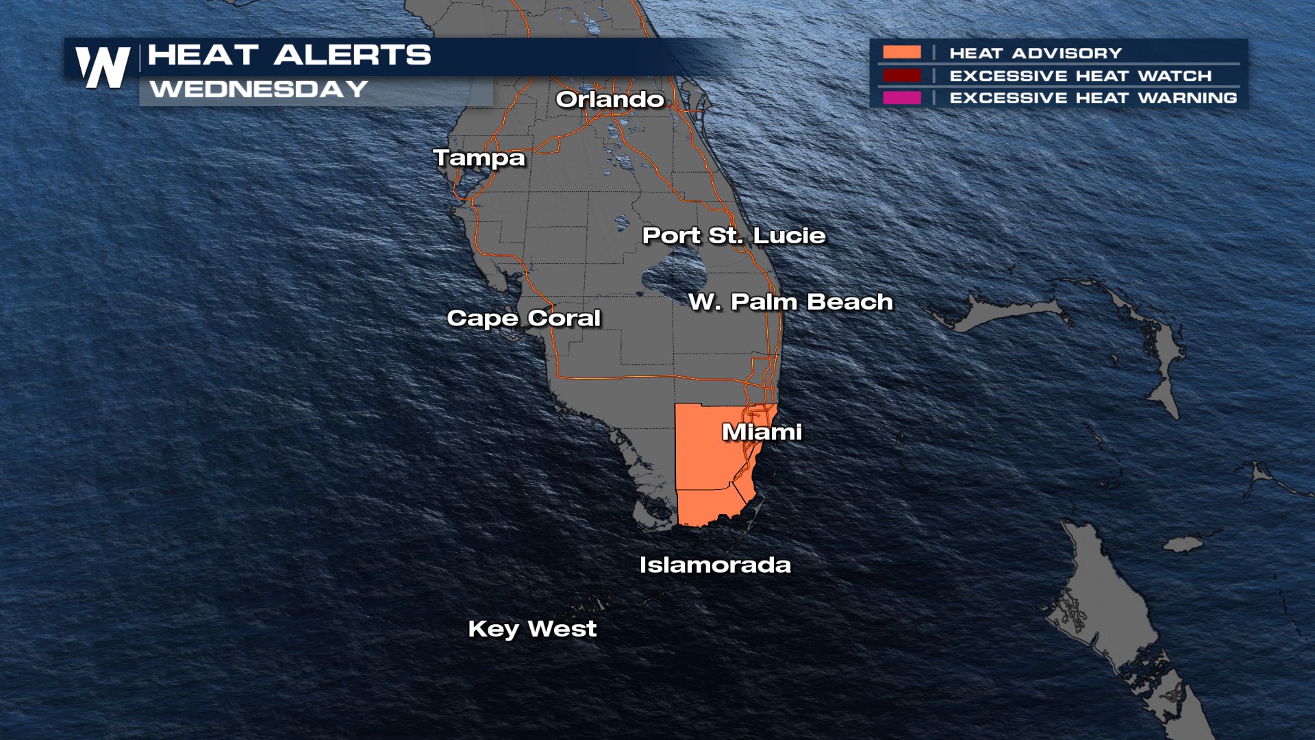
The other factor in southern Florida is the intense, unrelenting heat! Heat advisories remain in place for the Miami area Wednesday.
 Part of the reason for the heat alerts isn't necessarily the highs (in the 90s for most) but the heat index values, topping 110 in many locations, especially in the Gulf Coast States.

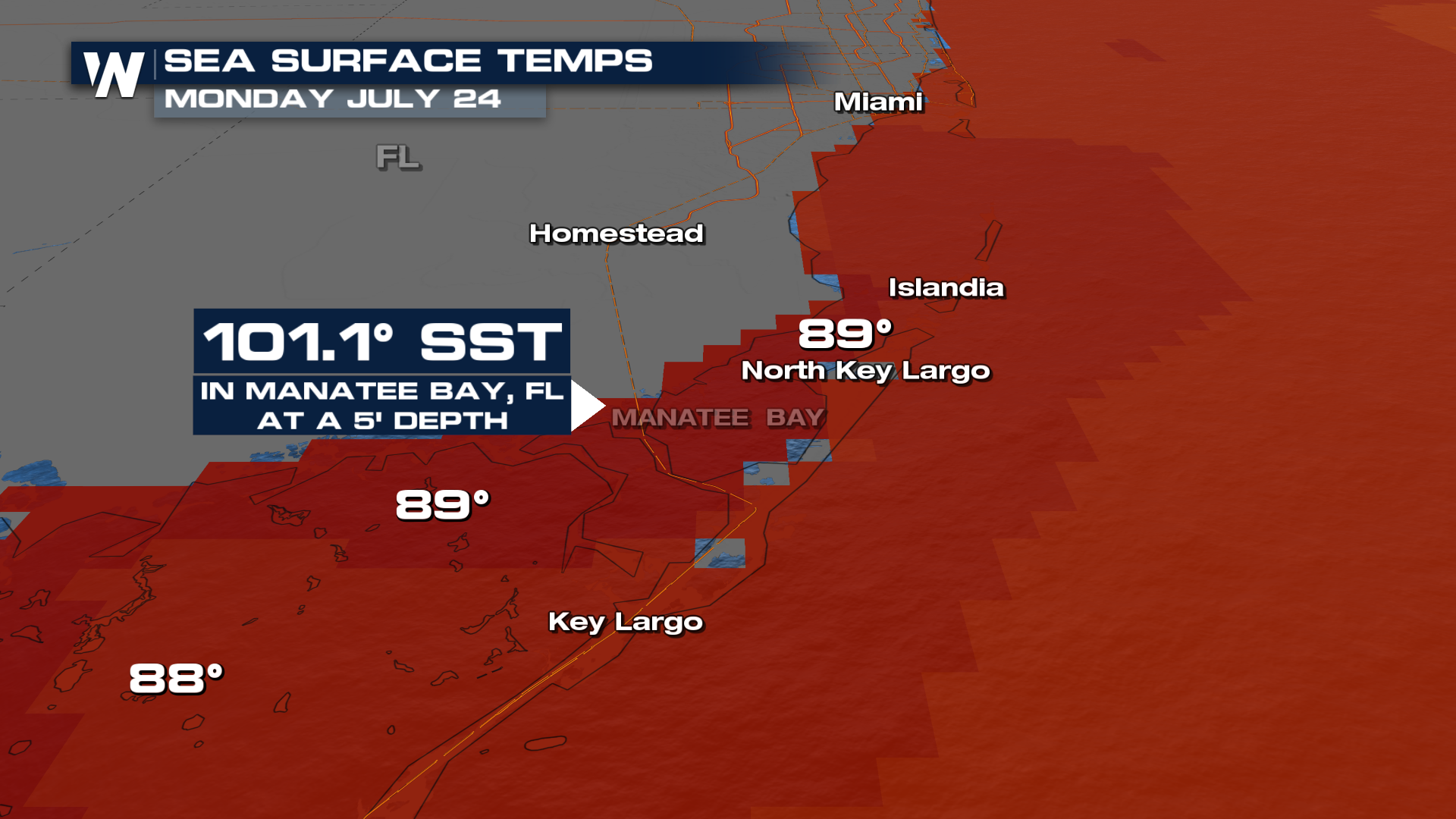
Not only is it hot on land, but the waters in the Gulf and Atlantic are between 85° to 90°! This is increasing the humidity and helping the heat index values into the triple digits!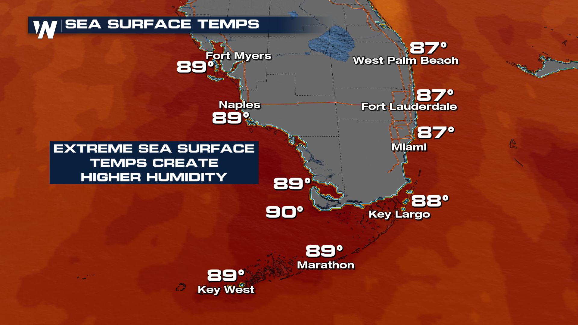 In face, Manatee Bay on Monday hit 101.1° at a depth of 5 ft. This temperature is a common hot tub temperature!
 Stay with us for the latest forecast, your eastern regional forecast at :10 past.


