Heavy Lake Effect Snow Falling in the Eastern Great Lakes
Special Stories
28 Nov 2018 11:19 AM
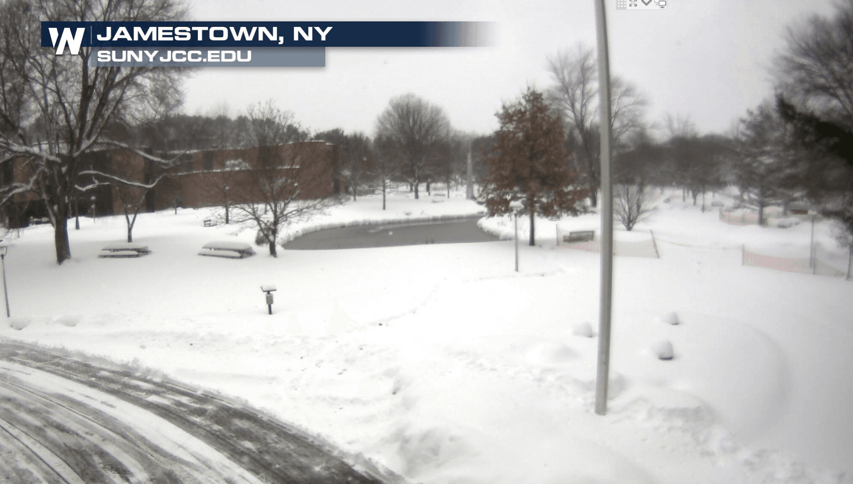
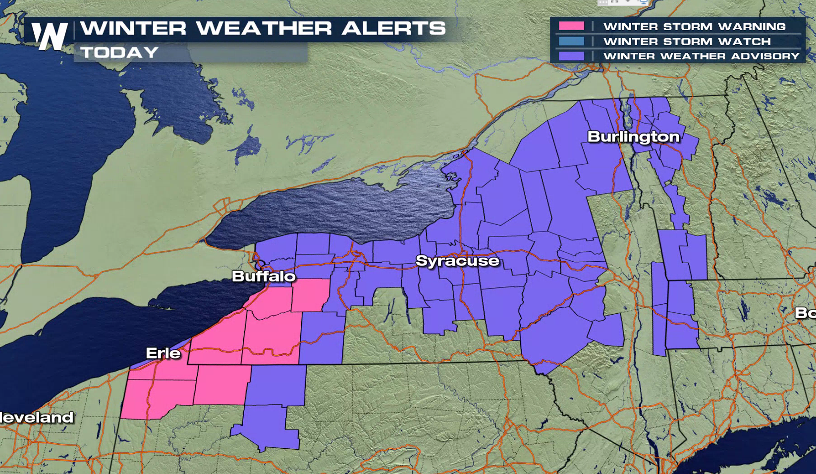
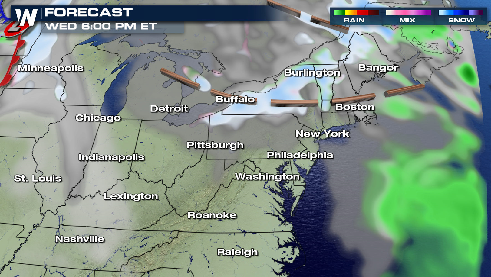
Cold air rushing across the eastern Great Lakes is helping to produce several lake effect snow bands, some with heavy snow. Winter weather alerts extend from northwestern Pennsylvania to Vermont. Up to an additional 6" may fall today (Wednesday) bringing some totals to around a foot of accumulation over the last 24 hours.
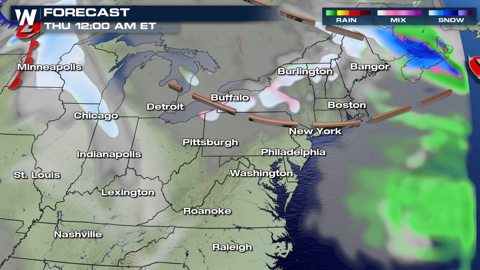
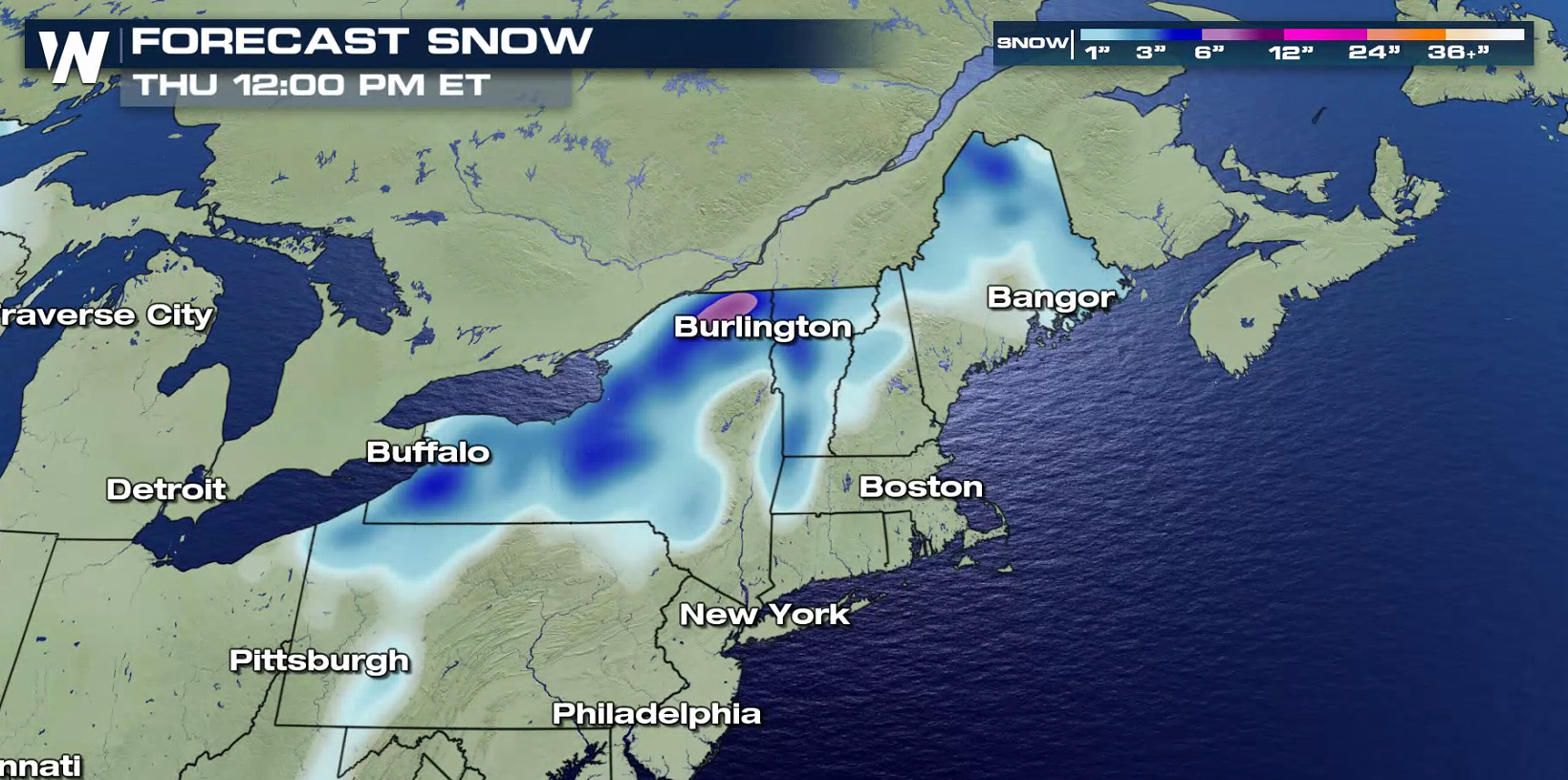 Along with the cold air, a trough of low pressure crossing the Great Lakes will help to enhance snowfall. This is behind the low pressure center that produced blizzard conditions from the Midwest into New England. Snow bands will become more disorganized into Thursday morning and diminish by afternoon as the wind direction shifts.
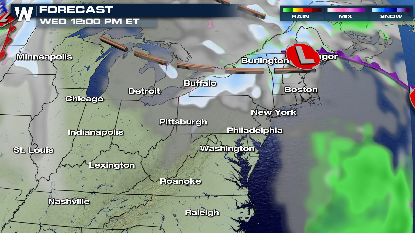
Along with the cold air, a trough of low pressure crossing the Great Lakes will help to enhance snowfall. This is behind the low pressure center that produced blizzard conditions from the Midwest into New England. Snow bands will become more disorganized into Thursday morning and diminish by afternoon as the wind direction shifts.
All Weather News
More
East Gears Up for Stormy, Wet Weekend
A low pressure system crashing through the Mi
1 Aug 2026 11:35 AM


Flooding, Severe Storms Target the Midwest Again
After an active week of storms across the nor
1 Aug 2026 1:40 AM


After Reaching Category 5, Genevieve Weakens in the Pacific
PacificFausto is now a post-tropical cyclone.
31 Jul 2026 1:30 AM

Flooding Risk Increases as Heavy Rain Targets the Tri-State Area
Tuesday, heavy rainfall moved across the Nort
30 Jul 2026 12:25 AM

Severe Weather: Energy From the Midwest Now in the Southeast
UPPER MIDWEST - Through Monday, dangerous tor
29 Jul 2026 10:30 PM