Storms Knock Out Power on the East Coast, More On the Way

Thursday's storms left a lot of residents in the dark across parts of the Interstate 95 region! Power crews have been working hard trying to get as many customers as possible back on board as the warm temperatures build in! If you decide to use a generator to power your home, please keep it away from windows and doors (at least 25 ft) to prevent carbon monoxide poisoning.
Next Round
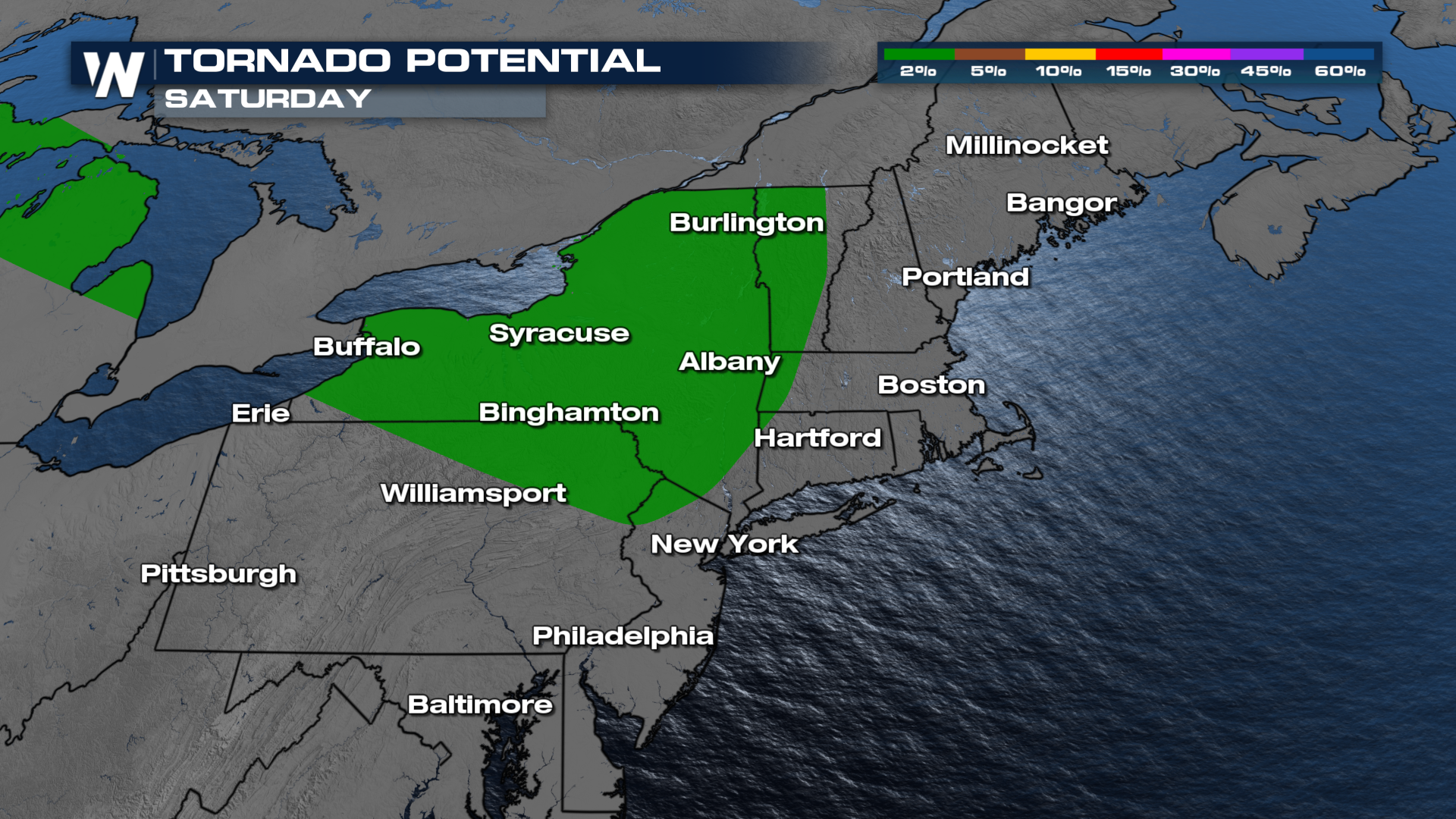
Another round of severe storms will be possible over the weekend, primarily farther north than Thursday's strongest storms. Energy from the Upper-Midwest moves through the Great Lakes late Friday, arriving in New York state on Saturday. Gusty winds are expected to be the main threat, meaning downed trees and power lines, in addition to a low-end tornado risk. 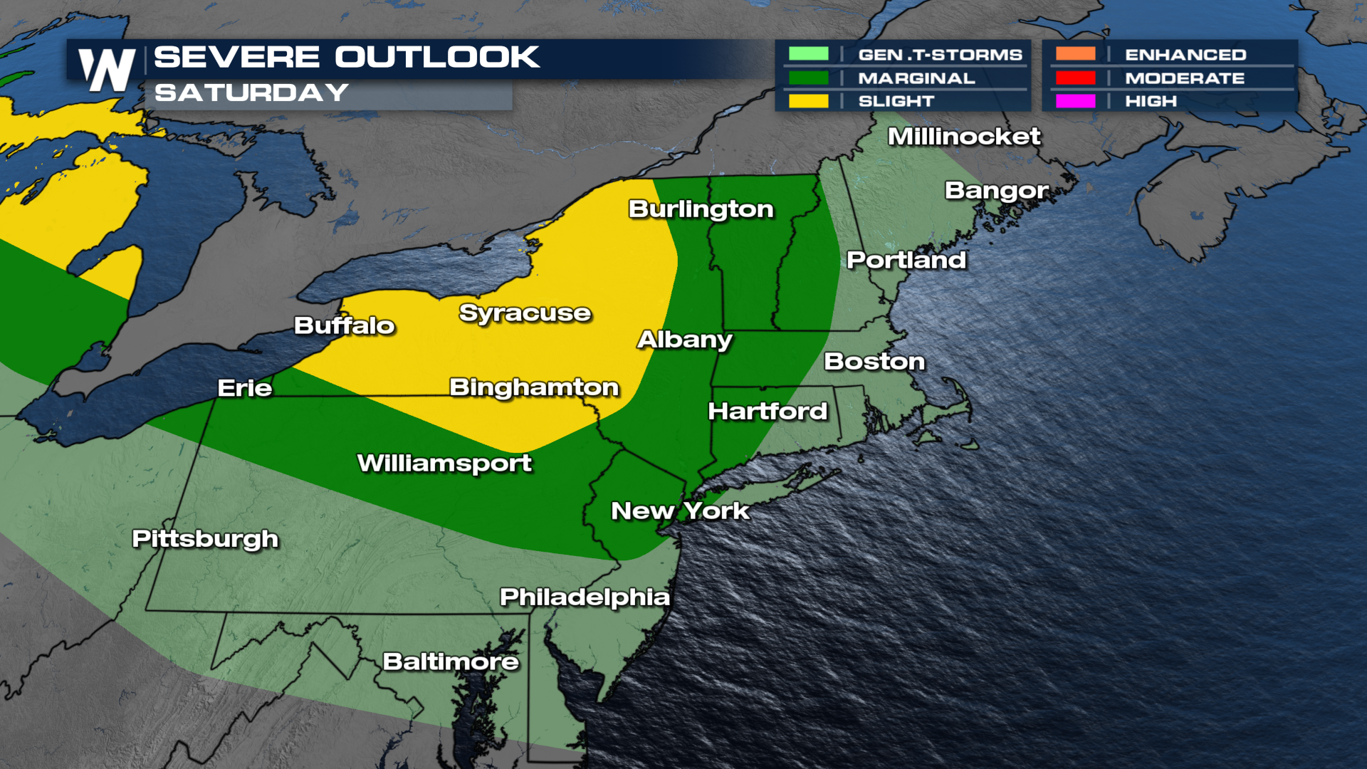
 The threat will continue Sunday morning as storms continue to move in from NW to SE.
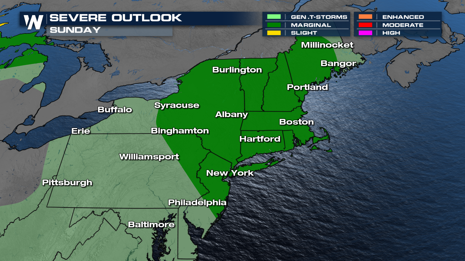
Forecast Timing
Tonight, a few storms will try to build into Western NY and PA but they will fizzle as they move eastward! However, more severe storms will be likely on Saturday with leftover severe storms rolling out of Michigan. Another round of severe storms could be possible into Sunday for the New England region.
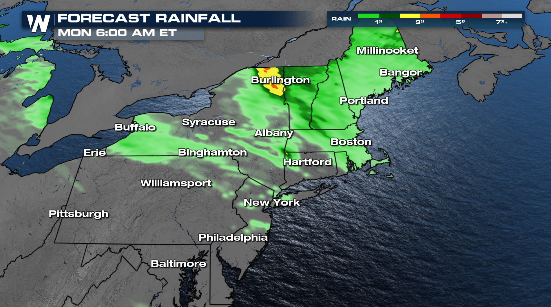
Flooding
Some heavy rain and flooding is becoming likely if repeated rounds of storms move over the same areas like our forecast suggests below!