Eastern Pacific Hurricane Season off to a Fast Start, Atlantic Remains Quiet

Eastern Pacific Ocean
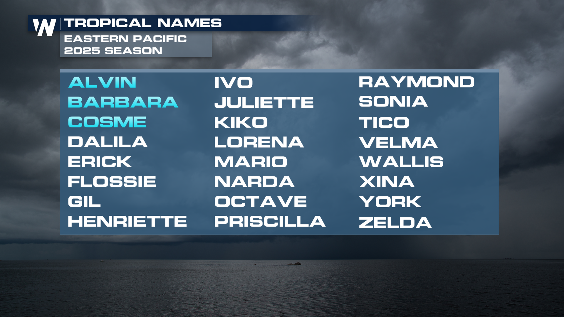
The 2025 Eastern Pacific hurricane season is off to a notably fast start, with three named storms, Alvin, Barbara, and Cosme, forming in less than two weeks since the season officially began on May 15. This level of early activity is well ahead of the seasonal average, which typically sees the first named storm by June 10, the second by June 24, and the third by July 6. The rapid development of these storms marks an unusually active beginning for the Eastern Pacific.
The next name for the Eastern Pacific systems after Barbara and Cosme will be Dalila. Currently, this area is now classified as Potential Tropical Cyclone 4. Tropical Storm Watches are now up for areas west of Acapulco, Mexico. Just like the first three storms, this will recurve into the open Pacific waters.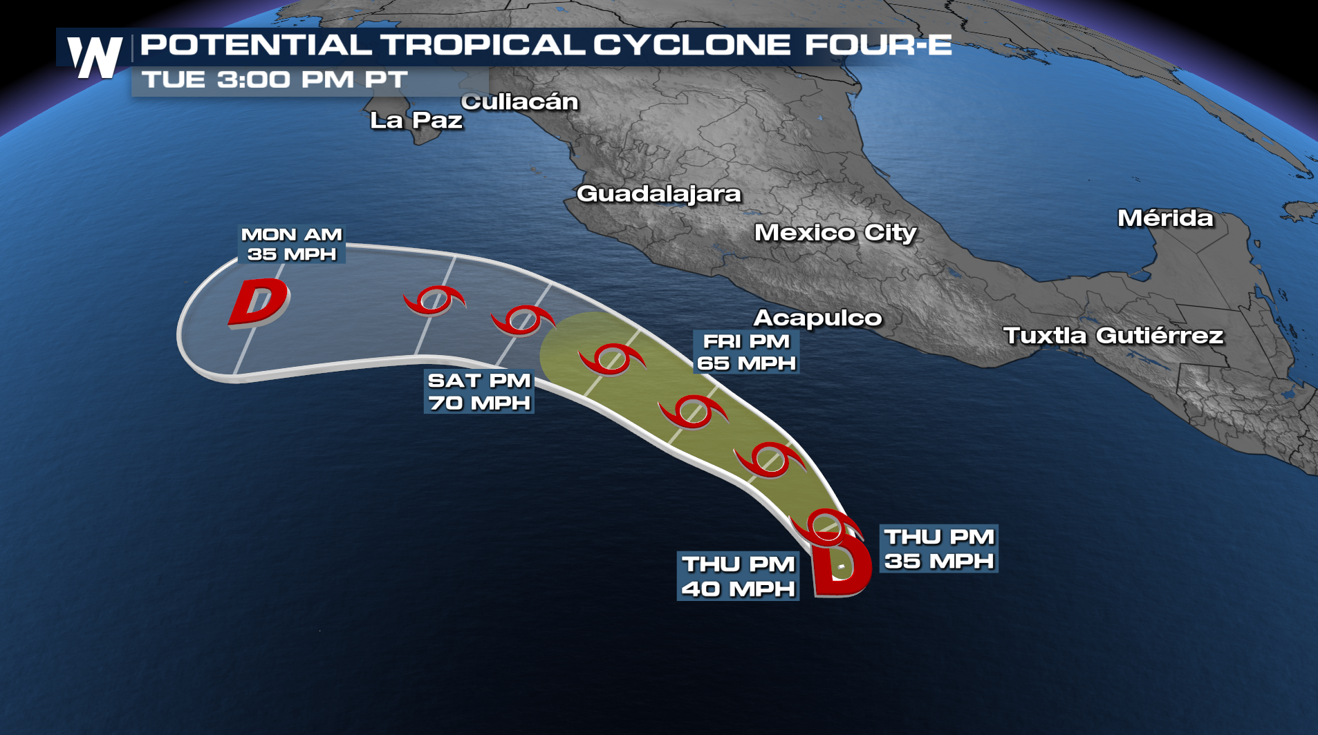
Looking Ahead
As we look ahead, the Climate Prediction Center is highlighting a region (below) with low confidence in the formation of a tropical system in the western Caribbean or southwestern Gulf, also known as the Bay of Campeche. This does not indicate a system is expected, so be sure to stay up to date with the 7-Day forecast from the National Hurricane Center.
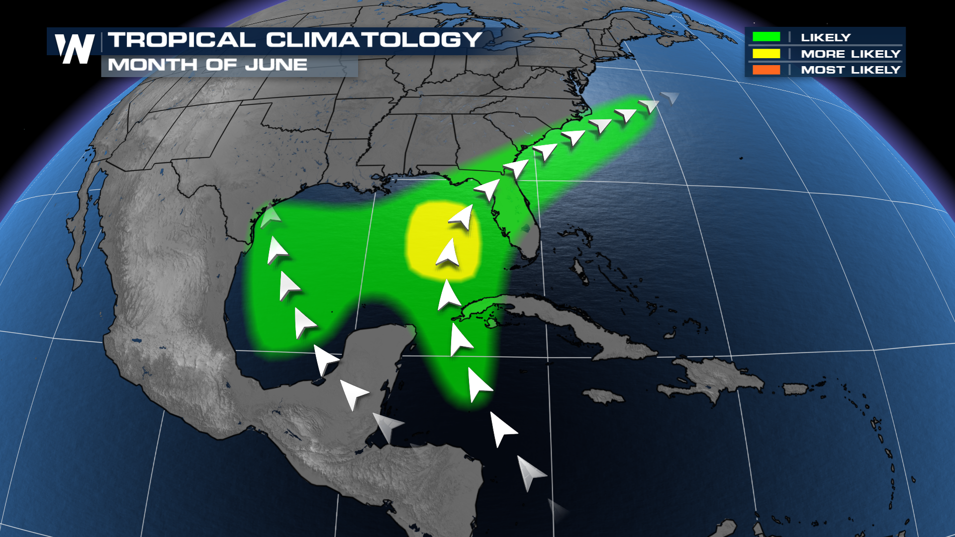
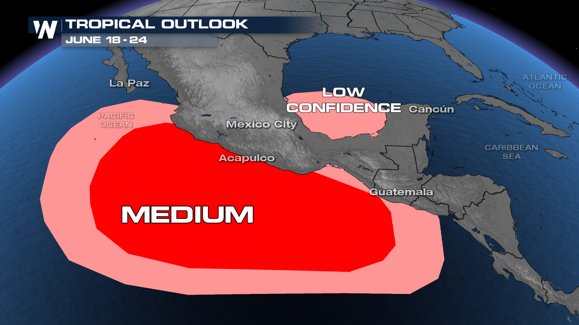 A system in the Gulf or western Atlantic is not unusual in June, which typically has warmer water early in the season compared to the main development region (MDR) in the Atlantic (between the Caribbean and west Africa).
The Atlantic hurricane season, which began on June 1, has remained quiet with no named storms forming so far. This lack of activity is being attributed to three key atmospheric factors: persistent wind shear, marginally warm water temperatures, and the presence of Saharan dust.
 The Saharan dust, which often travels westward from Africa, can suppress tropical development by introducing dry, stable air into the atmosphere. In addition, wind shear is disrupting the organization of tropical waves and disturbances, preventing them from developing into more significant systems. While sea surface temperatures are warm enough to support storm formation, they are not as favorable as in recent years, further limiting activity.
Unlike the Atlantic, the Eastern Pacific is not affected by Saharan dust, as the dust tends to move northward toward the U.S. before it can interfere with conditions in that region. As a result, the Eastern Pacific remains more conducive to early-season development. In fact, forecasters are currently monitoring the region for another potential tropical cyclone, which has a high chance of forming within the next seven days.
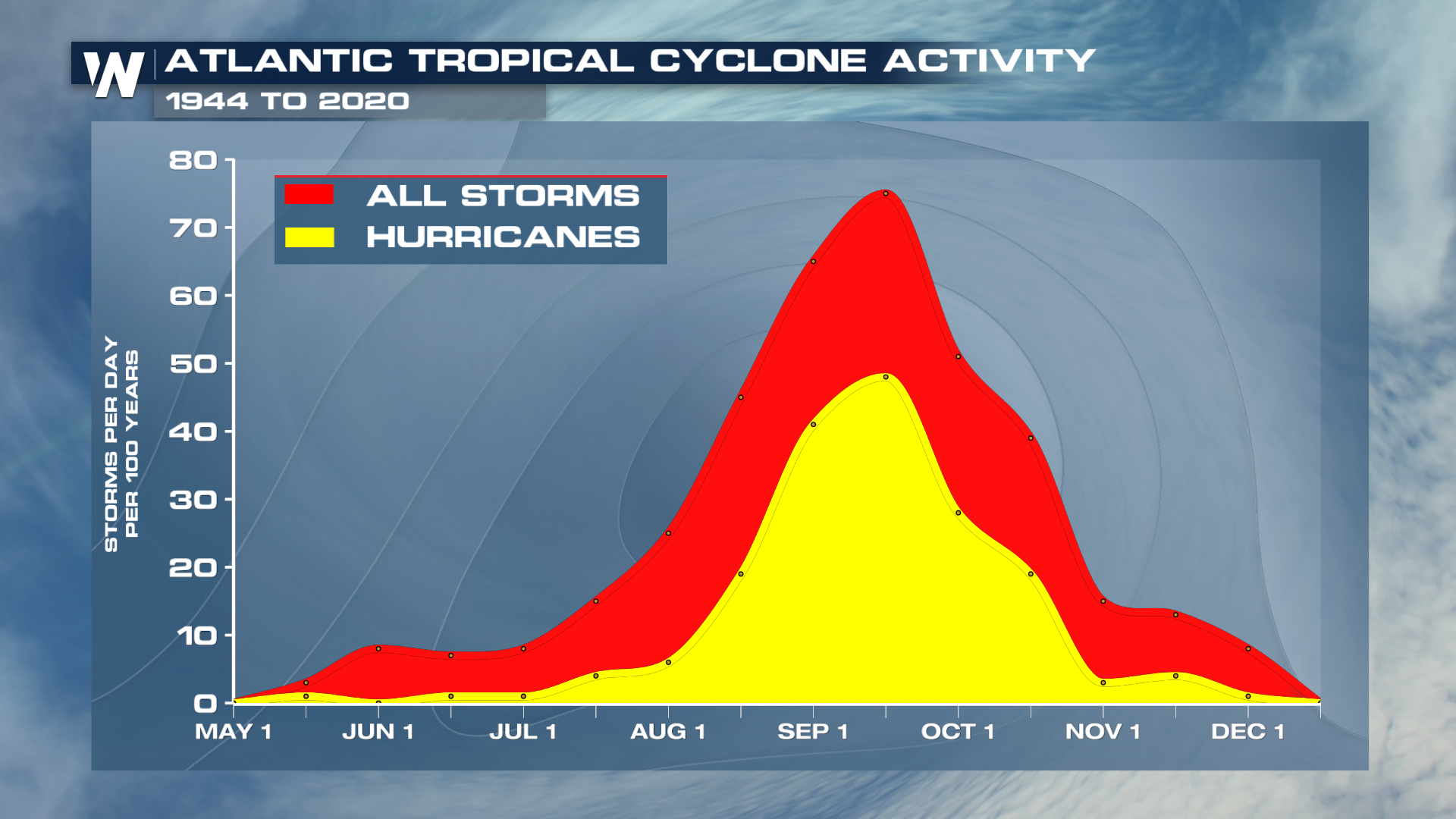
Although the Atlantic is off to a slow start, this is not unusual for early June. Historically, tropical activity in the Atlantic does not typically ramp up until later in the summer, particularly in August and September, with the peak occurring around the 15th of September.
 For now, the quiet beginning to the season is considered perfectly normal. The early season will more often see more tropical storms than hurricanes, but hurricanes can form and impact the United States, so it's always best to be prepared. Andrea is the first name on the list in the Atlantic in 2025.
NOAA and Colorado State are expecting an above-average season in the Atlantic Basin. Click here to read more.


