Severe Storms and Flooding Threaten Texas Late Week

Texas is bracing for several days of active weather, with repeated rounds of severe storms and heavy rainfall expected through the end of the work week. A stalled frontal boundary combined with high moisture levels will keep the atmosphere primed for thunderstorm development, particularly during the afternoons and overnight hours. Texas, Louisiana, Arkansas, and Mississippi remain under a Marginal Risk (level 1 out of 5) for severe storms. Isolated tornadoes, damaging winds, and large hail are all possible, especially as instability builds across the region.
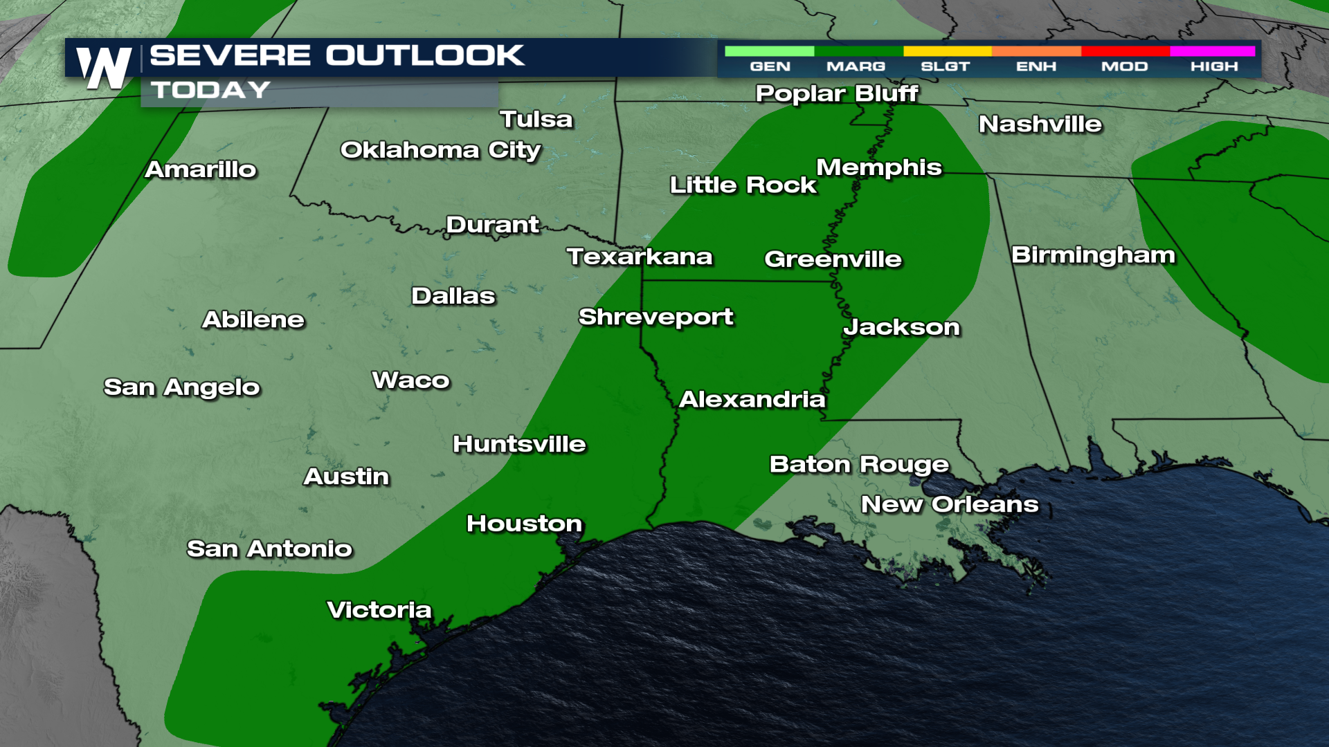
The setup includes a shortwave trough moving eastward across the Southern Plains, combined with strong southerly flow and very moist surface conditions, dewpoints in the lower to mid-70s. This environment will fuel thunderstorms capable of producing strong winds and hail. There will be moderate to high instability, supporting the potential for organized storm structures such as supercells or bowing line segments.
Flash flooding is a growing concern, particularly across Central and East Texas. Widespread rainfall totals of 2 to 4 inches are possible, with isolated areas potentially receiving 4 to 6 inches by Friday morning.
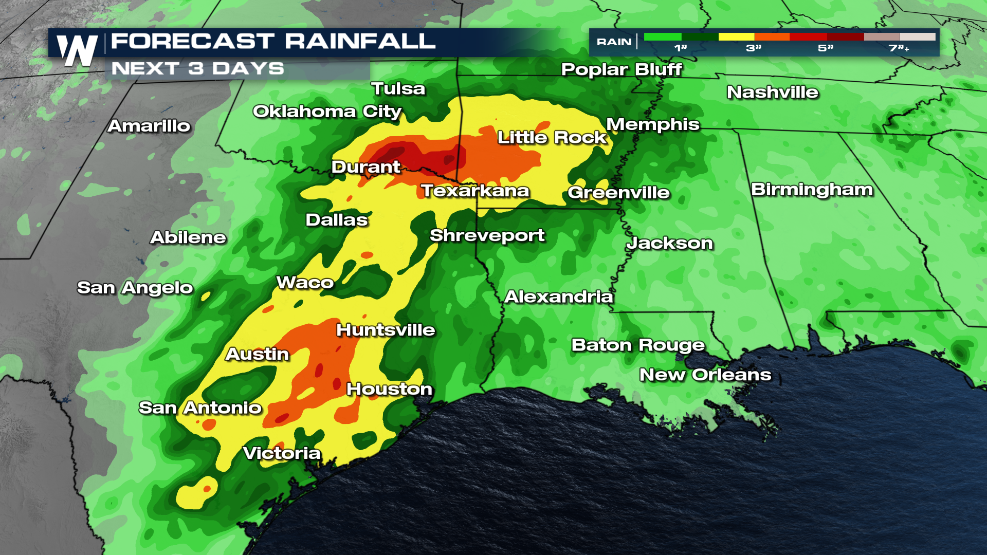
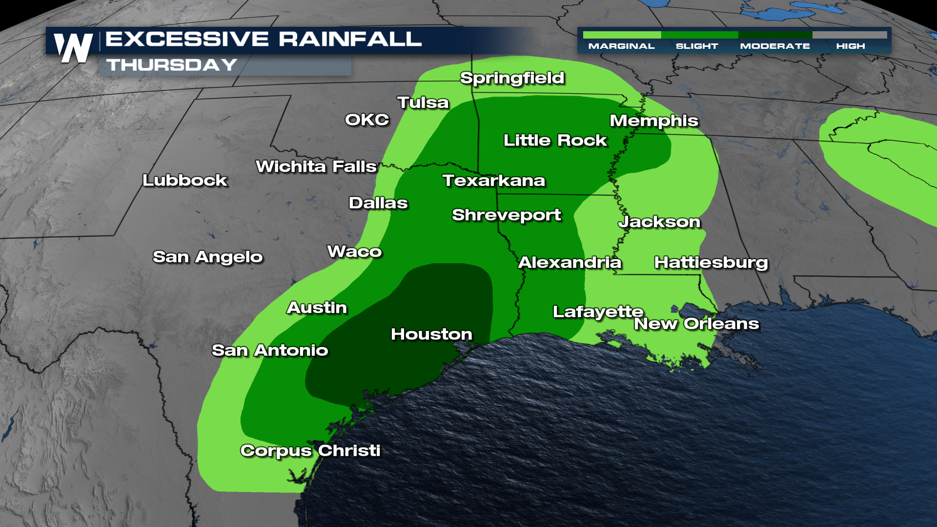
A MODERATE risk for excessive rainfall remains in place for parts of east-central Texas, including the metro of Houston, where multiple rounds of storms are expected to pass. Downpours could lead to flash flooding, especially in low-lying or already saturated areas.
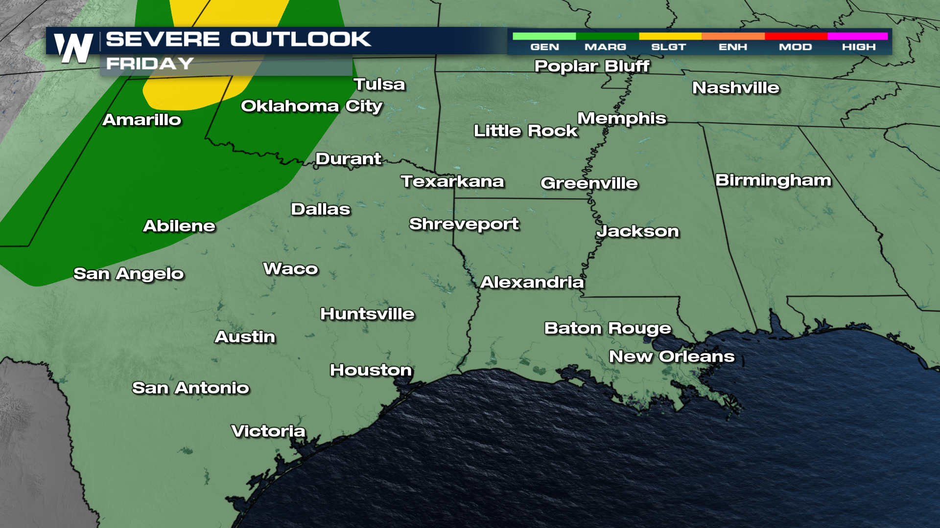
The threat persists on Friday, as a front moves out of the Rockies. For now, there is a Marginal to Slight threat for strong to severe storms in the Texas Panhandle.
Stay weather-aware, especially during the late afternoon and nighttime hours. Make sure to have multiple ways to receive warnings and avoid driving through flooded roadways. With severe weather and flooding threats overlapping, Texans should prepare for possible power outages, road closures, and rapidly changing weather conditions.


