Heavy Mountain Snow in the West
Special Stories
25 Mar 2020 1:00 PM
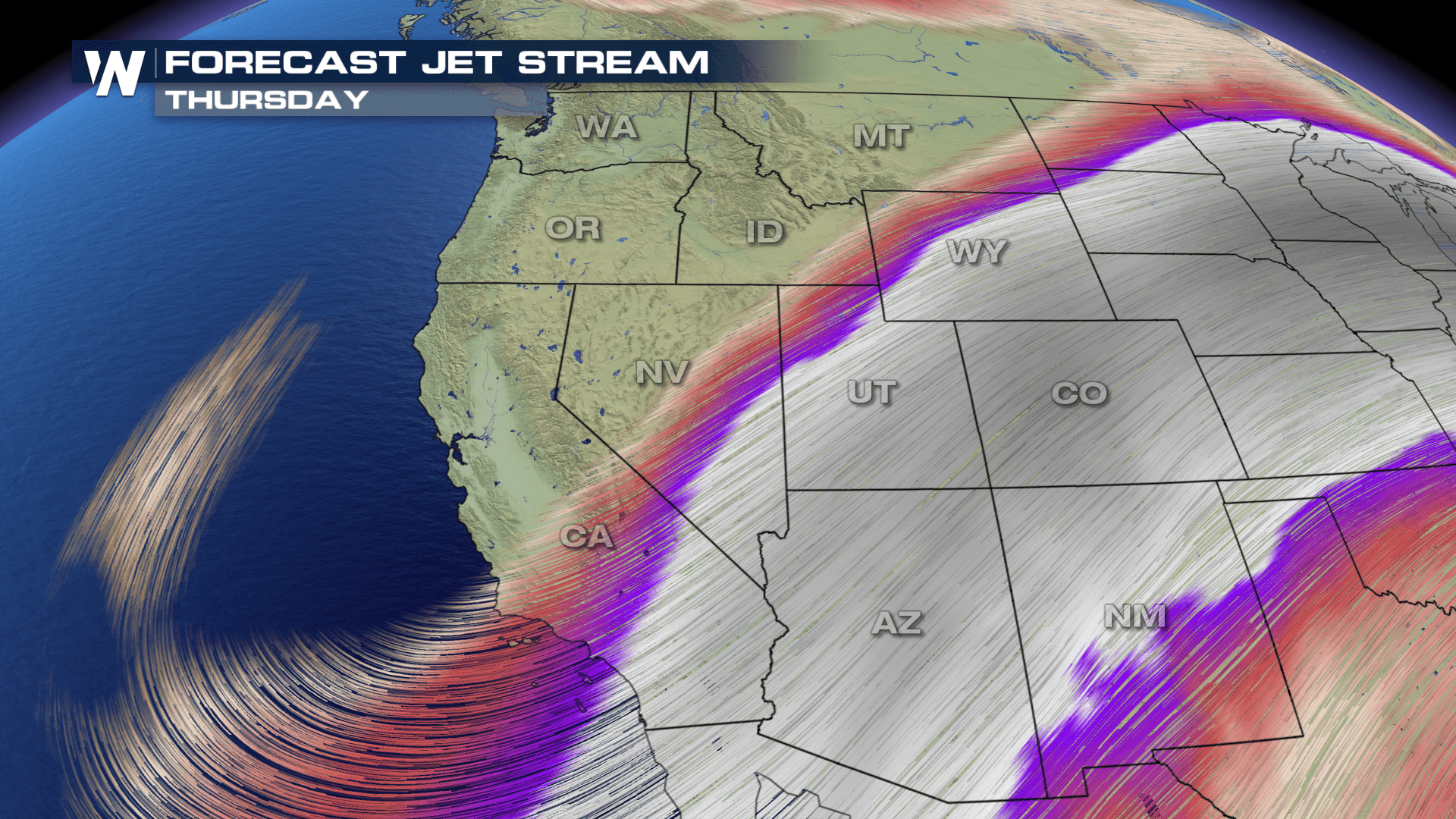
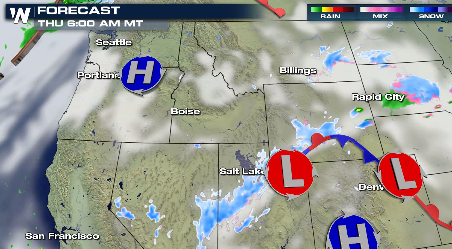
A persistent flow of Pacific moisture into the West will bring areas of heavy snow to the higher elevations throughout the week. Winter weather alerts include portions of the Wasatch Range, Sierra Nevada, and Beartooth Mountains.
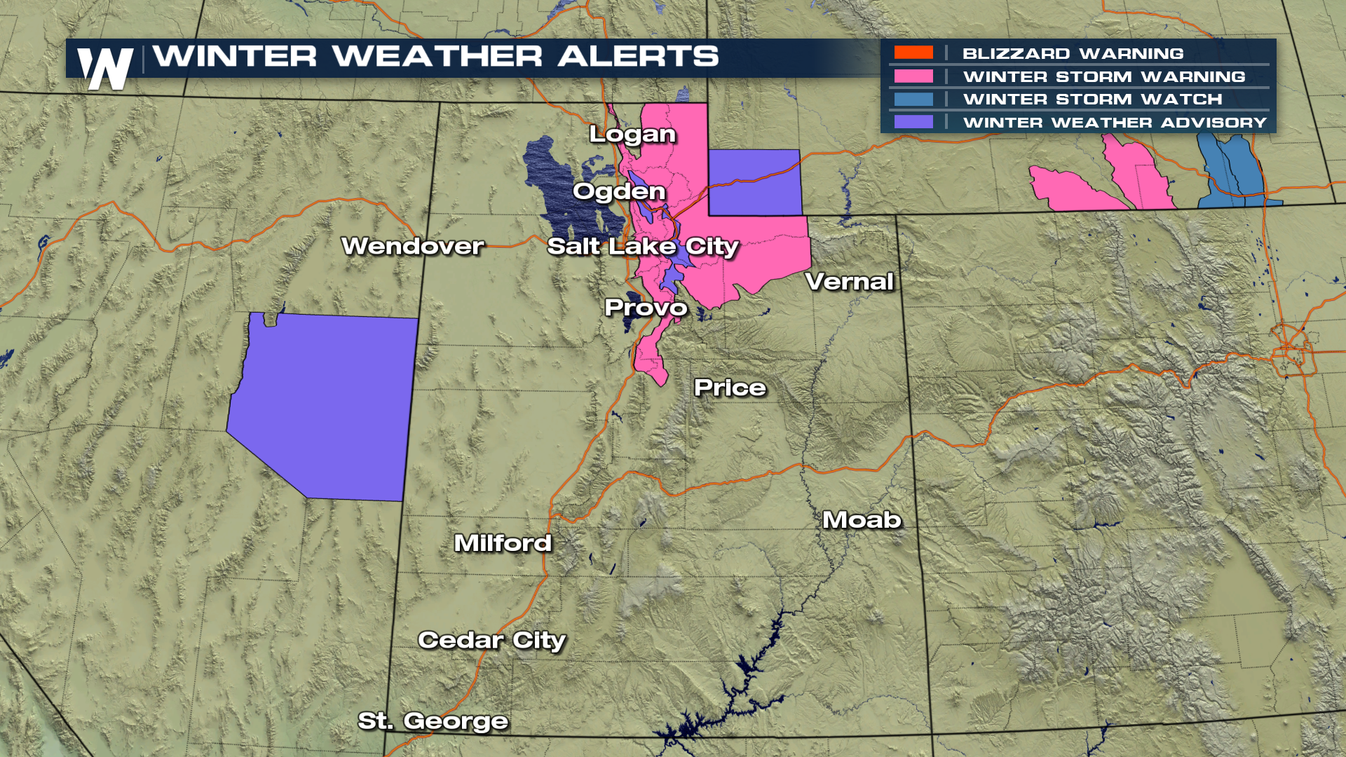
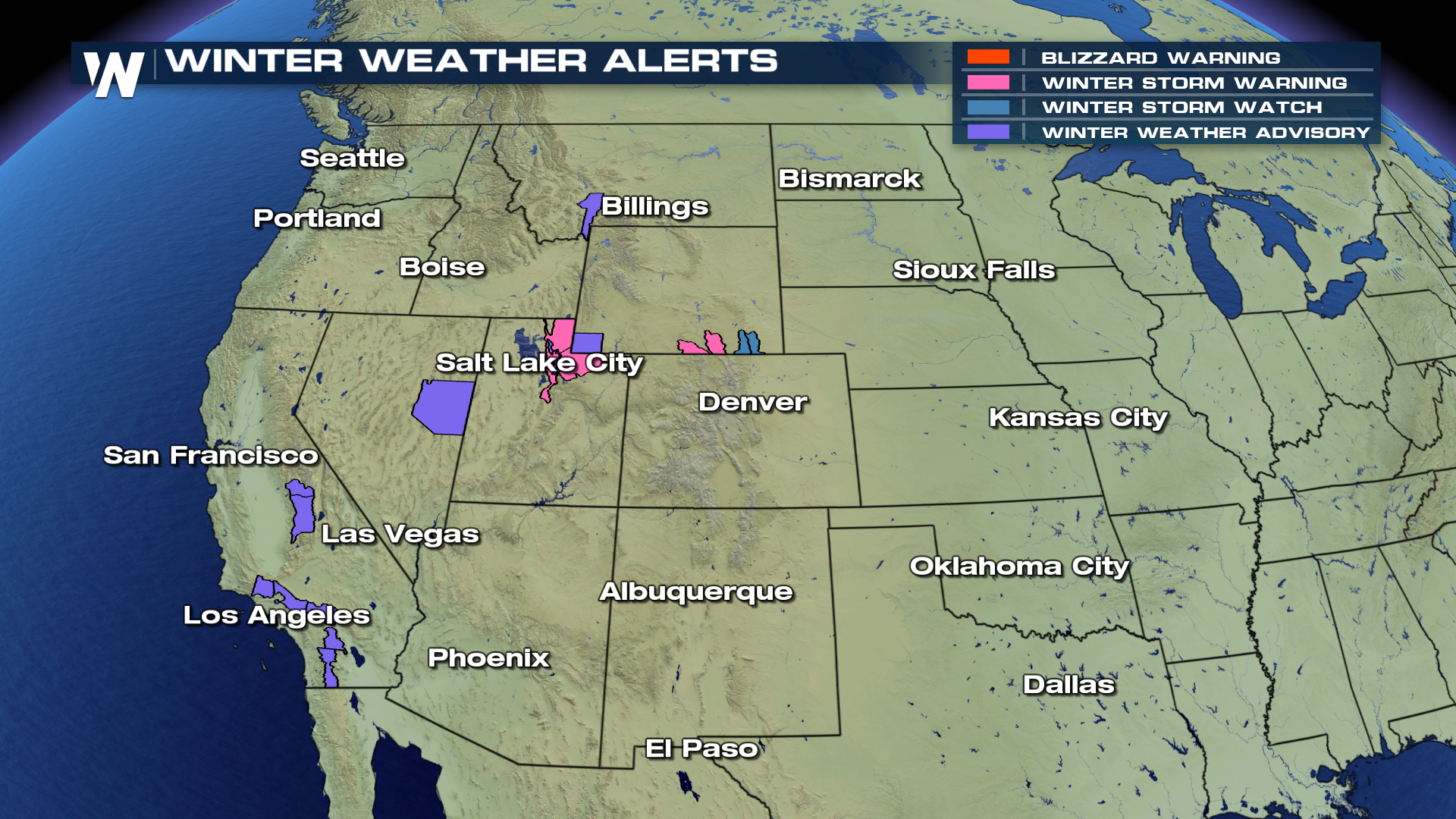 Upon closer inspection, parts of Wyoming and Utah remain under winter storm warnings! Winter is far from over in these areas! Not only will some snow bans bring heavy snow, but winds will create drifts and low visibility.
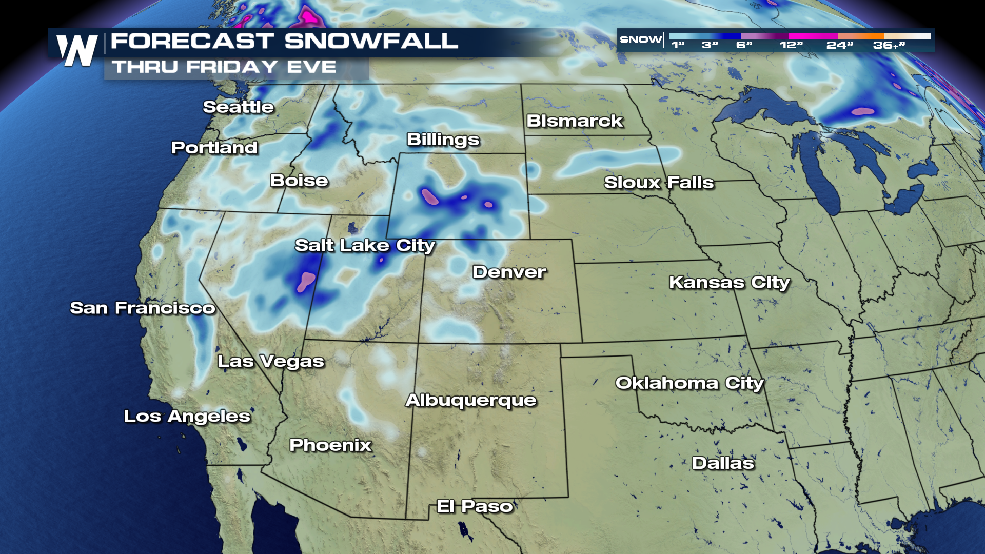
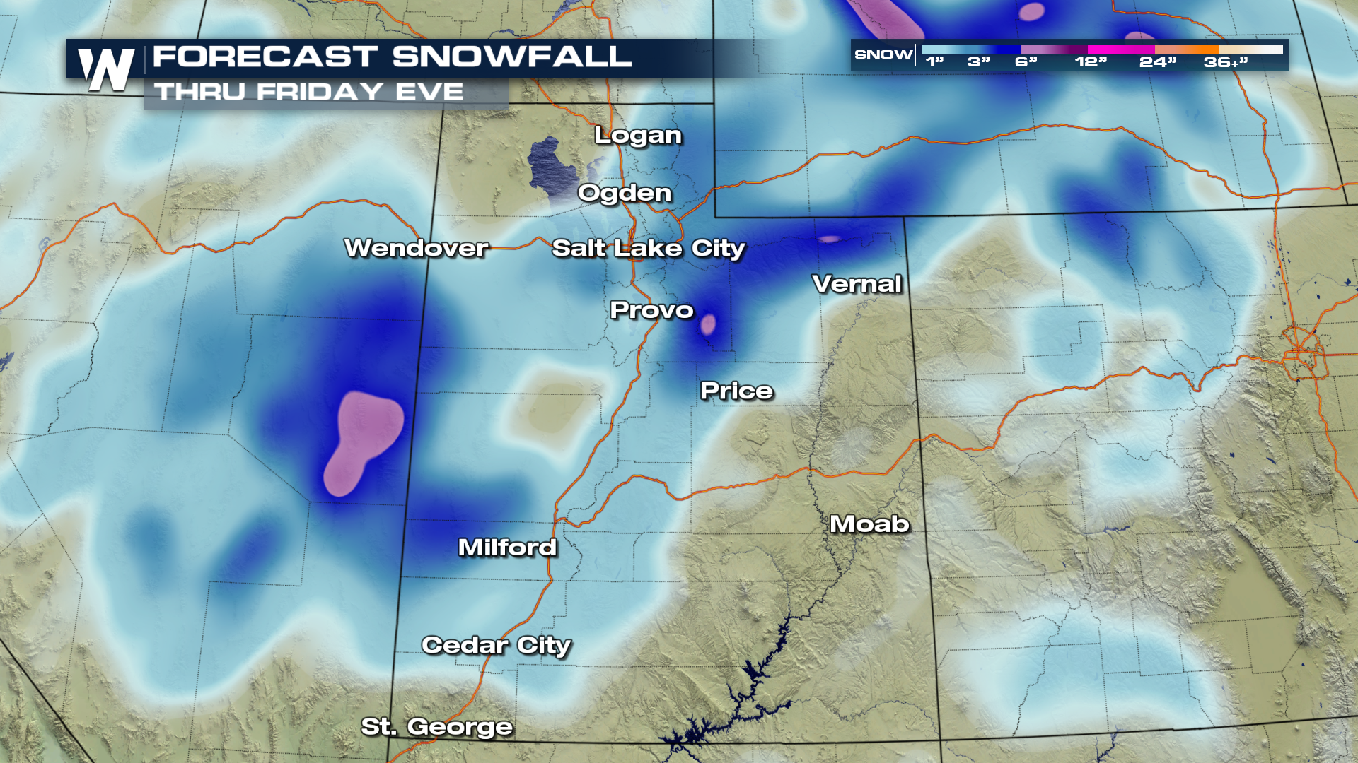 As much as one to two feet (storm total) snow is possible this week for many of the mountain ranges in the West. The image above shows *additional* snow from Wednesday afternoon through Friday evening. The snow will focus on Utah and Wyoming in particular, but Colorado's western slope will get a healthy 4-9".
 Another weak system will approach the Pacific Coast late Thursday, keeping snow in the forecast for the mountains and rain at the coast into Friday.
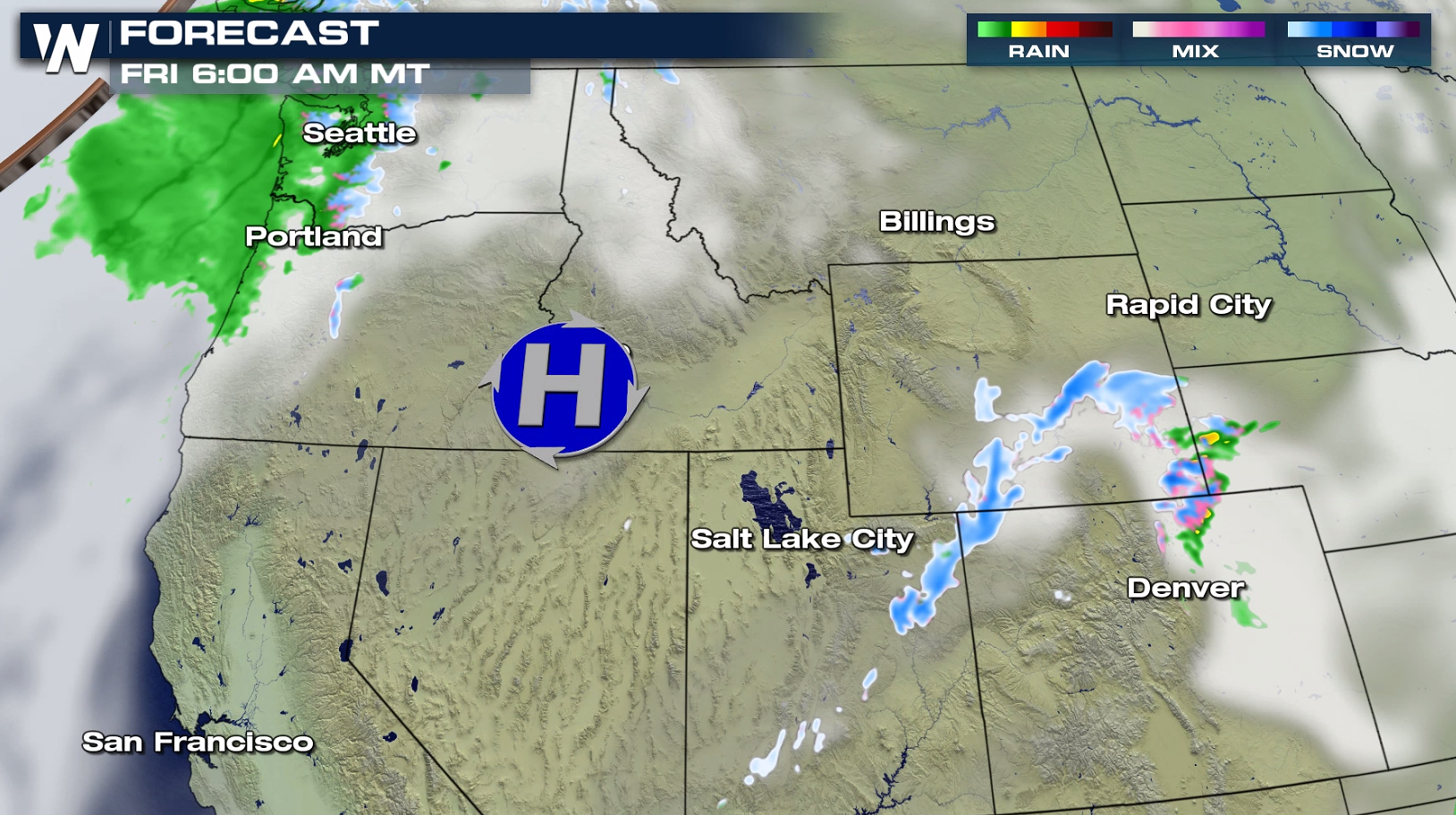 This storm's energy will eject into the Plains Friday night and then head toward the Midwest on Saturday. It will bring a lot of wind and rain, but possibly some heavy, wet snow in a few locations of the Upper Midwest. We will update you on that part of the weather story this week. Stay "tuned!"
If you have travel plans in the higher elevations, check back with WeatherNation on-air and online for the latest forecast and alerts.
This storm's energy will eject into the Plains Friday night and then head toward the Midwest on Saturday. It will bring a lot of wind and rain, but possibly some heavy, wet snow in a few locations of the Upper Midwest. We will update you on that part of the weather story this week. Stay "tuned!"
If you have travel plans in the higher elevations, check back with WeatherNation on-air and online for the latest forecast and alerts.
Upon closer inspection, parts of Wyoming and Utah remain under winter storm warnings! Winter is far from over in these areas! Not only will some snow bans bring heavy snow, but winds will create drifts and low visibility.
As much as one to two feet (storm total) snow is possible this week for many of the mountain ranges in the West. The image above shows *additional* snow from Wednesday afternoon through Friday evening. The snow will focus on Utah and Wyoming in particular, but Colorado's western slope will get a healthy 4-9".
Another weak system will approach the Pacific Coast late Thursday, keeping snow in the forecast for the mountains and rain at the coast into Friday.
This storm's energy will eject into the Plains Friday night and then head toward the Midwest on Saturday. It will bring a lot of wind and rain, but possibly some heavy, wet snow in a few locations of the Upper Midwest. We will update you on that part of the weather story this week. Stay "tuned!"
If you have travel plans in the higher elevations, check back with WeatherNation on-air and online for the latest forecast and alerts.All Weather News
More
Texas and Oklahoma Severe Chances Friday
Another round of severe storms will be possib
22 May 2026 1:30 PM

Severe Storms, Heavy Rain Target the Southeast
Heavy rain has already hit numerous areas in
22 May 2026 12:02 PM

NOAA Predicts Below Normal 2026 Hurricane Season
NOAA has released their predictions for the 2
22 May 2026 12:00 PM

Repeated Rain Raises the Flood Threat
A slow-moving frontal boundary that brought n
22 May 2026 10:25 AM

NOAA Releases Summer Outlook, Above Average Temperatures Expected
The National Oceanic and Atmospheric Administ
22 May 2026 9:05 AM

CALIFORNIA: Wildfires Prompt Evacuations
SIMI VALLEY, CA - On Monday, May 18th in Vent
22 May 2026 2:00 AM

Rockies Brace for Snow, Severe Storms as Cold Front Moves In
ROCKIES - Through the rest of the week, an up
21 May 2026 5:30 PM