Rain Winds Down Across the Northeast Overnight

Record high temperatures 25 to 30 degrees above average were felt across the Northeast this weekend. However, the warming trend has come to a halt! Cooler air filtered into much of the region following a cold front. Saturday, numerous severe thunderstorms were recorded across the region. The thunderstorm risk across portions of the Northeast has now dropped off, though some showers do remain.

A few more showers will linger across New England Monday as the surface low and attendant fronts continue to create lift. Additionally, afternoon heating on Monday will drive further development of widespread showers across the Mid-Atlantic.
Through Tuesday, 1 to 3 inches of rain is possible, and some spots could see heavier totals.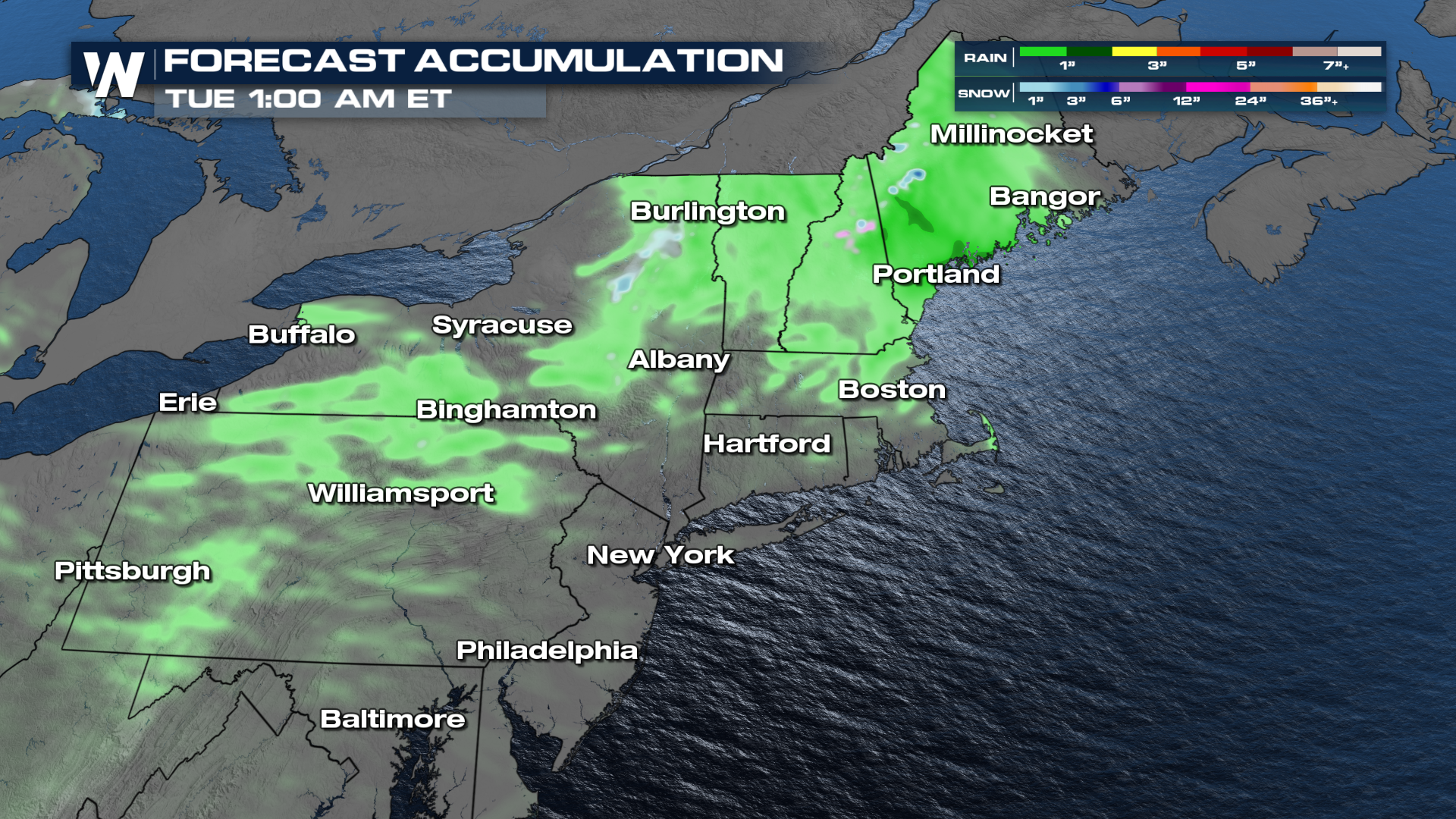
Some of these areas could really use the rain. Drought conditions have been expanding and worsening from the Mid-Atlantic into the Northeast over the past month.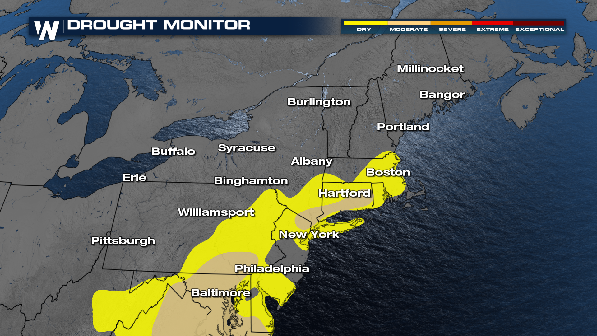
Watch WeatherNation for more details about the forecast and how it could affect your weekly plans!


