Heavy Snow in the Western Mountains
Special Stories
23 Jan 2019 8:22 AM
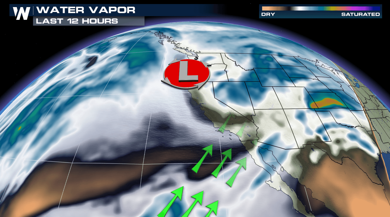
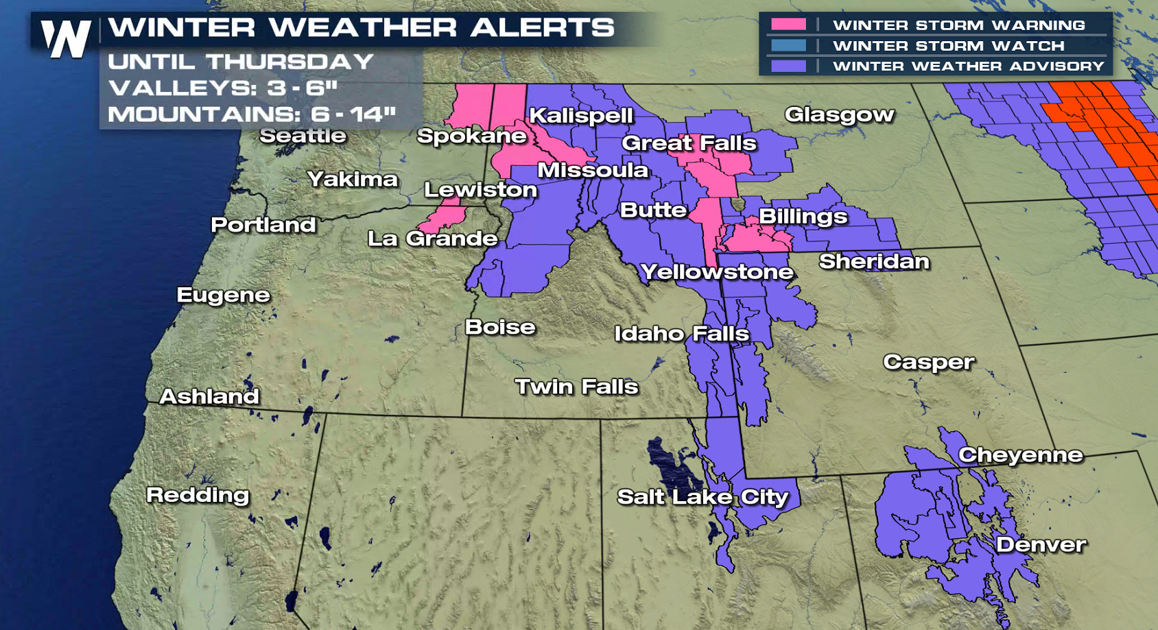
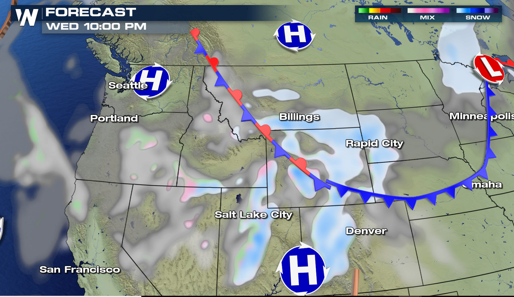
As one system exits the West, another winter storm will track will move into the region over the next 24 hours bringing significant snowfall. Winter weather alerts extend along the Continental Divide from Colorado to Idaho. 1 to 2 feet of snow may accumulate in the highest elevations.
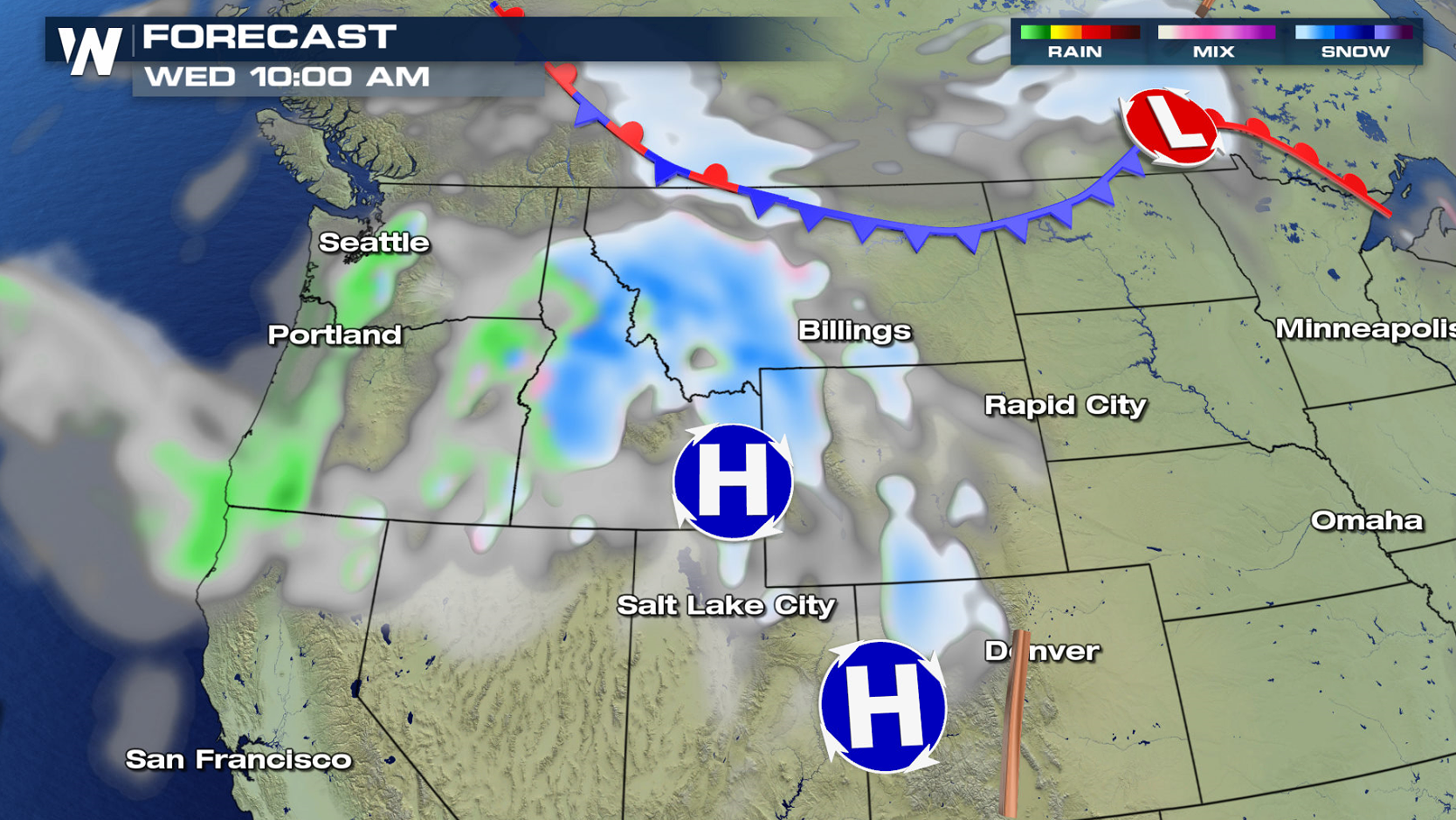
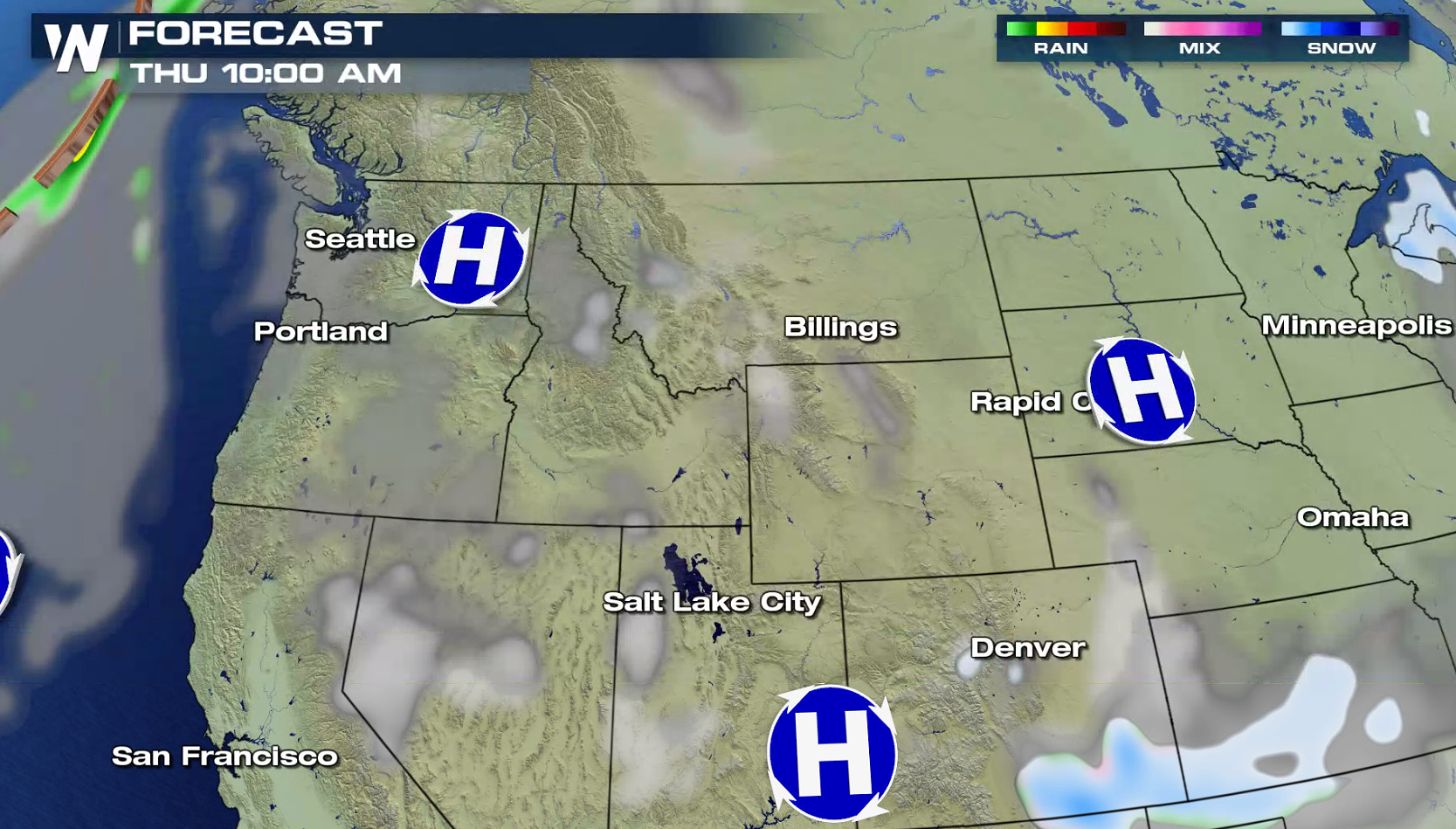
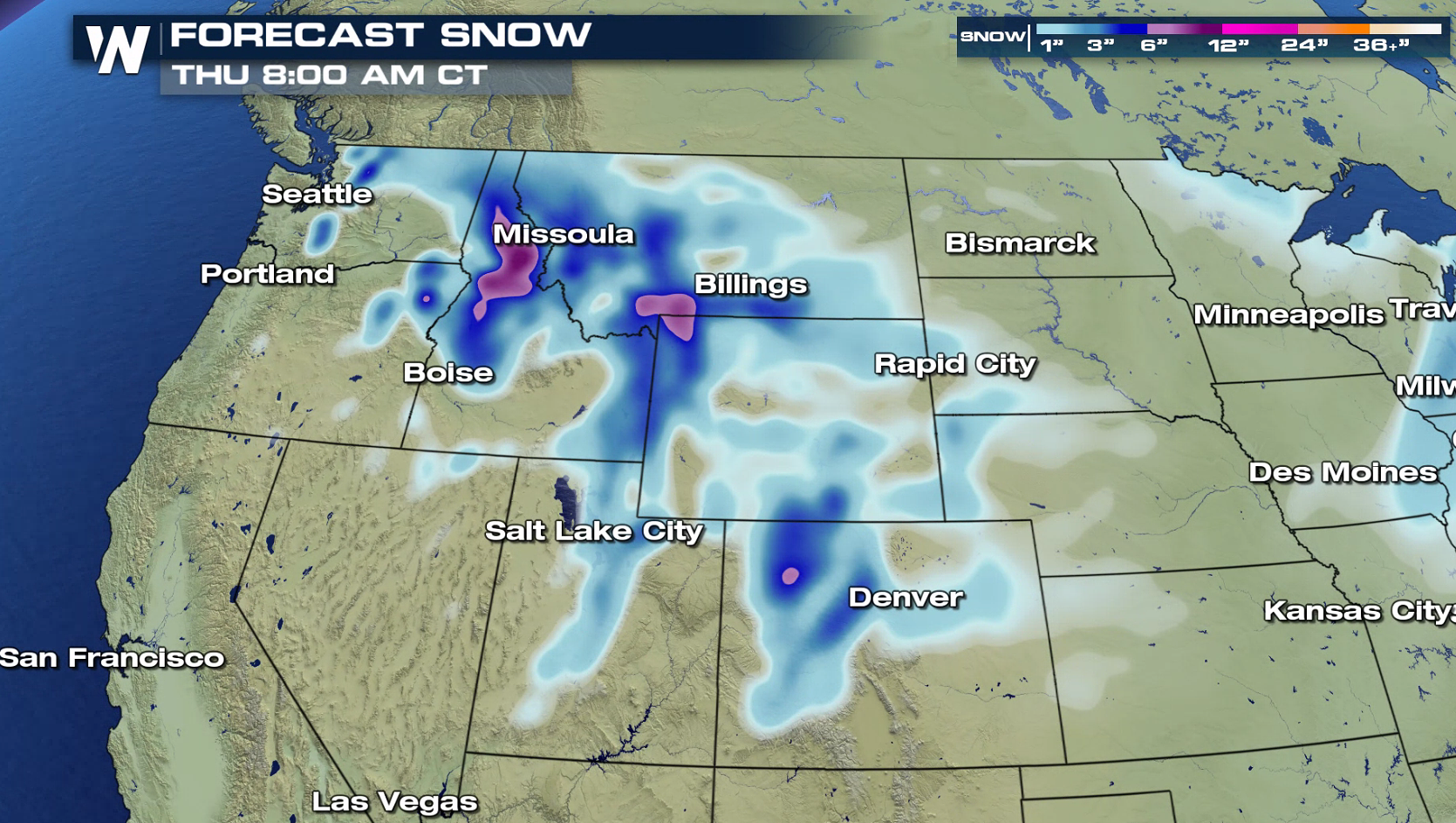 The first low pressure center has already pushed away from the Rockies and into the Great Lakes. A second low is moving southward out of Canada into the Northwest, funneling up moisture from the Pacific Ocean. This will help to produce areas of heavy snow, along with strong, gusty winds. Snow will spread to the east and south into tonight (Wednesday). High pressure will build across the West Thursday, giving the region a break from snowfall.
 For WeatherNation: Meteorologist Mace Michaels
The first low pressure center has already pushed away from the Rockies and into the Great Lakes. A second low is moving southward out of Canada into the Northwest, funneling up moisture from the Pacific Ocean. This will help to produce areas of heavy snow, along with strong, gusty winds. Snow will spread to the east and south into tonight (Wednesday). High pressure will build across the West Thursday, giving the region a break from snowfall.
For WeatherNation: Meteorologist Mace MichaelsAll Weather News
More


More Storms for the East Sunday and Monday
A low-pressure system crashing through the Mi
2 Aug 2026 2:20 AM

After Reaching Category 5, Genevieve Weakens in the Pacific
PacificGenevieve formed on last Friday south
2 Aug 2026 1:30 AM

Flooding, Severe Storms Target the Midwest Again
After an active week of storms across the nor
1 Aug 2026 1:40 AM

Flooding Risk Increases as Heavy Rain Targets the Tri-State Area
Tuesday, heavy rainfall moved across the Nort
30 Jul 2026 12:25 AM

Severe Weather: Energy From the Midwest Now in the Southeast
UPPER MIDWEST - Through Monday, dangerous tor
29 Jul 2026 10:30 PM