Heavy Snow from the Rockies to the High Plains
Special Stories
5 Apr 2018 11:04 AM
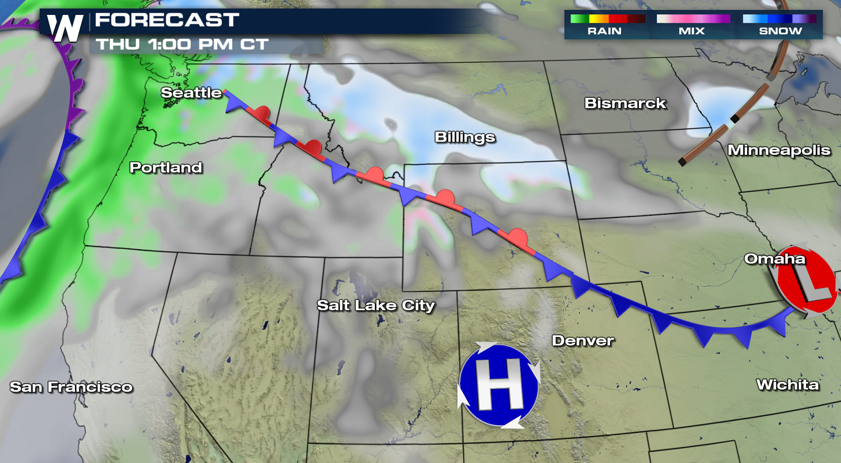
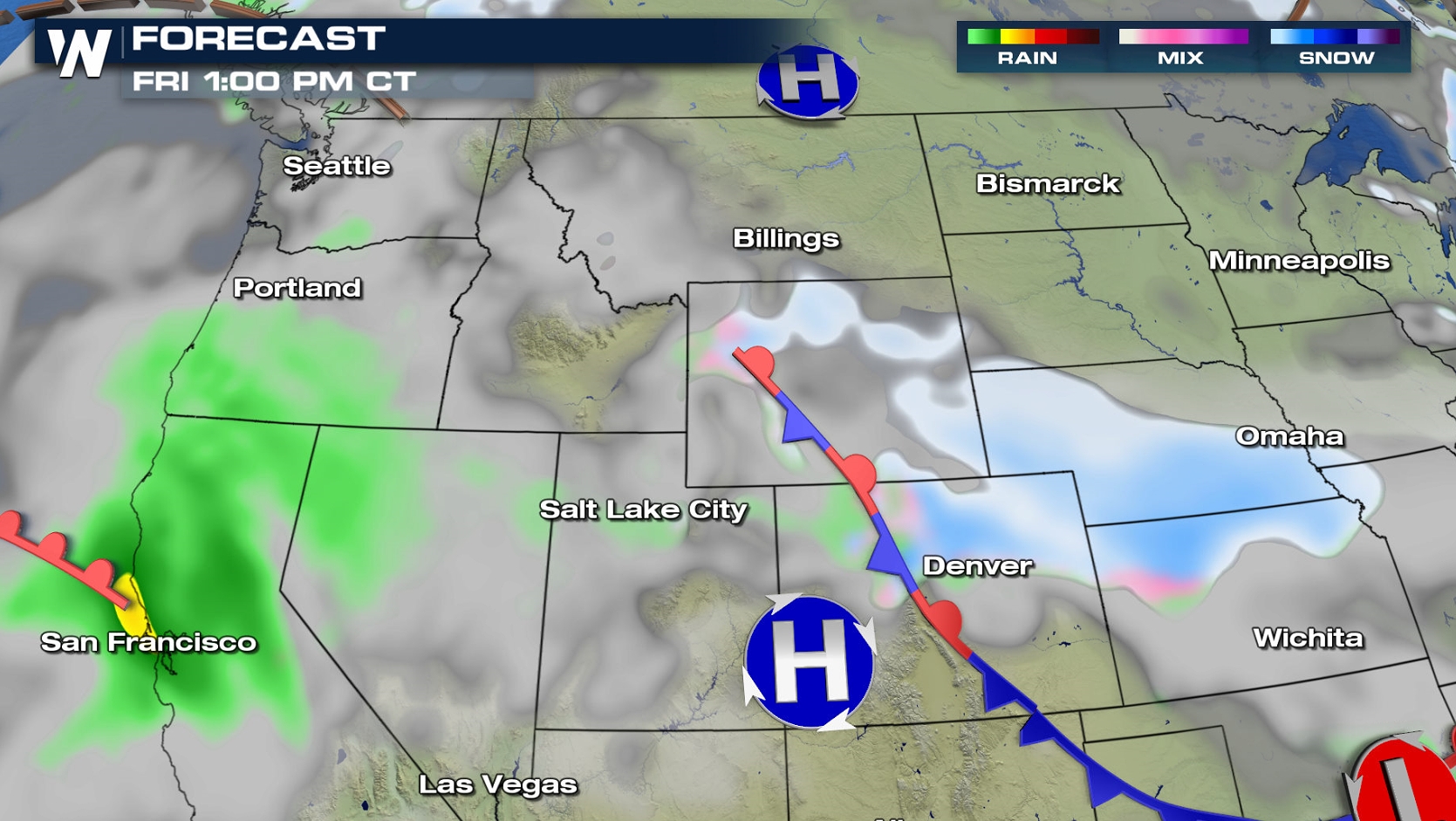
A storm system stretched out across the West will produce areas of heavy snow from Montana to Nebraska to end this week. Winter weather alerts extend from Nebraska and Colorado to Montana. More than a foot of snow is likely in the higher elevations, with 3" to 6" common into the Plains. Lower Michigan will also see some light snow accumulations into Friday morning.
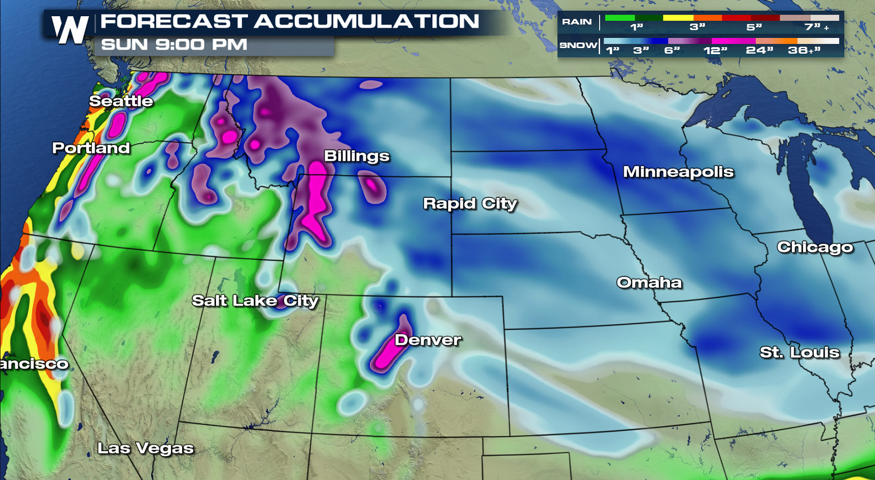
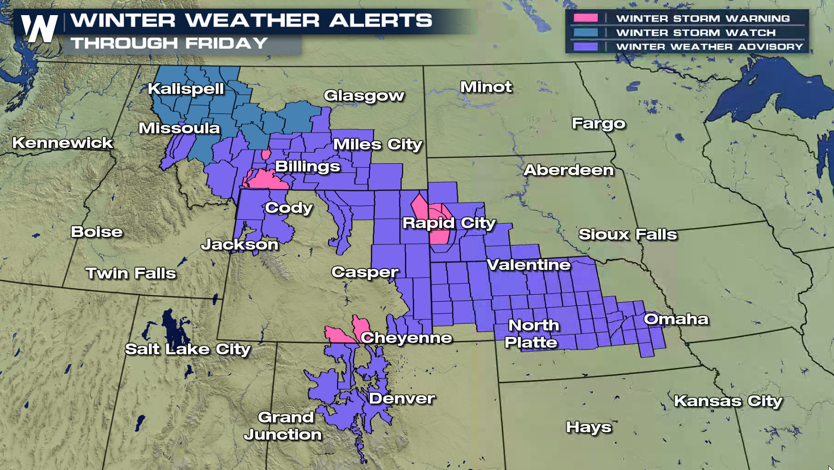
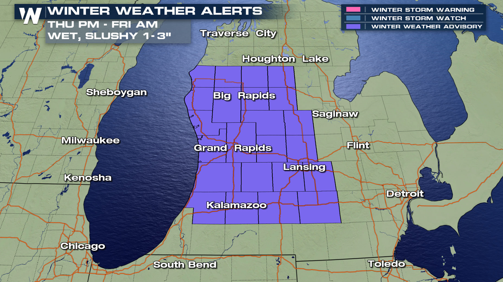 A front extends from the Cascades to the Front Range and is expected to barely move into Friday. Upper level energy crossing along the front will help to produce the snow, that could become heavy at times. The lead low pressure center will produce a few inches of snow in Lower Michigan.

 For WeatherNation: Meteorologist Mace Michaels
A front extends from the Cascades to the Front Range and is expected to barely move into Friday. Upper level energy crossing along the front will help to produce the snow, that could become heavy at times. The lead low pressure center will produce a few inches of snow in Lower Michigan.
For WeatherNation: Meteorologist Mace MichaelsAll Weather News
More

Flooding, Severe Storms Target the Midwest Again
After an active week of storms across the nor
1 Aug 2026 1:40 AM


After Reaching Category 5, Genevieve Weakens in the Pacific
PacificFausto is now a post-tropical cyclone.
31 Jul 2026 1:30 AM

Flooding Risk Increases as Heavy Rain Targets the Tri-State Area
Tuesday, heavy rainfall moved across the Nort
30 Jul 2026 12:25 AM

Severe Weather: Energy From the Midwest Now in the Southeast
UPPER MIDWEST - Through Monday, dangerous tor
29 Jul 2026 10:30 PM