Helping Las Cruces Residents Keep Cool
Special Stories
18 Feb 2020 1:03 AM
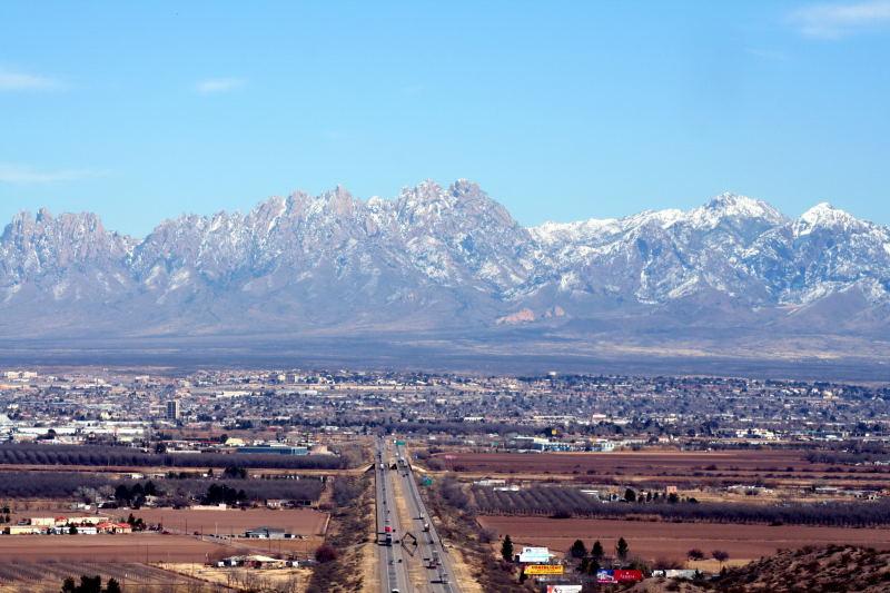
[Las Cruces, New Mexico with the Organ Mountains in the distance. From Wikimedia Commons]
[From NASA] New Mexico’s captivating landscape covers more than 120,000 square miles (310,800 square kilometers) of the American Southwest; a region that has boomed during America’s population shift toward warmer, sunny climates. New Mexico’s second-largest city, Las Cruces, has grown by almost 40% since 2000.
With this growth has come more housing, roads, sidewalks and parking lots – and climbing temperatures. Las Cruces now has an average of 120 days a year with highs of 90° F (32° C) or warmer; the most in its history. City officials compared NASA Earth-observing data, showing the city’s hottest areas, with census data of the most vulnerable populations to inform city development activities like tree-lined corridors to help residents keep their cool when temperatures rise.
Making things even hotter, larger cities like Las Cruces act as urban heat islands (UHI), which means they get hotter than surrounding areas during the day and don’t cool as much at night. Combined with a dearth of tree canopy and other shady spots in parts of Las Cruces, that means there’s little relief during heat waves, especially for the city’s higher-risk populations.
For Lisa LaRocque, a sustainability officer with the City of Las Cruces (CLC), the increasing heat is concerning. “When housing and outside conditions provide little respite from the heat, vulnerable populations will suffer continuously,” she said. “For example, there will be many more hours per year when air conditioning is required and evaporative coolers – the most common system used in the region – will be ineffective.”
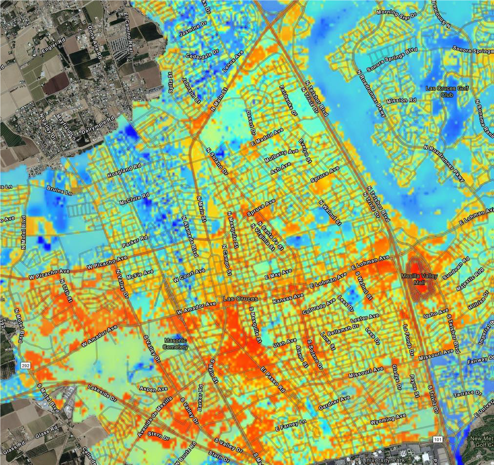 [Map showing hot spots around Las Cruces, New Mexico. Warmest locations are red, coolest are blue. Credit: The City of Las Cruces]
LaRocque’s work focuses on what she calls “upstream solutions”: changing both inside and outside conditions so vulnerable populations aren’t disproportionately affected. “Two areas that I am currently working on include adding green infrastructure to streets and increasing energy efficiency programs in low-income housing,” she noted.
To do that, however, the city wanted an accurate UHI tool to inform policy making. More specifically, Las Cruces needed to know how to best determine where it should concentrate its effort. So it turned to NASA DEVELOP for help. DEVELOP is a program within NASA’s Earth Applied Sciences program that spearheads strategic partnerships seeking solutions to environmental and other Earth science issues.
This project used satellite data to assess the extent and magnitude of the UHI in Las Cruces, assess patterns of social vulnerability and land-use within the city, and then compare land-use and social vulnerability to the UHI profile,” explained DEVELOP Arizona Center Lead Lance Watkins. Watkins and DEVELOP’s Arizona-based hub have run numerous DEVELOP projects that focus on UHI Reduction Strategies around the U.S.
For the Las Cruces, the DEVELOP team integrated Earth-observing imagery and data to determine surface temperature, impervious surfaces, vegetation cover and other environmental information at a much smaller scale than had been previously done.
[Map showing hot spots around Las Cruces, New Mexico. Warmest locations are red, coolest are blue. Credit: The City of Las Cruces]
LaRocque’s work focuses on what she calls “upstream solutions”: changing both inside and outside conditions so vulnerable populations aren’t disproportionately affected. “Two areas that I am currently working on include adding green infrastructure to streets and increasing energy efficiency programs in low-income housing,” she noted.
To do that, however, the city wanted an accurate UHI tool to inform policy making. More specifically, Las Cruces needed to know how to best determine where it should concentrate its effort. So it turned to NASA DEVELOP for help. DEVELOP is a program within NASA’s Earth Applied Sciences program that spearheads strategic partnerships seeking solutions to environmental and other Earth science issues.
This project used satellite data to assess the extent and magnitude of the UHI in Las Cruces, assess patterns of social vulnerability and land-use within the city, and then compare land-use and social vulnerability to the UHI profile,” explained DEVELOP Arizona Center Lead Lance Watkins. Watkins and DEVELOP’s Arizona-based hub have run numerous DEVELOP projects that focus on UHI Reduction Strategies around the U.S.
For the Las Cruces, the DEVELOP team integrated Earth-observing imagery and data to determine surface temperature, impervious surfaces, vegetation cover and other environmental information at a much smaller scale than had been previously done.
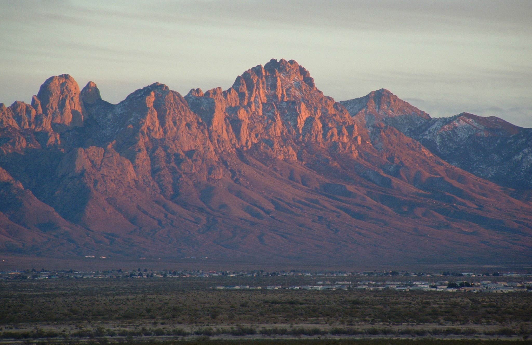 [The Organ Mountains, east of Las Cruces. From NASA]
It’s not uncommon for a city block to contain a mixture of land-cover types like sidewalks, buildings, trees, bushes, ponds, grass, etc.,” Watkins said. “The finer-resolution satellite imagery allows us to better detect the land-surface temperature associated with these surfaces.” With that data, the team then located areas of Las Cruces where social vulnerability and extreme heat overlapped.
The team found that the hottest and most vulnerable area of the city was a section of Las Cruces dubbed the Infill District.
“Because of these results, we placed thermometers to record air temperature throughout the Infill,” said Elizabeth Coontz, a former sustainability intern and long-range planner with Las Cruces. With these new thermometers in place, the city hoped to better identify the geographic subtleties of extreme heat across the Infill.
The project data also provided the baseline for a smaller-scale plan within the Infill District; the Nevada Avenue Project. “This Nevada project establishes a mile-long green corridor that harvests rainwater into shaded areas along the street,” LaRocque said. “The city has developed conceptual plans with resident input and is about to contract a firm for detailed construction drawing.” Implementation of that cooling corridor kicked off in the fall of 2018.
As Las Cruces continues developing its upstream cooling strategies, LaRocque added, they “would like to encourage the use of cool roofs and pavement, more trees and green space throughout the city, as well as targeted efforts in the Infill area. Projections for Las Cruces suggest more frequent extreme heat days, warm nights, and greater risk of prolonged multi-day heat events … The DEVELOP data provides compelling evidence that [sustainable cooling strategies] are needed.”
https://www.youtube.com/watch?v=ZucvlD6ib6E&feature=emb_logo
[The Organ Mountains, east of Las Cruces. From NASA]
It’s not uncommon for a city block to contain a mixture of land-cover types like sidewalks, buildings, trees, bushes, ponds, grass, etc.,” Watkins said. “The finer-resolution satellite imagery allows us to better detect the land-surface temperature associated with these surfaces.” With that data, the team then located areas of Las Cruces where social vulnerability and extreme heat overlapped.
The team found that the hottest and most vulnerable area of the city was a section of Las Cruces dubbed the Infill District.
“Because of these results, we placed thermometers to record air temperature throughout the Infill,” said Elizabeth Coontz, a former sustainability intern and long-range planner with Las Cruces. With these new thermometers in place, the city hoped to better identify the geographic subtleties of extreme heat across the Infill.
The project data also provided the baseline for a smaller-scale plan within the Infill District; the Nevada Avenue Project. “This Nevada project establishes a mile-long green corridor that harvests rainwater into shaded areas along the street,” LaRocque said. “The city has developed conceptual plans with resident input and is about to contract a firm for detailed construction drawing.” Implementation of that cooling corridor kicked off in the fall of 2018.
As Las Cruces continues developing its upstream cooling strategies, LaRocque added, they “would like to encourage the use of cool roofs and pavement, more trees and green space throughout the city, as well as targeted efforts in the Infill area. Projections for Las Cruces suggest more frequent extreme heat days, warm nights, and greater risk of prolonged multi-day heat events … The DEVELOP data provides compelling evidence that [sustainable cooling strategies] are needed.”
https://www.youtube.com/watch?v=ZucvlD6ib6E&feature=emb_logo
[Map showing hot spots around Las Cruces, New Mexico. Warmest locations are red, coolest are blue. Credit: The City of Las Cruces]
LaRocque’s work focuses on what she calls “upstream solutions”: changing both inside and outside conditions so vulnerable populations aren’t disproportionately affected. “Two areas that I am currently working on include adding green infrastructure to streets and increasing energy efficiency programs in low-income housing,” she noted.
To do that, however, the city wanted an accurate UHI tool to inform policy making. More specifically, Las Cruces needed to know how to best determine where it should concentrate its effort. So it turned to NASA DEVELOP for help. DEVELOP is a program within NASA’s Earth Applied Sciences program that spearheads strategic partnerships seeking solutions to environmental and other Earth science issues.
This project used satellite data to assess the extent and magnitude of the UHI in Las Cruces, assess patterns of social vulnerability and land-use within the city, and then compare land-use and social vulnerability to the UHI profile,” explained DEVELOP Arizona Center Lead Lance Watkins. Watkins and DEVELOP’s Arizona-based hub have run numerous DEVELOP projects that focus on UHI Reduction Strategies around the U.S.
For the Las Cruces, the DEVELOP team integrated Earth-observing imagery and data to determine surface temperature, impervious surfaces, vegetation cover and other environmental information at a much smaller scale than had been previously done.
[The Organ Mountains, east of Las Cruces. From NASA]
It’s not uncommon for a city block to contain a mixture of land-cover types like sidewalks, buildings, trees, bushes, ponds, grass, etc.,” Watkins said. “The finer-resolution satellite imagery allows us to better detect the land-surface temperature associated with these surfaces.” With that data, the team then located areas of Las Cruces where social vulnerability and extreme heat overlapped.
The team found that the hottest and most vulnerable area of the city was a section of Las Cruces dubbed the Infill District.
“Because of these results, we placed thermometers to record air temperature throughout the Infill,” said Elizabeth Coontz, a former sustainability intern and long-range planner with Las Cruces. With these new thermometers in place, the city hoped to better identify the geographic subtleties of extreme heat across the Infill.
The project data also provided the baseline for a smaller-scale plan within the Infill District; the Nevada Avenue Project. “This Nevada project establishes a mile-long green corridor that harvests rainwater into shaded areas along the street,” LaRocque said. “The city has developed conceptual plans with resident input and is about to contract a firm for detailed construction drawing.” Implementation of that cooling corridor kicked off in the fall of 2018.
As Las Cruces continues developing its upstream cooling strategies, LaRocque added, they “would like to encourage the use of cool roofs and pavement, more trees and green space throughout the city, as well as targeted efforts in the Infill area. Projections for Las Cruces suggest more frequent extreme heat days, warm nights, and greater risk of prolonged multi-day heat events … The DEVELOP data provides compelling evidence that [sustainable cooling strategies] are needed.”
https://www.youtube.com/watch?v=ZucvlD6ib6E&feature=emb_logo
All Weather News
More


More Storms for the East Sunday and Monday
A low-pressure system crashing through the Mi
2 Aug 2026 2:20 AM

After Reaching Category 5, Genevieve Weakens in the Pacific
PacificGenevieve formed on last Friday south
2 Aug 2026 1:30 AM

Flooding, Severe Storms Target the Midwest Again
After an active week of storms across the nor
1 Aug 2026 1:40 AM

Flooding Risk Increases as Heavy Rain Targets the Tri-State Area
Tuesday, heavy rainfall moved across the Nort
30 Jul 2026 12:25 AM

Severe Weather: Energy From the Midwest Now in the Southeast
UPPER MIDWEST - Through Monday, dangerous tor
29 Jul 2026 10:30 PM