Heavy Rain & Storms in Store for the High Plains this Week

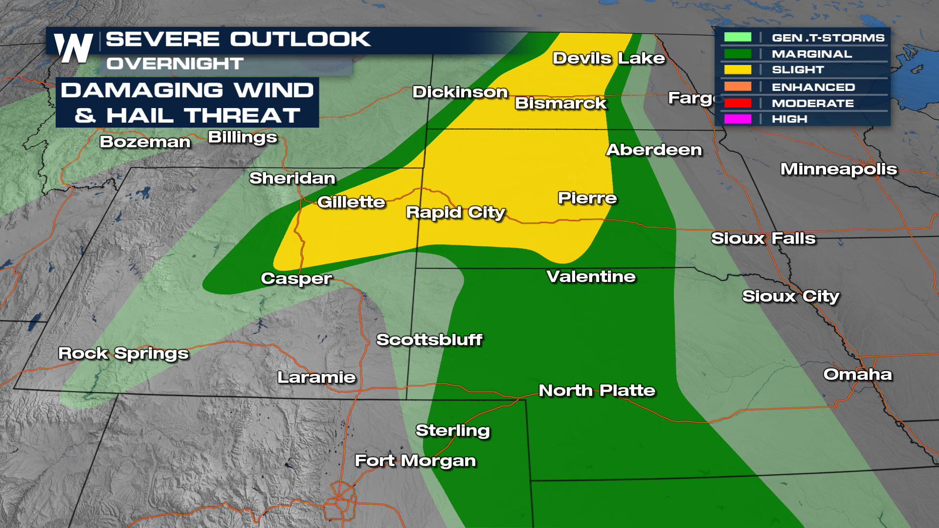
Over the next couple of days, there is a severe risk in the Northern High Plains. A surface low-pressure system will pull in moisture and instability all the way from the Gulf of Mexico, using it to fuel storms.
A few storms will form along the trough mentioned above while more develop along the higher terrain of the northern Rockies. These two areas of storm development merge Wednesday night. Severe storms are possible overnight, including the risk for tornadoes with the initial line of storms along the front (above). They will be more isolated in nature and pose the risk of large hail and updrafts that can rotate, forming a tornado.
On Wednesday the threat is draped across the Dakotas and once again damaging hail is possible. Storms will fire off the higher terrain but mostly along the front through the afternoon and evening hours. The other factor with all three days of severe weather is the flooding threat as locally heavy rainfall is expected, especially on Wednesday for western Nebraska and NE Colorado.
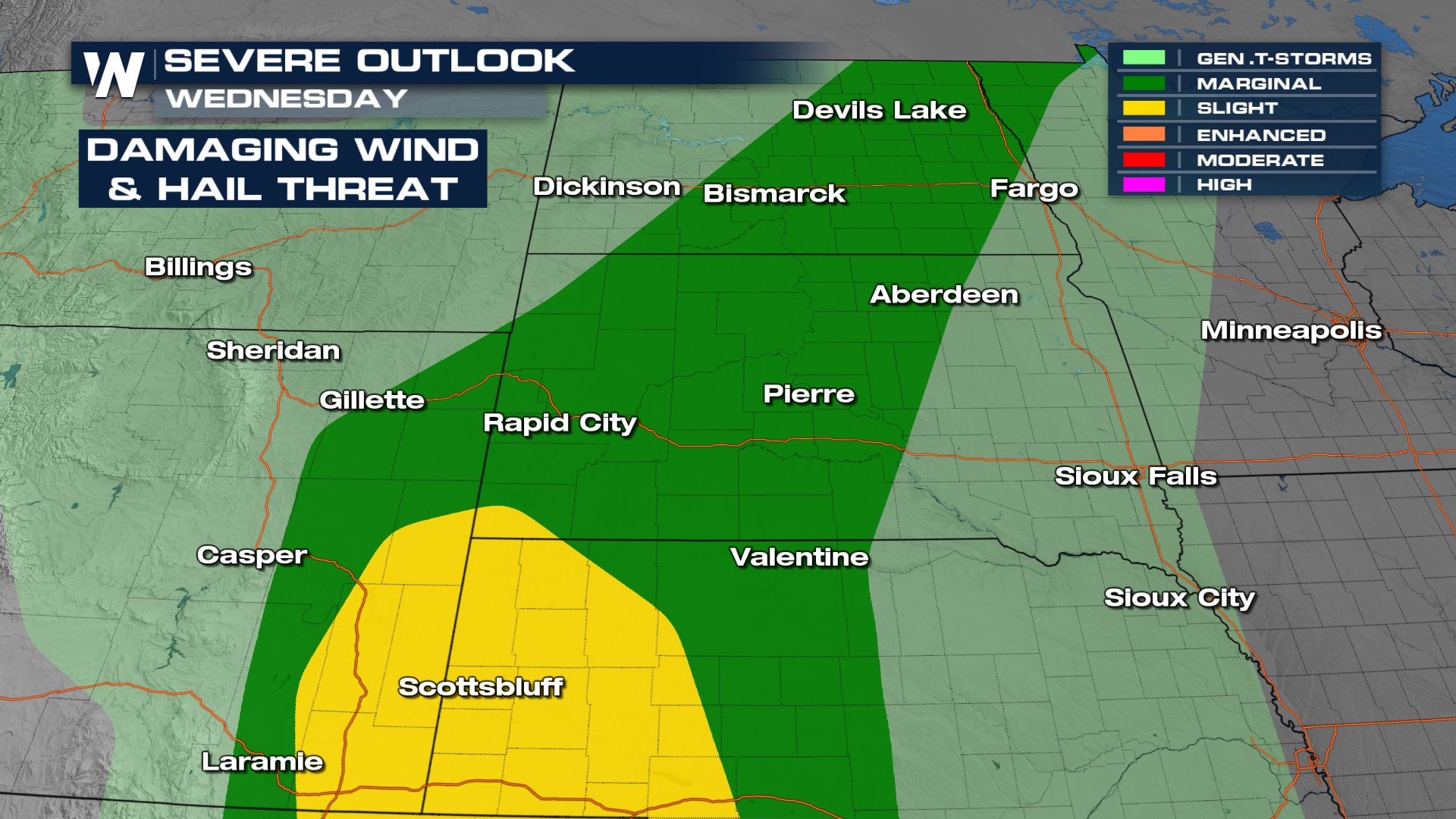 Below is the latest on the timing of severe storms on Wednesday.
For more on this forecast be sure to join us for our central regional :30 minutes past the hour.


