Historic YTD Rainfall as El Nino Changes the Pattern for Hawaii

Hawaii has experienced its wettest first nine months of the year on record, but a strengthening El Niño could bring a significant shift in rainfall as the islands head into their wet season. Hawaii has been anything but dry in 2026. From January through September, the islands recorded their wettest start to a year in NOAA’s 36-year statewide climate record. According to NOAA’s National Centers for Environmental Information (NCEI), Hawaii averaged 86.66 inches of precipitation through September, nearly double the normal amount for that period. That’s an astonishing 42.70 inches above average.
September alone brought an average of 10.83 inches statewide, more than twice the month’s typical rainfall. It was Hawaii’s second-wettest September in the 36-year record, with Hurricane Lowell contributing to the unusually wet conditions.
But the bigger weather story may be what comes next.
Just How Wet Has Hawaii Been?
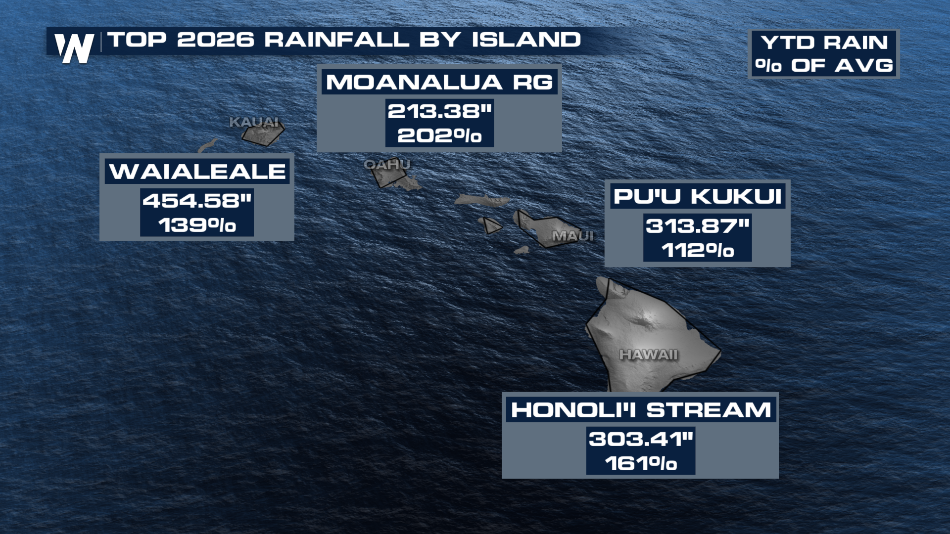
These figures highlight how widespread the unusually wet conditions have been, even across locations with dramatically different rainfall climates.
El Niño Could Flip the Script
Despite the historic rainfall, Hawaii may be heading toward a much drier pattern heading into the state’s typical wet season. El Niño is a natural climate phenomenon characterized by unusually warm ocean temperatures in the central and eastern equatorial Pacific. Those changes influence atmospheric circulation, shifting tropical rainfall patterns and affecting weather around the world.
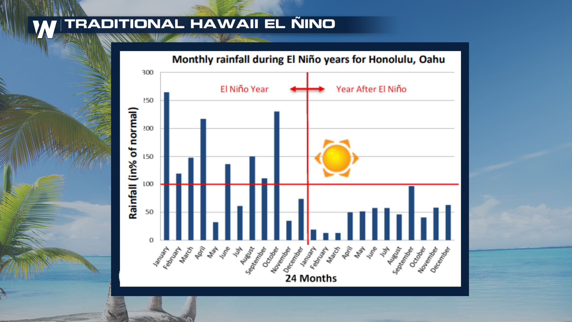
For Hawaii, El Niño winters are generally associated with below-normal rainfall, particularly during the latter part of the wet season. Hawaii’s wet season typically runs from October through April, making the timing of this developing pattern especially significant.
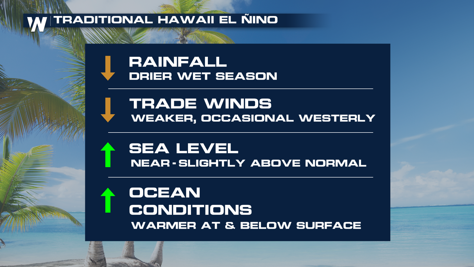
The agency’s winter outlook also favors below-normal precipitation across Hawaii from December through February.
That doesn’t mean the islands will stop seeing rain. Instead, it means the odds favor a drier-than-normal season overall, even after one of the wettest starts to a year on record.
Why the Shift Matters
Rainfall is essential to Hawaii’s water supply, agriculture, ecosystems and overall drought conditions.
A wetter-than-normal year can help replenish water resources and improve drought conditions. However, extended periods of heavy rainfall can also increase the risk of flash flooding, landslides and infrastructure damage.
On the other hand, a prolonged dry period can create new concerns, particularly if rainfall deficits persist through the wet season.
That’s why the developing El Niño deserves attention. Hawaii’s record-setting rainfall earlier this year doesn’t guarantee that water supplies and landscapes will remain protected from drought later on.
What’s Ahead for Hawaii?
NOAA’s latest seasonal guidance points toward increased chances of below-normal rainfall across the Hawaiian Islands as El Niño strengthens. The November outlook also favors drier-than-normal conditions across the state, potentially signaling the beginning of a transition away from the exceptionally wet weather experienced earlier in 2026.
The next several months will help determine whether the islands can maintain their substantial rainfall surplus or whether El Niño begins to chip away at it.
For now, Hawaii’s 2026 rainfall is already one for the record books.


