The History of Upper Air Observations: Kites, Aircrafts, and Balloons
As a child, you may have felt the wind on your face as you launched a colorful kite into the air and watched it soar high above you. But, you might not know that, over 250 years ago, meteorologists in Europe were using kites to carry thermometers aloft and record upper-air observations.
Using Observation Kites
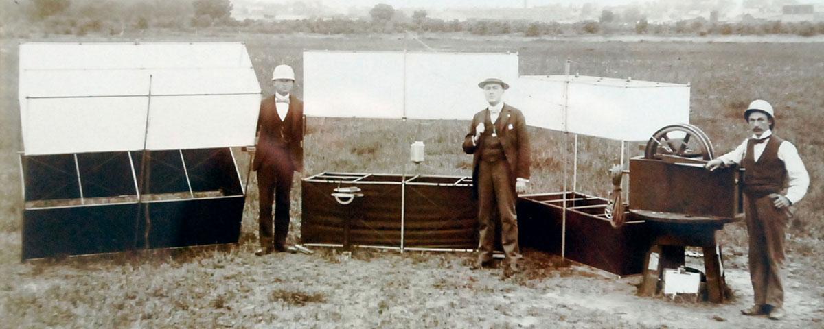
By the late 1890s, the U.S. Weather Bureau had begun regular kite observations across the country. However, these “observation kites” looked vastly different from the kites we might see children play with today.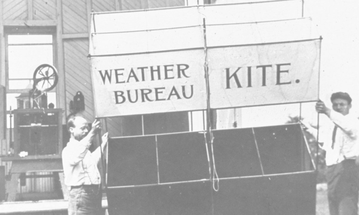 The Weather Bureau’s “box kites” towered over 6 feet tall, and strong, thin piano wire attached to a steam-driven reel held them in place. Scientists attached meteorological instruments known as “meteorographs” to the kites. These instruments recorded pressure, temperature, and relative humidity data on an automated clockwork driven chart recorder.
Advantages and Disadvantages of Observation Kites
Despite their advantages over manned balloon ascents, which were very dangerous, kite observations also had several disadvantages. For example, the kites could only reach an altitude of under 2 miles (about 3 kilometers), which limited their ability to take observations in the upper layers of the atmosphere. Moreover, meteorologists and scientists were unable to evaluate the data until after they reeled in the kite and recovered the observations from the meteorograph. If winds were too strong or too light, kites were not able to take observations at all. The potential for the kites to break away and endanger lives and property also made them a less than ideal option.The Search for a Better Option
Because of the problems associated with kites, scientists continued to search for a better way to take observations in the upper layers of the atmosphere. And, by 1933, the advent of aircraft carrying meteorographs completely ended routine kite observations. However, like the kite, pilots could not fly in poor weather, and scientists could not analyze the data collected until the plane landed. Additionally, pilots could only fly a little over 3 miles (about 5 kilometers) above the ground.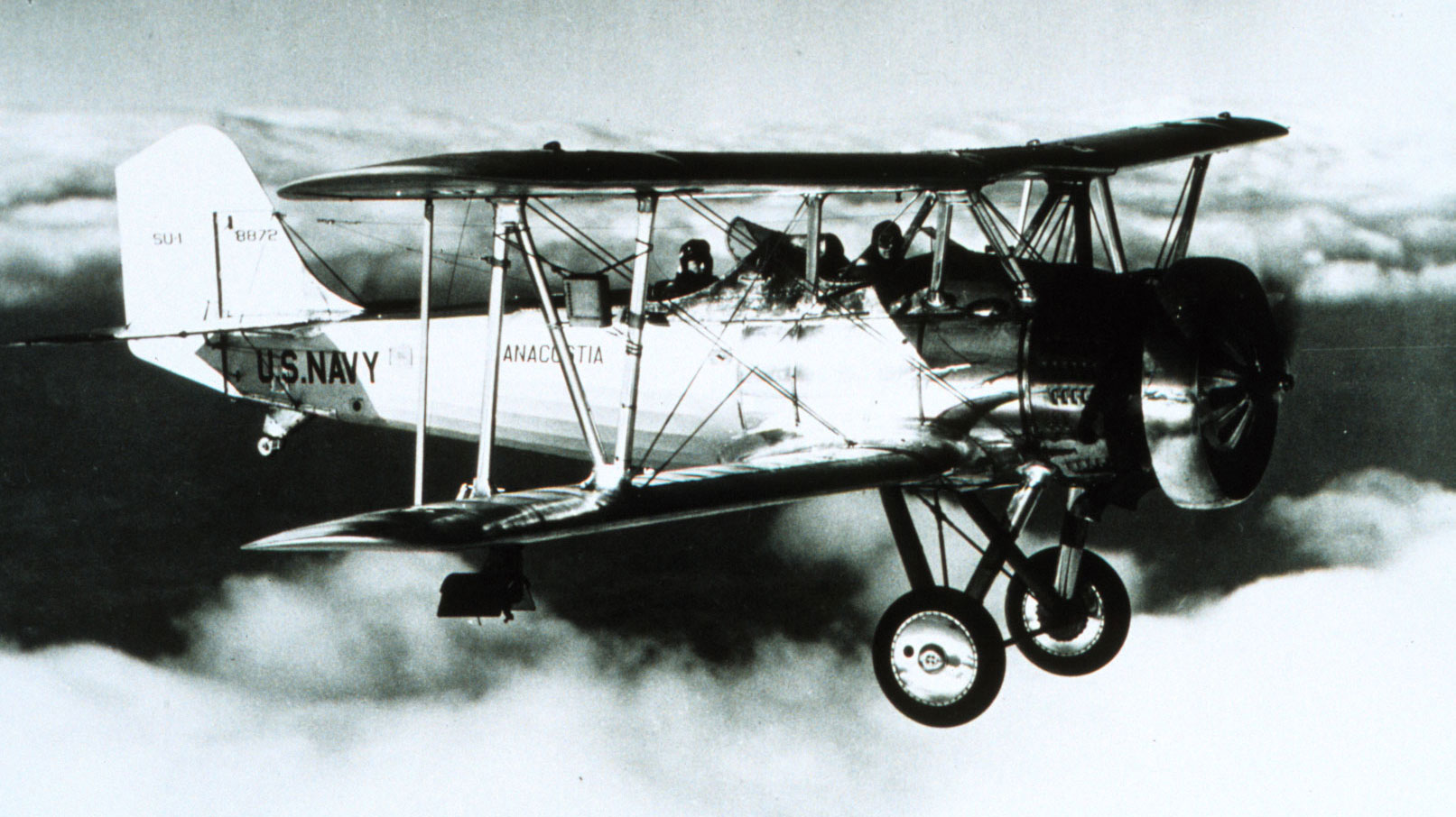 [This Navy biplane had a meteorograph mounted on its starboard wing strut. As it flew in 1934, it took meteorological measurements of atmospheric pressure, temperature, and humidity. Courtesy of the NOAA Photo Library]
The inability of kite and aircraft meteorographs to reach higher layers of the atmosphere, operate in all weather, and provide data in real time helped foster the development of the first radio transmission of upper-air data. In the late 1920s, scientists began suspending primitive radio transmitters from large, unmanned balloons. And, by the early 1930s, they were launching the first radio-meteorographs or “radiosondes” into the stratosphere. In 1937, the Weather Bureau established a network of radiosonde stations that continues to the present day in the United States.
https://www.youtube.com/watch?v=jGQWUFEMxT8The Importance of Upper-Air Data
During its journey through the atmosphere, a modern-day radiosonde uses radio waves to transmit a variety of measurements to computers on the ground, including:- Altitude
- Atmospheric pressure
- Temperature
- Relative humidity
- Wind speed
- Wind direction
- GPS coordinates


