Hurricane Hector to Pass South of Hawaii Wednesday
Special Stories
8 Aug 2018 7:01 AM
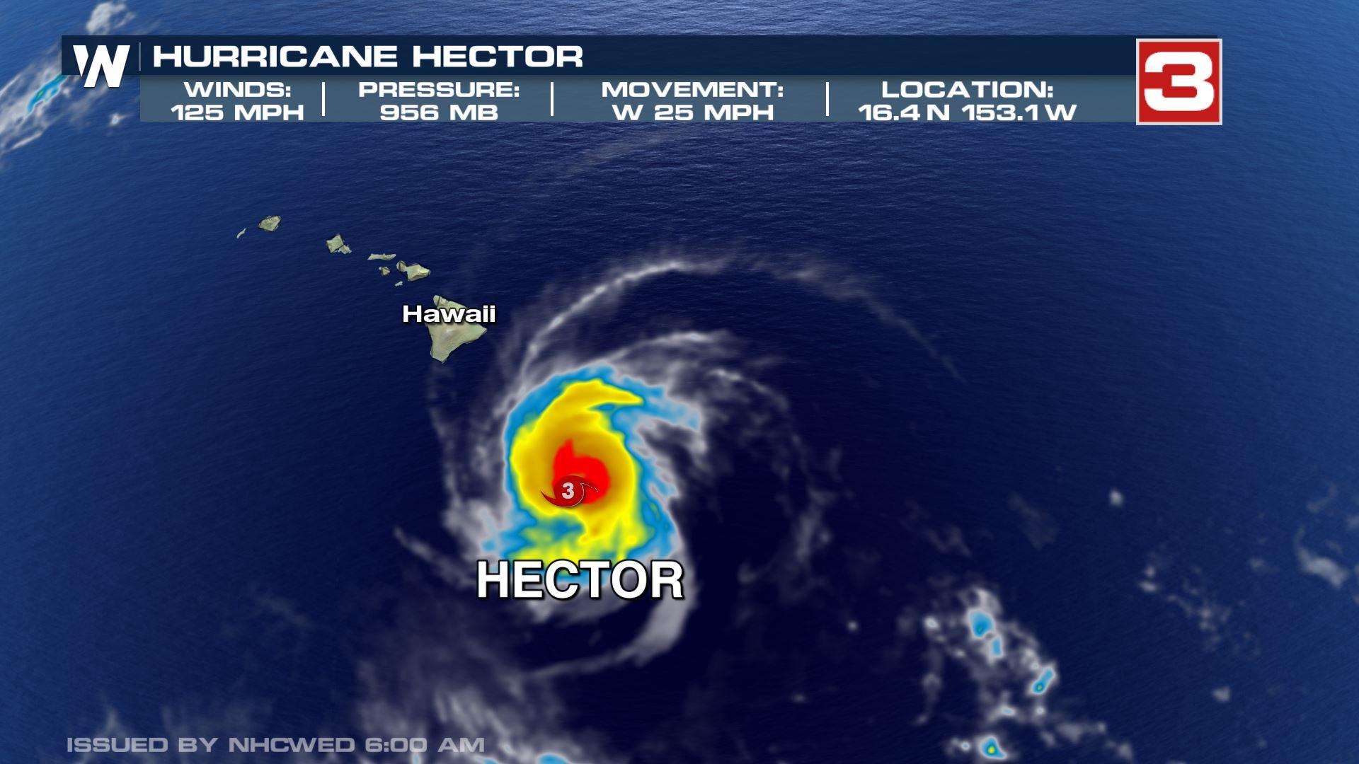
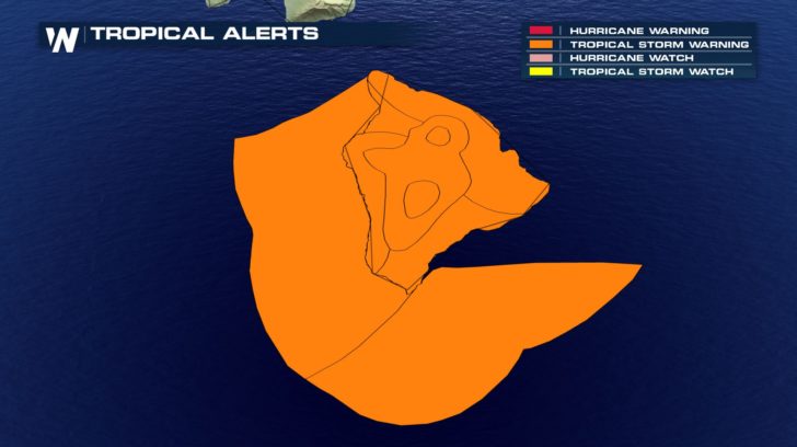
Hurricane Hector, a Cat-3 hurricane as of 6:45 AM Wednesday, is forecasted to track south of Hawaii's Big Island Wednesday. As of 6:45 AM winds were sustained at 125 MPH and it was moving west at 25 mph. The storm is forecasted to remain a Cat-3 hurricane and move south of the big island, bringing strong wind and storm surge to the southern portion of the island.
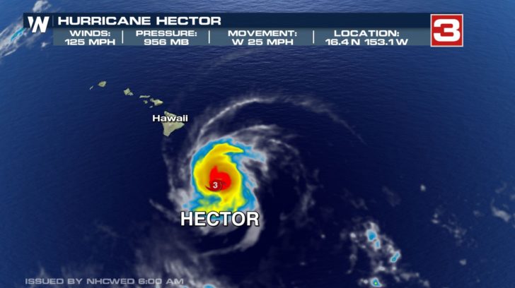
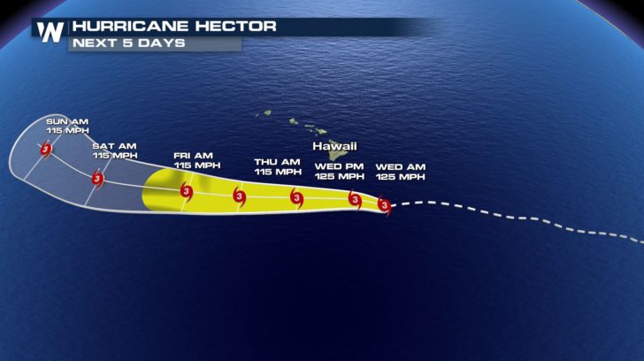
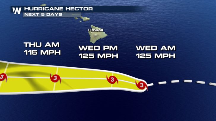 While Hector won't make a direct hit, the Big Island will still feel an impact from the storm Wednesday. Tropical storm warnings are out through the day. Tropical storm force winds, 39 to 73 mph, will impact the island Wednesday into Thursday with calmer conditions returning Friday.
 For Weather Nation: Meteorologist Emily Roehler
While Hector won't make a direct hit, the Big Island will still feel an impact from the storm Wednesday. Tropical storm warnings are out through the day. Tropical storm force winds, 39 to 73 mph, will impact the island Wednesday into Thursday with calmer conditions returning Friday.
For Weather Nation: Meteorologist Emily RoehlerAll Weather News
More
More Storms for the East Through Monday
A low-pressure system that moved through the
2 Aug 2026 10:40 PM

Wildfire Outbreak in the Pacific Northwest
SPOKANE, WA - On Saturday, August 1st, the Ol
2 Aug 2026 10:35 PM


After Reaching Category 5, Genevieve Weakens in the Pacific
PacificGenevieve formed on last Friday south
2 Aug 2026 6:25 PM

Flooding, Severe Storms Target the Midwest Again
After an active week of storms across the nor
1 Aug 2026 1:40 AM

Flooding Risk Increases as Heavy Rain Targets the Tri-State Area
Tuesday, heavy rainfall moved across the Nort
30 Jul 2026 12:25 AM

Severe Weather: Energy From the Midwest Now in the Southeast
UPPER MIDWEST - Through Monday, dangerous tor
29 Jul 2026 10:30 PM