Stormy Saturday Leads to Northeast Power Outages

Strong thunderstorms ripped across much of the East Coast Saturday, producing winds near 85 mph in Washington, DC (ABOVE). A funnel cloud was also spotted in Storrs, Connecticut, and numerous areas across the Northeast reported tree and power line damage from the storms.
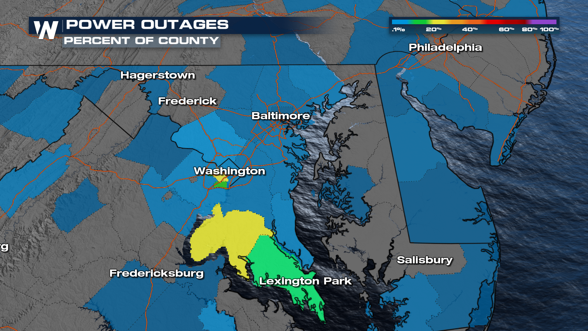
 At one point Saturday evening, about 150,000 customers were out of power in parts of Virginia and Maryland close to DC, due to the high winds from the storms.
Overnight
A few areas of the eastern U.S. remain highlighted with the risk for severe weather through midnight ET as storms continue to push to the east. Damaging winds along the east coast will be the greatest concern.

Damaging winds and hail will continue to be the main threat as these storms move from west to east. Heavy rain and frequent lightning will be likely with all storms, regardless of severity. Soils are saturated, especially in New England. Low-lying areas, streams, creeks, and rivers can be prone to flooding with additional rain.
Cooler Air Arrives
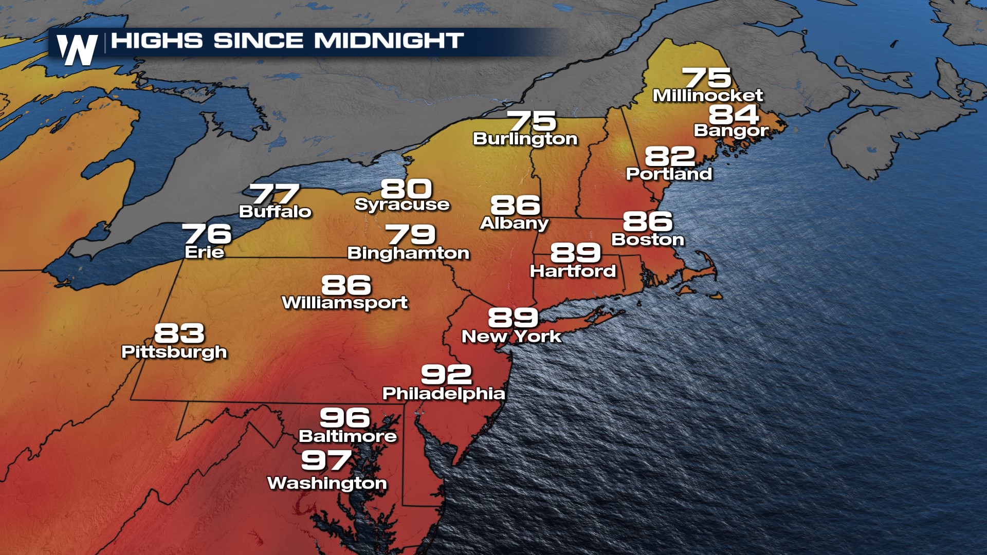
It was a very hot day across portions of the Northeast Saturday! Baltimore and Washington D.C. pushed into the upper 90s with humidity making it feel even hotter!
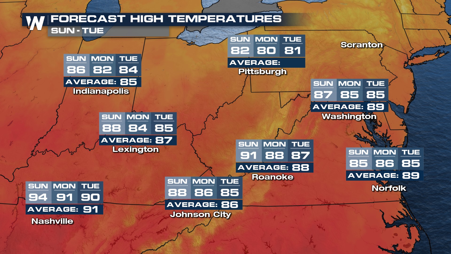
 Sunday we see temps drop down, for some more than 10 degrees! This much-needed heat relief is due to cooler air from Canada draining in behind the severe storm-producing cold front.
 Temperatures will be running at or below average for many Northeast cities into the middle of the upcoming week. This is quite different from the rest of the country, where most will still be baking in the heat with temperatures well above average for this time of year.
Tune in to WeatherNation at :10 past the hour for your Eastern Regional Forecast. Stay tuned to WeatherNation for further updates on this developing situation!


