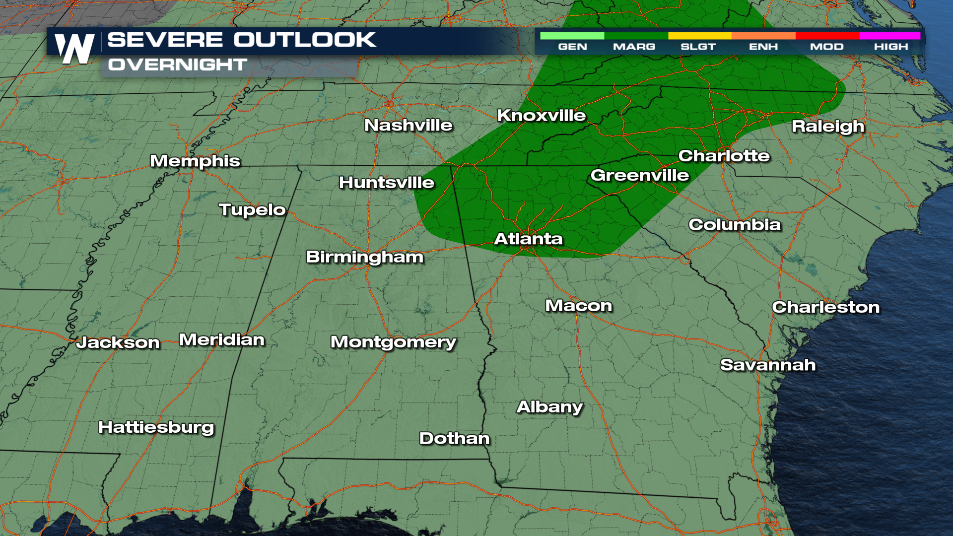
Thunderstorms Possible in the Southeast Overnight

SOUTHEAST - Strong thunderstorms have developed over the Southeast over the last few days, causing tornadoes, damaging winds, and hail. The upper-level "heat dome" that has been steering storms westward over the past few days is being replaced by an upper-level low. The lift associated with this feature will create thunderstorm development each afternoon with daytime heating. Northern Georgia and up through the Smokies remain under a Marginal Risk for severe thunderstorms overnight. Other areas will continue to see general scattered showers and thunderstorms.
Temperatures
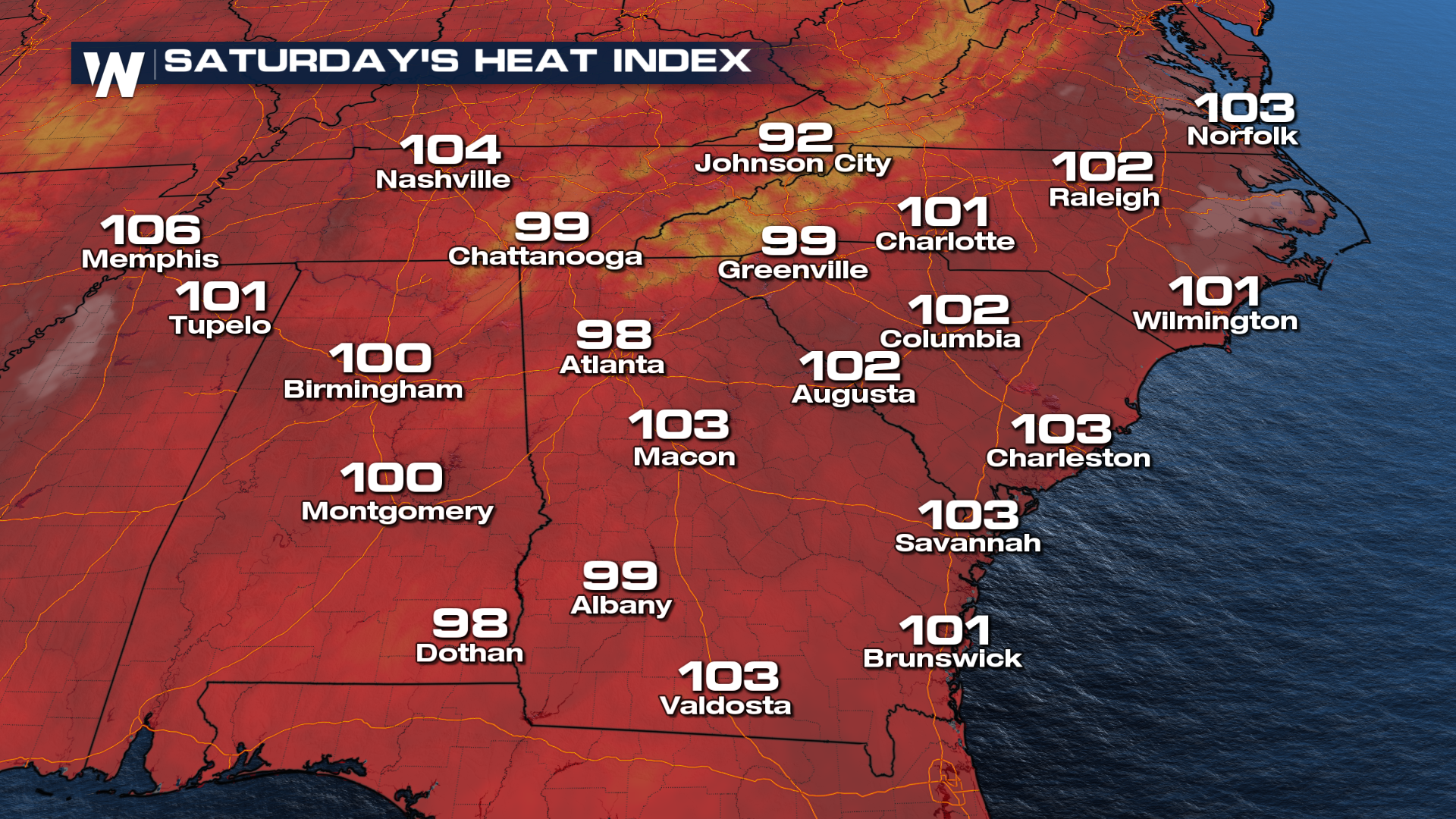
Although there hasn't been an area highlighted for potential severe weather this weekend, high heat and moisture will continue to fuel at least general thunderstorms. Here's a look at the forecasted heat index values for Saturday. Many locations will once again reach triple-digit heat indices.
Join us at :10 past the hour for more on your eastern regional forecast.


