Hurricane Isaias Makes Landfall

Special Stories
3 Aug 2020 6:00 PM
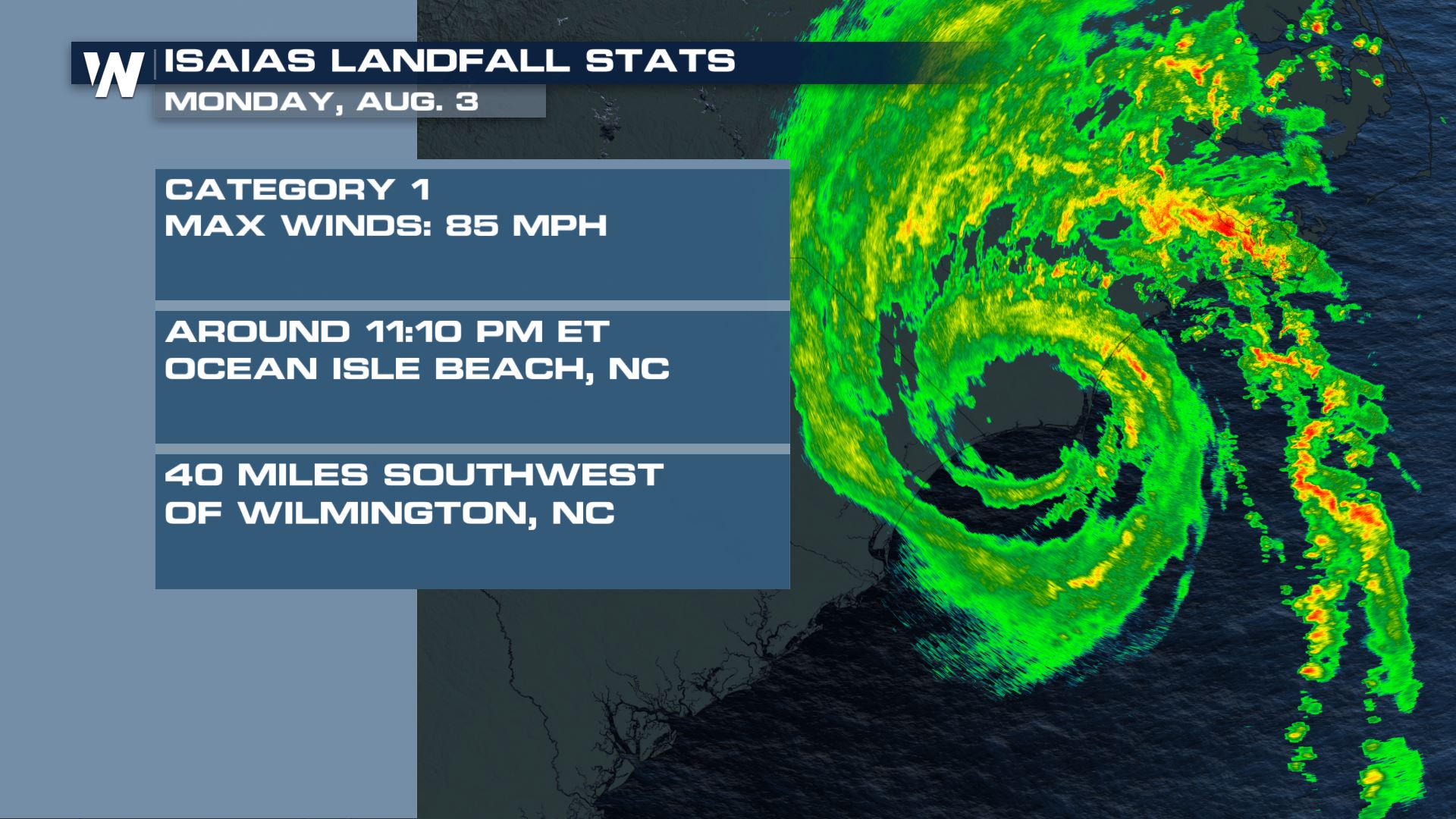
Around 11:10 PM ET Hurricane Isaias made landfall near Ocean Isle Beach, North Carolina with maximum sustained winds at 85 mph and a minimum central pressure of 988 mb.
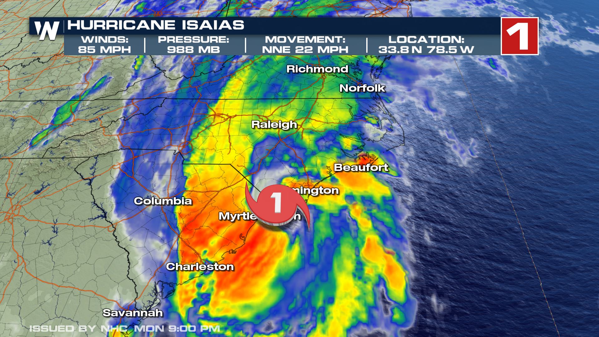
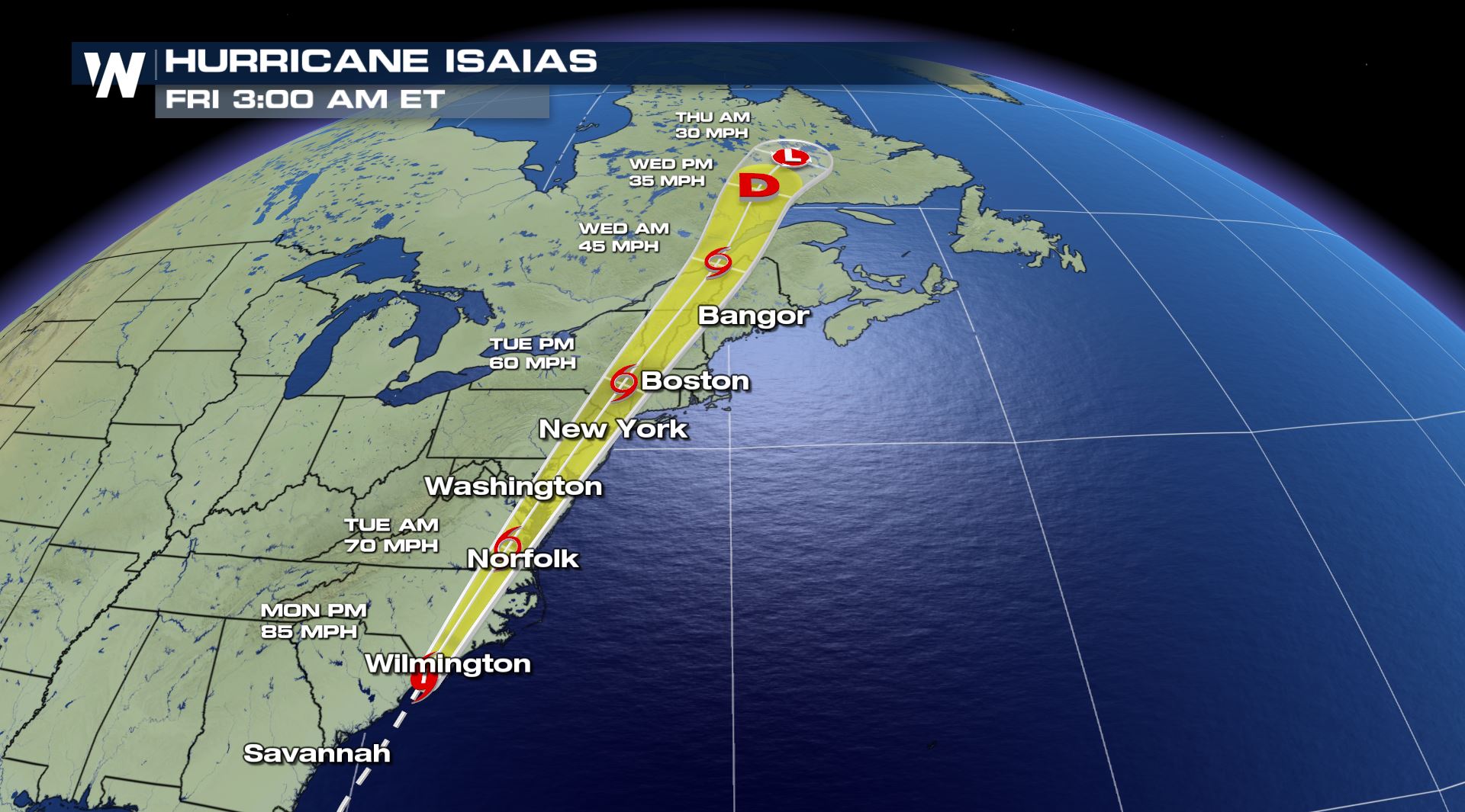
 Just before the 11 PM ET update the National Hurricane Center upgraded Isaias to a category 1 hurricane with maximum sustained winds that strengthened to 85 mph. The minimum central pressure is still at 988 mb and is now travelling even faster moving north-northeast at 22 mph and is located 25 miles east-northeast of Myrtle Beach, South Carolina.
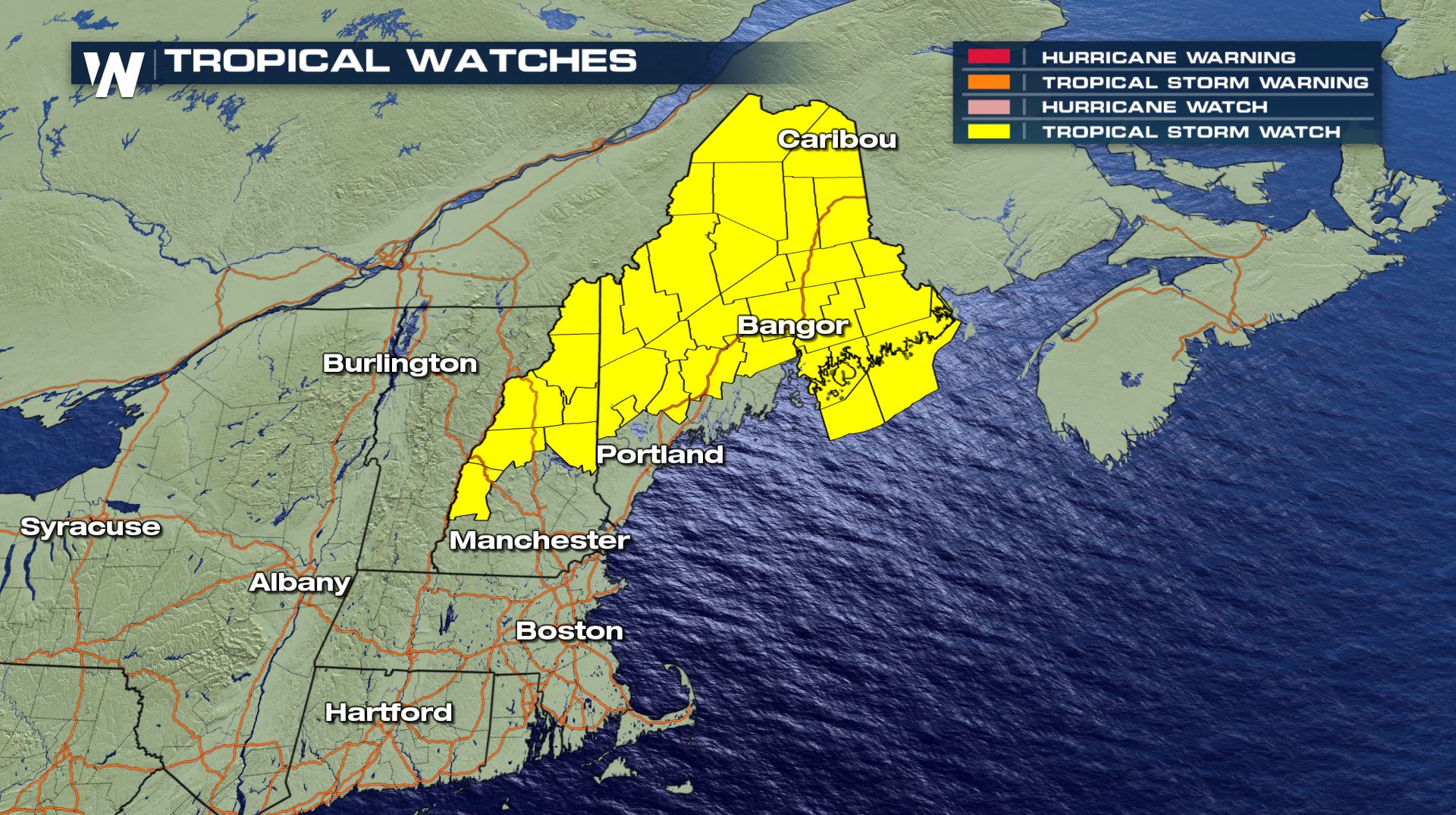
 Tropical Storm warnings have now been extended even farther northward from Stonington, Maine to Eastport Maine. Conversely, tropical storm warnings have been discontinued south of the Santee River.
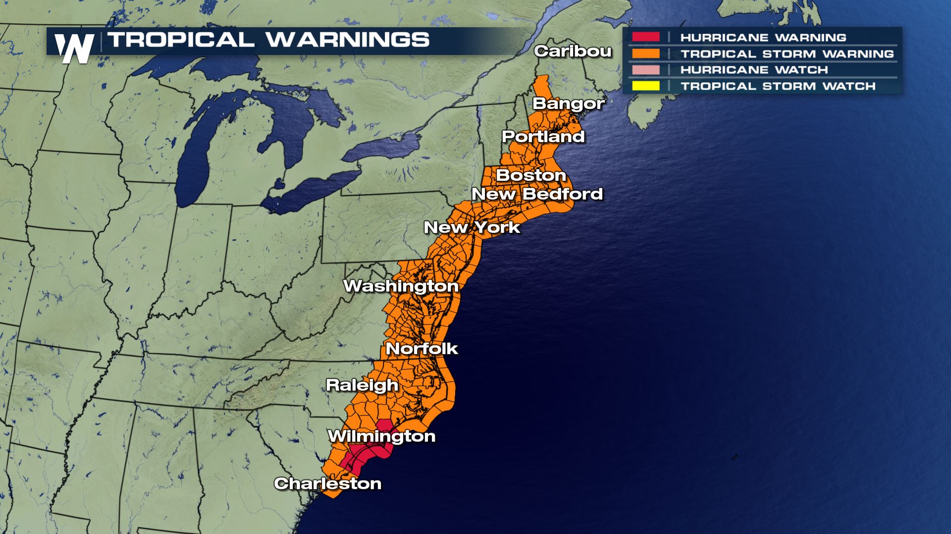 The extension of the warnings replace the tropical storm watches that were in place for parts of New England.
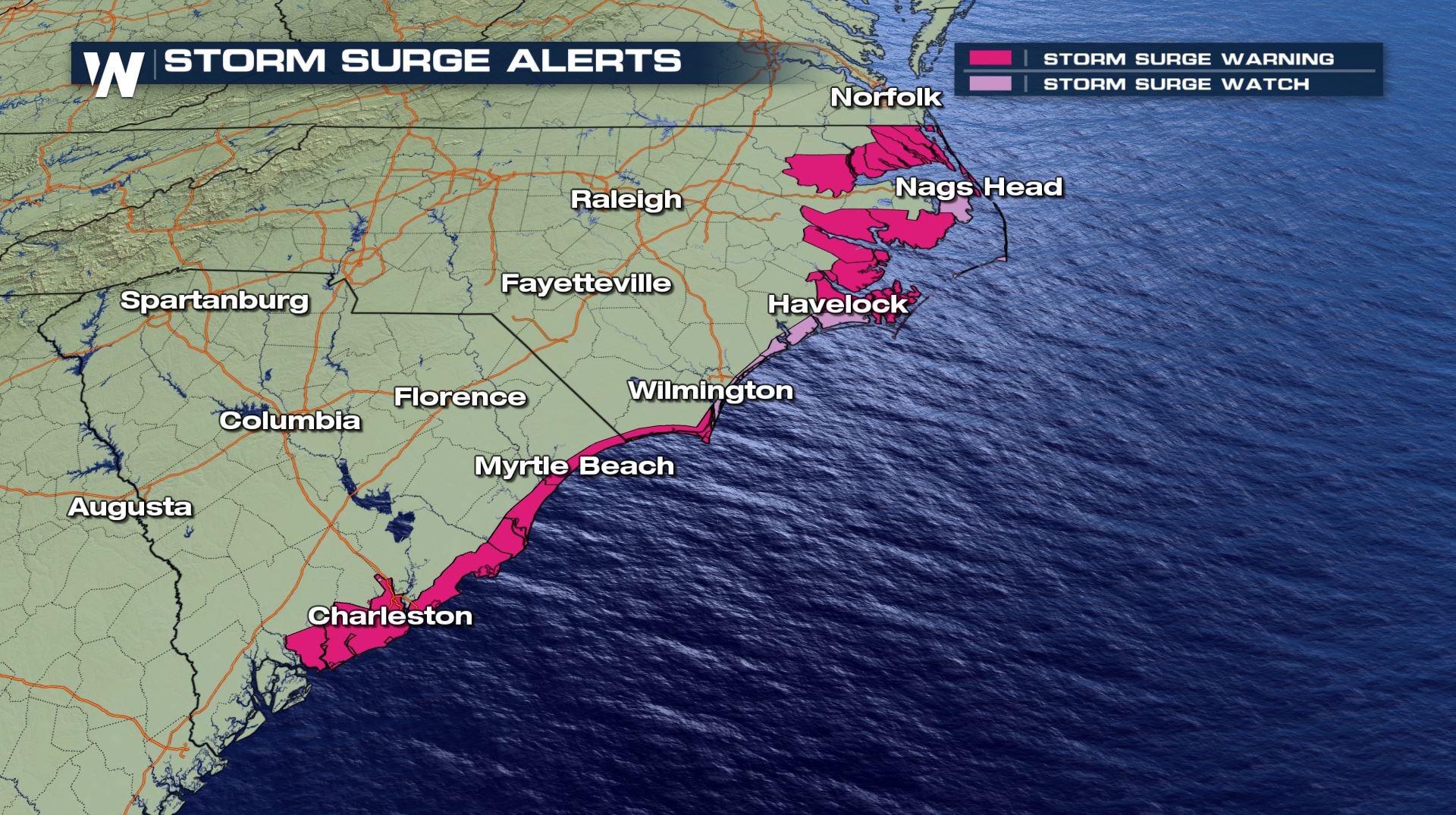
 Storm surge warnings have also been expanded to include Ocracoke inlet, North Carolina to Oregon Inlet, North Carolina. This means ocean water could possibly rise to as high as 5 feet above usual stages.
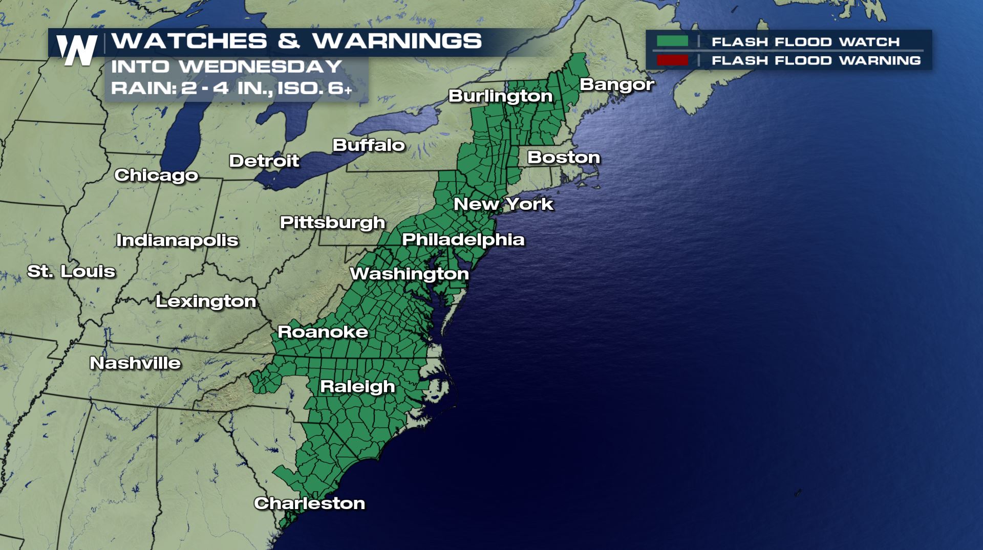
 While there hasn't been much inundating rainfall associated with the storm over the Continental U.S. yet, the forecast brings heavy rain inland once the storm makes landfall tonight. Flooding is the main concern. A number of flash flood watches have been put up for areas from South Carolina all the way northward to New England and even into parts of Maine to the Canadian Border.
 The latest track has the storm moving up the eastern seaboard tonight and through Tuesday. The current track has the storm near New York City by Tuesday evening.
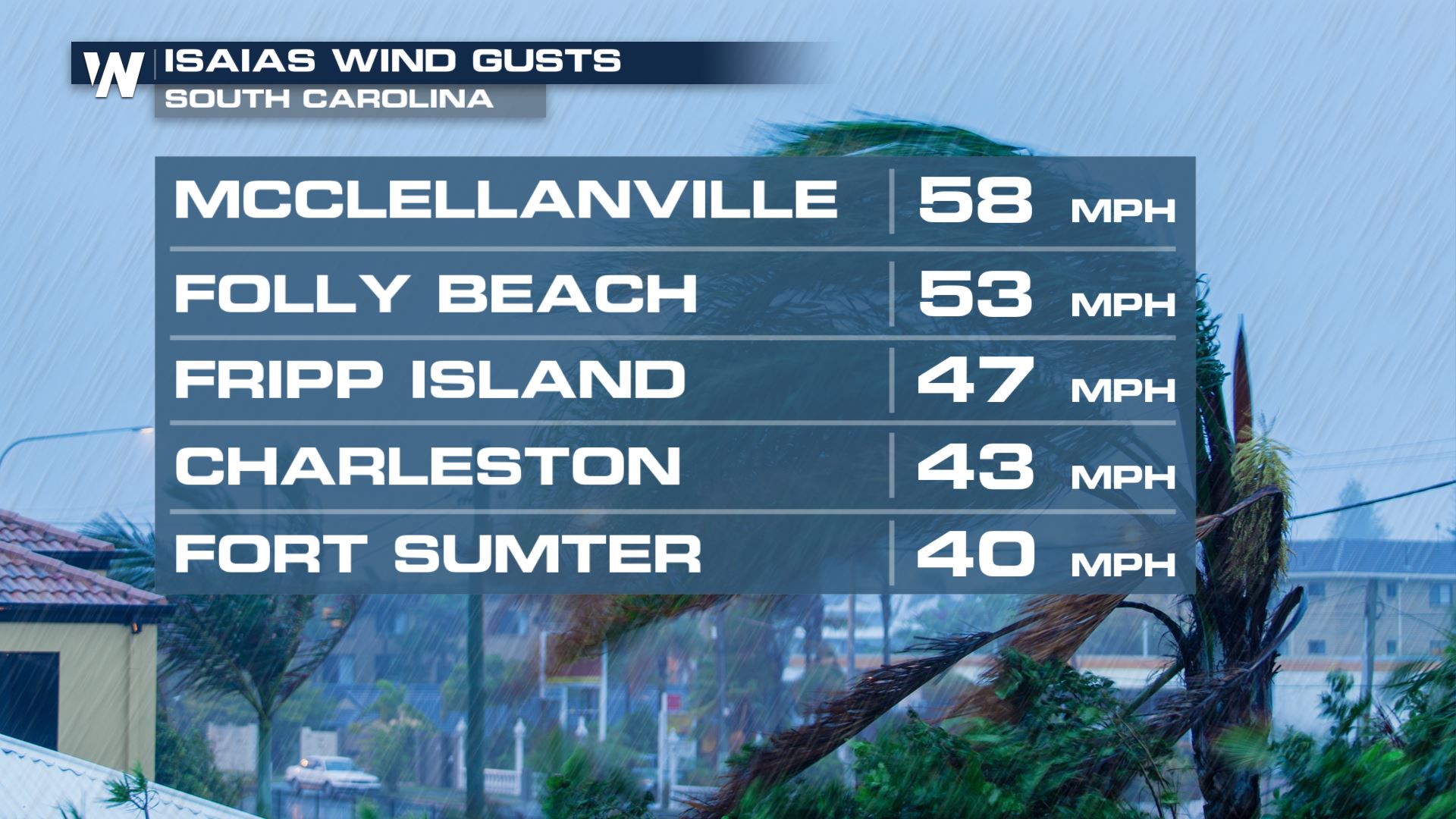
 South Carolina wind gusts have topped 50 miles per hour in a couple of locations so far. Here are a few of the reports, which we will update as the night goes on:
 Join WeatherNation on air and online as we track the 9th named storm of the busy 2020 Atlantic hurricane season.
Just before the 11 PM ET update the National Hurricane Center upgraded Isaias to a category 1 hurricane with maximum sustained winds that strengthened to 85 mph. The minimum central pressure is still at 988 mb and is now travelling even faster moving north-northeast at 22 mph and is located 25 miles east-northeast of Myrtle Beach, South Carolina.
Tropical Storm warnings have now been extended even farther northward from Stonington, Maine to Eastport Maine. Conversely, tropical storm warnings have been discontinued south of the Santee River.
The extension of the warnings replace the tropical storm watches that were in place for parts of New England.
Storm surge warnings have also been expanded to include Ocracoke inlet, North Carolina to Oregon Inlet, North Carolina. This means ocean water could possibly rise to as high as 5 feet above usual stages.
While there hasn't been much inundating rainfall associated with the storm over the Continental U.S. yet, the forecast brings heavy rain inland once the storm makes landfall tonight. Flooding is the main concern. A number of flash flood watches have been put up for areas from South Carolina all the way northward to New England and even into parts of Maine to the Canadian Border.
The latest track has the storm moving up the eastern seaboard tonight and through Tuesday. The current track has the storm near New York City by Tuesday evening.
South Carolina wind gusts have topped 50 miles per hour in a couple of locations so far. Here are a few of the reports, which we will update as the night goes on:
Join WeatherNation on air and online as we track the 9th named storm of the busy 2020 Atlantic hurricane season.All Weather News
More
Catastrophic Flooding in the Texas Hill Country
Multiple Flash Flood Emergencies were issued
5 Jul 2025 10:20 PM

Severe Storms in the Midwest Continue To Spoil the Holiday Weekend
NORTHERN PLAINS - A frontal system continues
5 Jul 2025 10:15 PM

Tropical Storm Chantal Forms This Morning
Tropical Storm Chantal has formed, with winds
5 Jul 2025 4:35 PM


Near Seasonal Temperatures for Many Come July 4th!
AAA is expecting over 70 million travelers to
4 Jul 2025 10:15 AM


Northwest Heat Met With Thunderstorm Risk
NORTHWEST - Today, portions of Montana are un
3 Jul 2025 12:00 AM