Lake Effect Snow Continues for the Great Lakes
Special Stories
6 Dec 2018 8:40 AM
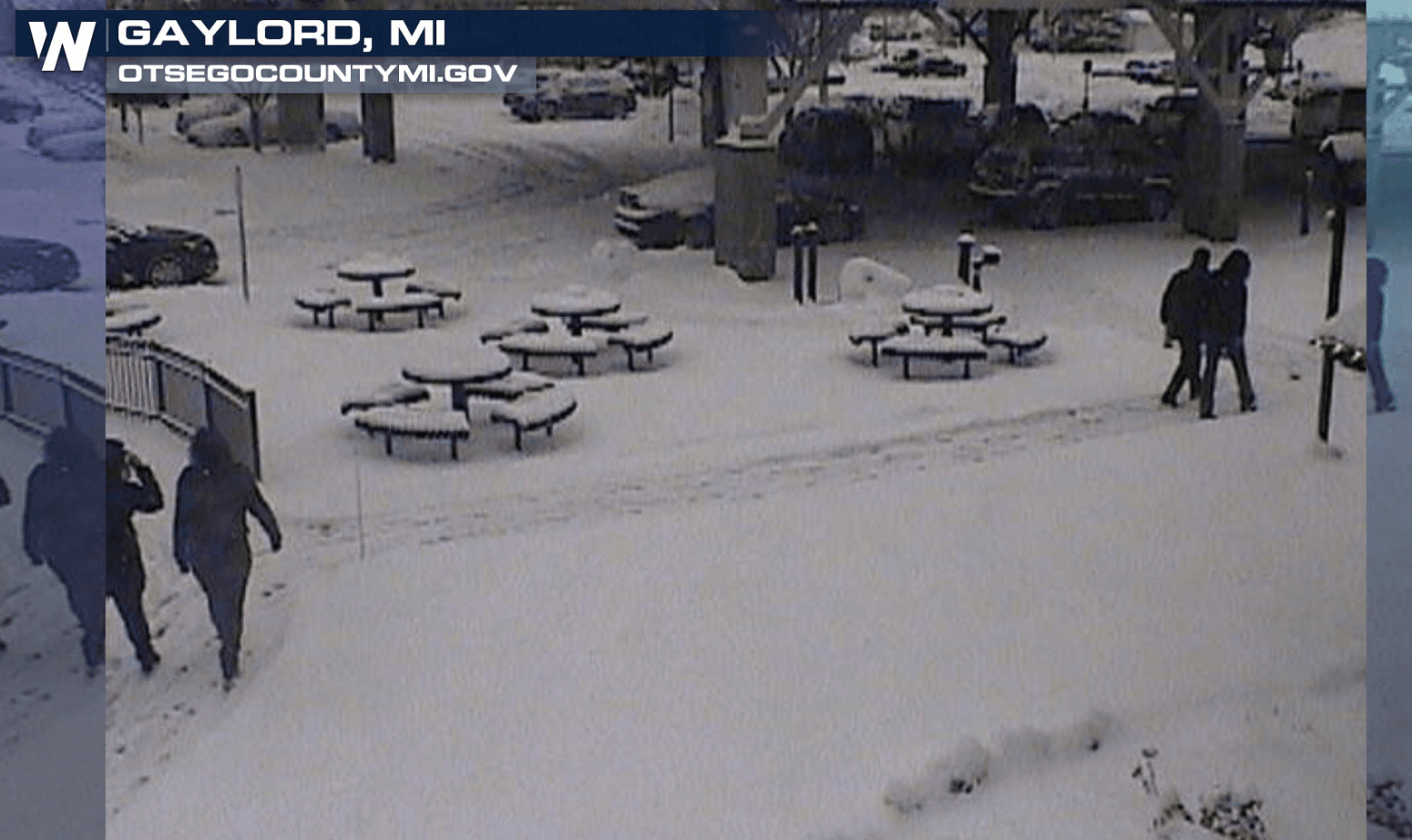
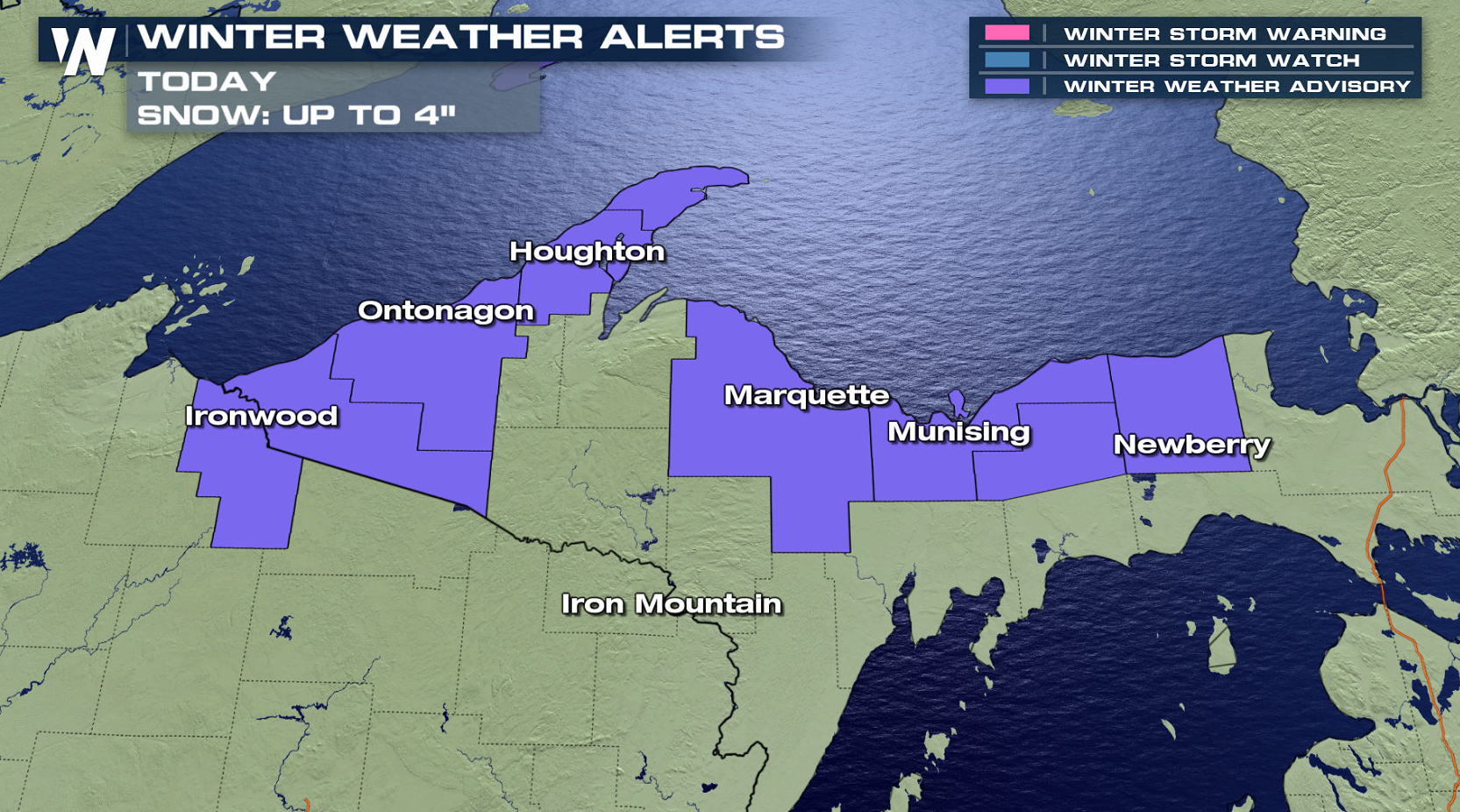
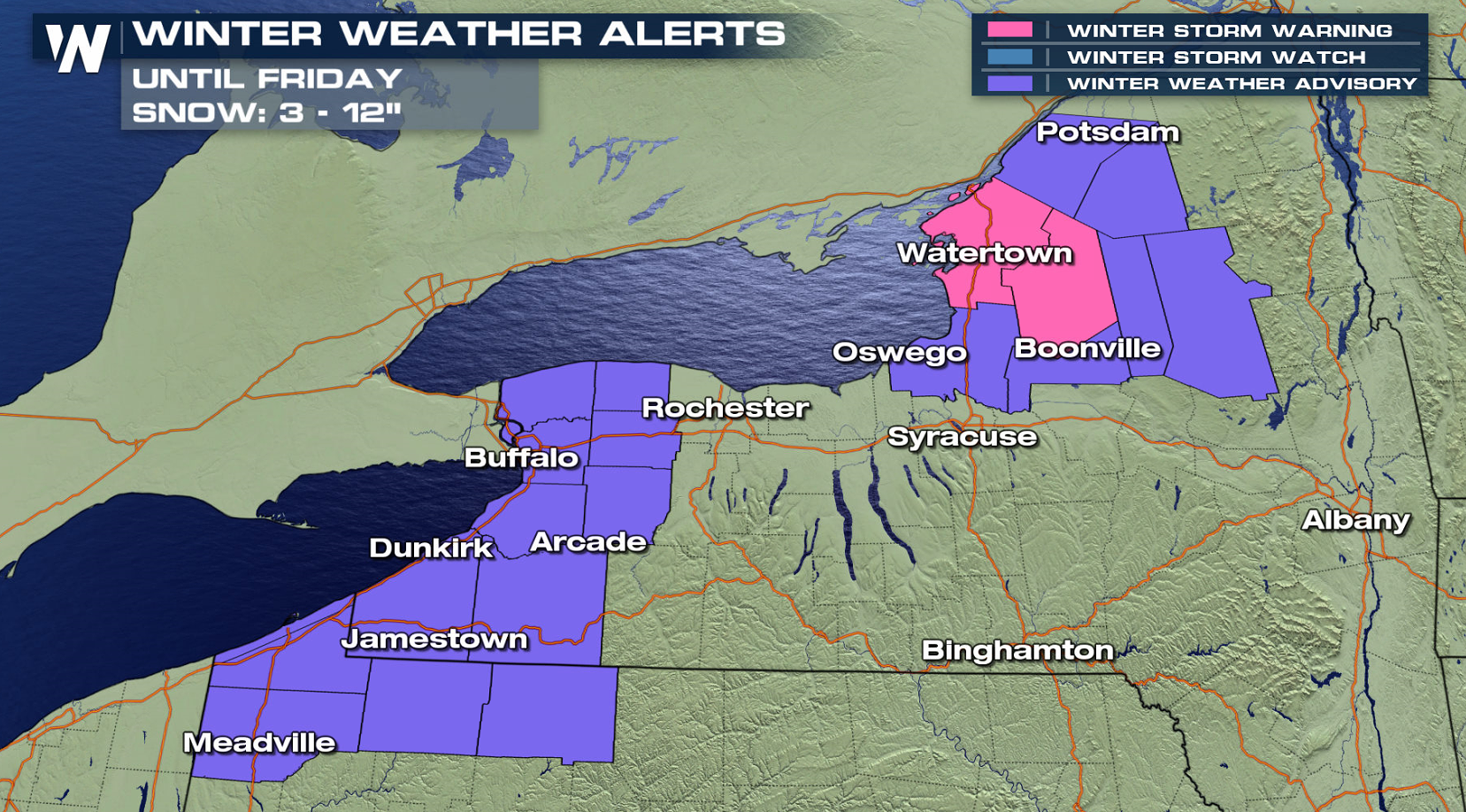
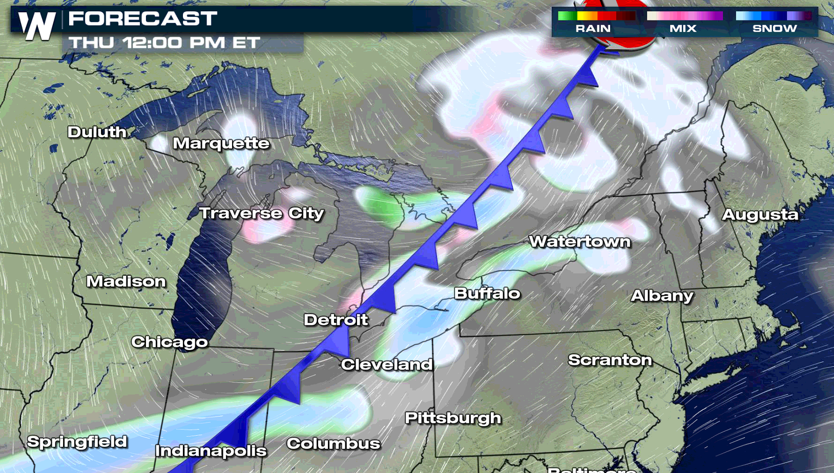
Lake effect snow will continue across the Great Lakes to end the work week. Winter Weather Advisories extend from Upper Michigan to Upstate New York. Most totals will be in the 3" to 6" range, but a few areas could see near a foot of fresh powder.
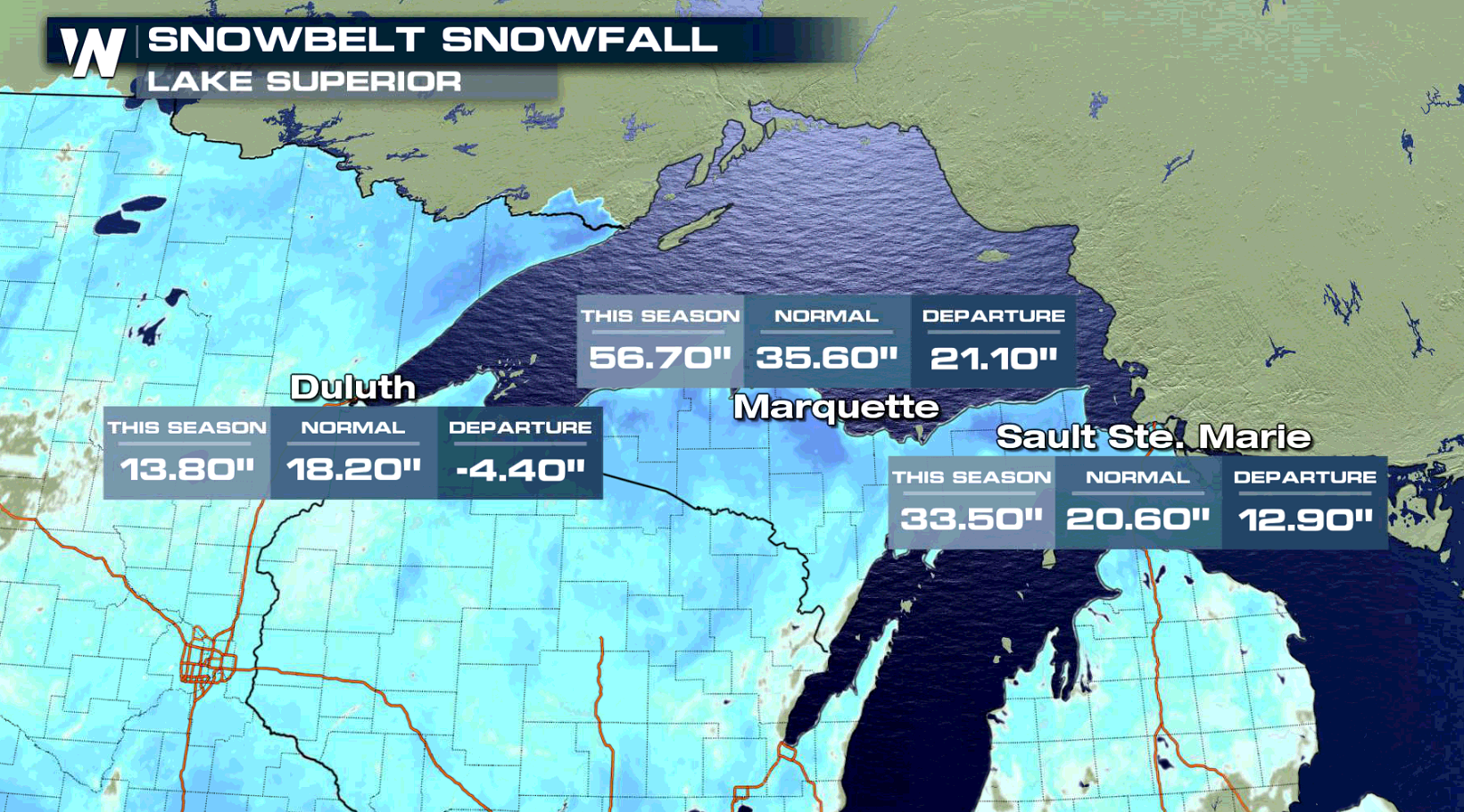
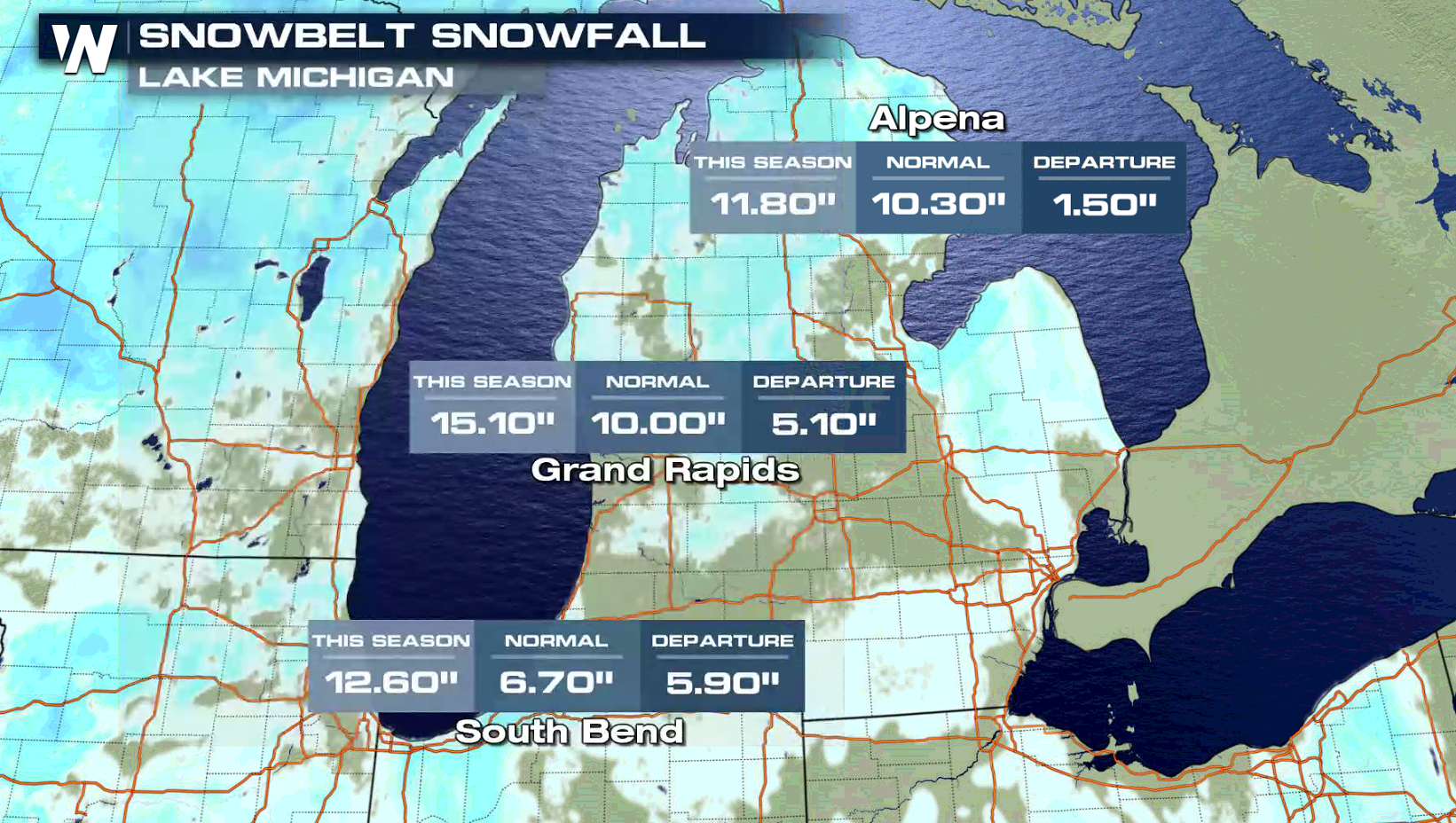
 The lake effect snow belts have been producing plenty of snow this season, with well above average accumulations in Michigan. Lake Superior has been especially active, with Marquette and Sault Ste. Marie 1 to 2 feet above normal.
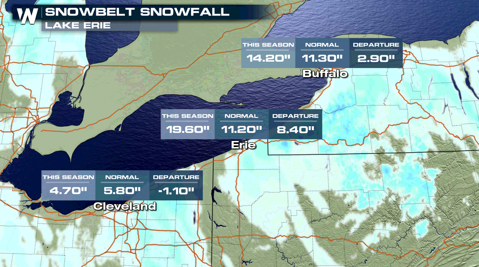
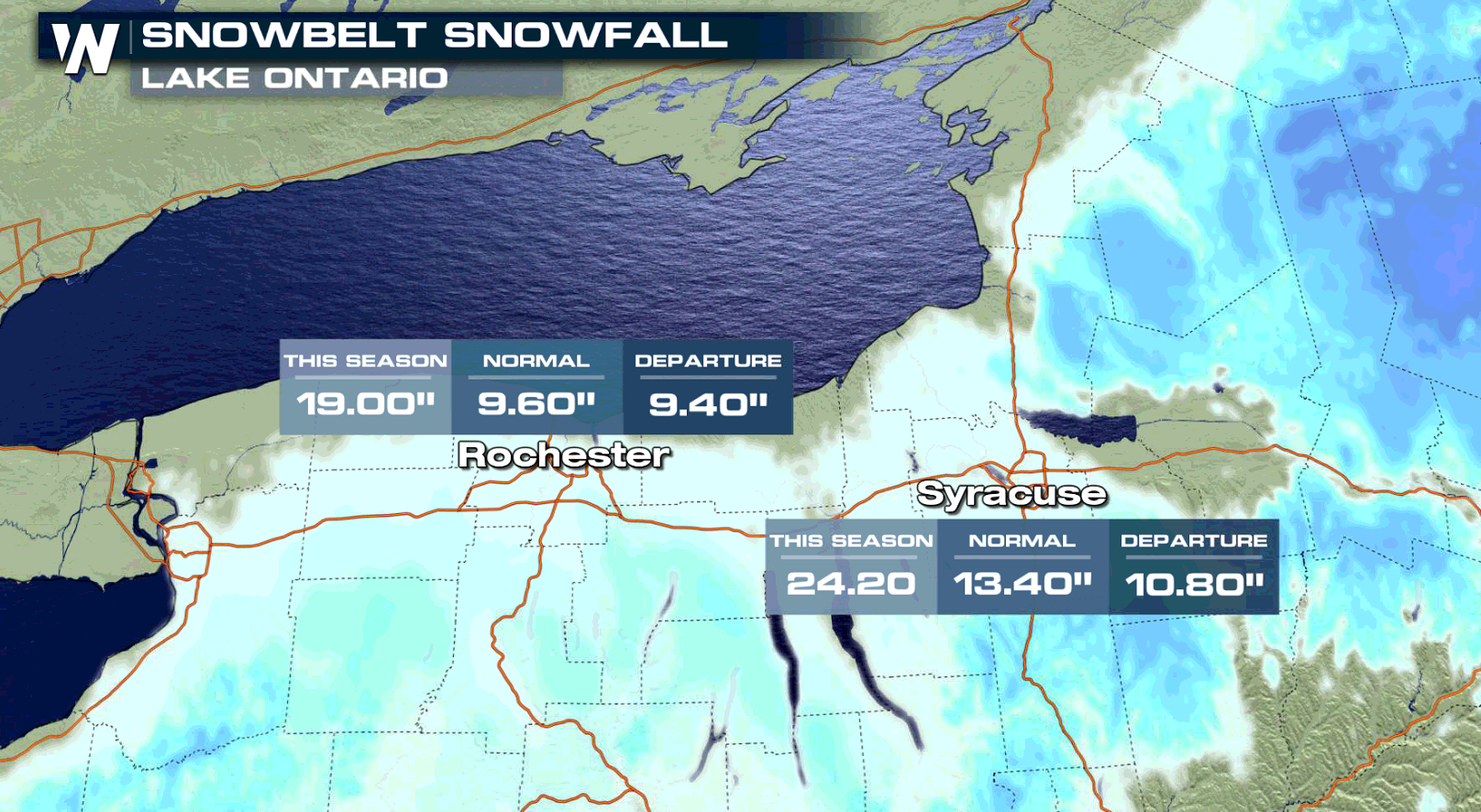
 Lake Erie and Lake Ontario have been active as well, with most locations seeing greater than average snowfall.
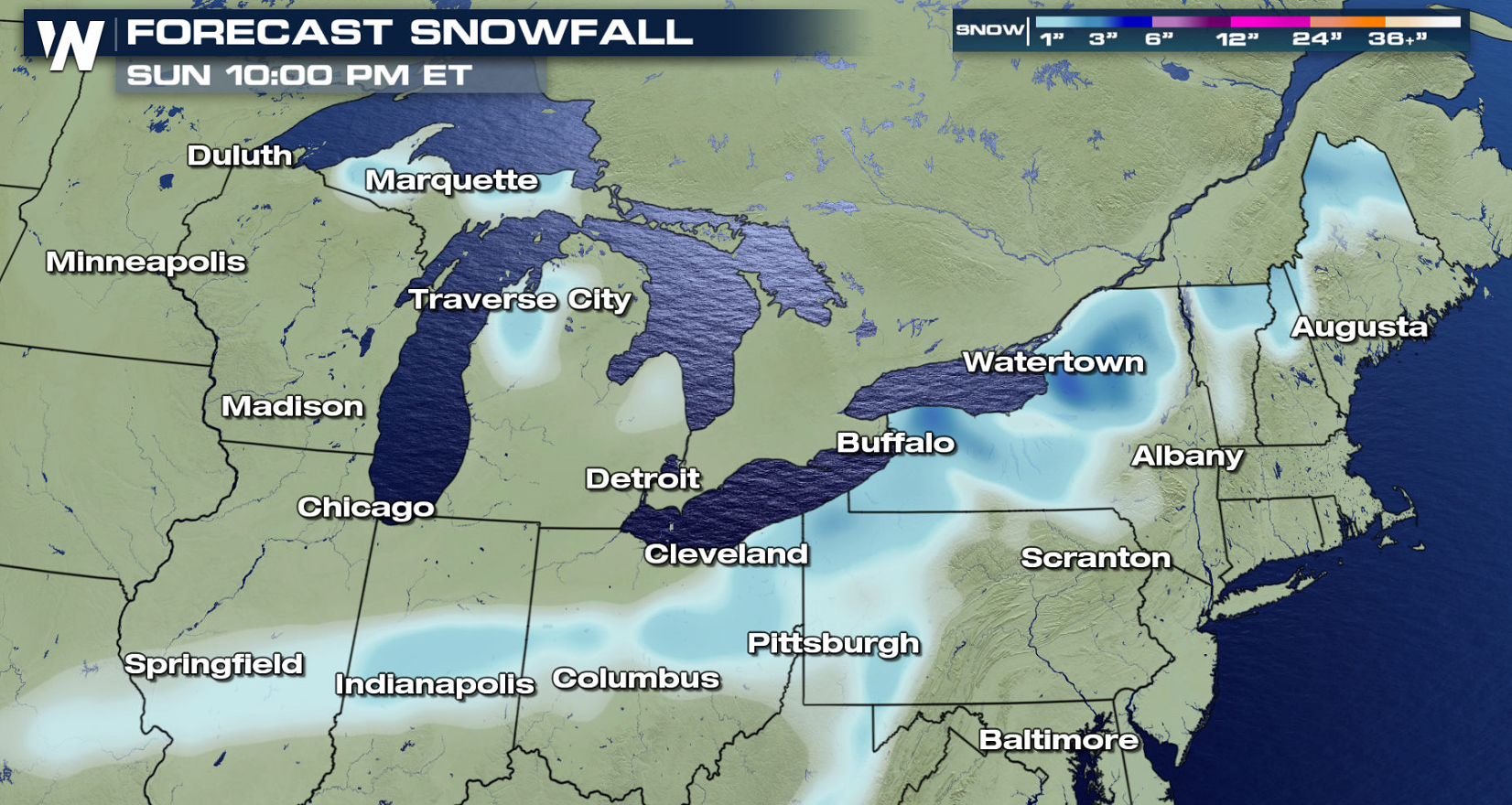
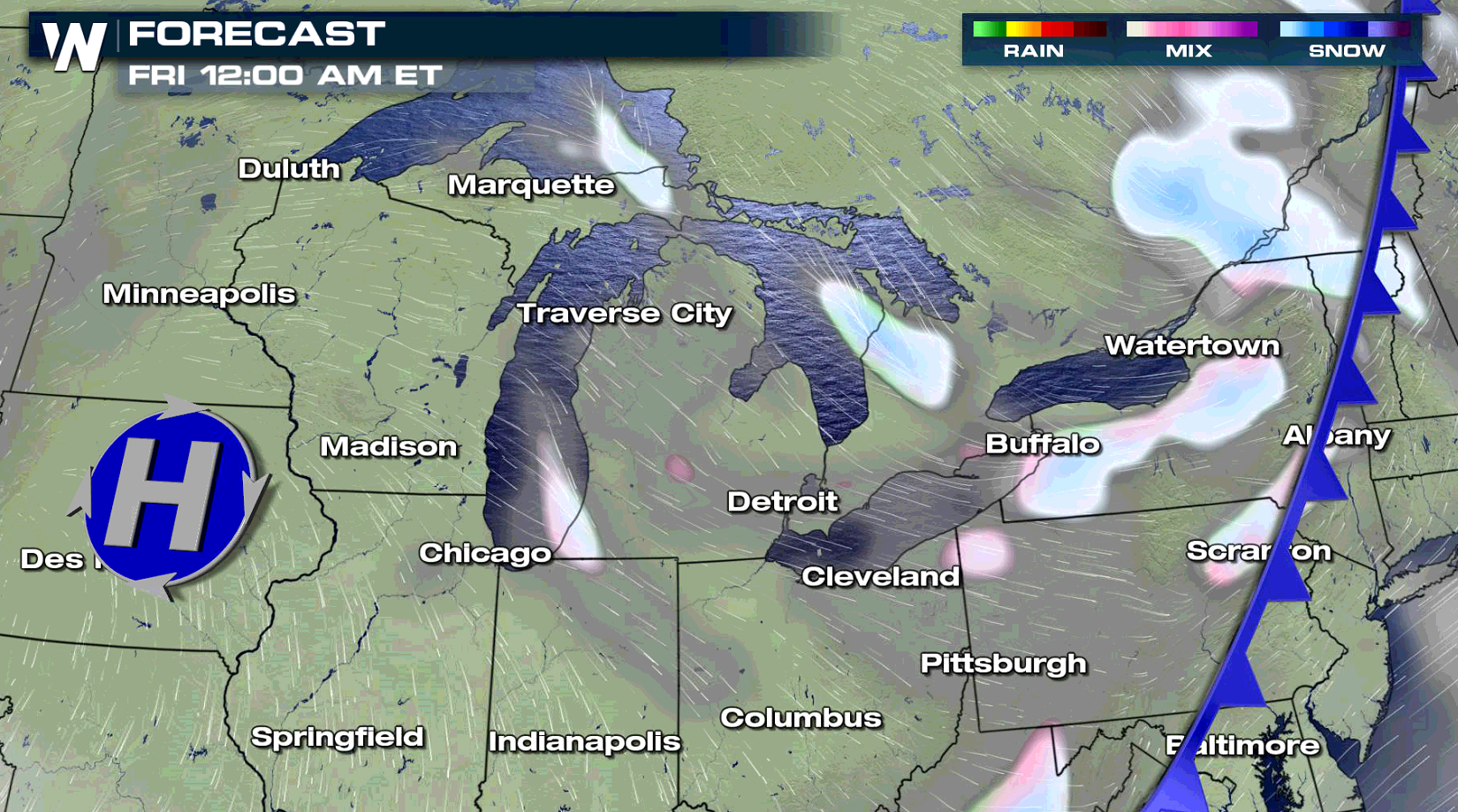
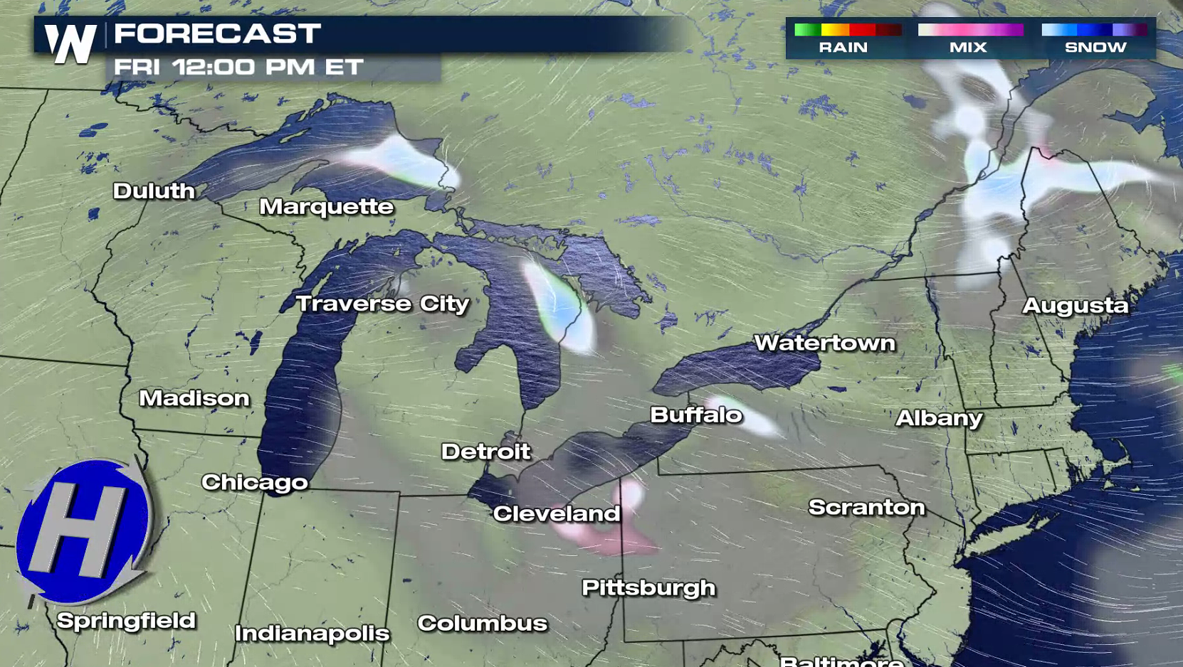
 A trough and cold front will cross the Great Lakes into Friday. This will help to push much colder air across the warmer waters, fueling the lake effect snow. Drier high pressure will move into the region this weekend, bringing an end to most of the lake effect snow.
 For WeatherNation: Meteorologist Mace Michaels
The lake effect snow belts have been producing plenty of snow this season, with well above average accumulations in Michigan. Lake Superior has been especially active, with Marquette and Sault Ste. Marie 1 to 2 feet above normal.
Lake Erie and Lake Ontario have been active as well, with most locations seeing greater than average snowfall.
A trough and cold front will cross the Great Lakes into Friday. This will help to push much colder air across the warmer waters, fueling the lake effect snow. Drier high pressure will move into the region this weekend, bringing an end to most of the lake effect snow.
For WeatherNation: Meteorologist Mace MichaelsAll Weather News
More

Flooding, Severe Storms Target the Midwest Again
After an active week of storms across the nor
1 Aug 2026 1:40 AM


After Reaching Category 5, Genevieve Weakens in the Pacific
PacificFausto is now a post-tropical cyclone.
31 Jul 2026 1:30 AM

Flooding Risk Increases as Heavy Rain Targets the Tri-State Area
Tuesday, heavy rainfall moved across the Nort
30 Jul 2026 12:25 AM

Severe Weather: Energy From the Midwest Now in the Southeast
UPPER MIDWEST - Through Monday, dangerous tor
29 Jul 2026 10:30 PM