Lake-Effect Snow Continues, Shifts Toward Chicago This Weekend

Persistent bursts of cold air have continued to produce heavy snow around the Great Lakes this week. While ice continues to build on the lakes, it doesn't look like it will stop the potential for snow over the next few days as another round of arctic air spills over the region.
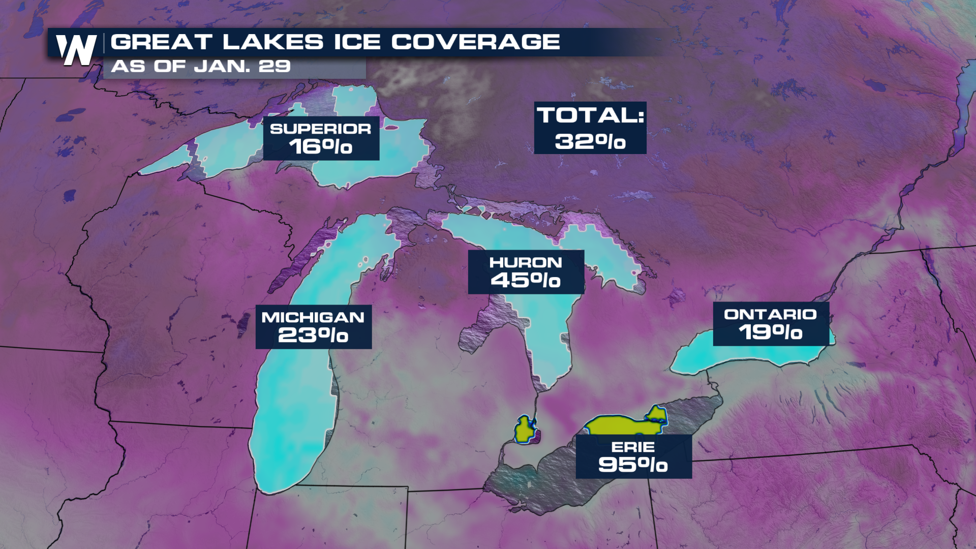 While Lake Erie is now mostly ice-covered, Lakes Michigan, Superior, and Ontario remains mostly ice free exposed, meaning cold air can still pick up plenty of moisture.
As winds shift to the north on Friday, lake effect snow will also shift, sending snow southward into northern Illinois and Indiana. The alerts now include the Chicago metro.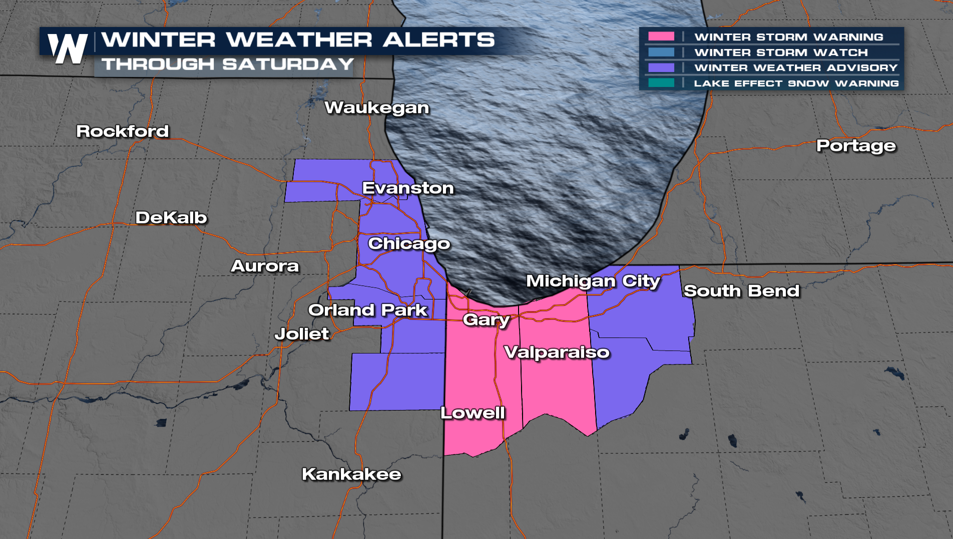
Some of those snow bands will even aim at Chicago, IL tonight into Saturday, with the potential for 6"+ in some neighborhoods around the city. Areas like Gary, IN, could also see some heavier totals in the area.
. The band setting up for northern Illinois also has the potential for heavy accumulation from Chicago through Gary, IN.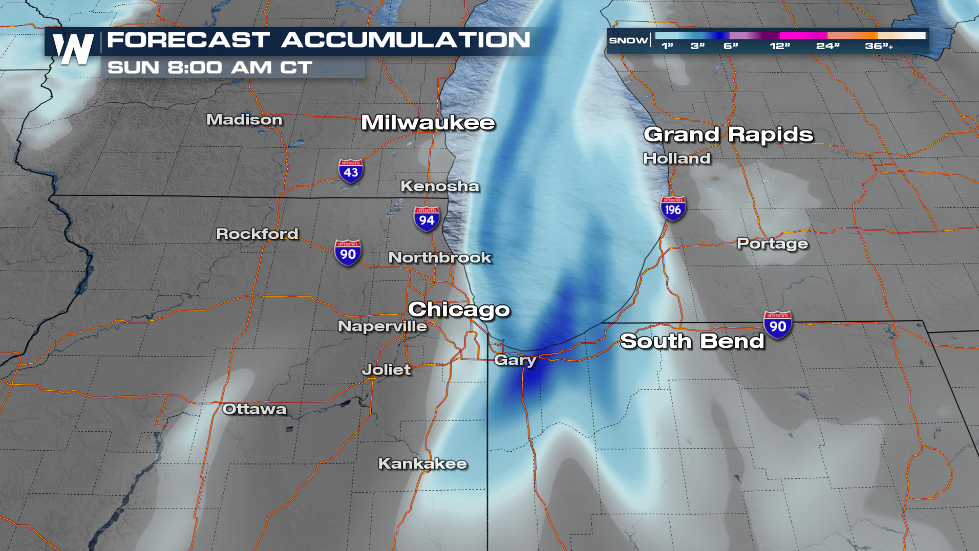
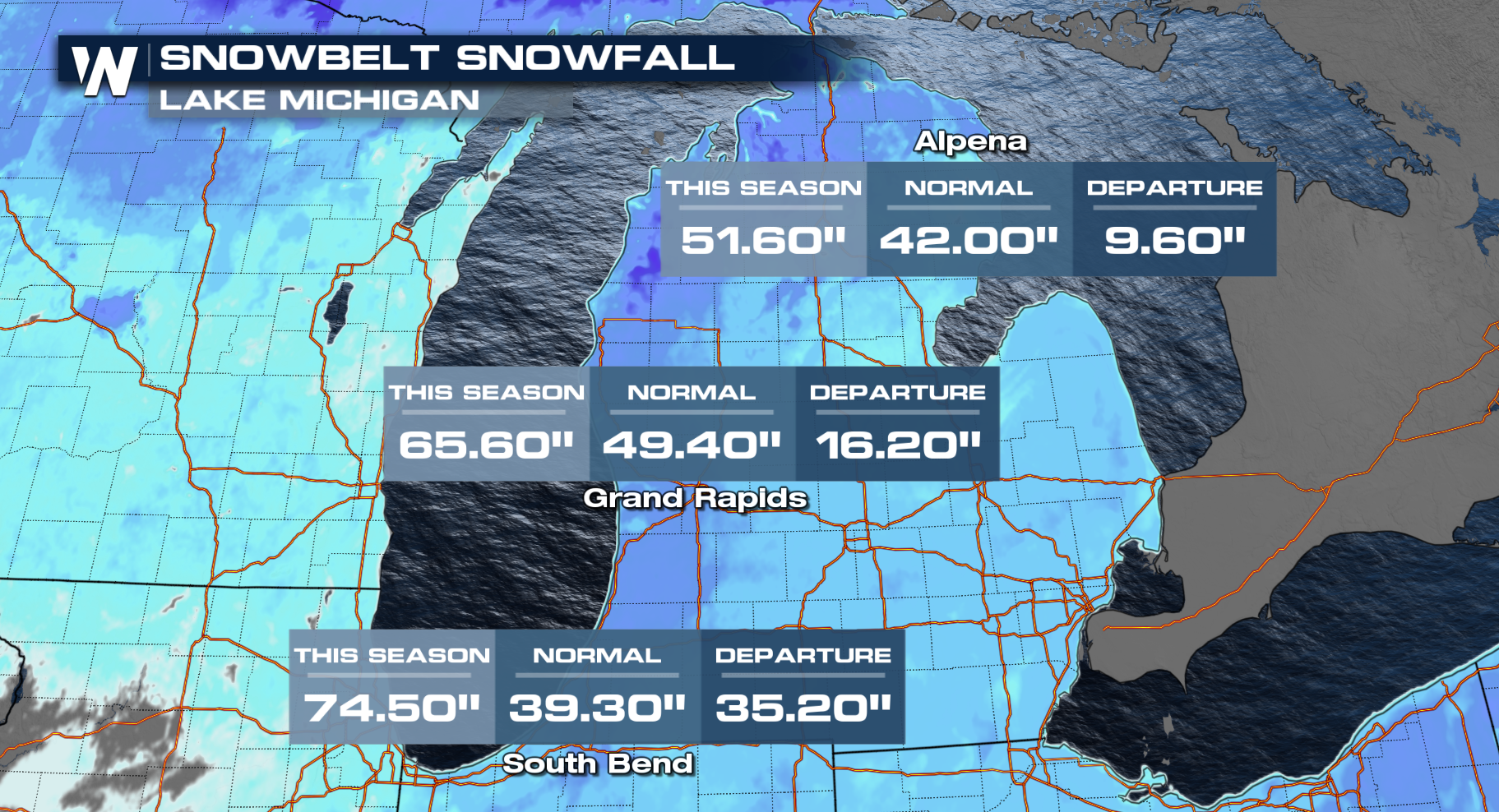
As for Lake Michigan it has been an active year.
For more details on the Central U.S., be sure to join us :30 past the hour, for more details on the northeast, be sure to join us :10 past the hour.


