Lake Effect Snow Throughout the Great Lakes
Special Stories
18 Dec 2019 8:54 AM
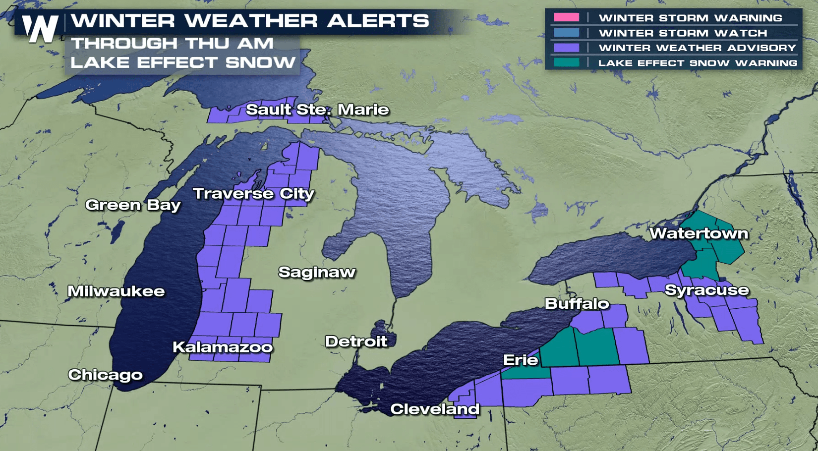
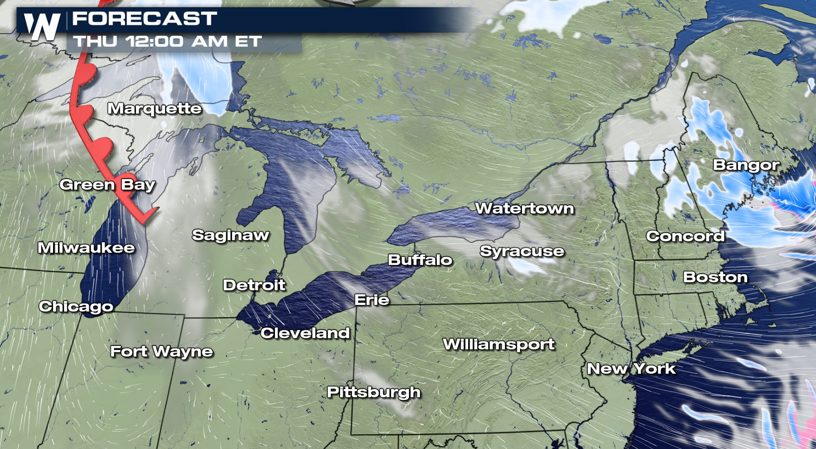
Bands of lake effect snow showers will be found through the Great Lakes into Thursday morning. Alerts have been issued from Upper Michigan to Western New York from Lake Superior to Lake Ontario.
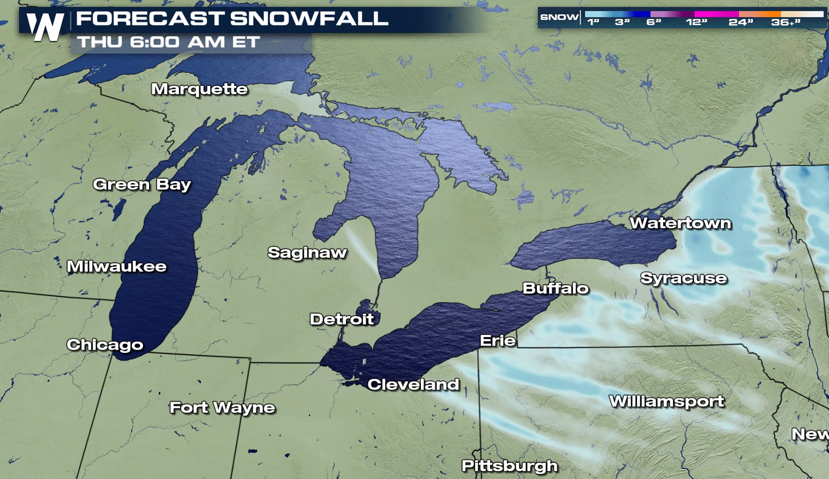 Up to a foot of snow is possible, especially downstream of Lake Erie and Ontario. Squalls could be locally intense at times, producing low visibility as winds gust to 40 mph at times.
https://twitter.com/NWSBUFFALO/status/1207063122583982080
https://twitter.com/NWSGaylord/status/1207254394313547783
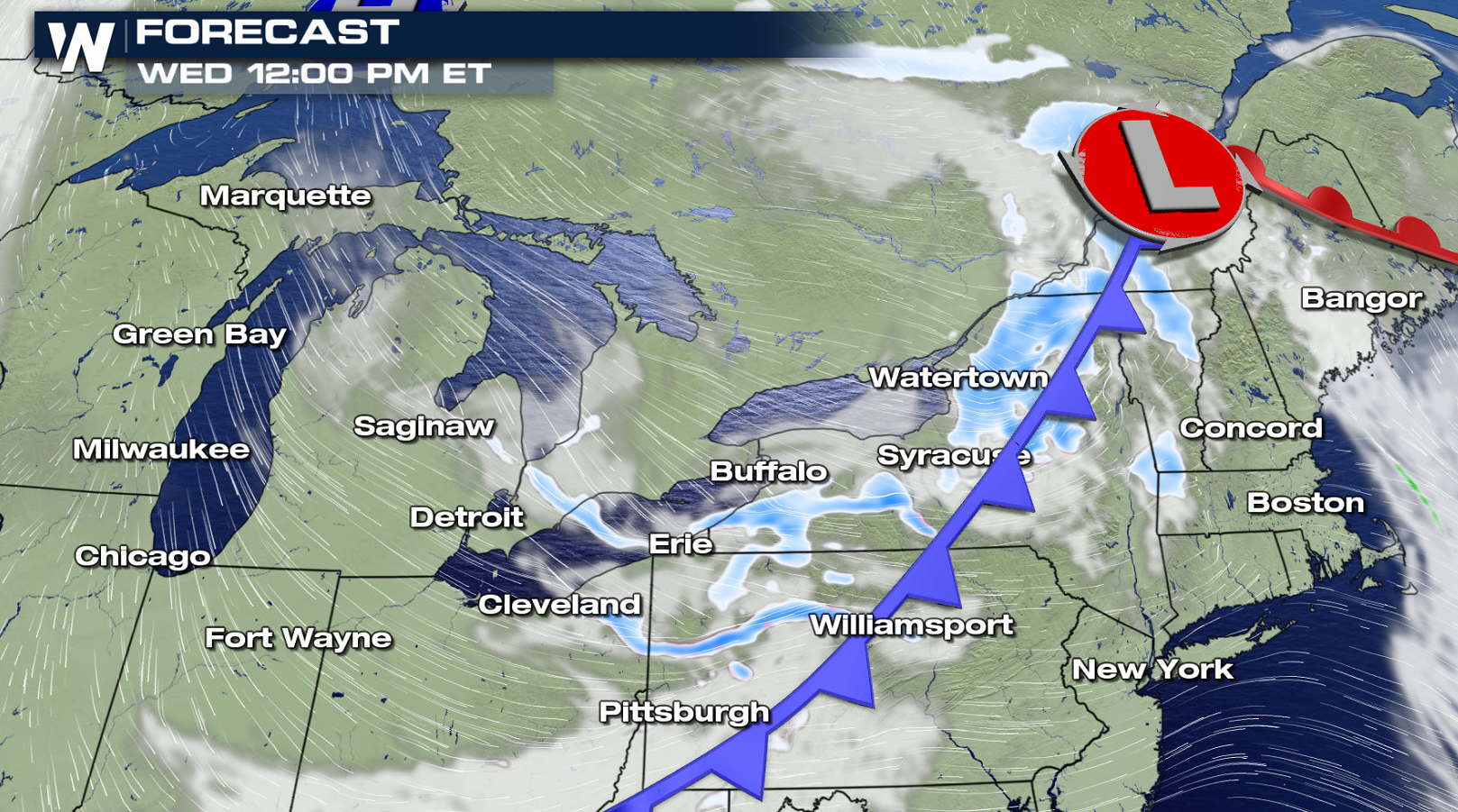
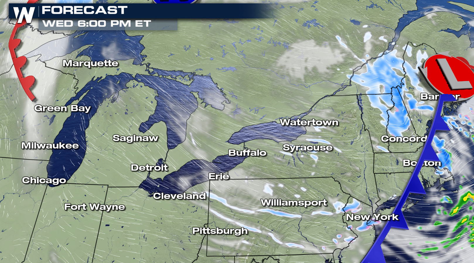
Arctic air has been dropping southward behind a cold front, now in the Northeast. The front will enhance lake effect bands through the afternoon (Wednesday). Lake effect snows will diminish as another system approaches from the west Thursday, warming temperatures and changing wind directions.
Up to a foot of snow is possible, especially downstream of Lake Erie and Ontario. Squalls could be locally intense at times, producing low visibility as winds gust to 40 mph at times.
https://twitter.com/NWSBUFFALO/status/1207063122583982080
https://twitter.com/NWSGaylord/status/1207254394313547783
Arctic air has been dropping southward behind a cold front, now in the Northeast. The front will enhance lake effect bands through the afternoon (Wednesday). Lake effect snows will diminish as another system approaches from the west Thursday, warming temperatures and changing wind directions.
All Weather News
More
Tropical Storm Chantal Forms This Morning
Tropical Storm Chantal has formed, with winds
5 Jul 2025 4:35 PM

Catastrophic Flooding in the Texas Hill Country
Multiple Flash Flood Emergencies were issued
5 Jul 2025 4:35 PM


Severe Storms in the Midwest Continue To Spoil the Holiday Weekend
NORTHERN PLAINS - A frontal system continues
5 Jul 2025 8:30 AM

Near Seasonal Temperatures for Many Come July 4th!
AAA is expecting over 70 million travelers to
4 Jul 2025 10:15 AM


Northwest Heat Met With Thunderstorm Risk
NORTHWEST - Today, portions of Montana are un
3 Jul 2025 12:00 AM