Large Hail & Tornado Threat for the Central Plains Overnight

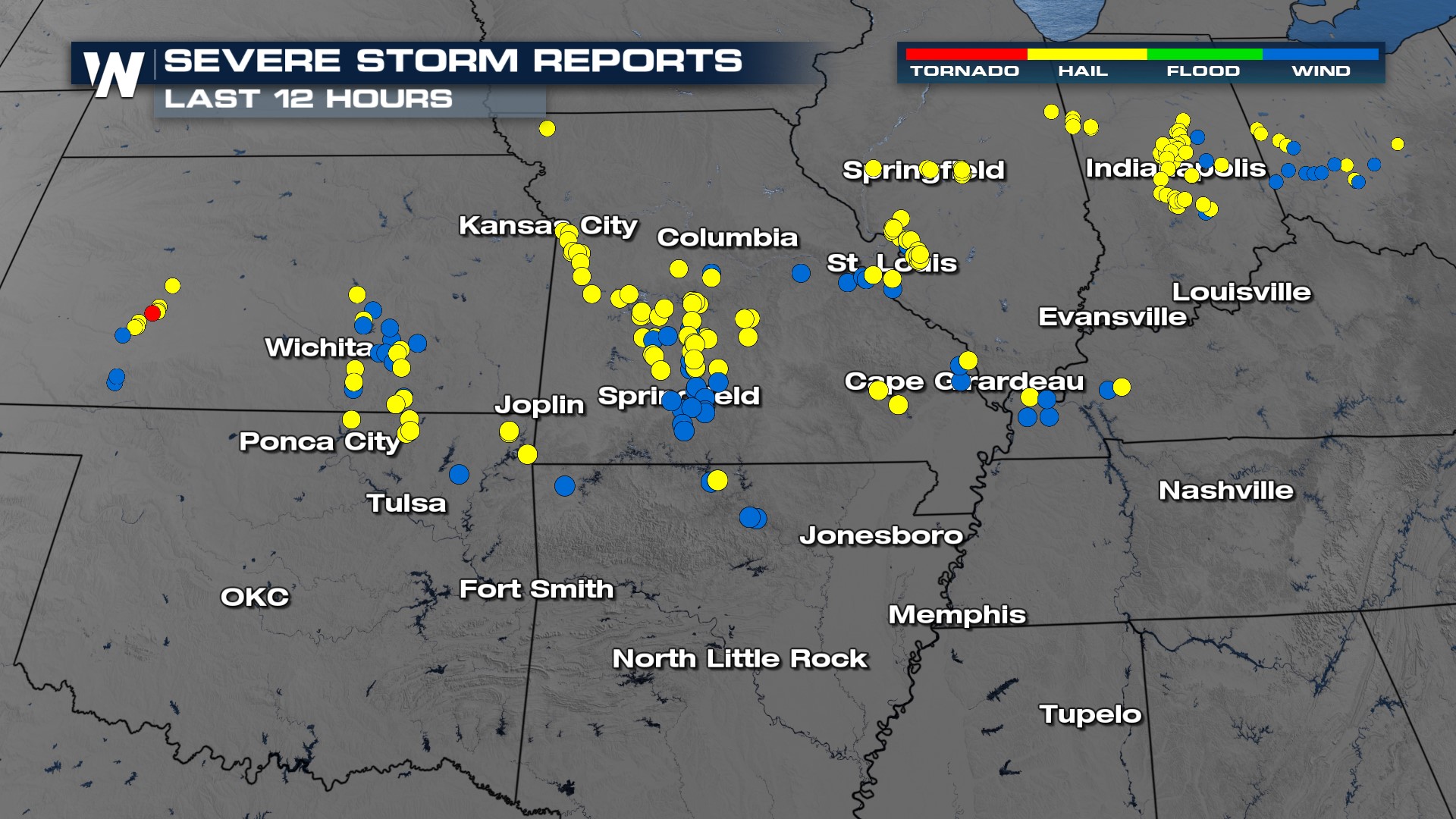
Strong storms rumbled through the Plains Monday creating large hail and even an isolated tornado report. Here's a look at some of Monday's severe weather reports and the largest hail recorded.
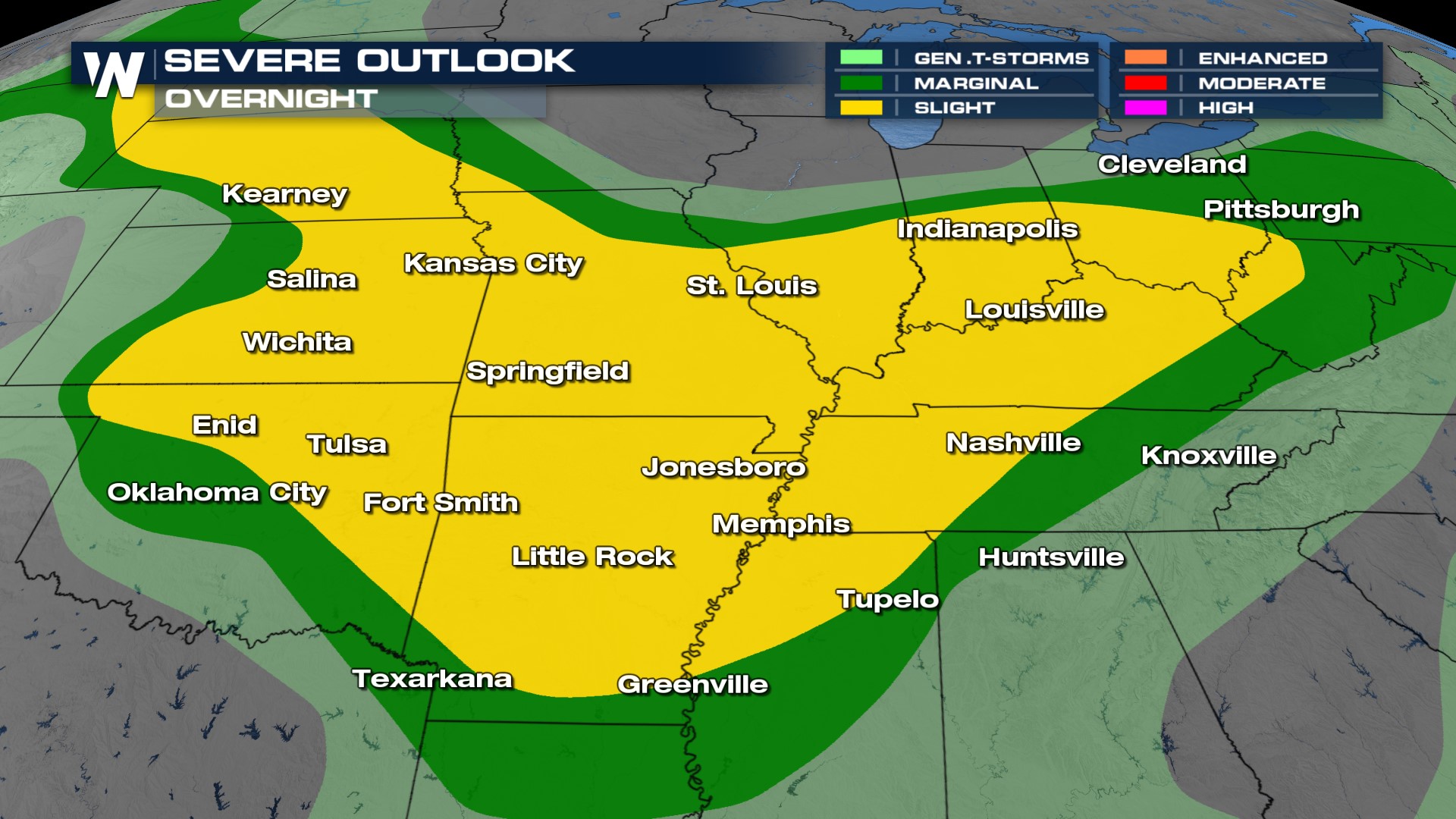
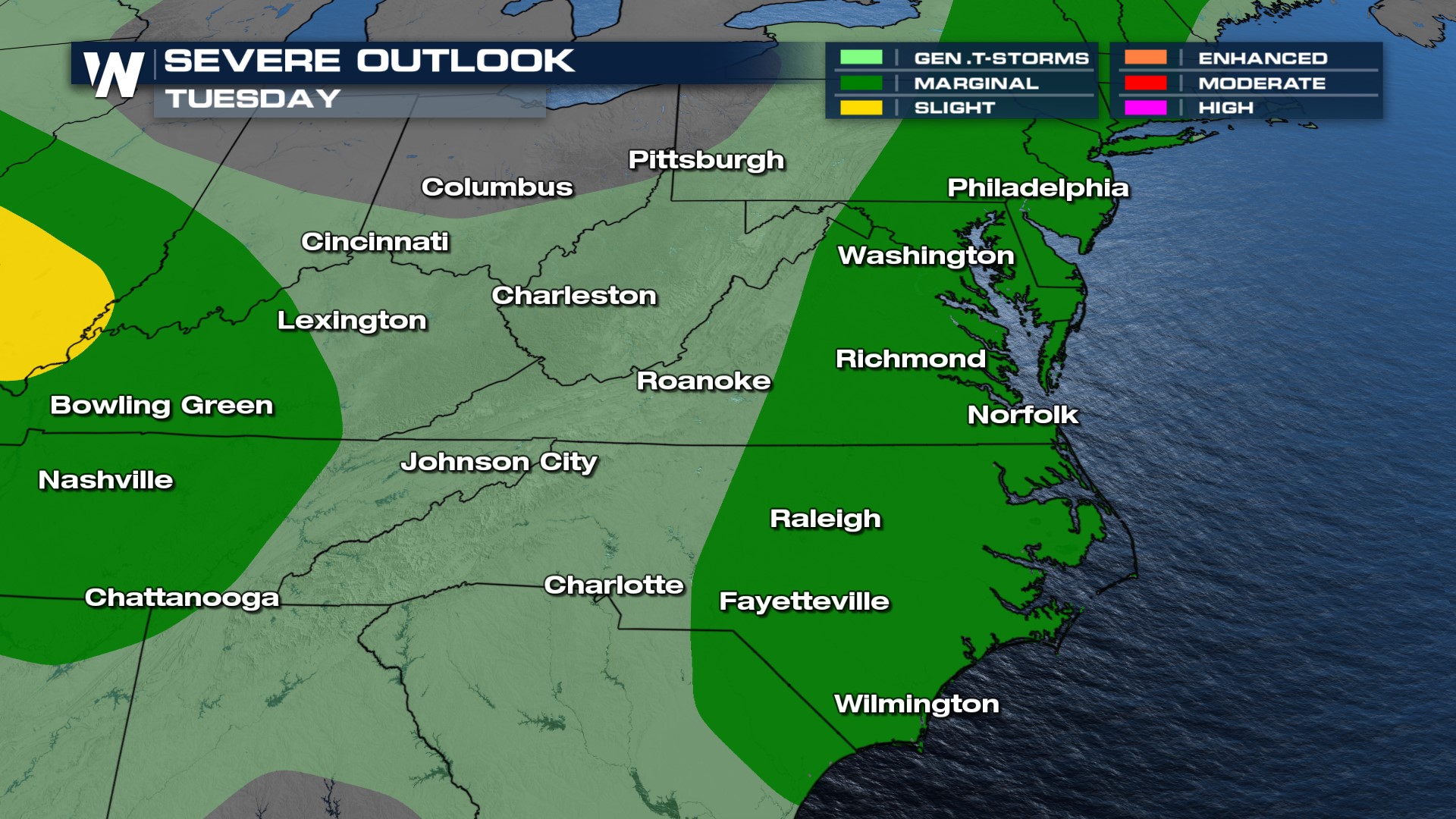
Severe Outlook
The Storm Prediction Center maintains a SLIGHT risk (level 2/5) overnight, upgrading us from an earlier marginal (level 1/5). Damaging winds, large hail, and an isolated tornado will all be possible in these areas and some cells may last overnight due to the high humidity and forcing mechanisms that will help to spark and fuel storms.
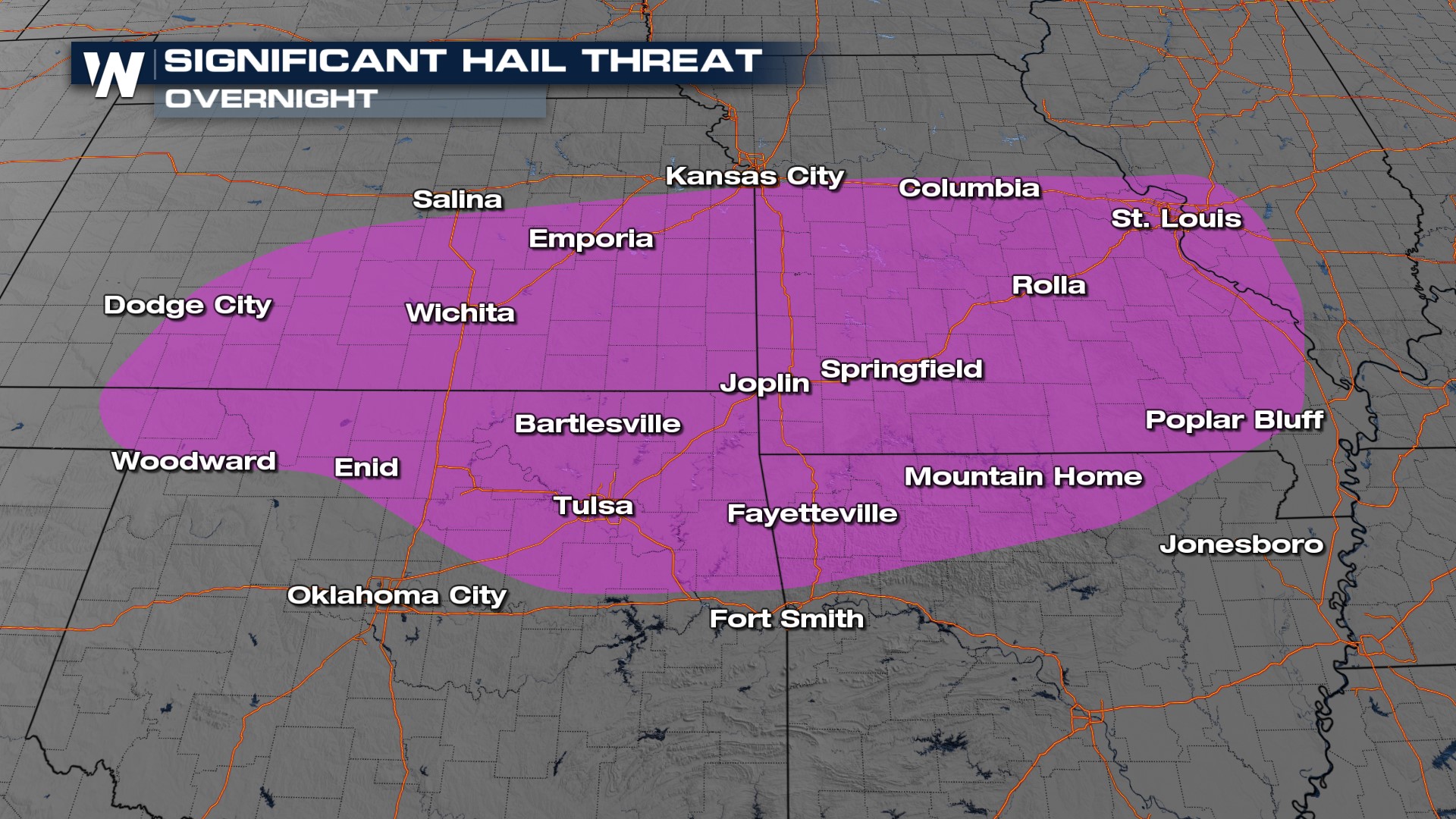
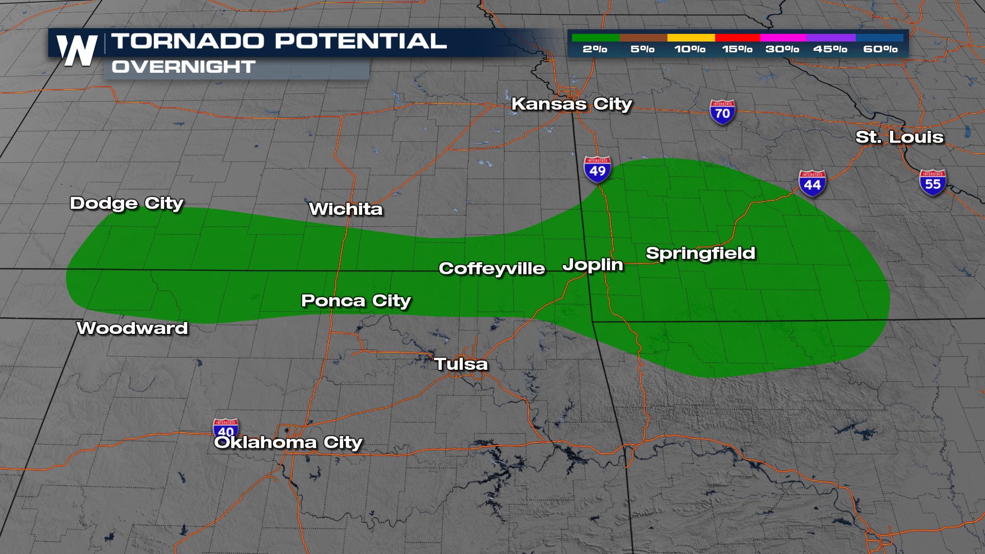
In addition to the slight risk, the SPC has issued a SIGNIFICANT hail outlook (2" or larger) and a tornado threat.
More storms develop overnight and become a morning severe threat around central Tennessee, but later in the day, daytime heating supports stronger storms around the mid-Atlantic.
The SPC has highlighted the severe threat from the Northeast to North Carolina. All modes of severe weather are possible but damaging hail is most likely.
Stay with WeatherNation for the latest in the severe weather threat for the Midwest & Ohio Valley this week.


