Late-Season Winter Storm in the Black Hills
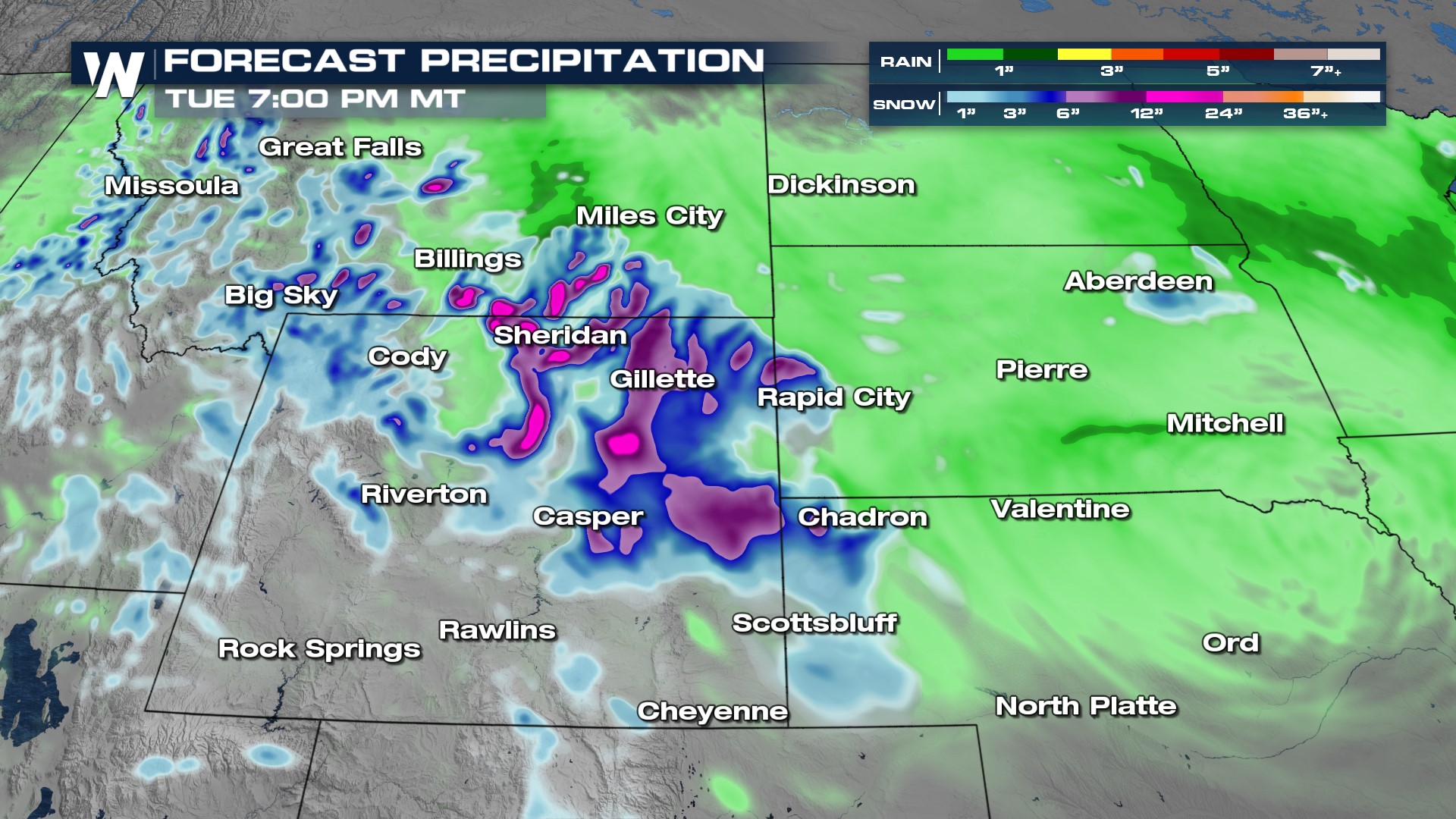
While there is extensive fire danger across much of the Central U.S., the Plains are gearing up for some much-needed moisture from this powerful low. As the low closes in on the Bighorn National Forest, there's a potential of tapping into some cold air via "upslope flow" which would change rain into snow in the higher terrain areas of South Dakota and the Northern Rockies.
Pockets of snow linger throughout the day Sunday until dry time returns Monday. Scattered showers near the low-pressure center and even behind it continue through the Plains into Monday but the widespread heavy rain is highest Sunday.
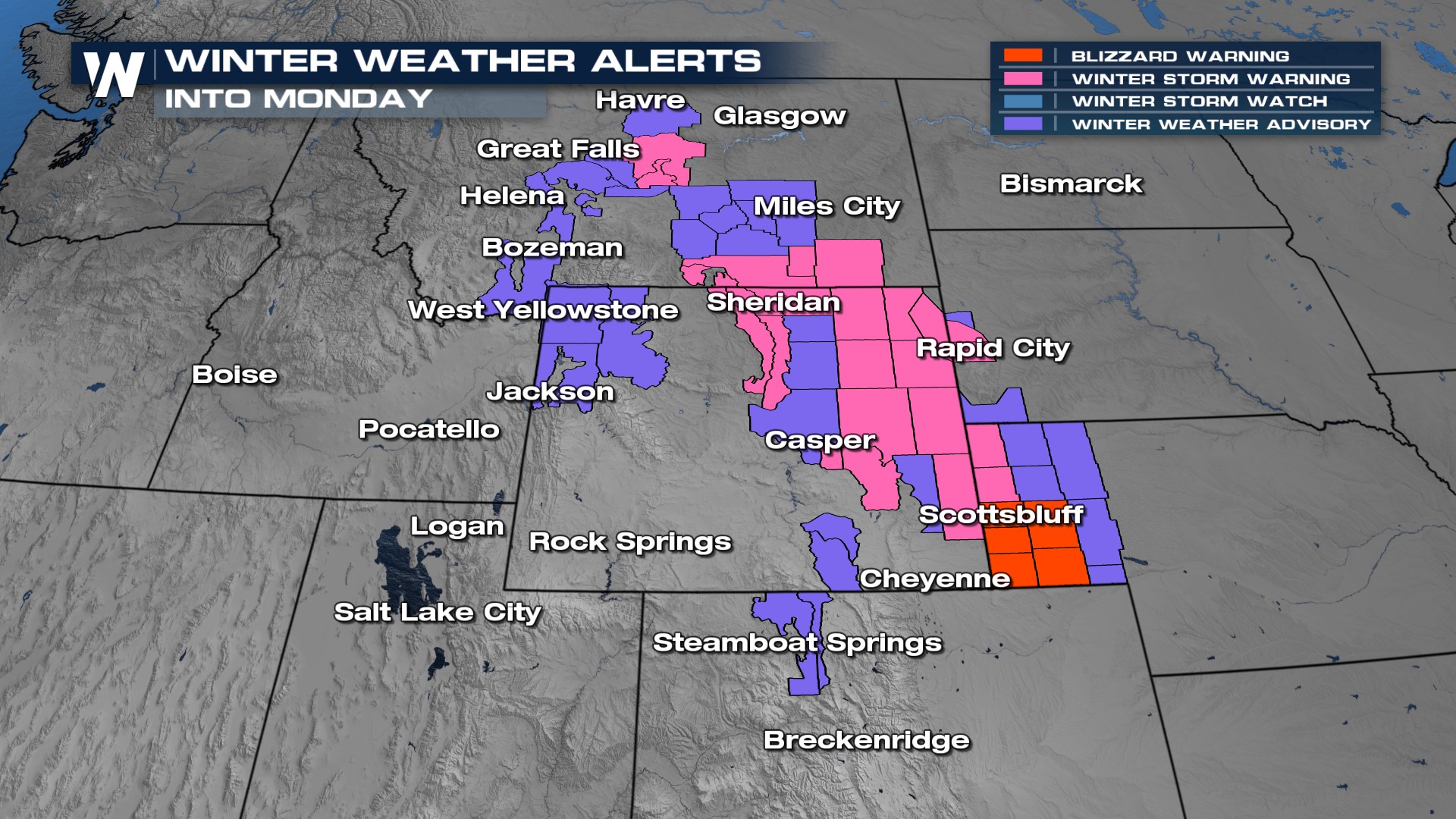
Winter alerts are abundant across the area, with winter storm warnings sprawling from southeastern Montana and into the panhandle of Nebraska.

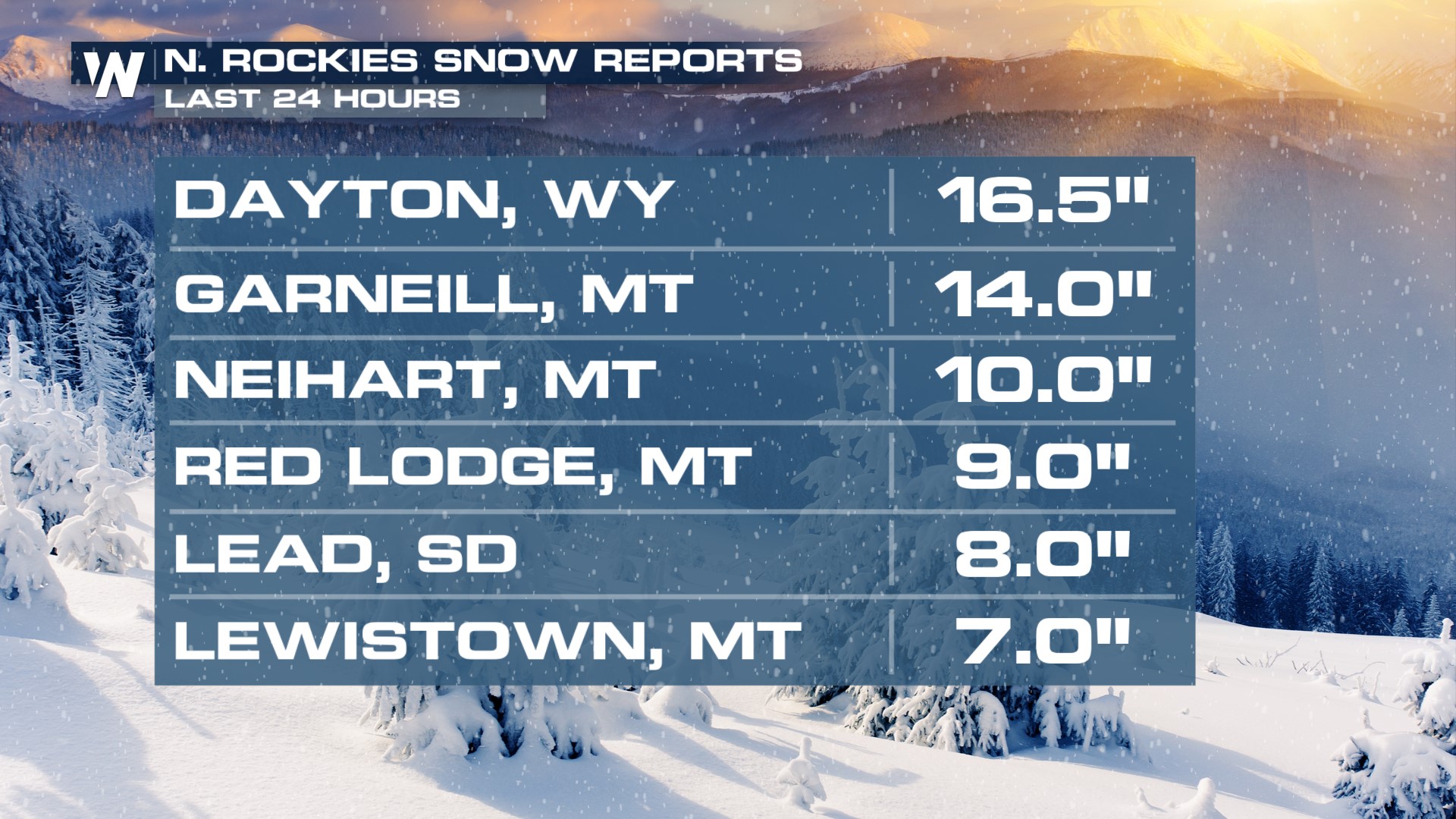
We've already seen over a foot of snow towards the borders of Wyoming and Montana, especially towards and in the Bighorn National Forest. Dayton, WY received 16.5" of snow in the last 24 hours, and it's not finished with us yet.

This late-season snowfall brings the possibility of dumping an additional foot of snow, especially in the counties highlighted in pink for the winter storm warnings. The foothills of the higher elevations even have the chance of seeing 1-3" of rain by Monday afternoon.
