Lingering Storms Impact the Northeast Again Today
Top Stories
2 Jul 2021 4:25 PM
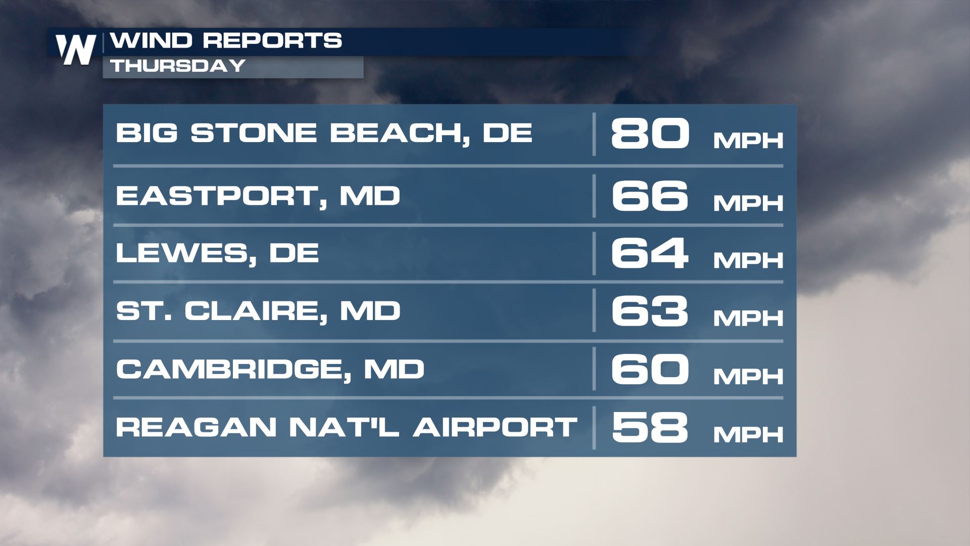
A trough digging into the Northeast brought severe storms to the region on Wednesday and Thursday, with dozens of reports of large hail and strong wind gusts. As the trough digs into a warm/moist airmass, deep shear will help aid in bringing damaging winds to the surface again for later Friday. Wind gusts on Friday topped 80 mph in parts of Delaware!

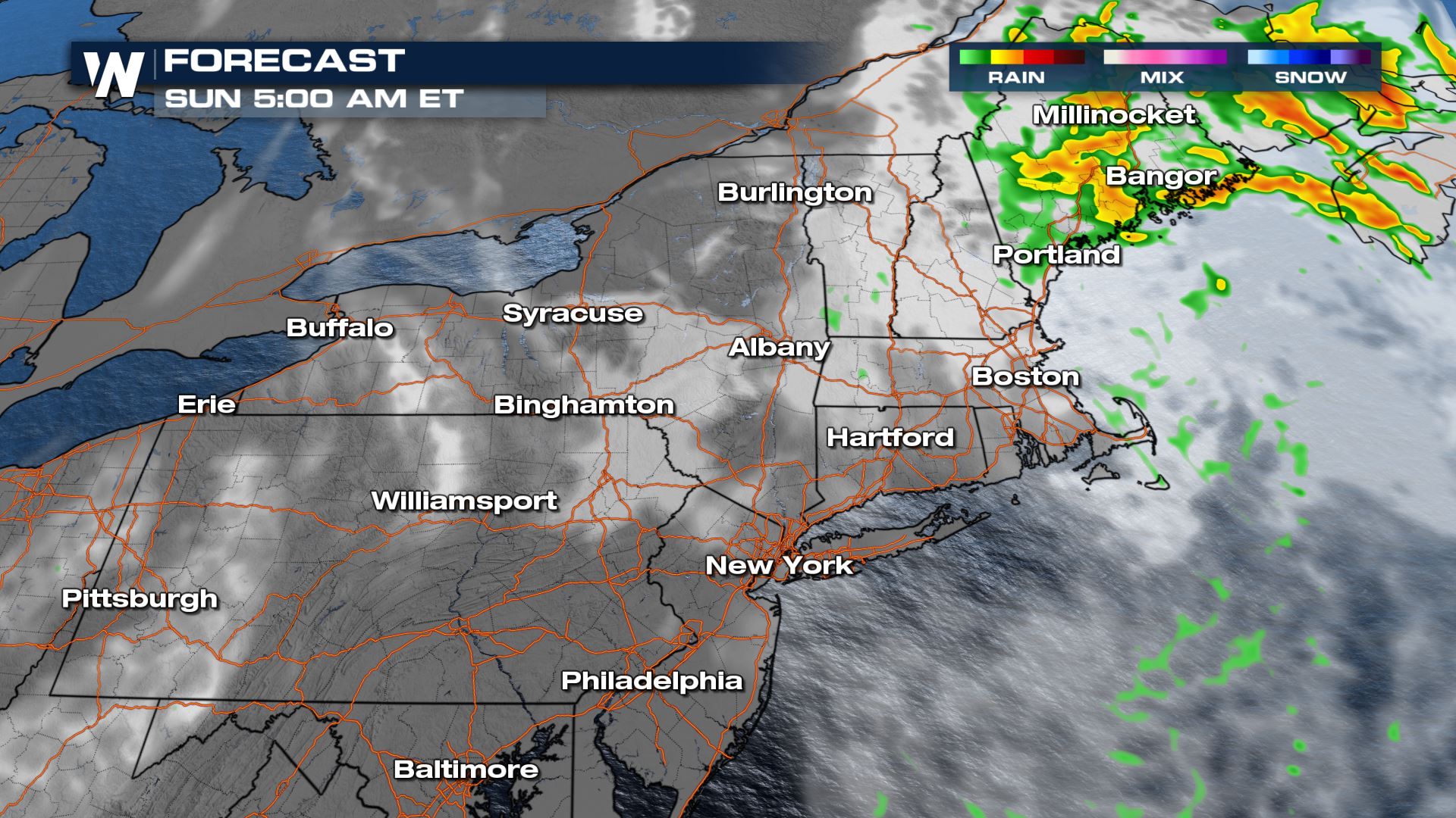
By Sunday morning, the low will pull away, leaving showers across northern New England through the beginning of fourth of July morning.
 For more on the storm chances, tune to your east regional forecast :10 after the hour on WeatherNation.
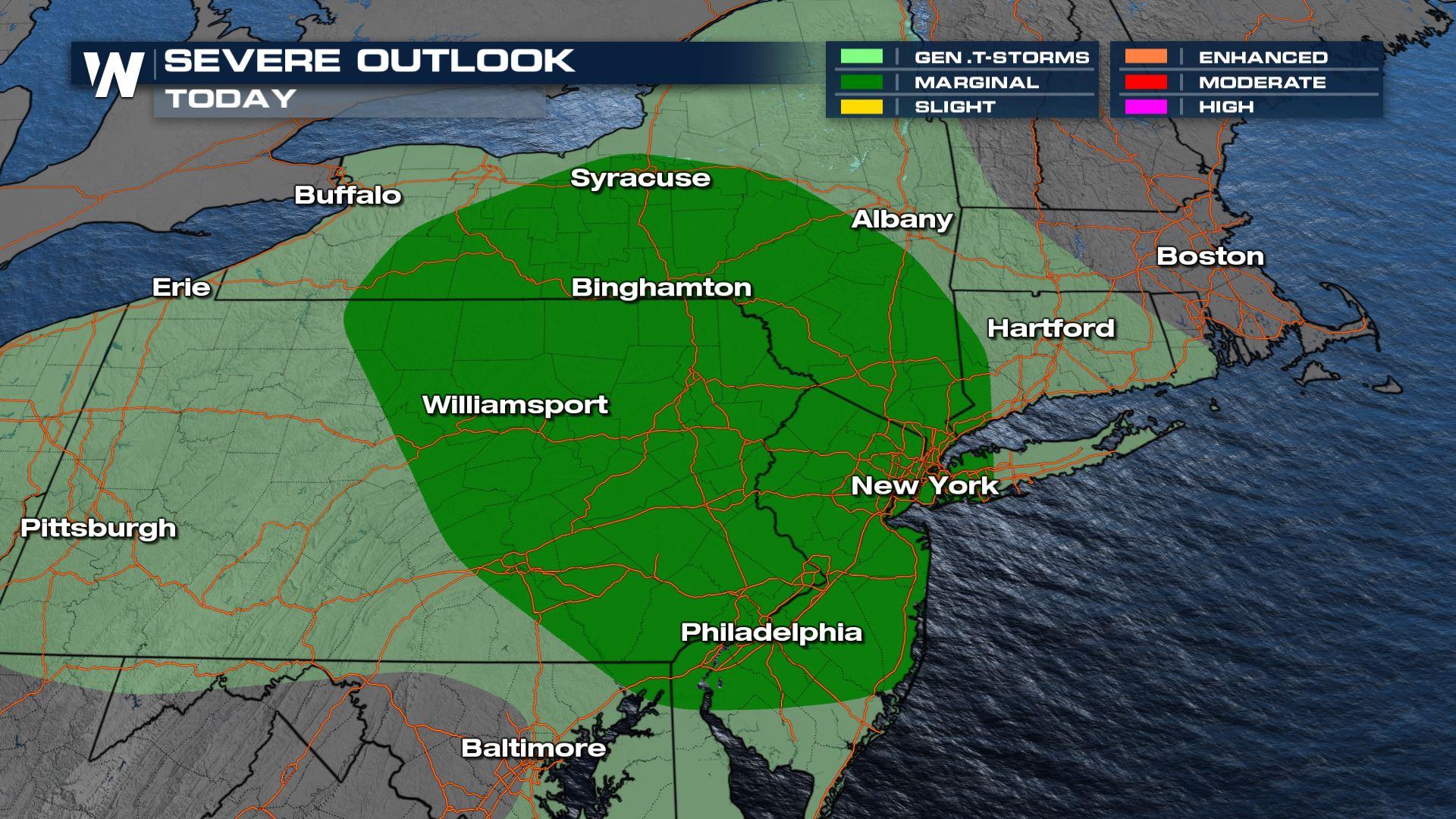
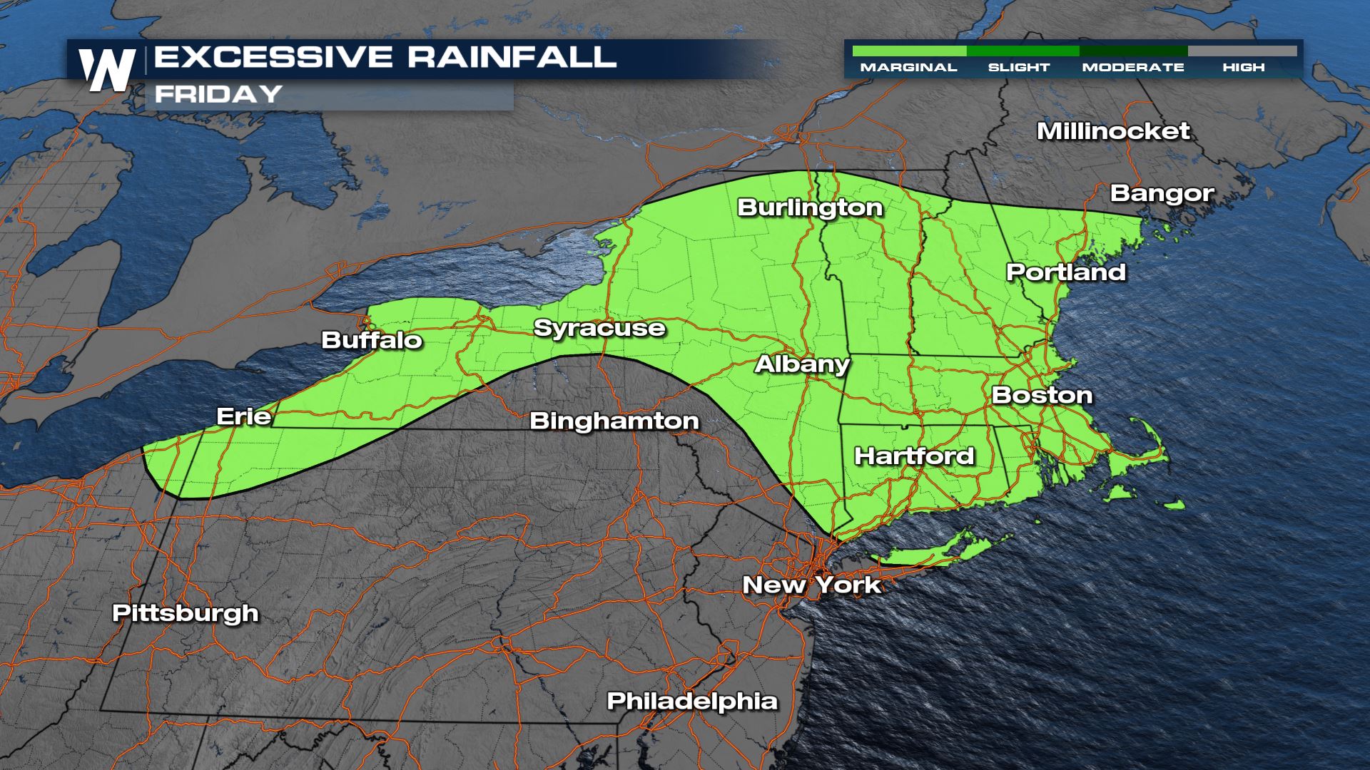
Severe Potential
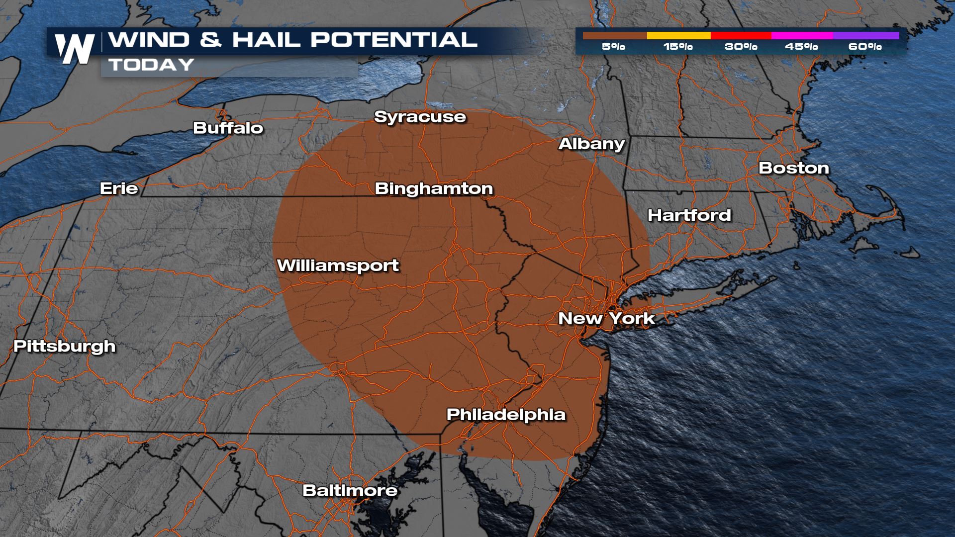
There is a level 1 out of 5 threat (marginal risk) for the southern tier of New York down into eastern PA. We are going to be seeing the potential of gusty winds, but some small hail and an isolated spin-up may also be possible.
Forecast
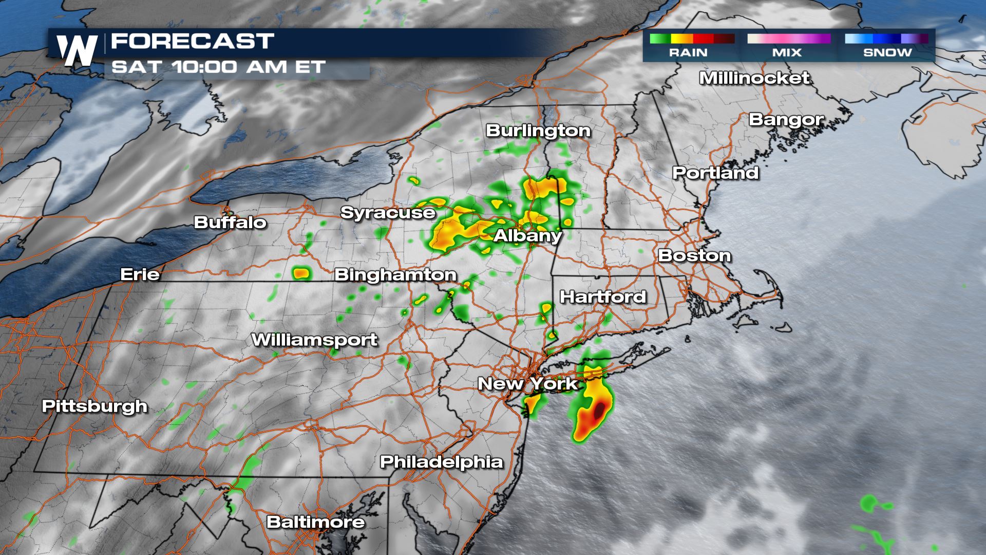
Below are some screenshots of our model showing storms firing up in the afternoon and evening. During the overnight hours, the severe weather risk diminishes but heavy rain will be ongoing leading to flash flooding potential.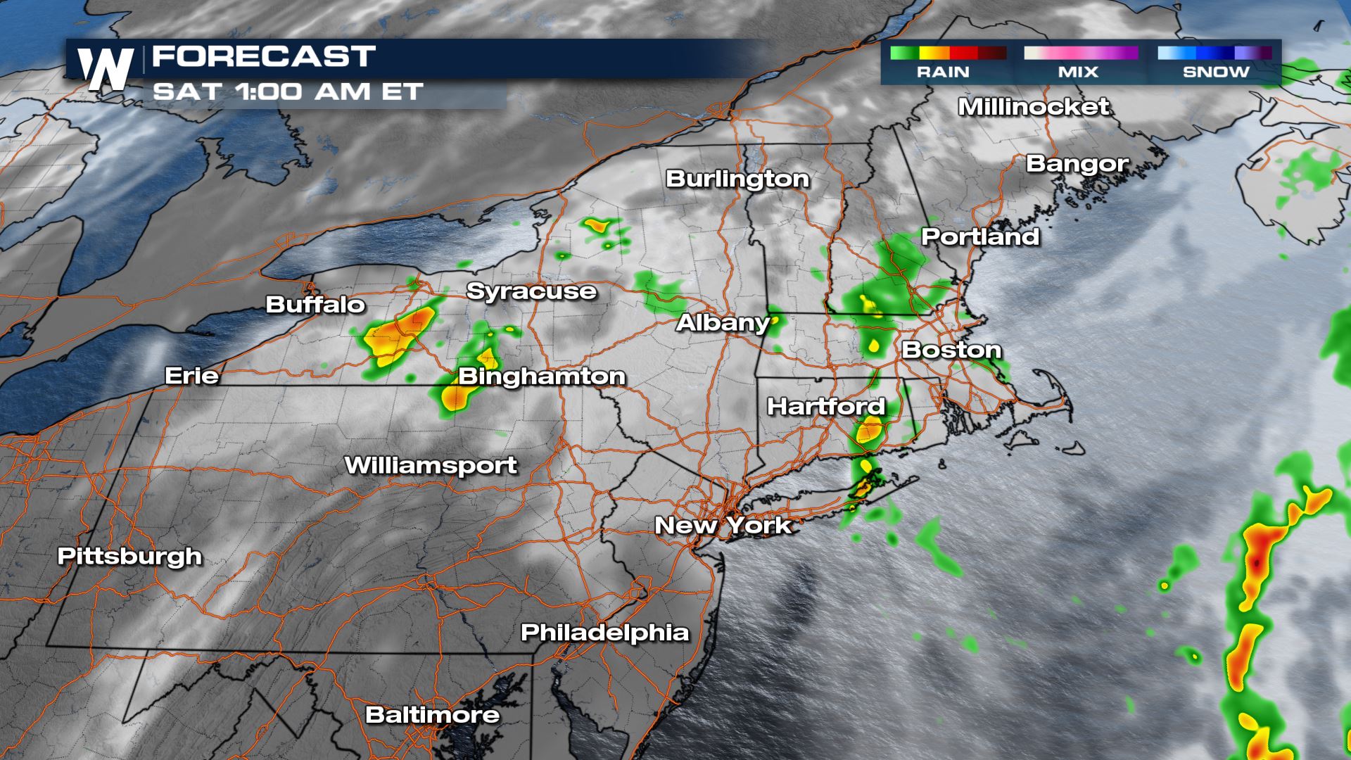
Forecast Rainfall
There will be pockets of 3-5" rainfall in some of the stronger storms, but another 1-2" of widespread rainfall will be possible through Saturday.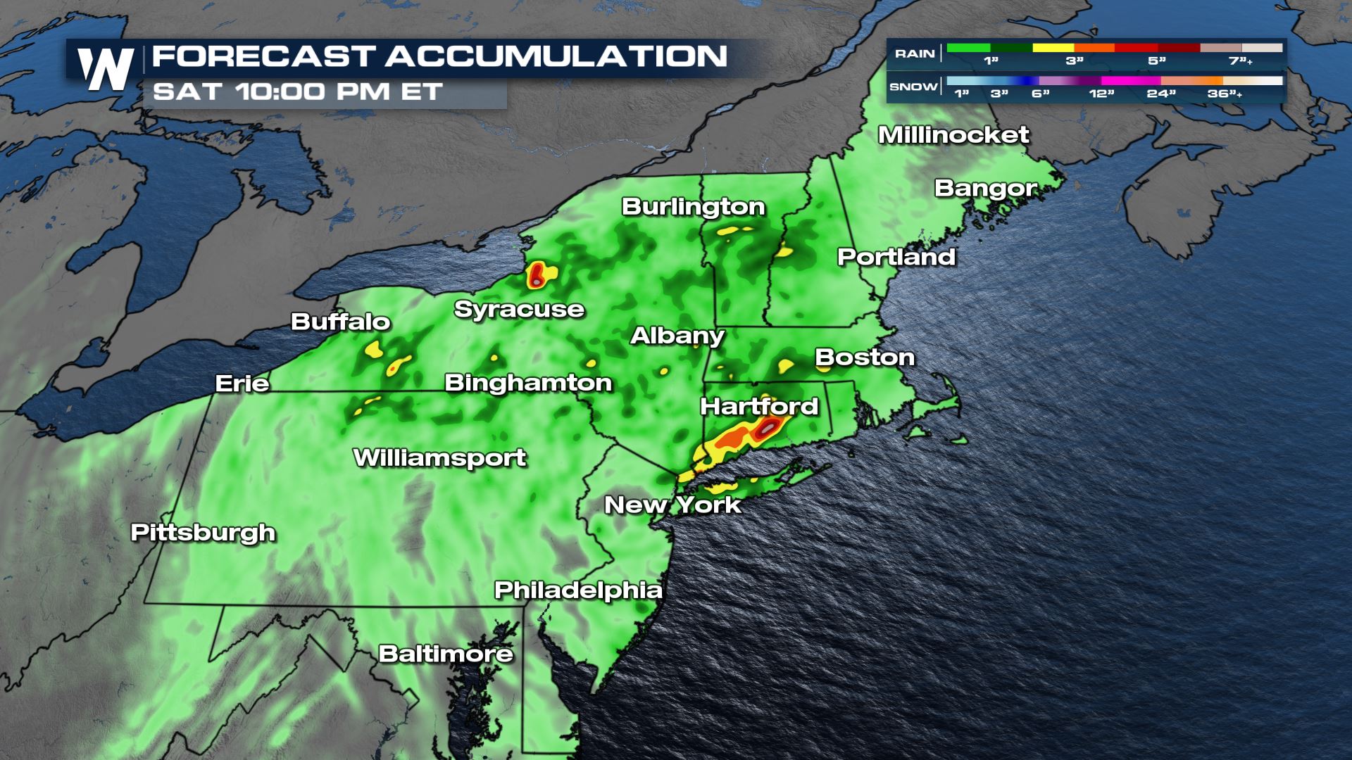
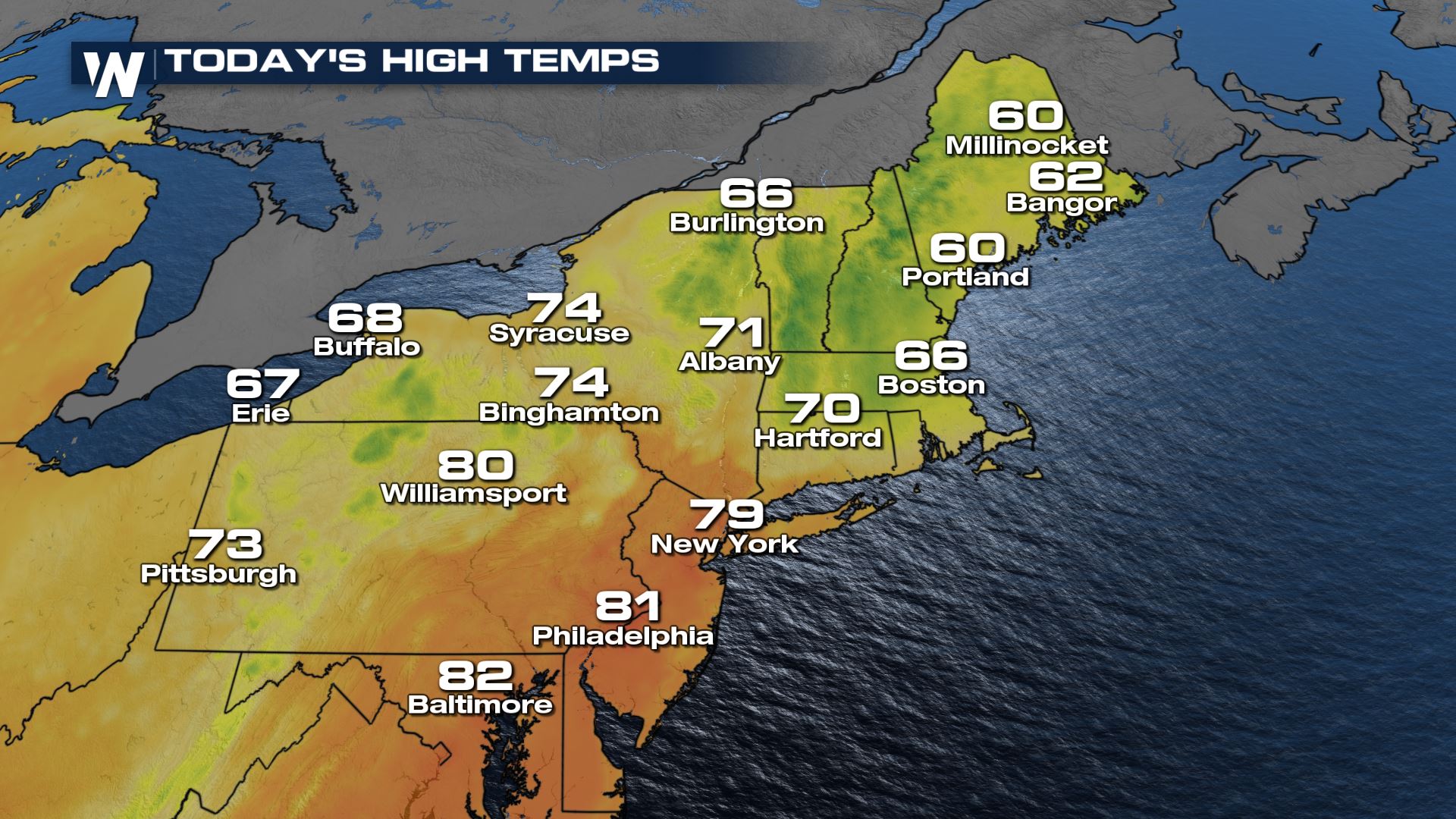
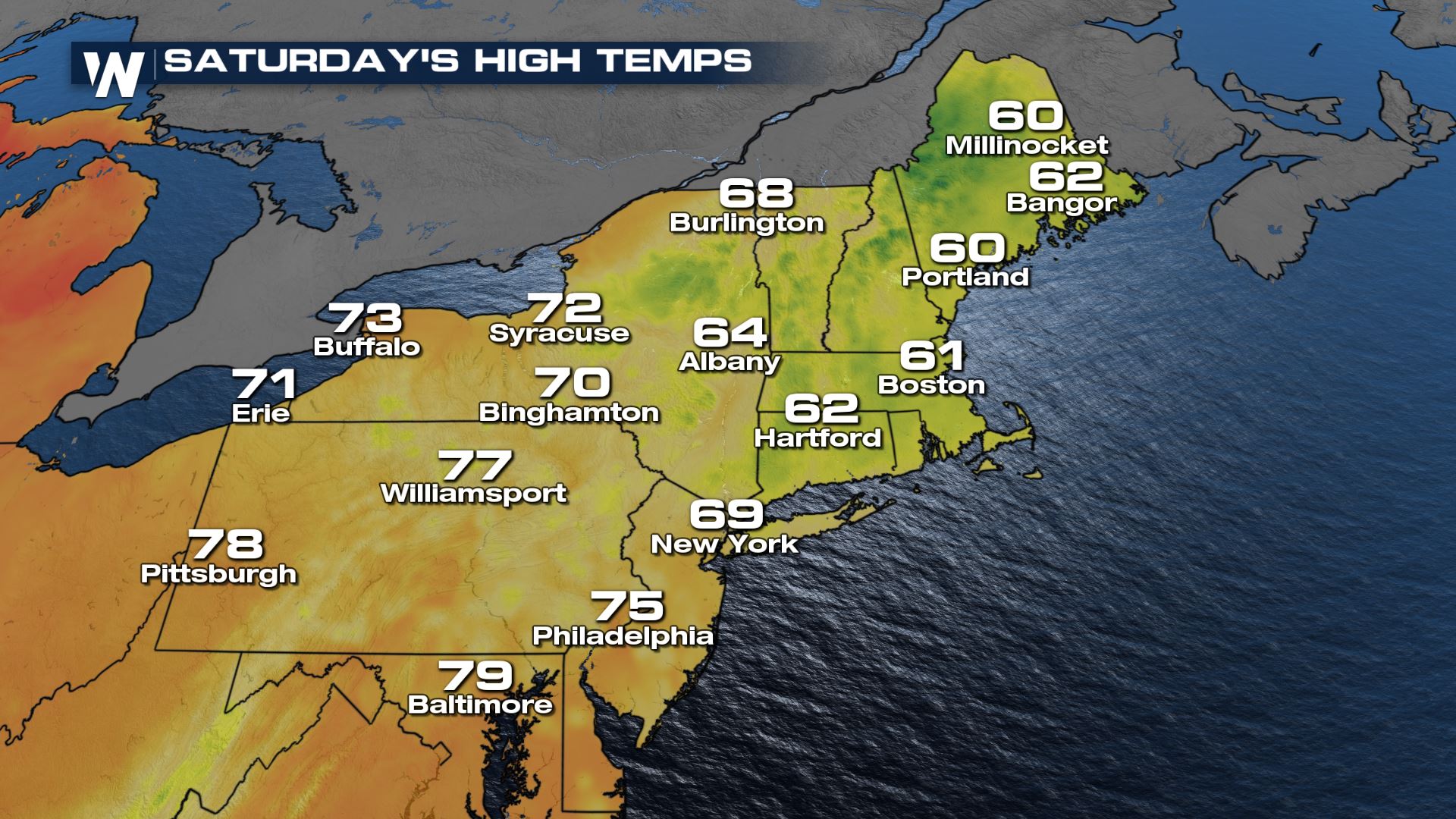
Temperatures
Temps will be about 15-20° below average across New England with the passing of the cold front. It should limit storms from being widespread severe, but we could see a couple storms tap into the moisture and reach severe criteria.
For more on the storm chances, tune to your east regional forecast :10 after the hour on WeatherNation.All Weather News
More
Wildfire Outbreak in the Pacific Northwest
SPOKANE, WA - On Saturday, August 1st, the Ol
2 Aug 2026 7:20 PM

More Storms for the East Through Monday
A low-pressure system that moved through the
2 Aug 2026 7:20 PM


After Reaching Category 5, Genevieve Weakens in the Pacific
PacificGenevieve formed on last Friday south
2 Aug 2026 6:25 PM

Flooding, Severe Storms Target the Midwest Again
After an active week of storms across the nor
1 Aug 2026 1:40 AM

Flooding Risk Increases as Heavy Rain Targets the Tri-State Area
Tuesday, heavy rainfall moved across the Nort
30 Jul 2026 12:25 AM

Severe Weather: Energy From the Midwest Now in the Southeast
UPPER MIDWEST - Through Monday, dangerous tor
29 Jul 2026 10:30 PM