Looking Ahead: Active Weather Returns to the Northwest

As the jet stream makes its way farther south, the Pacific Northwest is expected to reap some of the consequences. Such as heavy snow, lots of rain, strong winds, and colder temperatures. The good news is, it's far out in the forecast so we have some time to prepare.
Given that this forecast is half of a week away, there is still great uncertainty to it. We encourage you to stay up to date with this article and with our forecast on WeatherNation as this event gets closer to us.
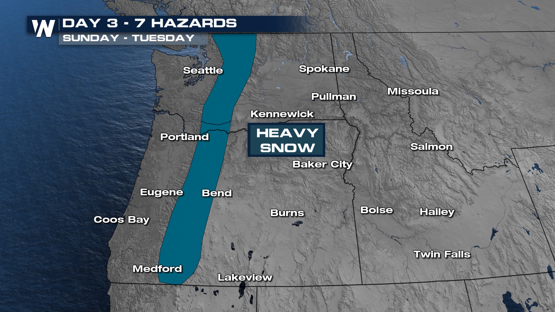
There are a few parts of this intricate forecast that we already know. The Weather Prediction Center (WPC) is expecting to see heavy snow in the Cascade Range from Sunday into Tuesday. Expect travel to be highly impacted in and near the mountain ranges.
Rain has the potential to accumulate the most along the foothills of the mountains and along the coast. There's a chance for many places to see over 3" of rain pile up over the next seven days.

Strong winds will be a widespread problem starting as early as Sunday afternoon and lingering into late Monday. Gusts over 60 mph are likely in and near the taller mountain peaks.
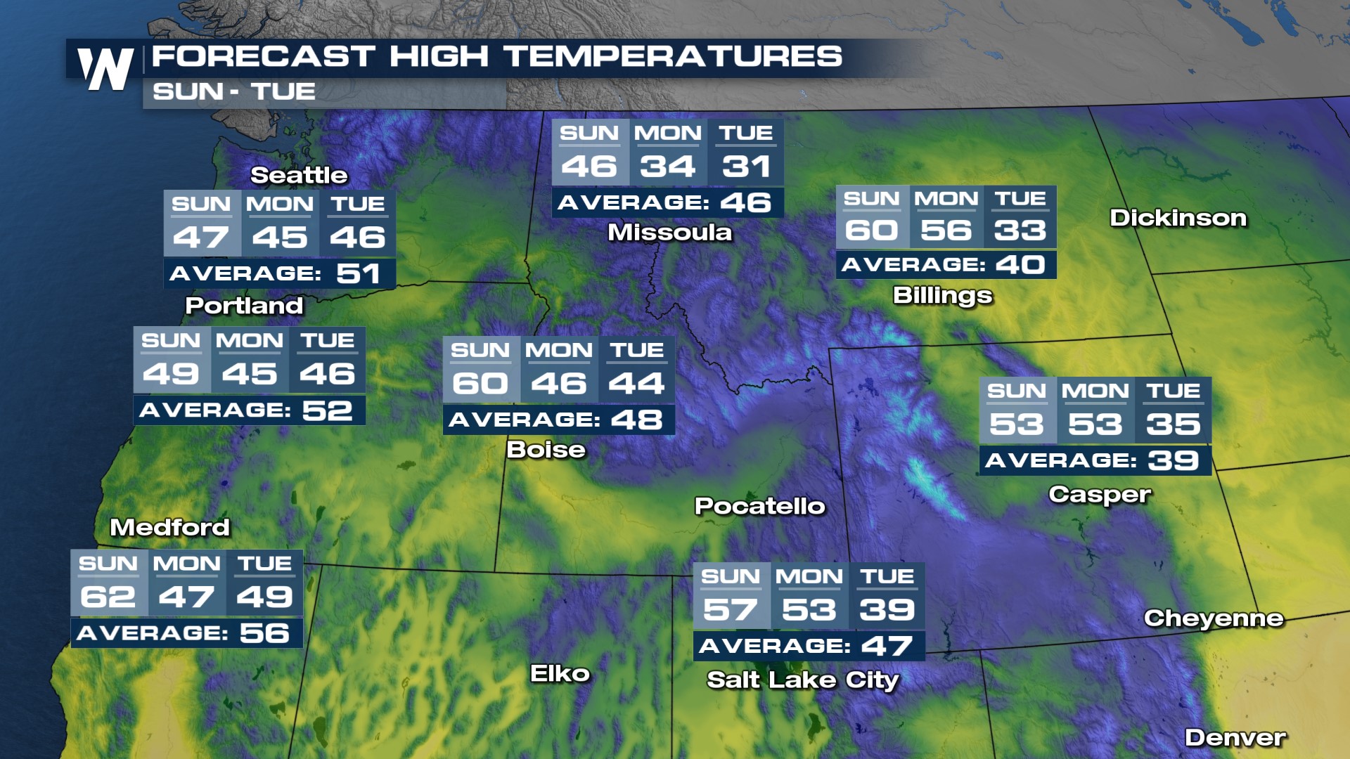
Many of us will also see the drop in temperatures by the end of the weekend and into the new workweek ahead. Enjoy the generally calm and above average weather while it lasts over the next few days, because this forecast will shake things up for us very soon.