Major Flooding Possible in the Desert Southwest This Week

FLASH FLOODING
It has been a very active week across portions of the Southwest. Multiple flash flood warnings remain in place, and record-breaking daily rainfall in several cities across the region. Flood alerts remain in place across most of New Mexico through the end of the work week.
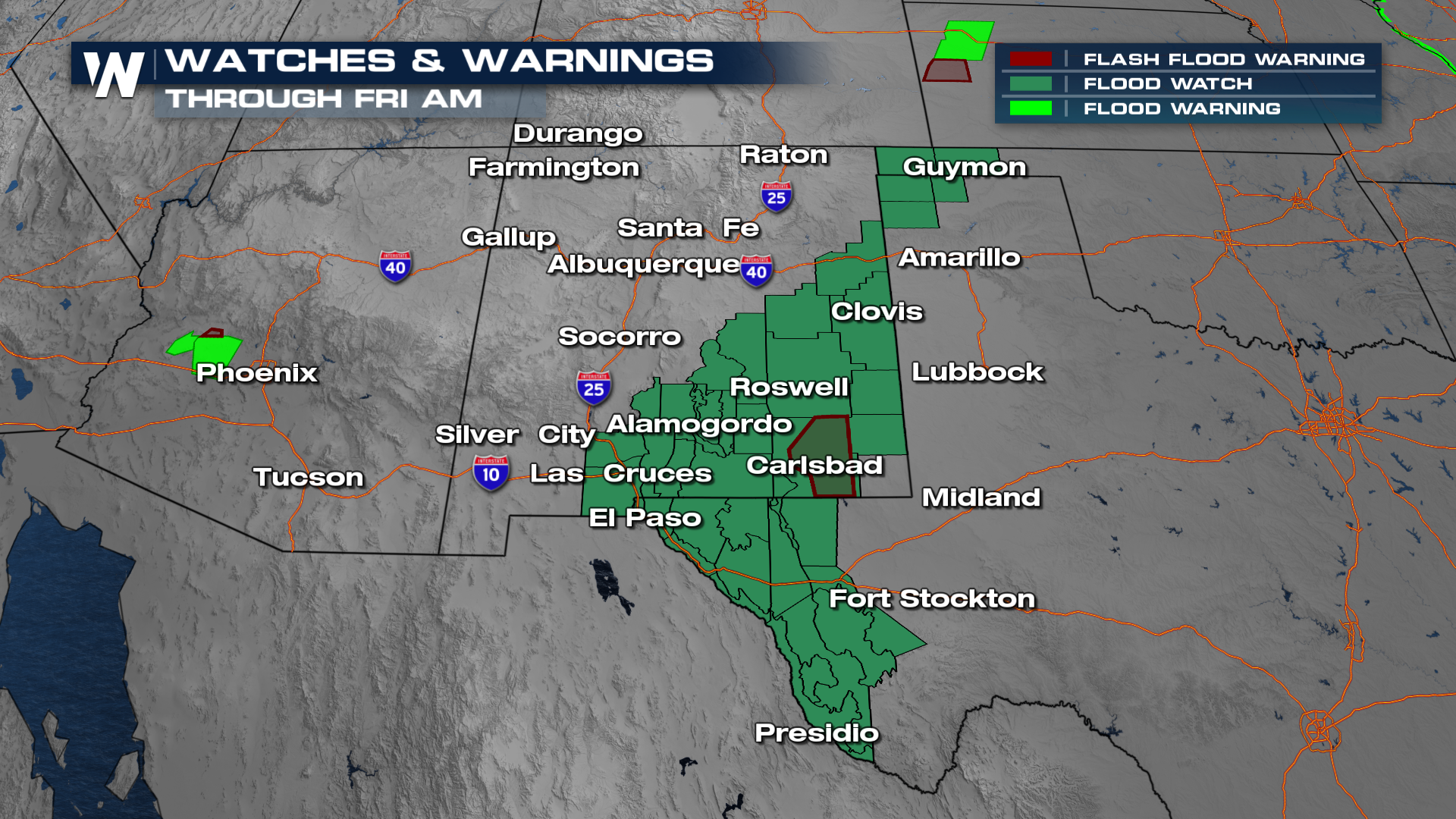
Heavy rain will continue to funnel into New Mexico Friday, with isolated rain continuing through the weekend.
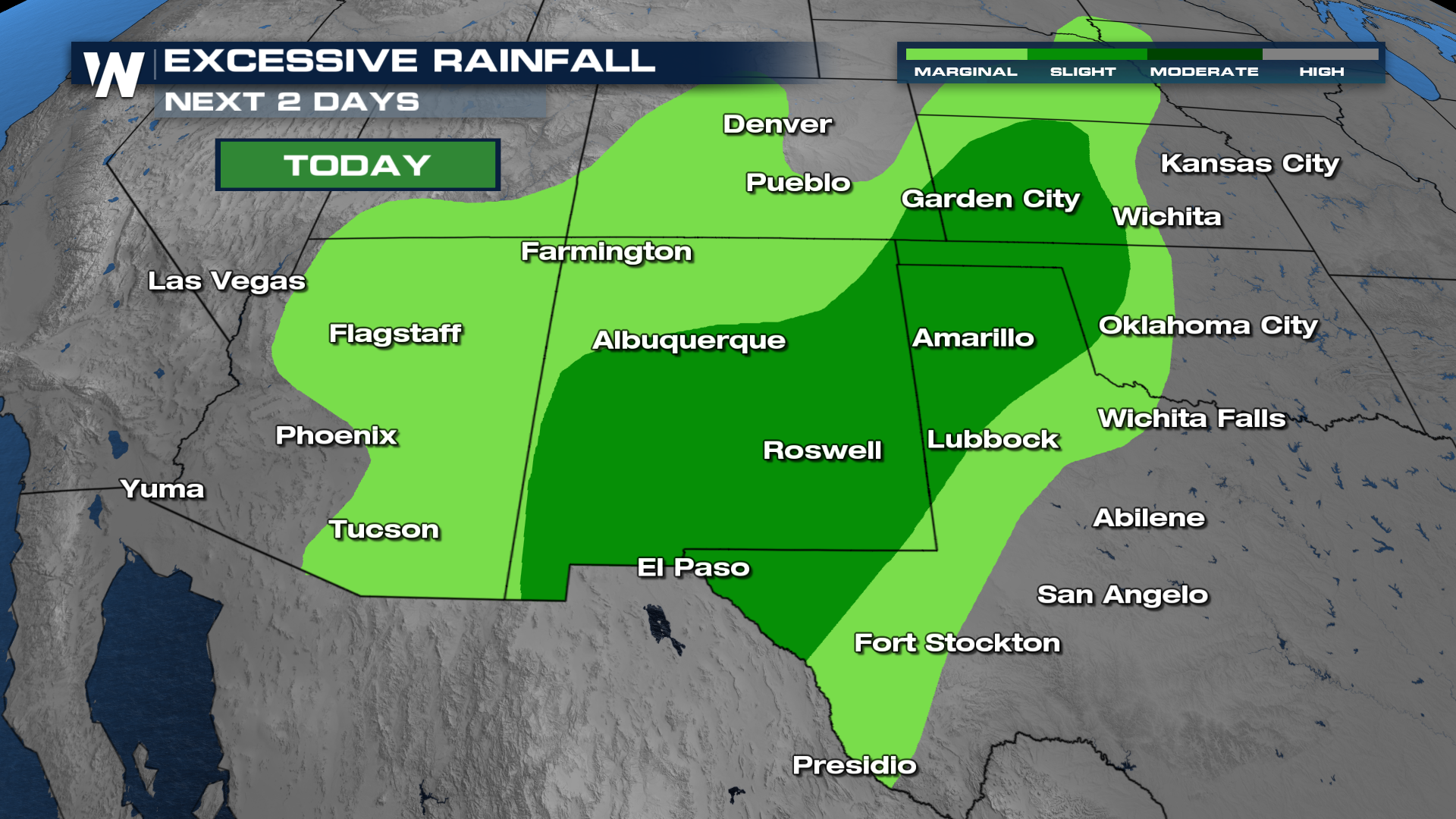
This is rich, tropical moisture inundating these areas. We're expecting heavy totals and high rainfall rates. Because of this, the Weather Prediction Center (WPC) has issued a SLIGHT (level 2 out of 4) risk for flash flooding in areas of New Mexico and Texas for Thursday. A marginal risk remains for portions of Texas and New Mexico for Friday.
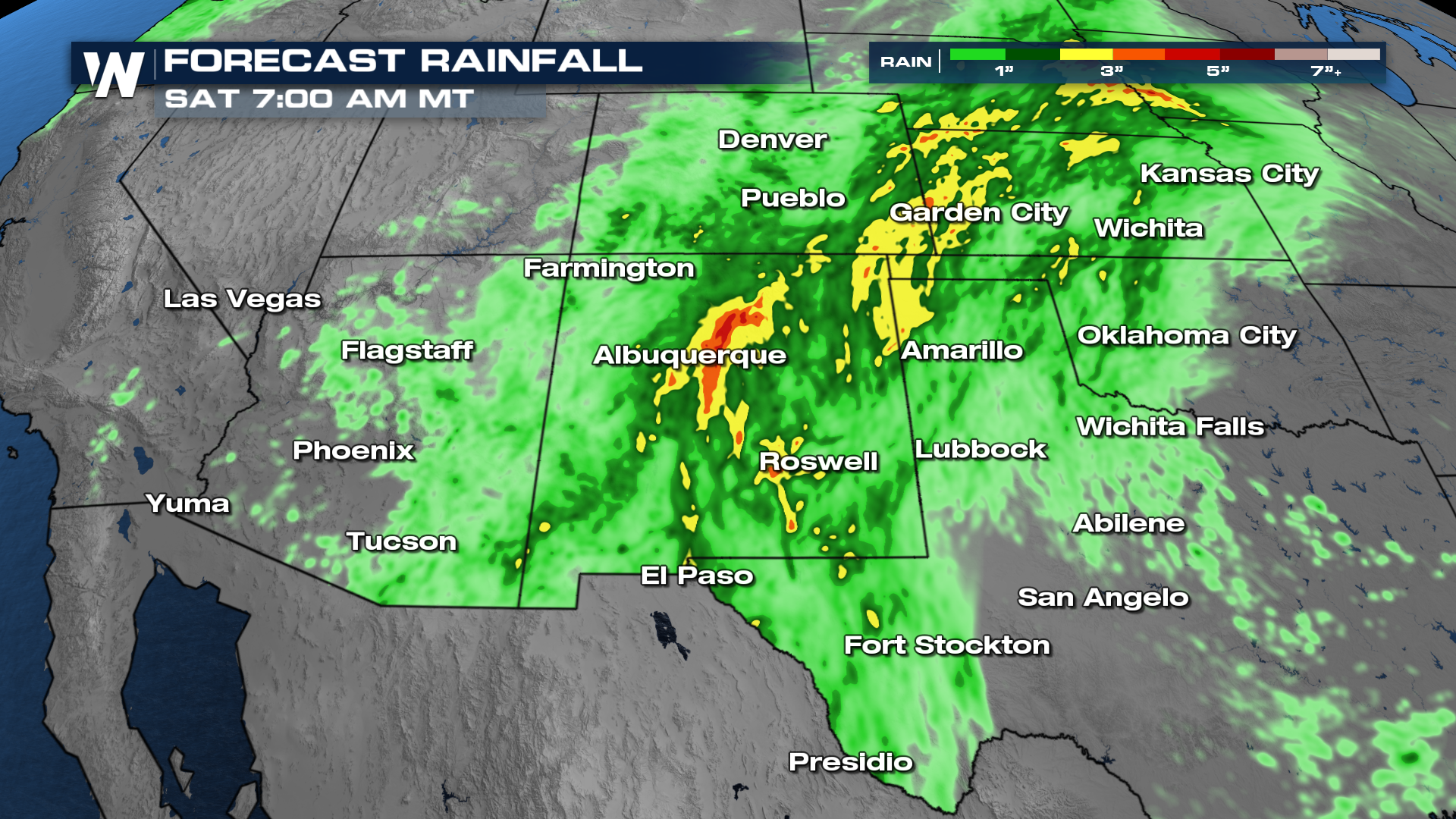
As for totals, some spots can see up to 4" of rain by the time Saturday rolls around. That's a lot to pick up anywhere in the country, but especially dangerous in the desert southwest.
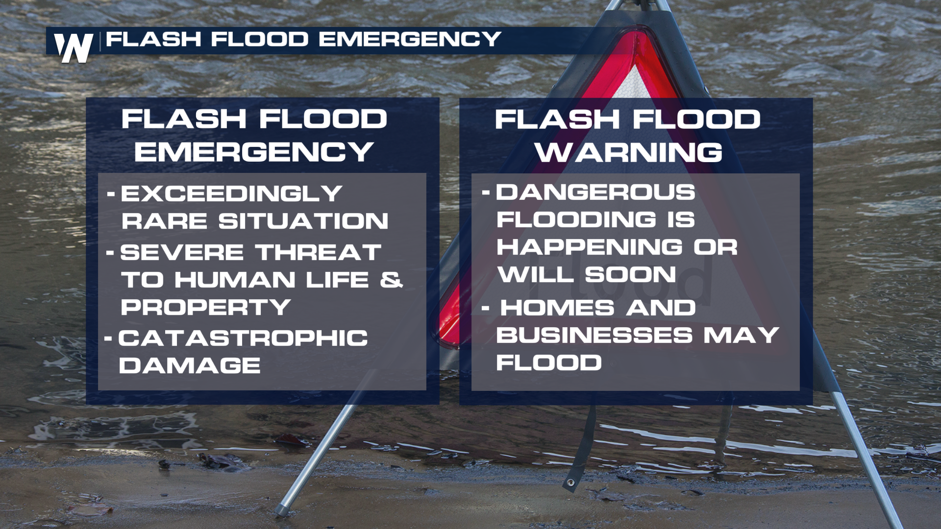
Going forward, it's very important to know the difference between a flash flood warning and a flash flood emergency. Doing so will get you better prepared for flood events.
Make sure to keep alerts on through this week, and have multiple ways to get them. Also, stay tuned to WeatherNation for the latest. We'll have your full western U.S. breakdown and :50 past the hour.


