Marginal Risk of Severe Weather for Parts of Utah, Wyoming and Nevada Today
Top Stories
14 Mar 2018 4:29 AM
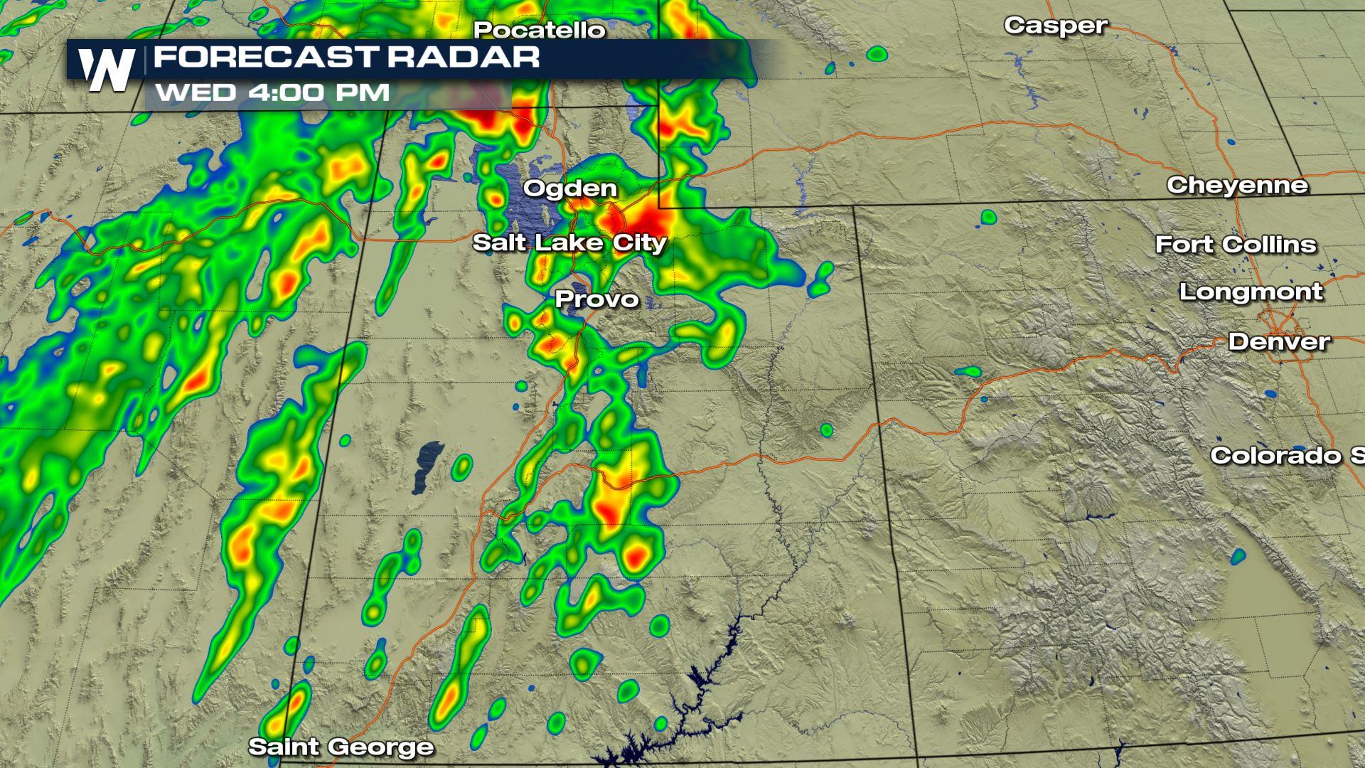
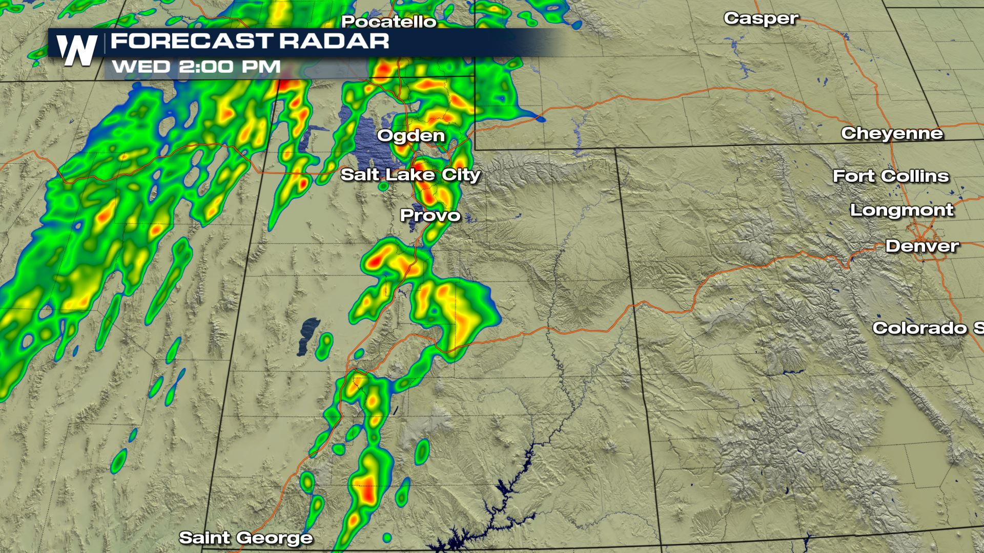
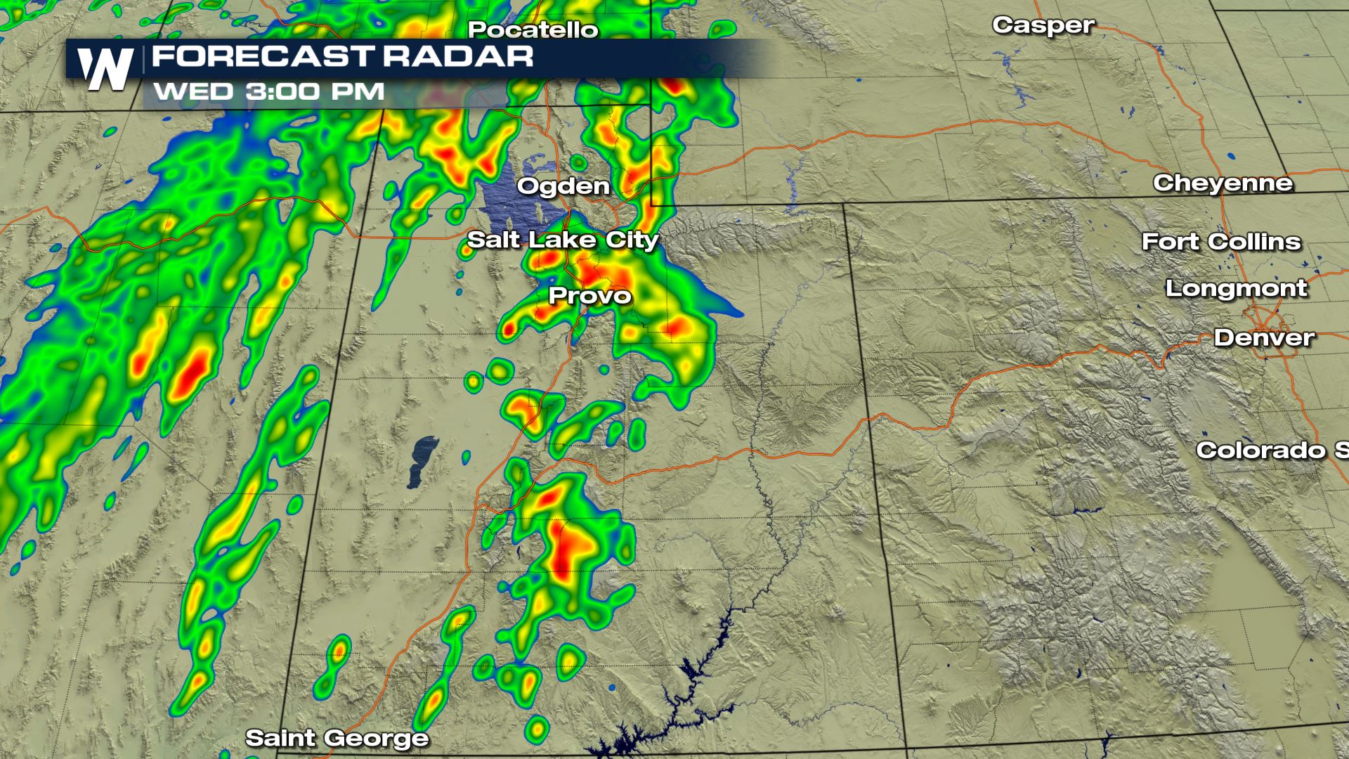
Showers and storms are in the forecast today for the Eastern Great Basin. We are not looking at a major severe outbreak, but there could definitely be some strong storms firing up this afternoon with the potential for large hail and damaging winds.
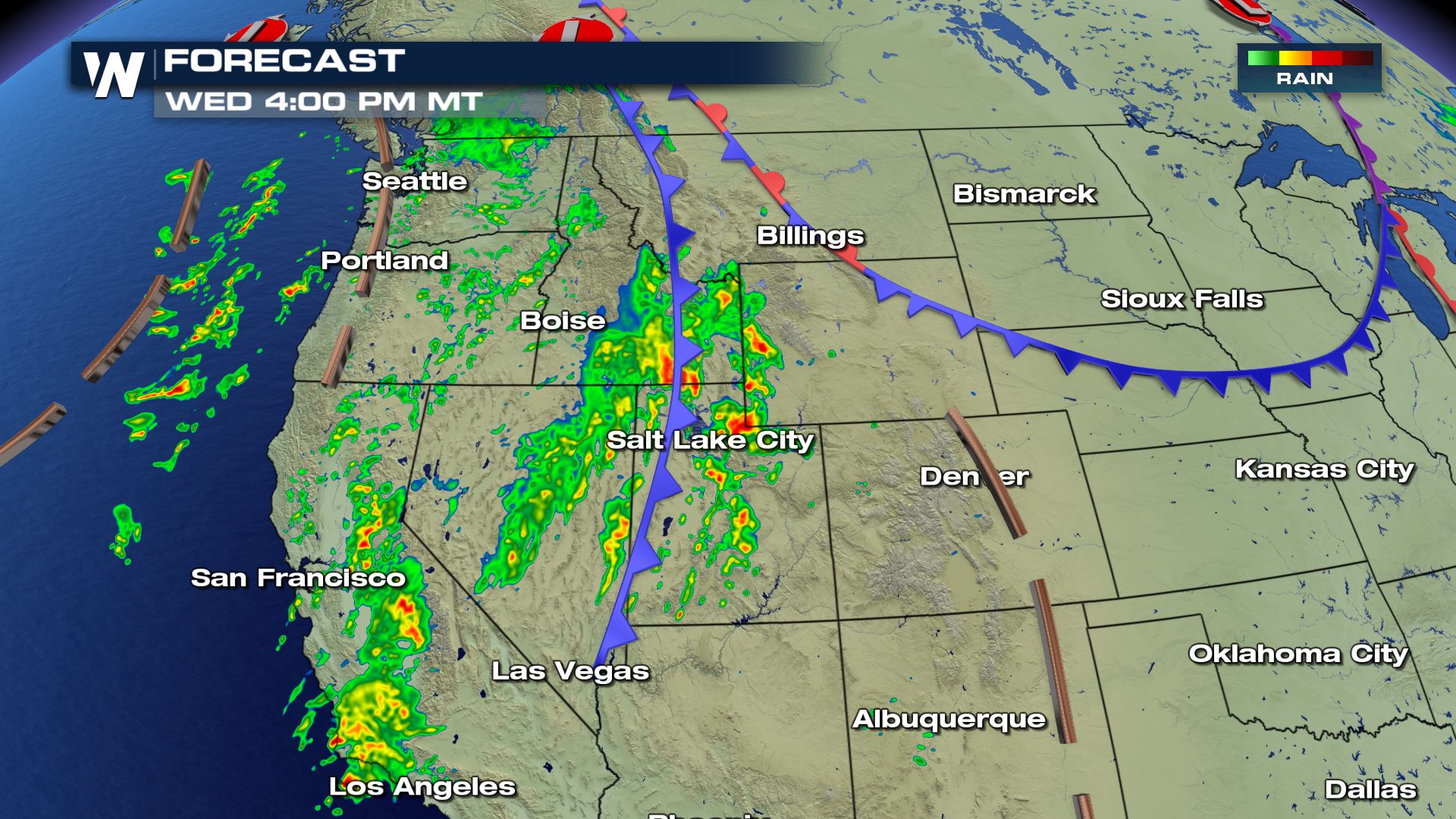 A cold front sliding through the western U.S. will be the focus for shower and thunderstorm development later this afternoon. Daytime heating and temperatures cooling very quickly in the upper levels of the atmosphere. This means that showers and storms will be increasing for this afternoon and isolated storm cells could turn severe.
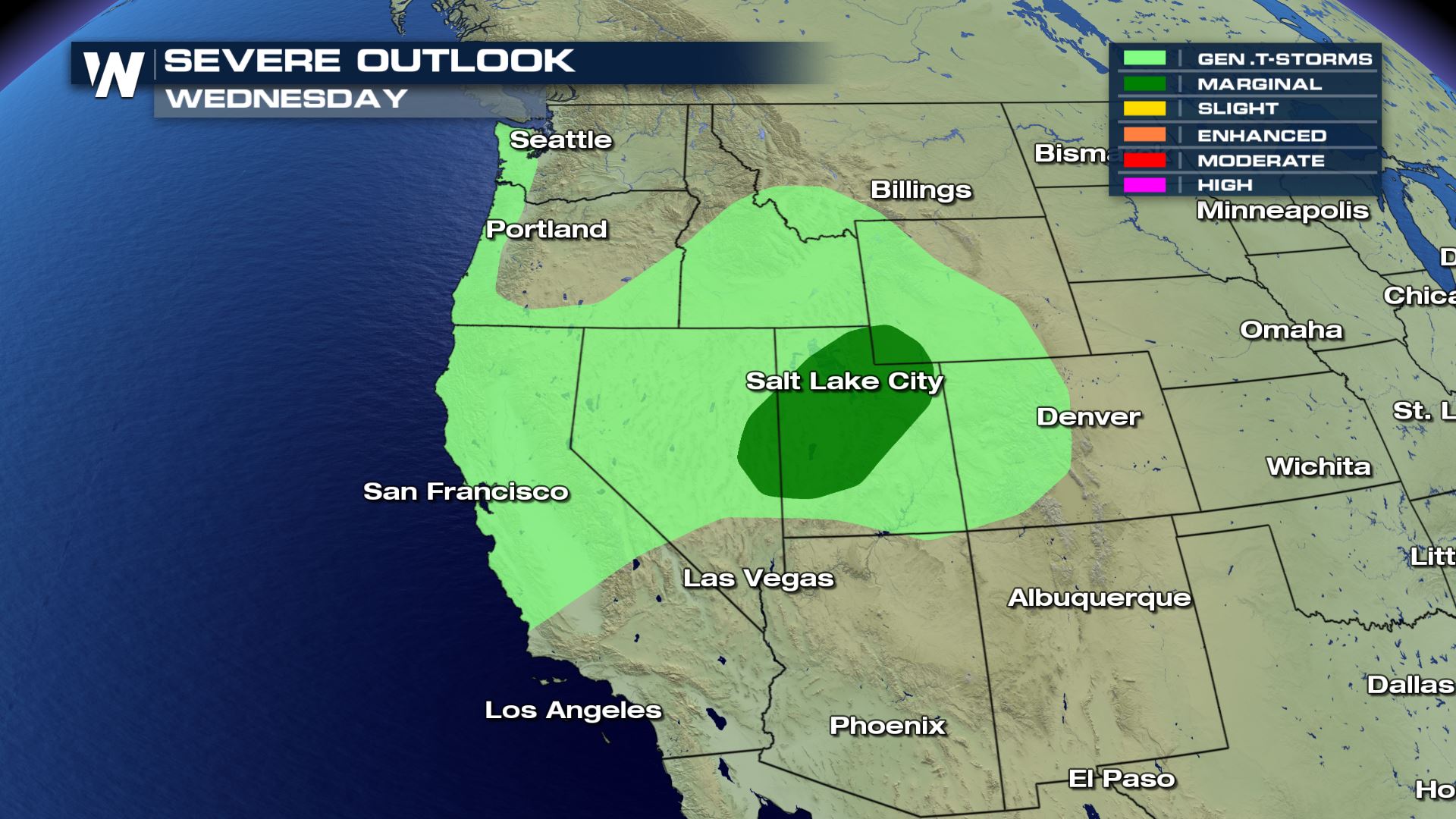 The Marginal Risk of severe weather is over parts of Nevada and Wyoming, but is mainly over a big chunk of Utah. What is a Marginal Risk of severe weather? Here is the definition from the Storm Prediction Center.
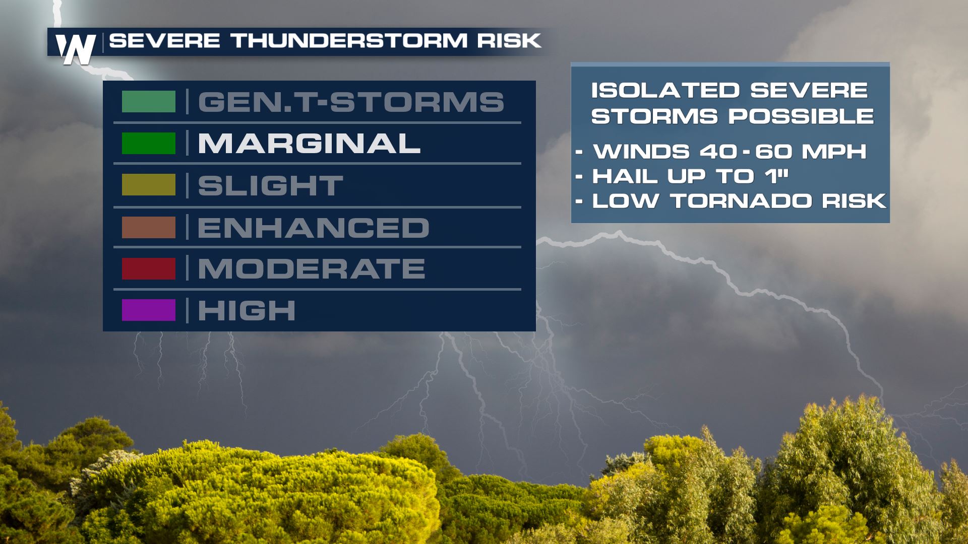 Marginal risks are typically isolated and the main threats are usually wind and hail.
Here is a look at severe risk forecast for today.
Marginal risks are typically isolated and the main threats are usually wind and hail.
Here is a look at severe risk forecast for today.
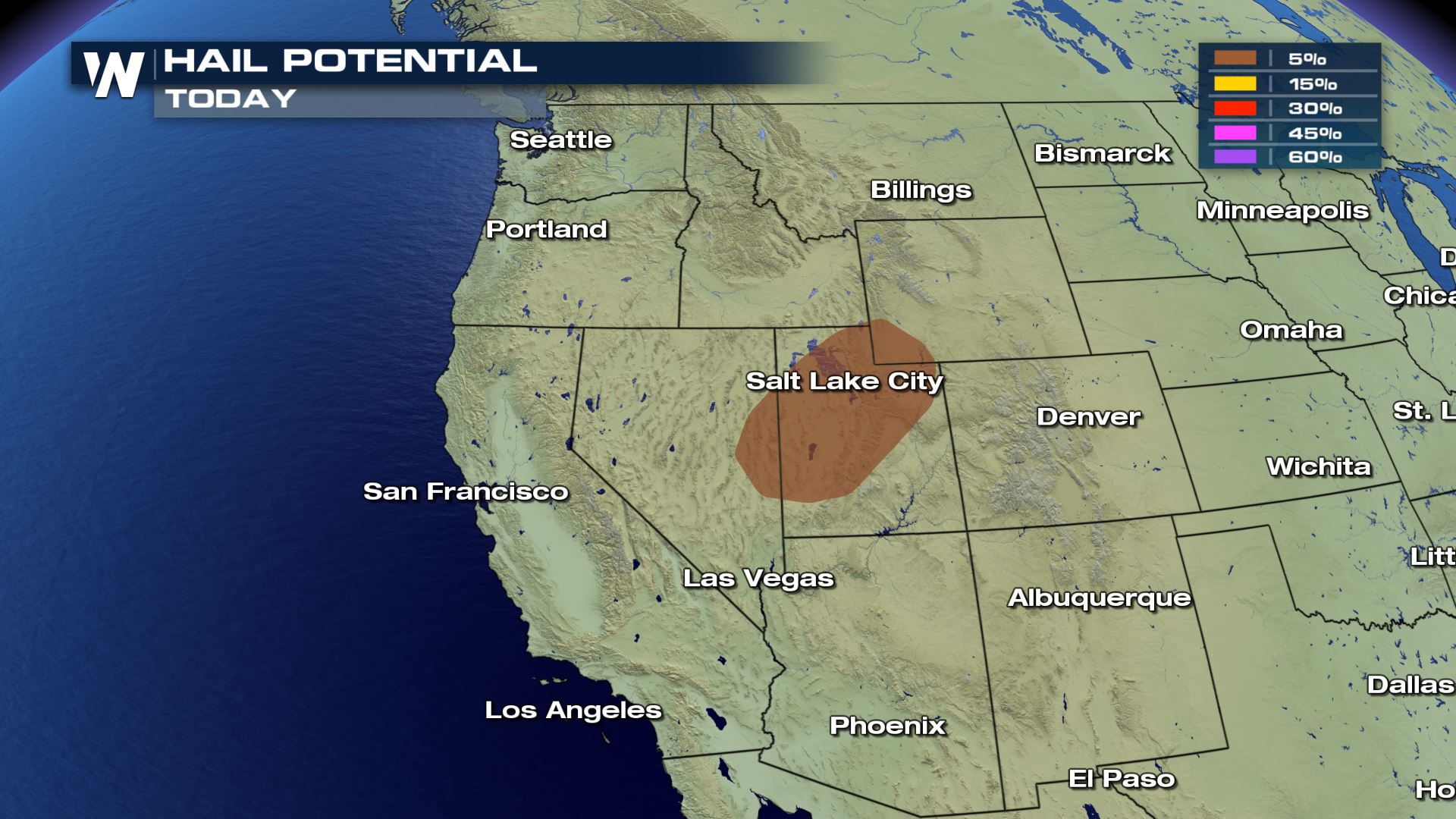

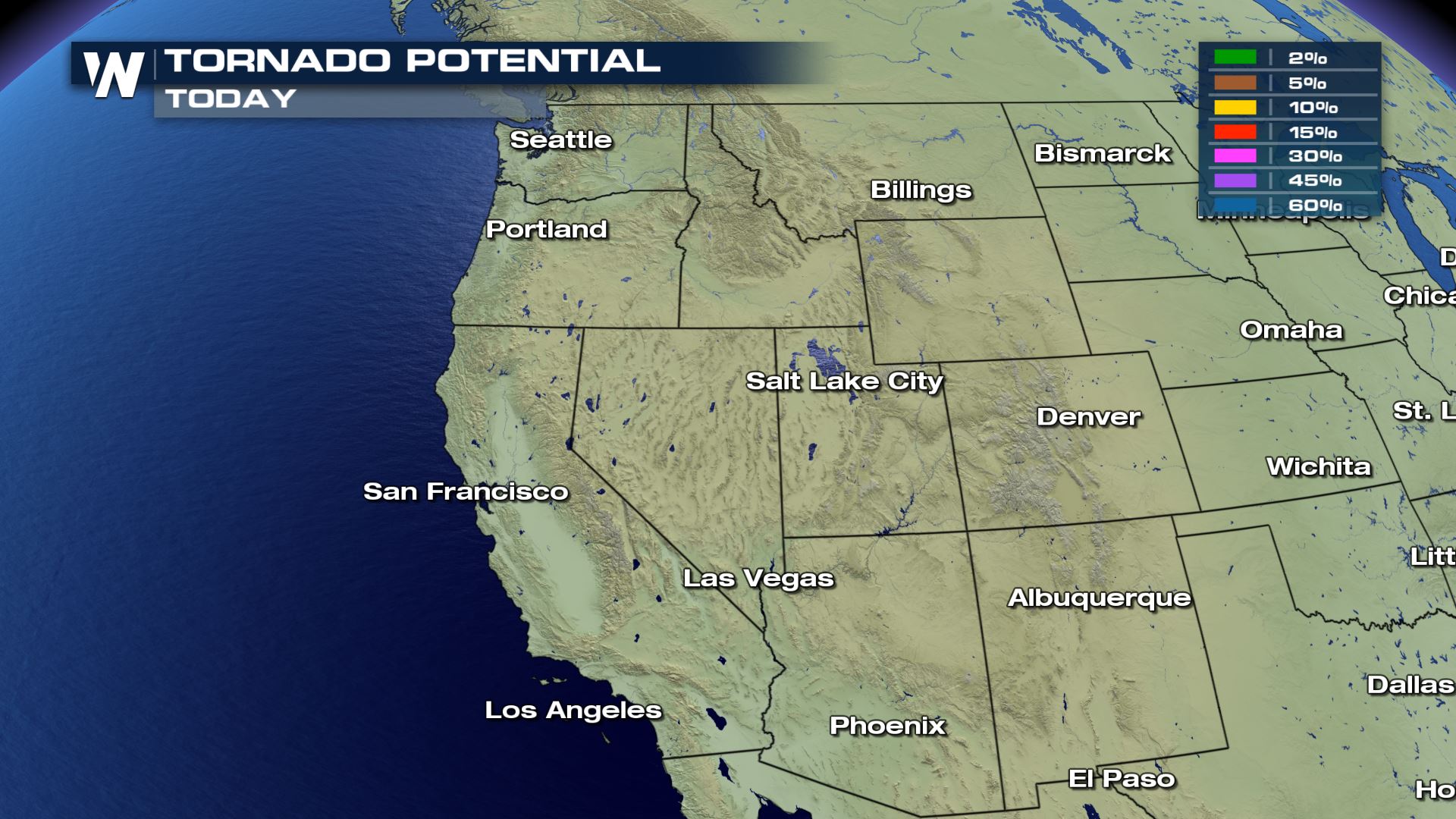 Notice how there isn't even a risk of tornadoes today with any of these storm chances. Large hail and damaging winds will be possible with a 5% risk.
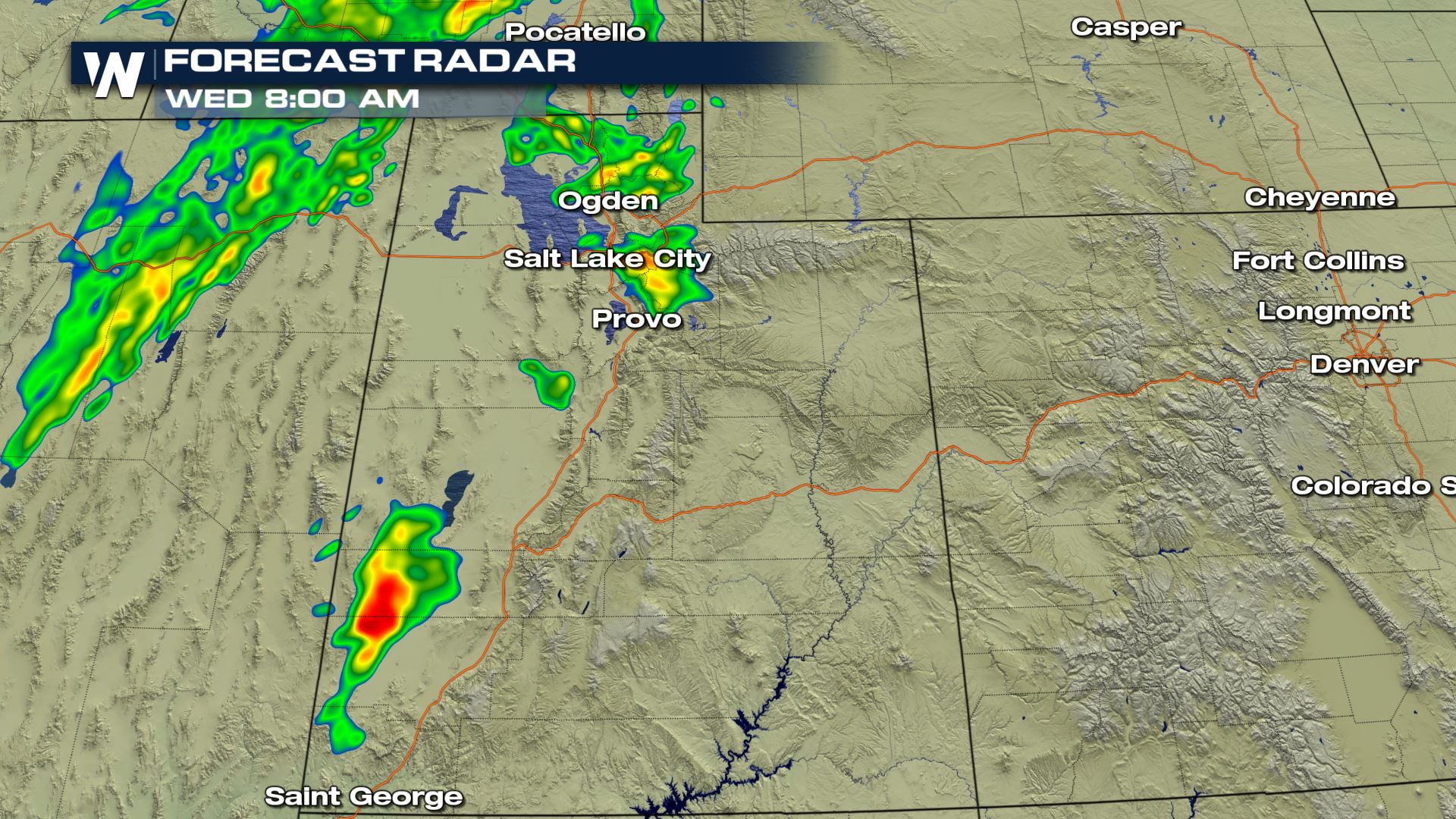
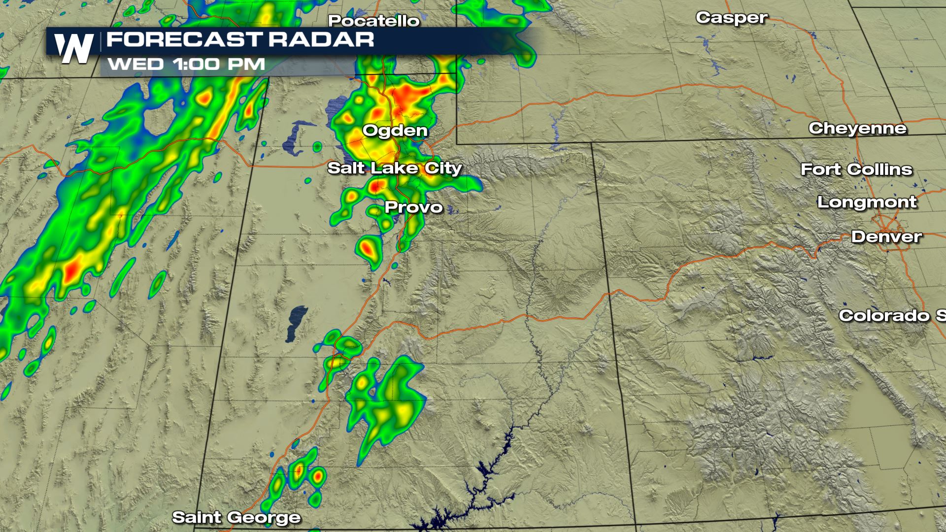
 Most of today's thunderstorms will be firing up during the peak heating hours this afternoon. A lot of today's storms will be below severe weather criteria...only a few isolated storms will have the chance to turn severe.
Meteorologist Patrick Crawford
Most of today's thunderstorms will be firing up during the peak heating hours this afternoon. A lot of today's storms will be below severe weather criteria...only a few isolated storms will have the chance to turn severe.
Meteorologist Patrick Crawford
Forecast
A cold front sliding through the western U.S. will be the focus for shower and thunderstorm development later this afternoon. Daytime heating and temperatures cooling very quickly in the upper levels of the atmosphere. This means that showers and storms will be increasing for this afternoon and isolated storm cells could turn severe.
Severe Risks
The Marginal Risk of severe weather is over parts of Nevada and Wyoming, but is mainly over a big chunk of Utah. What is a Marginal Risk of severe weather? Here is the definition from the Storm Prediction Center.
Marginal risks are typically isolated and the main threats are usually wind and hail.
Here is a look at severe risk forecast for today.
Notice how there isn't even a risk of tornadoes today with any of these storm chances. Large hail and damaging winds will be possible with a 5% risk.
Latest Timing
Most of today's thunderstorms will be firing up during the peak heating hours this afternoon. A lot of today's storms will be below severe weather criteria...only a few isolated storms will have the chance to turn severe.
Meteorologist Patrick Crawford
All Weather News
More
Severe Storms Target the Northeast Saturday
While smoke and heat have made headlines in t
17 Jul 2026 8:05 PM

Monsoon Moisture Brings Weekend Flood Threat
The monsoon has returned to the southwestern
17 Jul 2026 7:55 PM

Texas Hill Country: Life-Threatening Flooding
TEXAS HILL COUNTRY - Life-threatening floodin
17 Jul 2026 12:10 PM

Thick Wildfire Smoke Continues to Pour Across the Great Lakes, East Coast
Wildfires burning in Northwestern Ontario, Ca
17 Jul 2026 11:20 AM

Two Tropical Areas to Monitor in the Atlantic
Two areas of potential tropical development a
17 Jul 2026 11:10 AM

Heat Alerts Across the Nation End Thursday
ALL-TIME RECORD HIGHS were broken across the
16 Jul 2026 1:00 AM

Rare Enhanced Severe Threat For New England
WHAT TO EXPECT The SPC has issued a severe ou
15 Jul 2026 1:35 AM