Massive Hail Reported in West Texas Tuesday
Tuesday afternoon, severe warned storms in west Texas dropped 5 INCH in diameter hail. That's larger than an DVD! This is in the wake of morning storms that tore through the Dallas area early Tuesday morning with hail up to 2" in diameter and winds to 80 mph around 6 AM CT. A wind gust of 83 mph was recorded in Denton, TX with 77 mph winds in Dallas! As a result of the storm nearly 750k customers were without power early Tuesday morning. Large hail pummeled the suburbs of golf ball size and larger.
Strong storms also rolled through Houston, the same complex that impacted Dallas earlier in the day. Heavy rain in the city leads to ponding on the roadways including the Gulf Freeway (I-45). The baseball-sized hail came down in the suburbs on Tuesday afternoon.
We turn our attention to West Texas overnight as storms developed along the dryline, a clash of moist and dry areas. These storms have had a history of producing very large hail and gusty winds and that threat will continue overnight. The primary risks overnight will be damaging winds and hail, with an isolated tornado threat. Storms will roll into the I-35 and I-45 corridor once again overnight so you must have multiple ways to get alerts before you go to bed.,
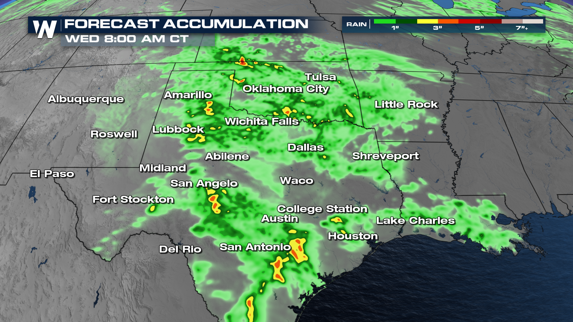
Heavy rainfall on the order of 3-5" is expected as storms blast through overnight. Expect a slow commute in major cities on Wednesday morning due to ponding on the roadways.
 For more on the storm chances in Texas on Wednesday and Thursday, visit our web article with more information on the midweek storm threat.