Quick-Moving System Brings Northern Latitude States Snow
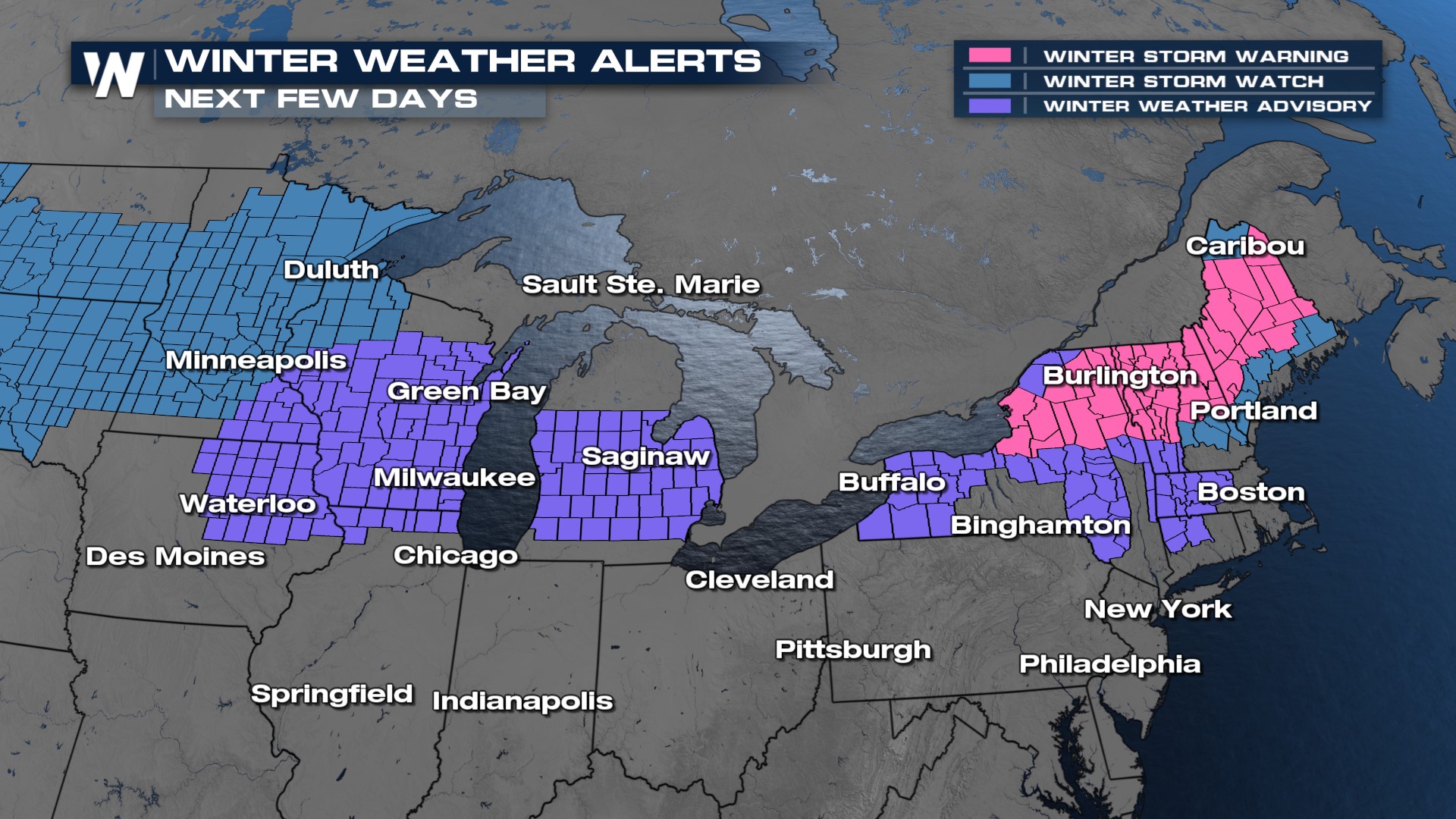
We're tracking a low-pressure system bringing winter impacts to the northern Plains and Great Lakes, eventually tracking into northern New England. This will bring a cool-down and snow to areas of the US that haven't had much snow in the last few months. Winter alerts have been issued across the northern tier of the country to account for the system, from the Dakotas into Maine. (NOTE: The watches in northern Wisconsin and Minnesota in blue are for the next system)

Snow falling around the Great Lakes will continue through around Midday for locations like Milwaukee (see bottom of the page for an hourly forecast). Areas of eastern Michigan will likely see snow taper off through the afternoon, while areas in New York see snow build in through the evening. Snow becomes heavy into Saturday and Saturday night across northern New York and new England, with over 18" possible in higher elevations.
This system will bring a widespread 3-6" of snow across the board, with higher totals of 8"+ in central Wisconsin and northern Michigan with lake-enhanced snowfall. Another system will keep heavy snow potential in this region from Sunday into Monday. Milwaukee could end up with some of the higher snow totals around the Great Lakes.