Severe Weather Remains a Threat in the Midwest
Special Stories
28 Aug 2020 8:30 AM
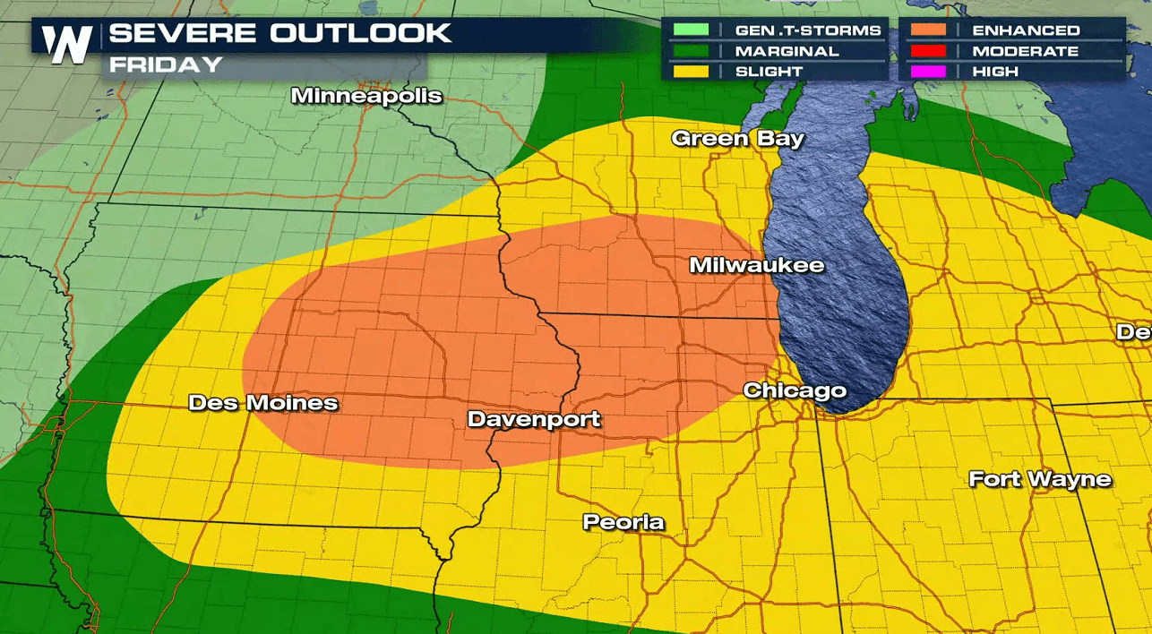
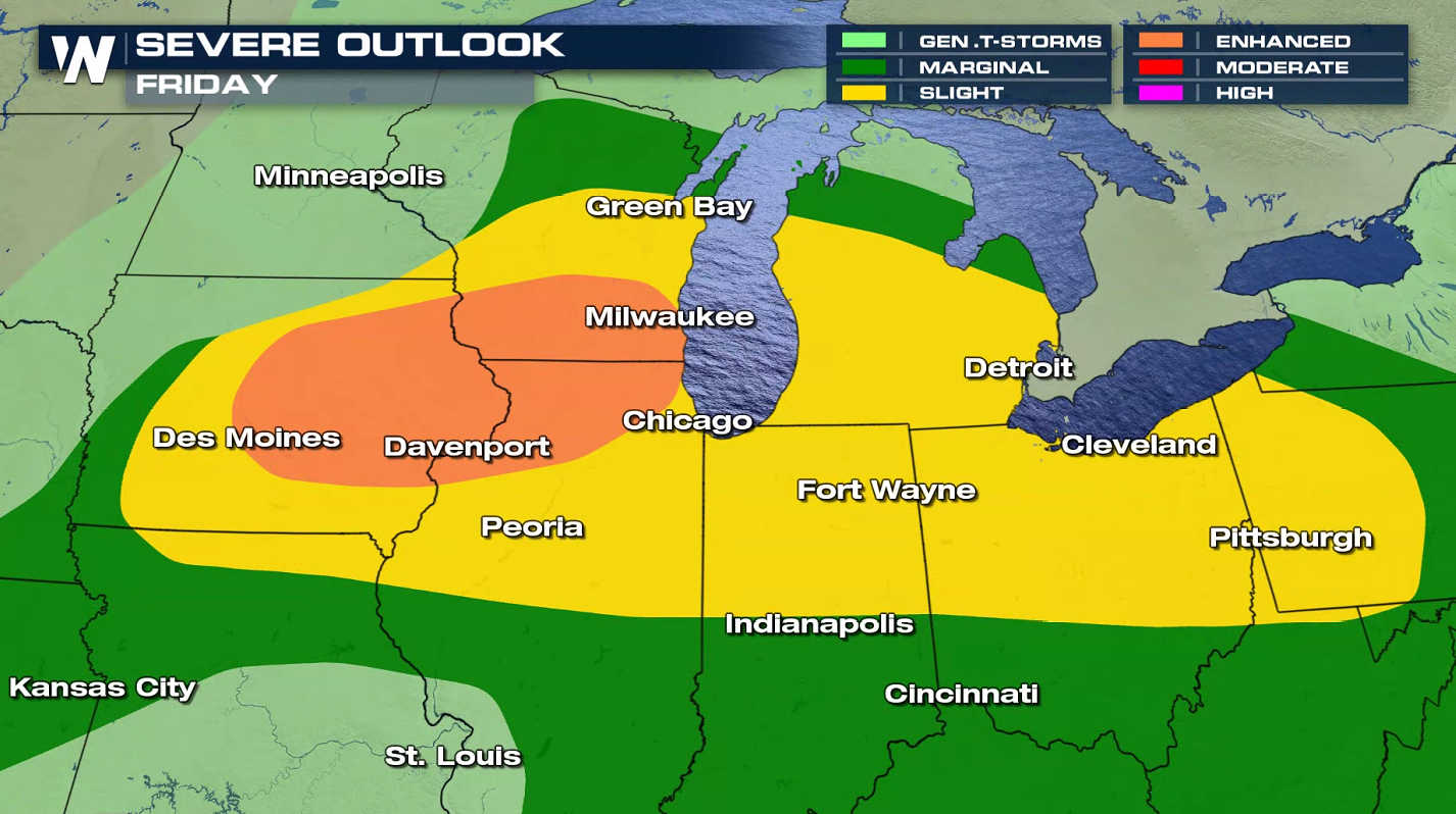
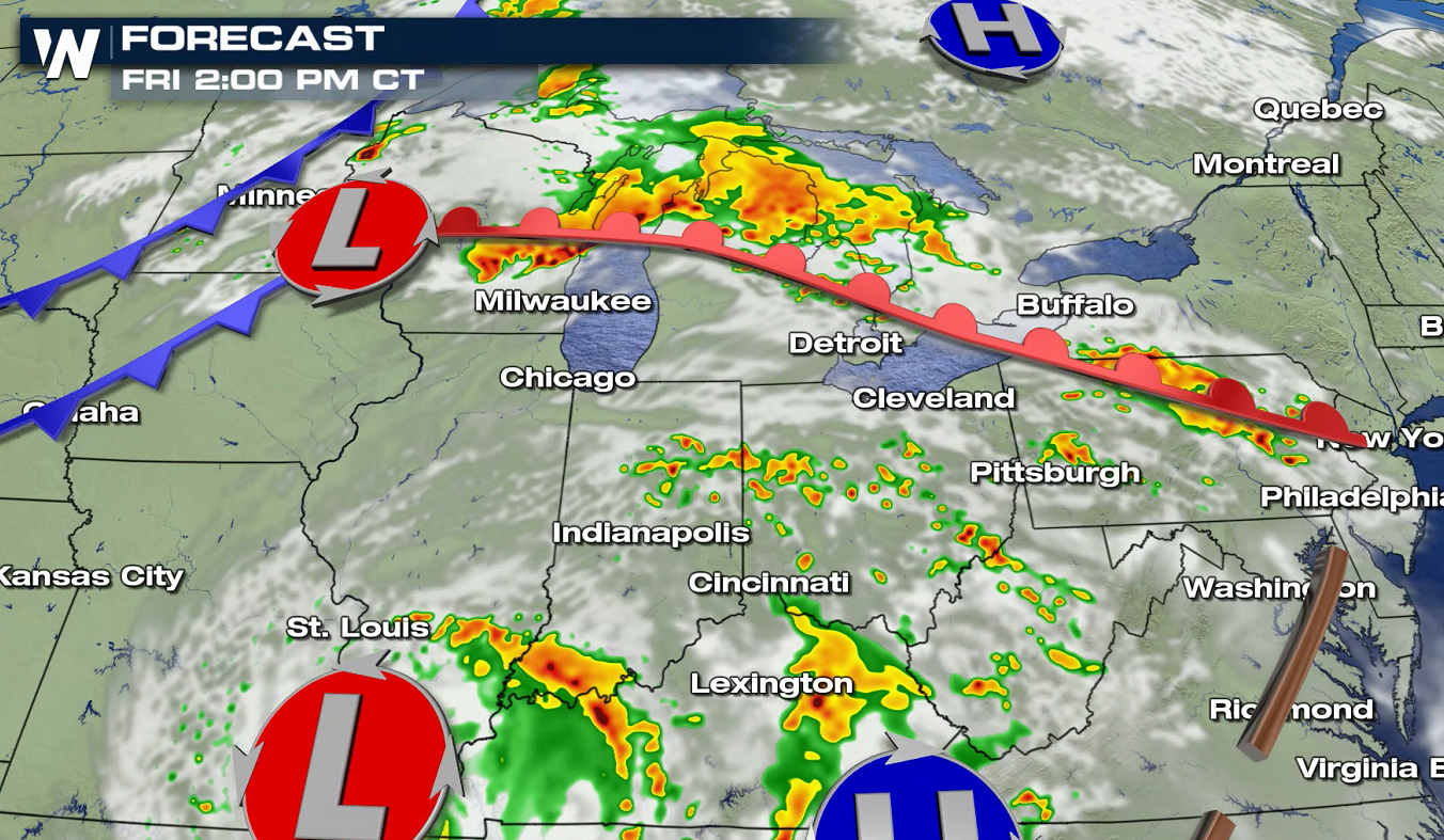
The Upper Midwest and Northern Plains have been a target for severe storms already this week and the threat continues into this weekend. The Storm Prediction Center has issued a risk for severe storms extending from Iowa to Pennsylvania. There is an elevated risk (level 3 on a scale of 1 to 5) in eastern Iowa, southern Wisconsin and northwestern Illinois.
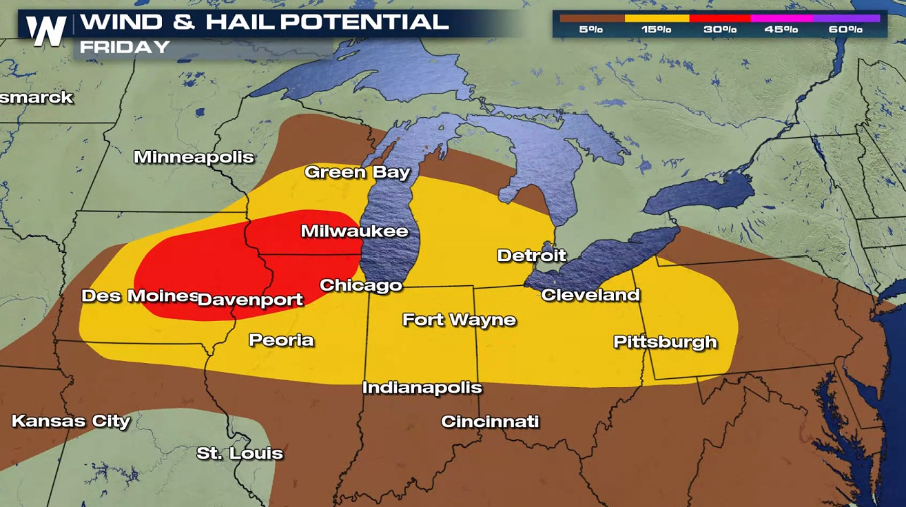
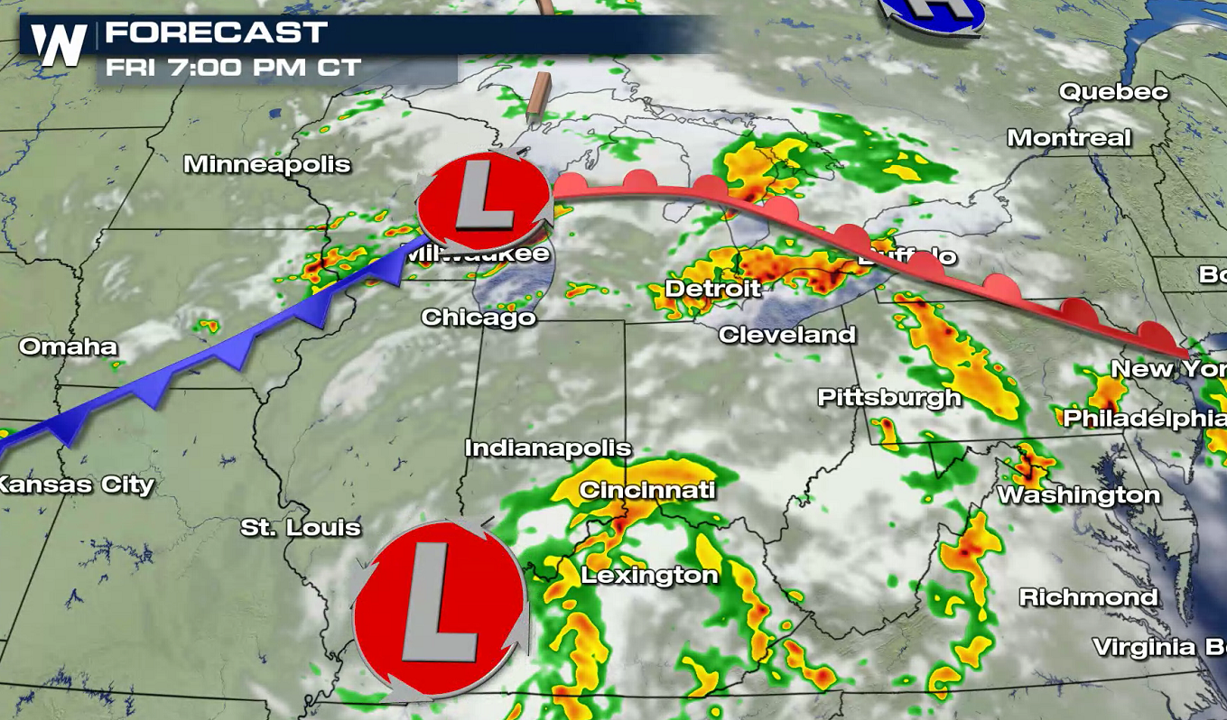
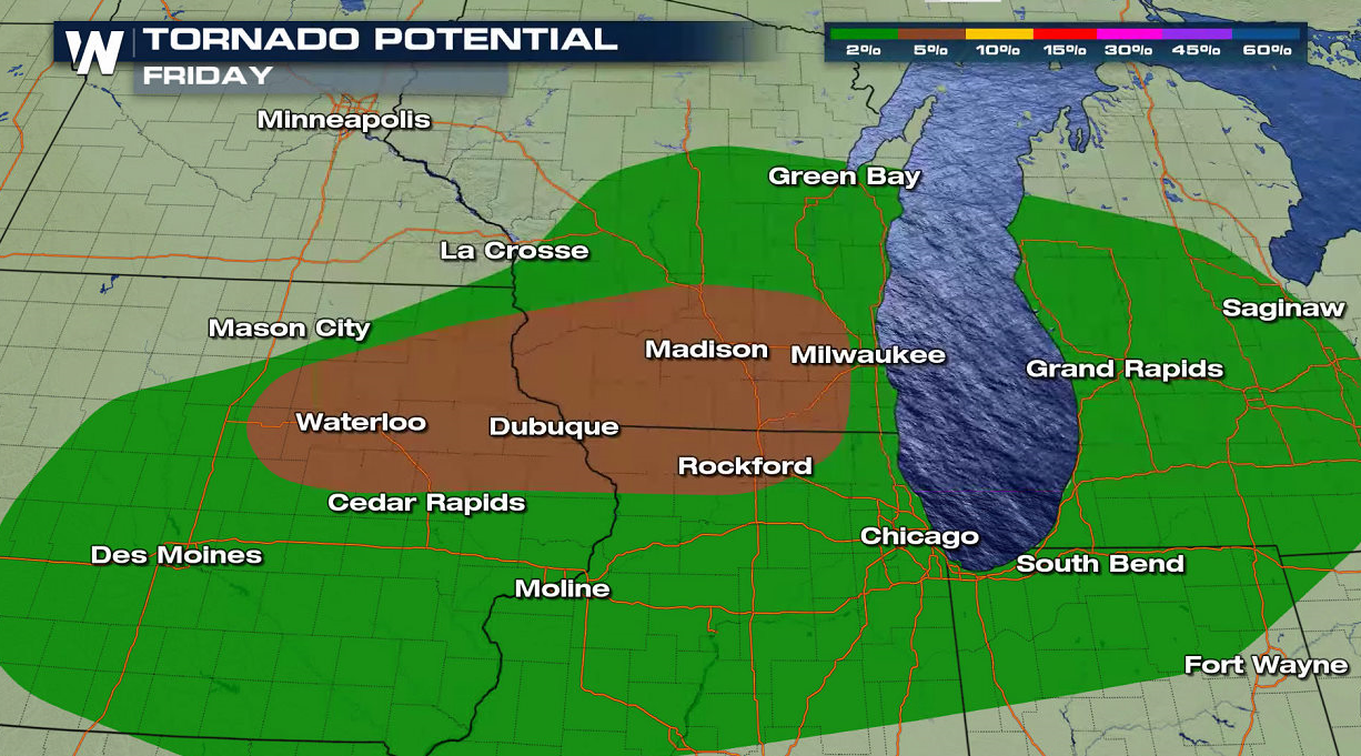 Strong, damaging wind gusts are the main threat with a complex of thunderstorms that is likely to form this evening. Isolated tornadoes and large hail are also possible, mainly in the late afternoon and evening.
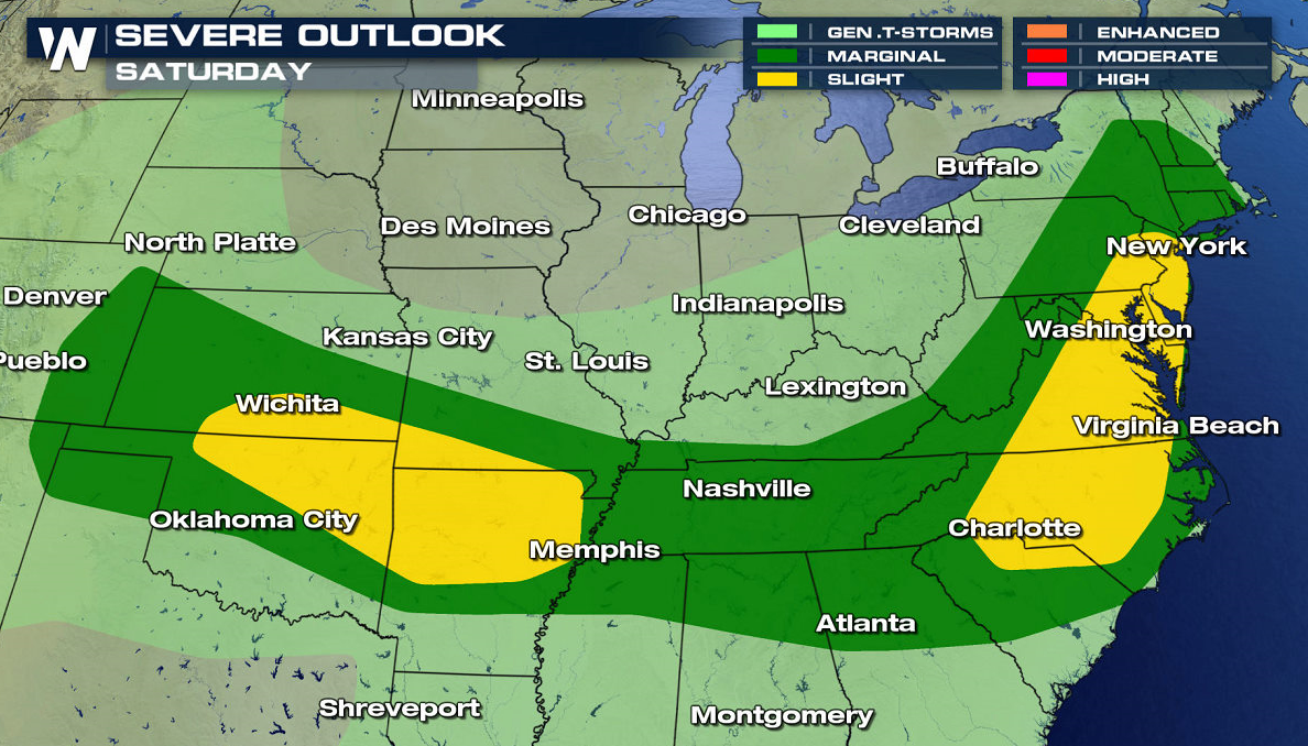
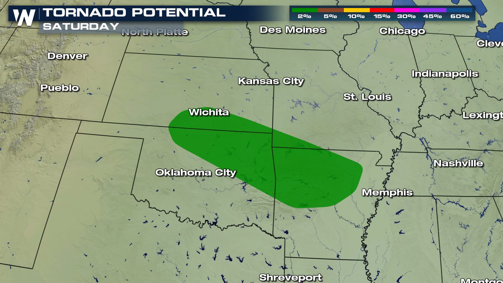
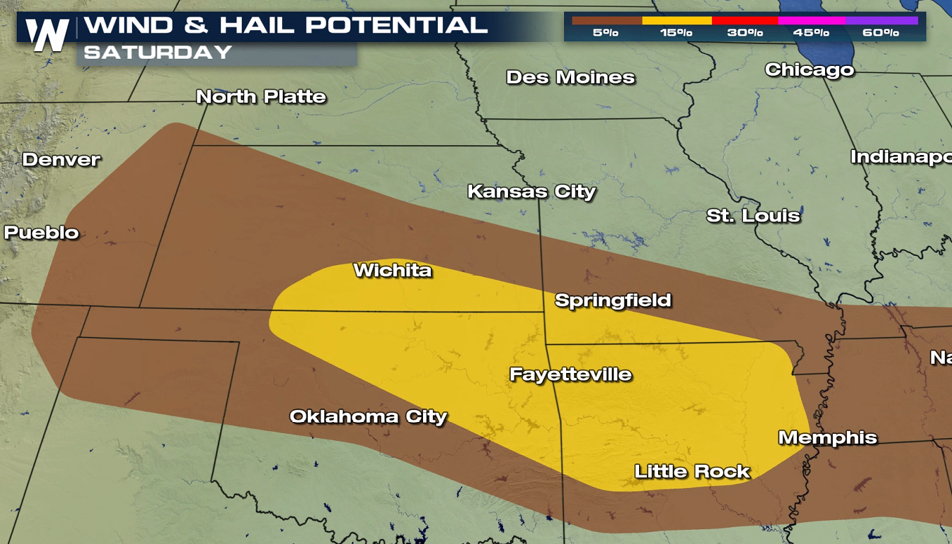
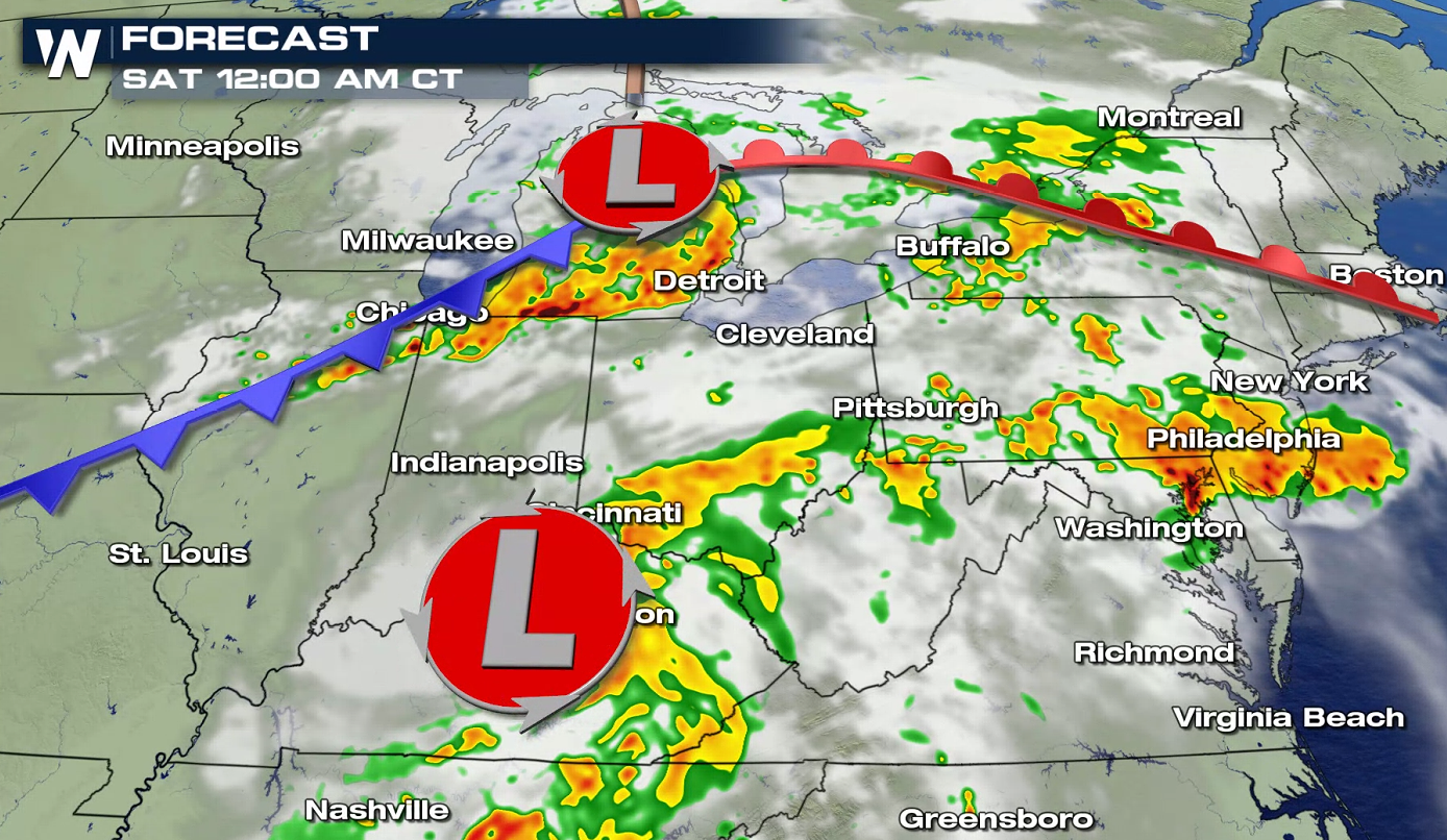 The front moves slightly for Saturday, pushing southeastward. Areas from the central Plains to the Eastern Seaboard may see a few severe thunderstorms. There is an slight risk (level 2 on a scale of 1 to 5) in southeastern Kansas, northeastern Oklahoma, southwestern Missouri and most of Arkansas.
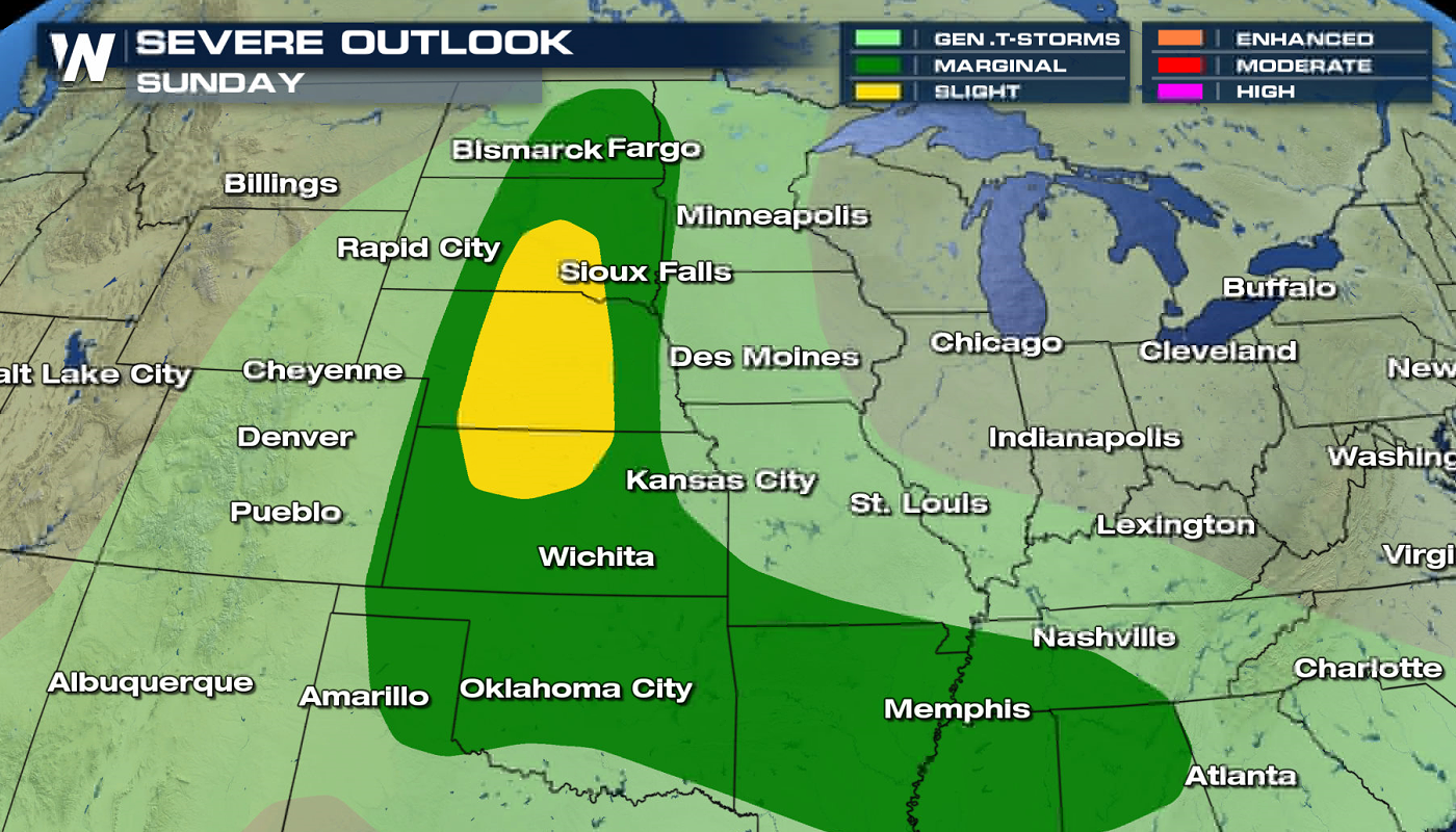
 On Sunday, there is a marginal risk (level 1 on a scale of 1 to 5) over most of the central High Plains. A slight risk (level 2) has been posted from Kansas to South Dakota.
 For the latest on our ongoing severe weather threat tune into WeatherNation on our streaming platforms or follow us on social media @WeatherNation!
Strong, damaging wind gusts are the main threat with a complex of thunderstorms that is likely to form this evening. Isolated tornadoes and large hail are also possible, mainly in the late afternoon and evening.
The front moves slightly for Saturday, pushing southeastward. Areas from the central Plains to the Eastern Seaboard may see a few severe thunderstorms. There is an slight risk (level 2 on a scale of 1 to 5) in southeastern Kansas, northeastern Oklahoma, southwestern Missouri and most of Arkansas.
On Sunday, there is a marginal risk (level 1 on a scale of 1 to 5) over most of the central High Plains. A slight risk (level 2) has been posted from Kansas to South Dakota.
For the latest on our ongoing severe weather threat tune into WeatherNation on our streaming platforms or follow us on social media @WeatherNation!All Weather News
More

More Storms for the East Through Monday
A low-pressure system that moved through the
3 Aug 2026 12:20 PM


After Reaching Category 5, Genevieve Weakens in the Pacific
PacificGenevieve formed last Friday south of
3 Aug 2026 12:30 AM

Flooding, Severe Storms Target the Midwest Again
After an active week of storms across the nor
1 Aug 2026 1:40 AM

Flooding Risk Increases as Heavy Rain Targets the Tri-State Area
Tuesday, heavy rainfall moved across the Nort
30 Jul 2026 12:25 AM