Monday Severe Weather Update
Top Stories
8 Apr 2019 4:14 AM
The severe storm chances will be moving to the Southeast for the start of the work week. Here is the very latest.
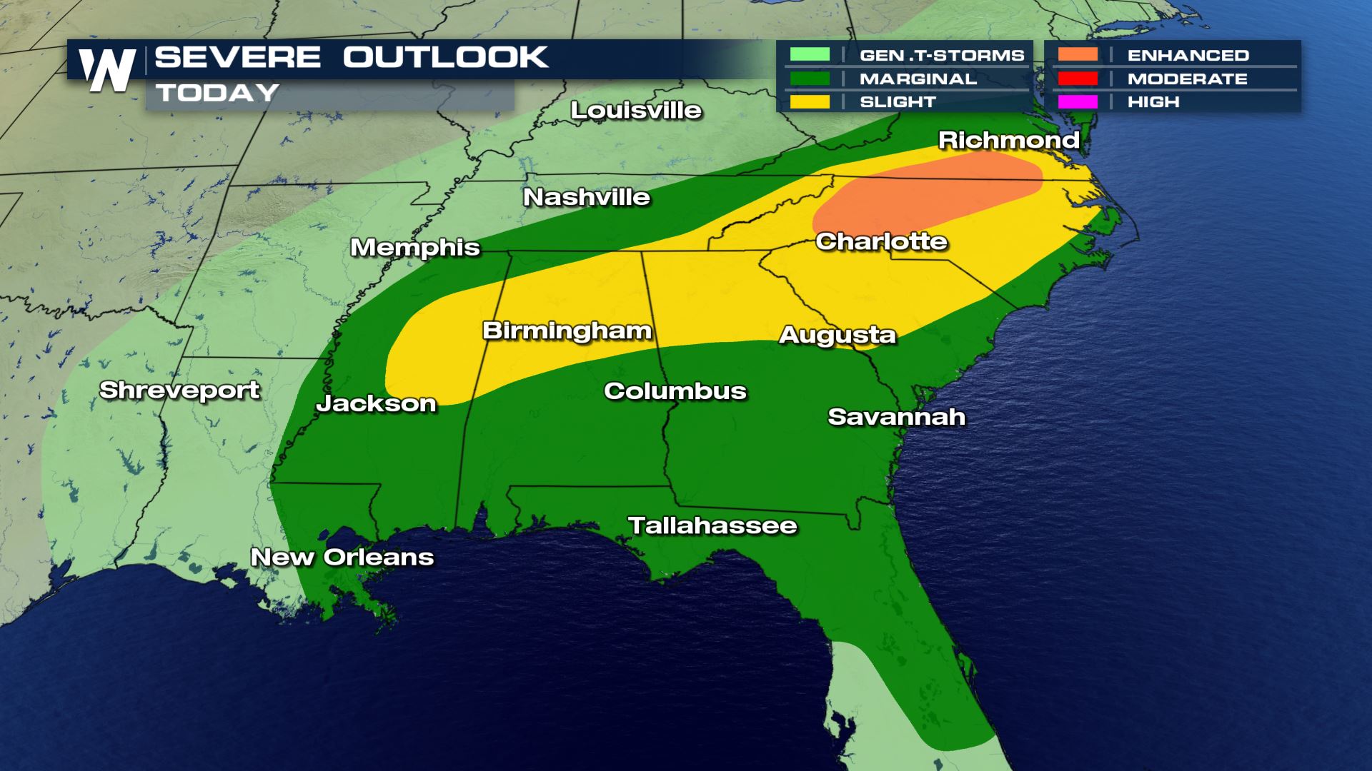 The severe weather will be confined to the East and Southeast with the highest risk in parts of Mississippi, Alabama and the Mid-Atlantic. Large hail, damaging winds and tornadoes will all be possible. Cities like Charlotte, Birmingham and Atlanta will need to be weather alert.
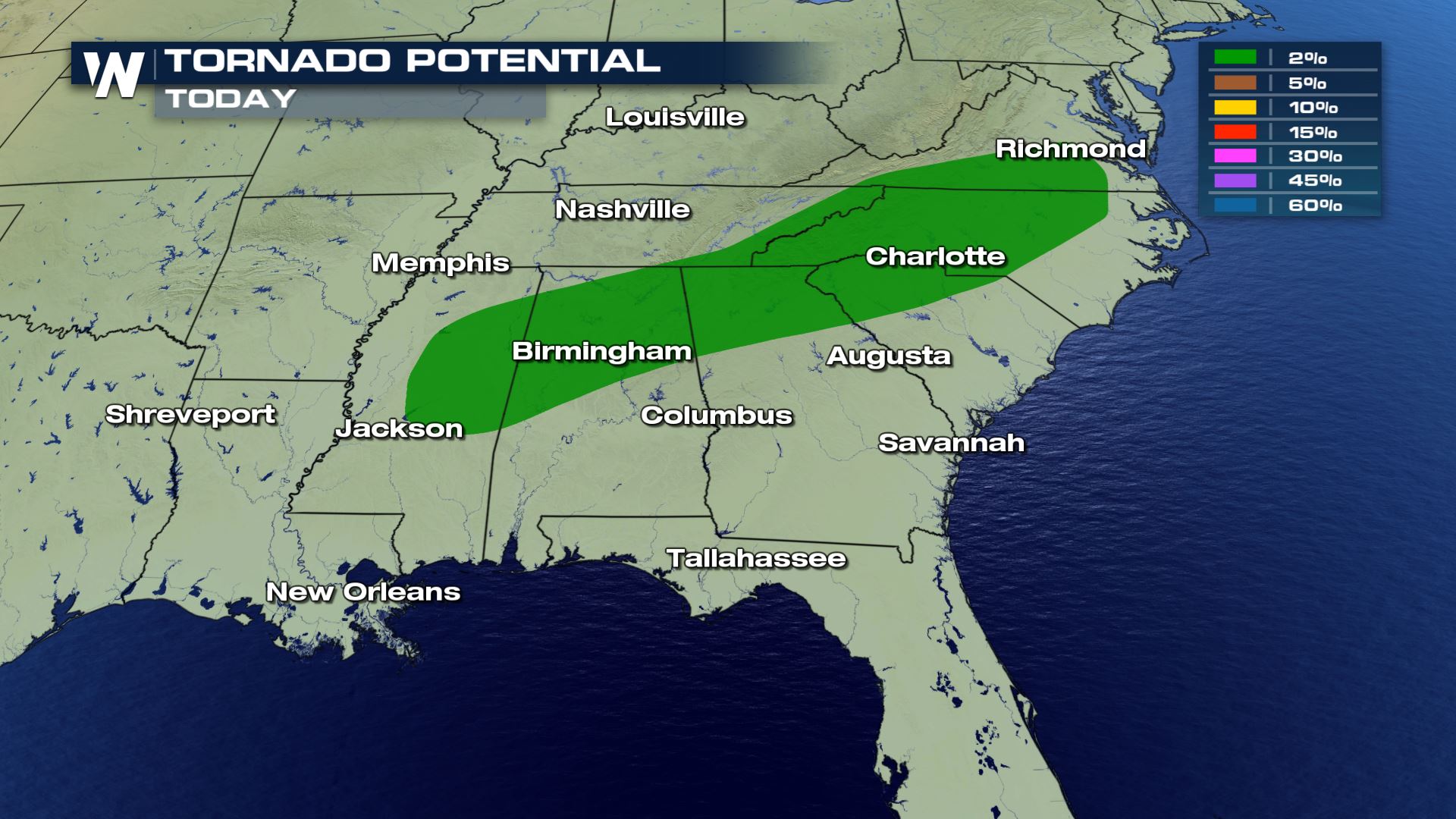
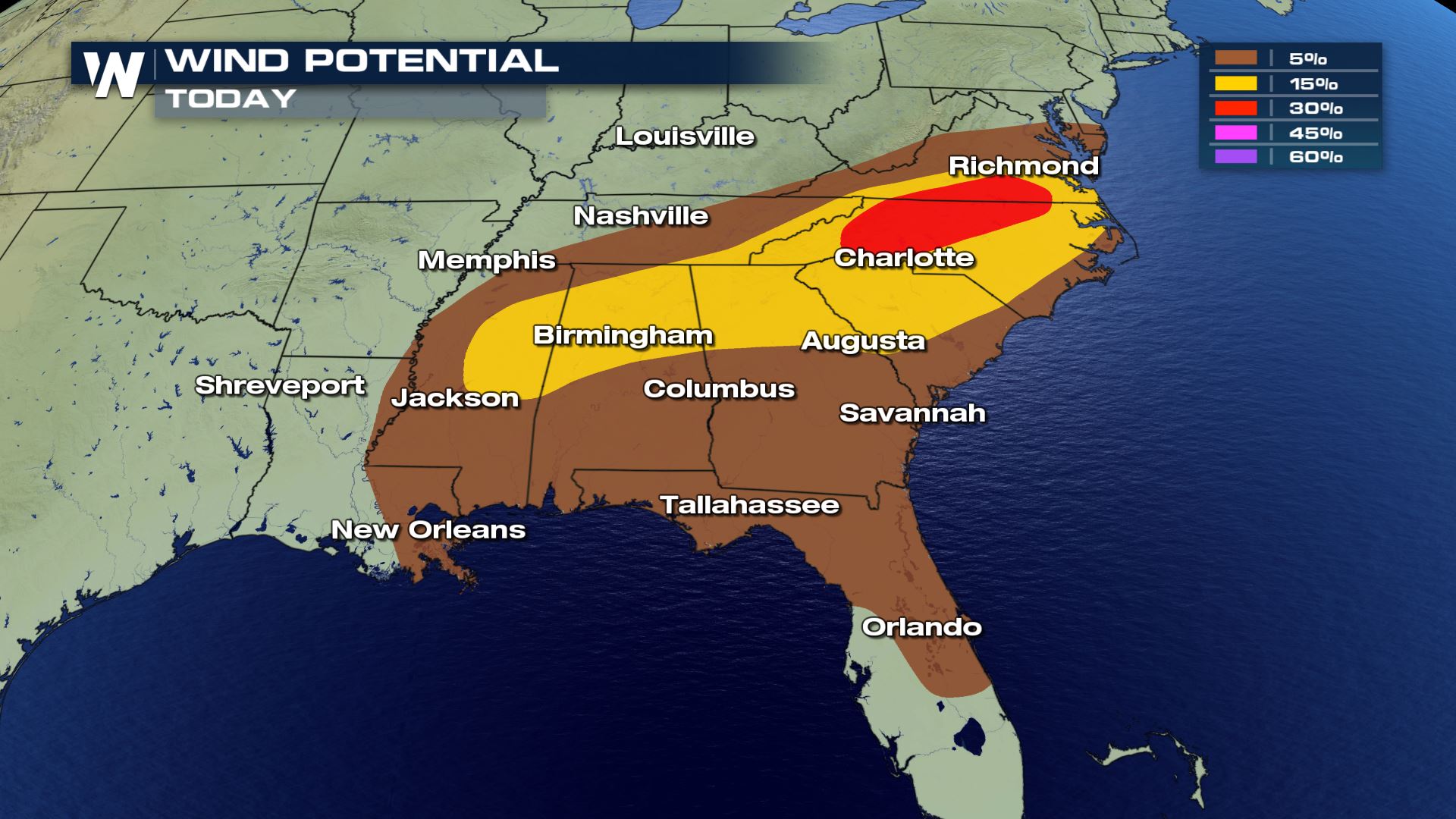
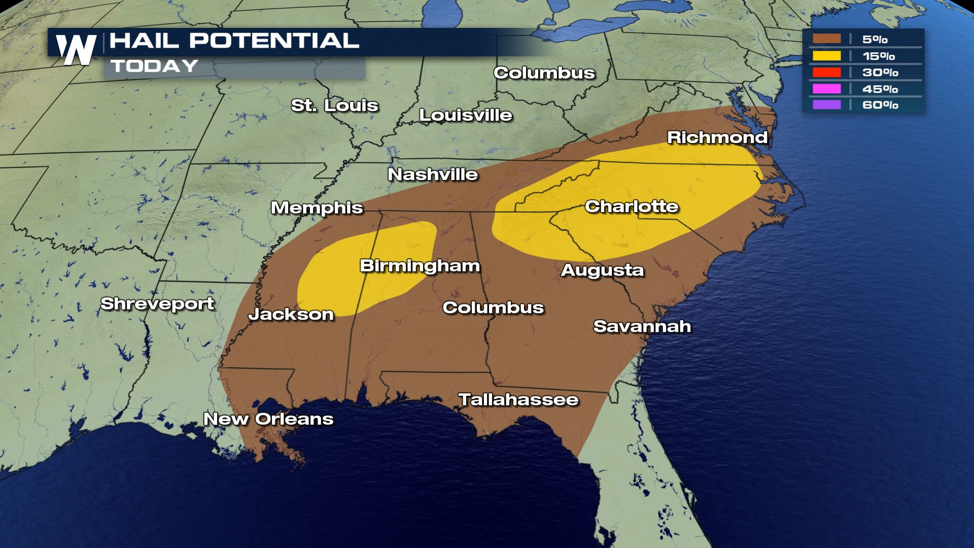 All modes of severe weather are in the forecast today. The other risk that we also want to mention is the frequent lightning.
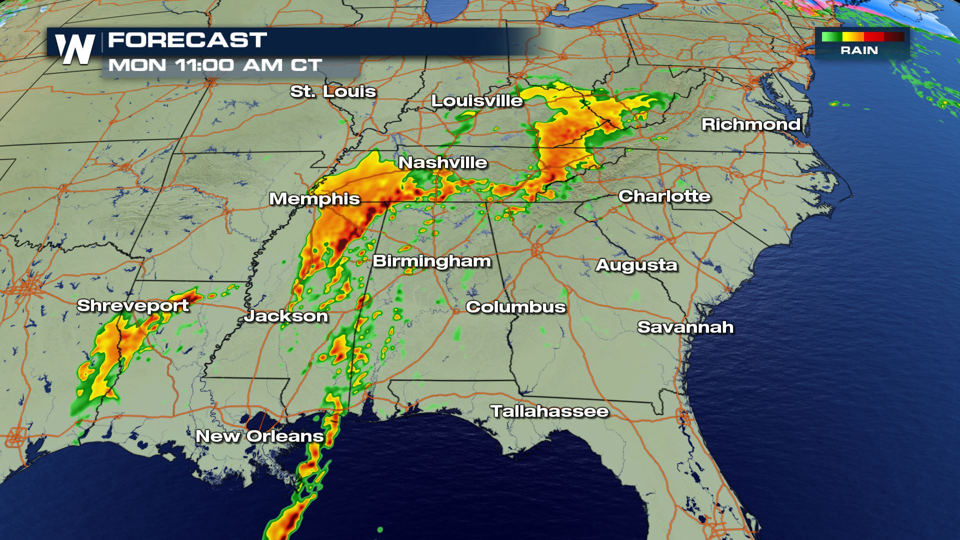

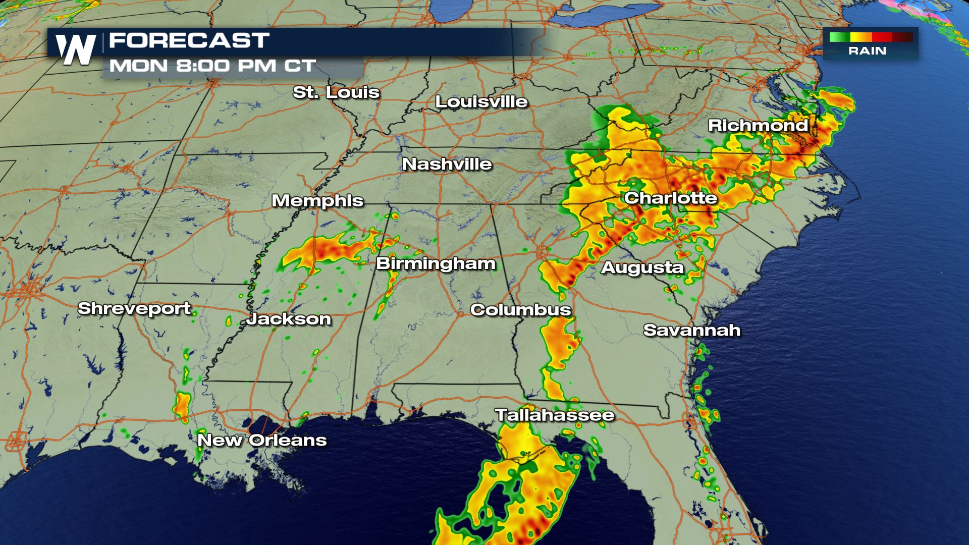
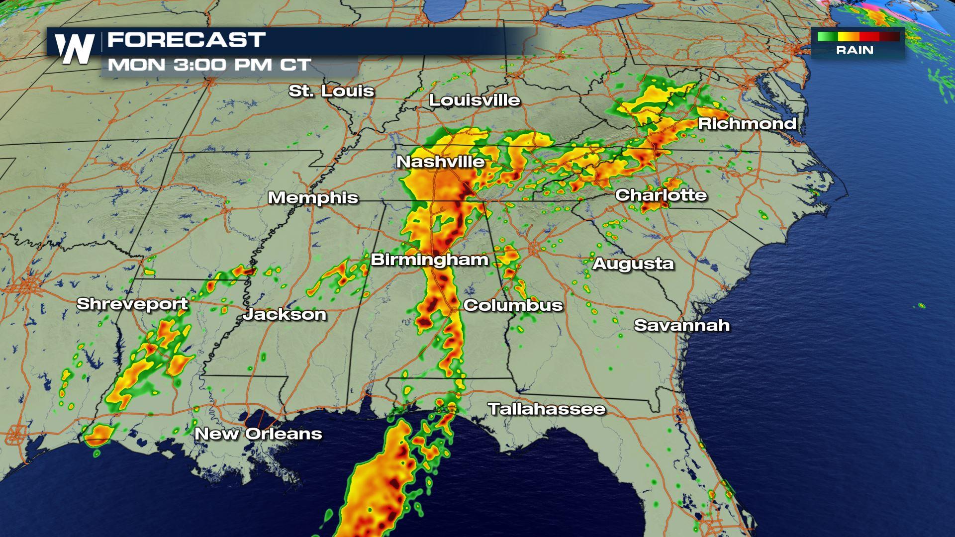
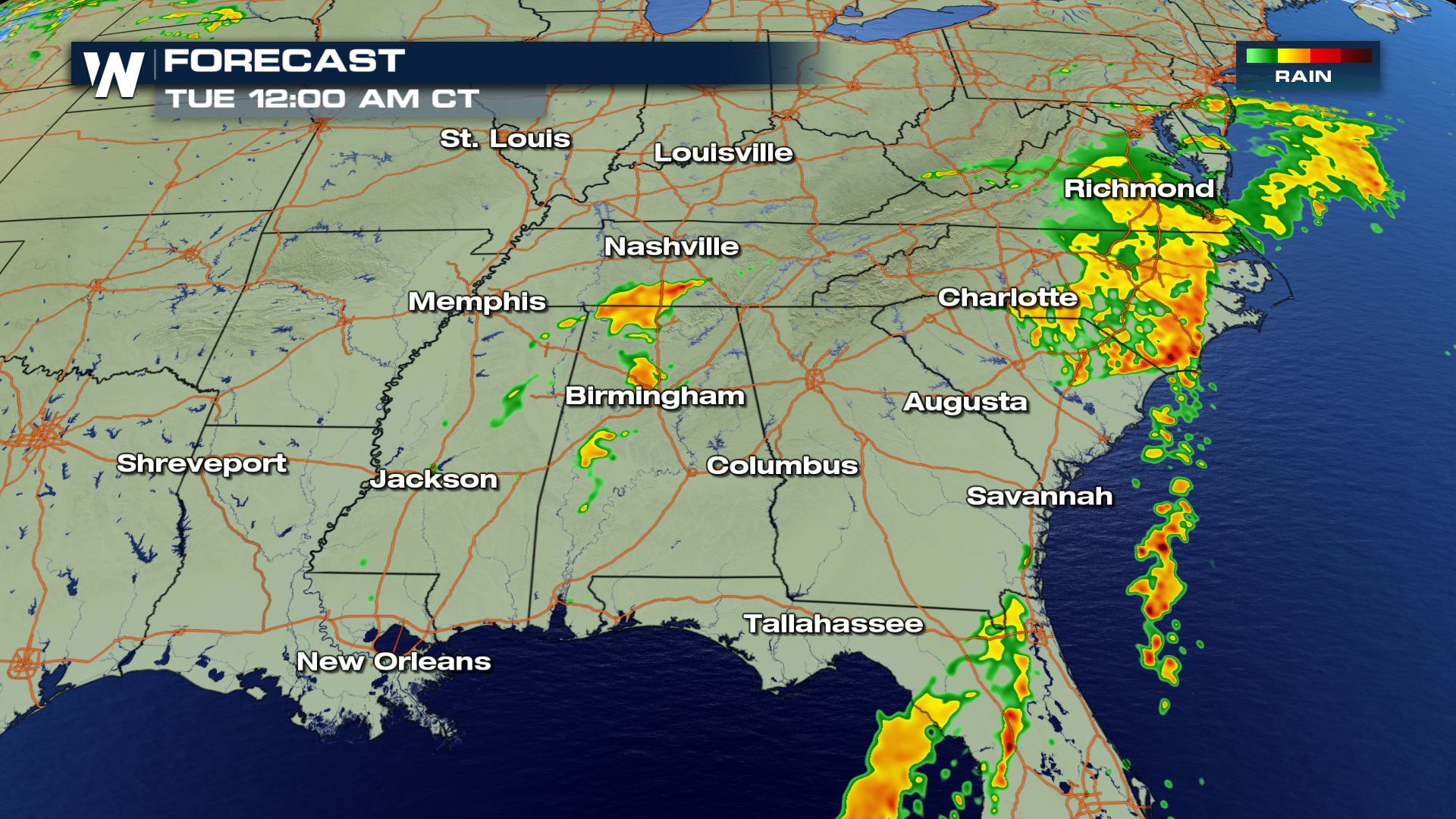 The timing for Monday's storms will be all morning and through the afternoon. This system is moving East so through the night the storms will be diminishing from West to East.
Keep checking with WeatherNation for more updates on Monday's severe weather chances.
The timing for Monday's storms will be all morning and through the afternoon. This system is moving East so through the night the storms will be diminishing from West to East.
Keep checking with WeatherNation for more updates on Monday's severe weather chances.
Severe Outlook
The severe weather will be confined to the East and Southeast with the highest risk in parts of Mississippi, Alabama and the Mid-Atlantic. Large hail, damaging winds and tornadoes will all be possible. Cities like Charlotte, Birmingham and Atlanta will need to be weather alert.
Severe Risks
All modes of severe weather are in the forecast today. The other risk that we also want to mention is the frequent lightning.
Forecast
The timing for Monday's storms will be all morning and through the afternoon. This system is moving East so through the night the storms will be diminishing from West to East.
Keep checking with WeatherNation for more updates on Monday's severe weather chances.All Weather News
More
East Gears Up for Stormy, Wet Weekend
A low pressure system crashing through the Mi
1 Aug 2026 11:35 AM


Flooding, Severe Storms Target the Midwest Again
After an active week of storms across the nor
1 Aug 2026 1:40 AM


After Reaching Category 5, Genevieve Weakens in the Pacific
PacificFausto is now a post-tropical cyclone.
31 Jul 2026 1:30 AM

Flooding Risk Increases as Heavy Rain Targets the Tri-State Area
Tuesday, heavy rainfall moved across the Nort
30 Jul 2026 12:25 AM

Severe Weather: Energy From the Midwest Now in the Southeast
UPPER MIDWEST - Through Monday, dangerous tor
29 Jul 2026 10:30 PM