Monday Severe Weather Update
Top Stories
8 Jul 2019 4:22 AM
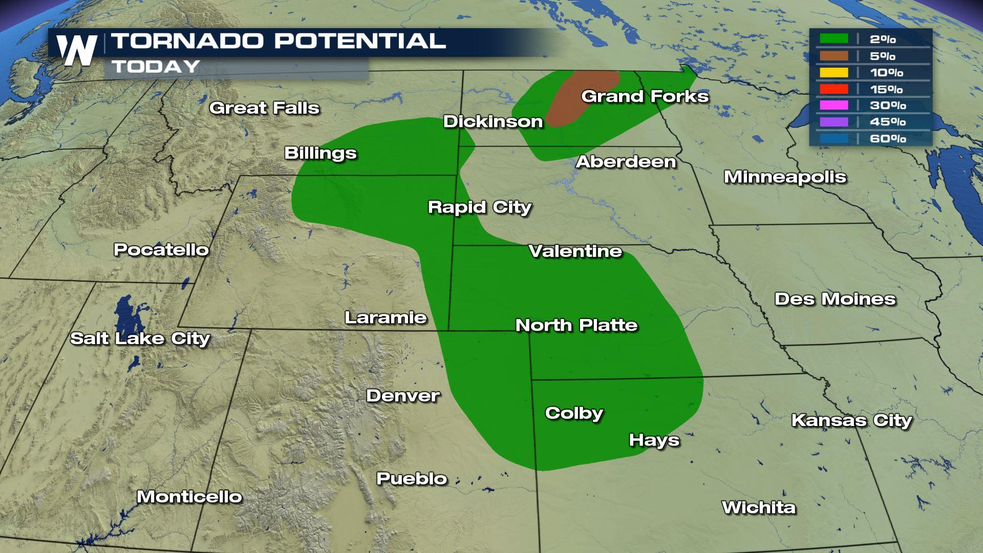
Severe storms likely today for areas in the Northern and Central Plains. Large hail, damaging winds and tornadoes will all be possible. The severe risk will be moving east to start the week so please keep checking with WeatherNation for the latest updates.
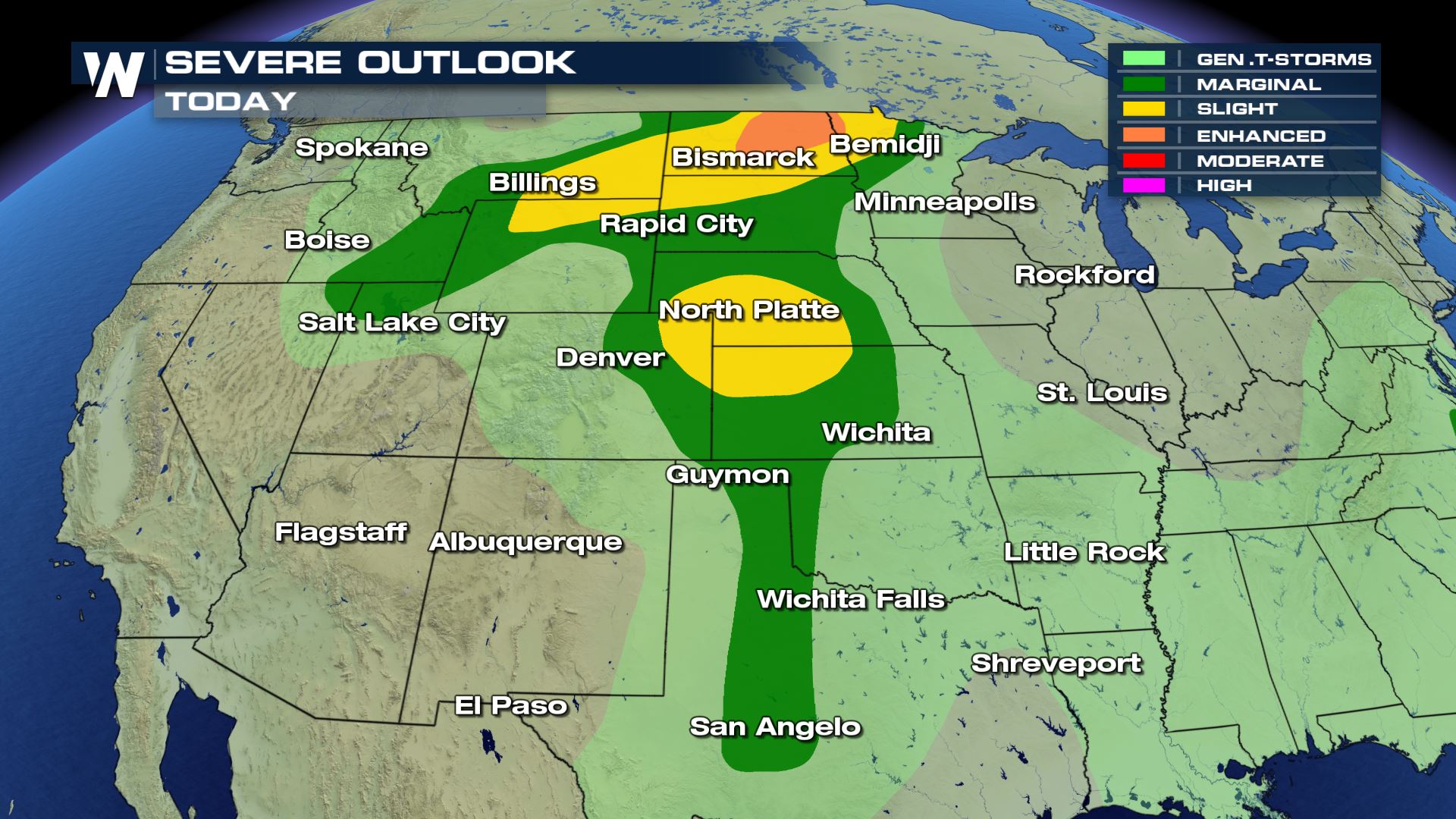 Today's severe risk will be across the Northern and Central Plains and even areas down into Texas and Oklahoma will have the chance for an isolated strong storm.

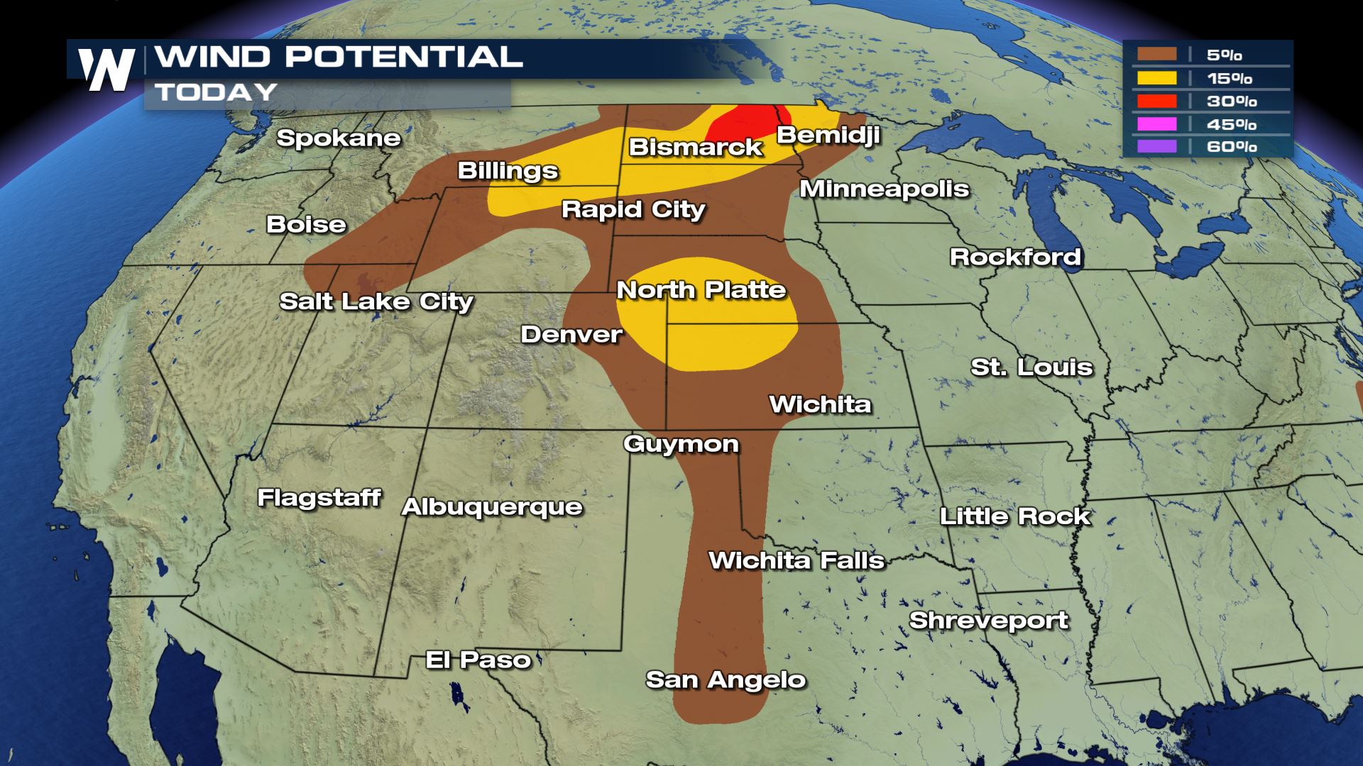
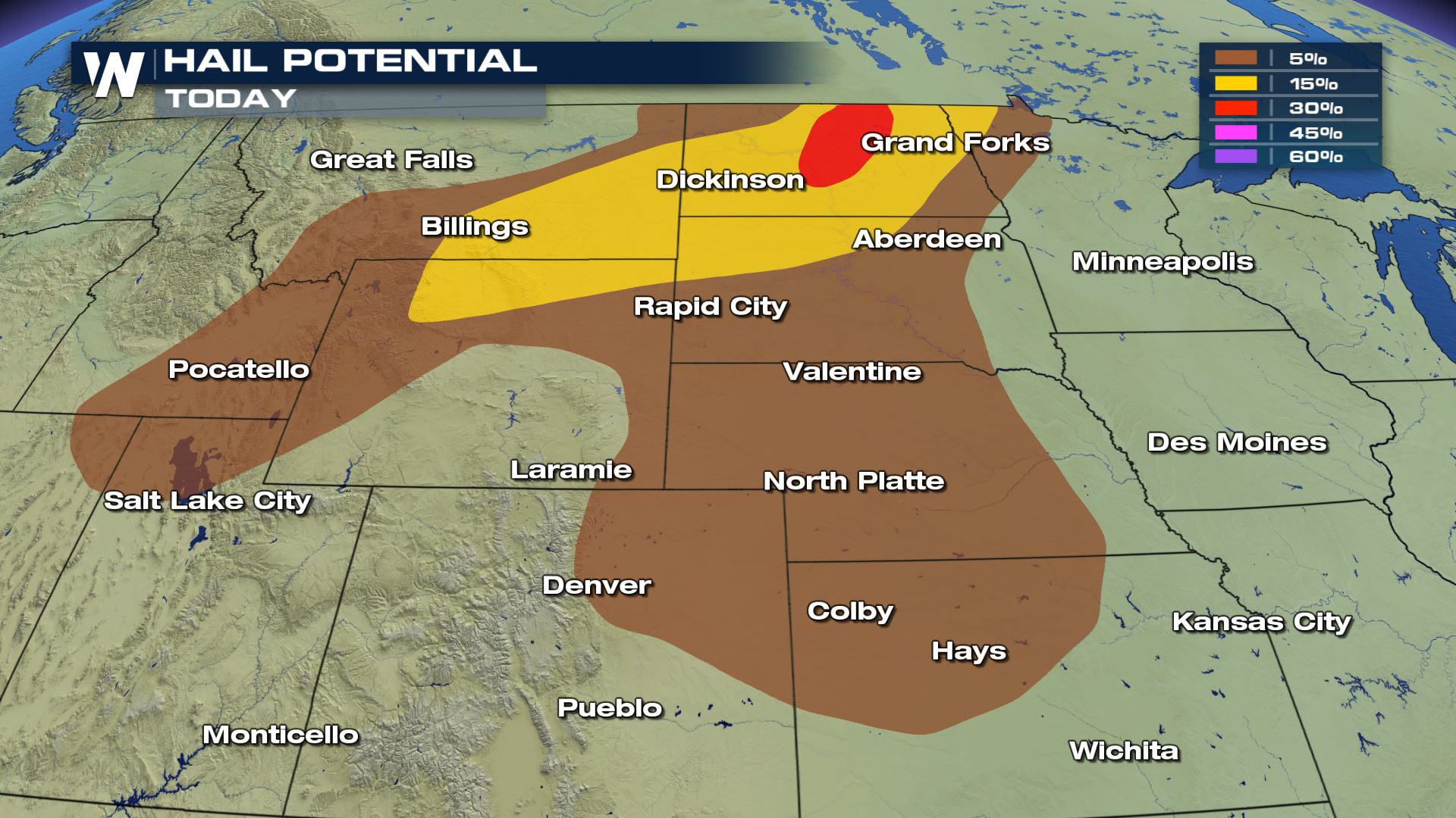 Damaging winds and large hail will be the primary risks with today's storms, but we can't rule out an isolated tornado or two.
 Showers and storms will be firing up later today during the peak heating hours this afternoon. There will be the potential for some storms to linger in the the late night hours so you will want to have a way to get alerts to keep you safe. WeatherNation will have more updates on-air and online.
Severe Outlook
Today's severe risk will be across the Northern and Central Plains and even areas down into Texas and Oklahoma will have the chance for an isolated strong storm.
Severe Risks
Damaging winds and large hail will be the primary risks with today's storms, but we can't rule out an isolated tornado or two.
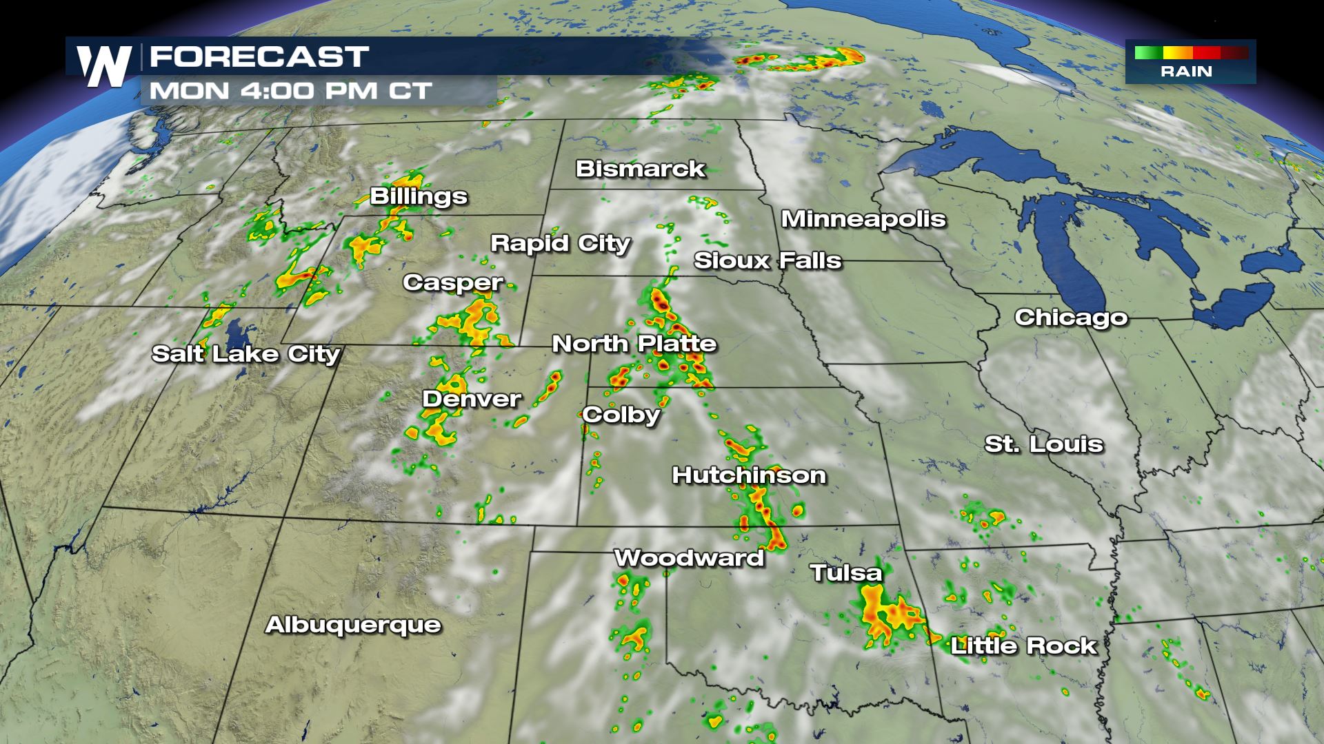
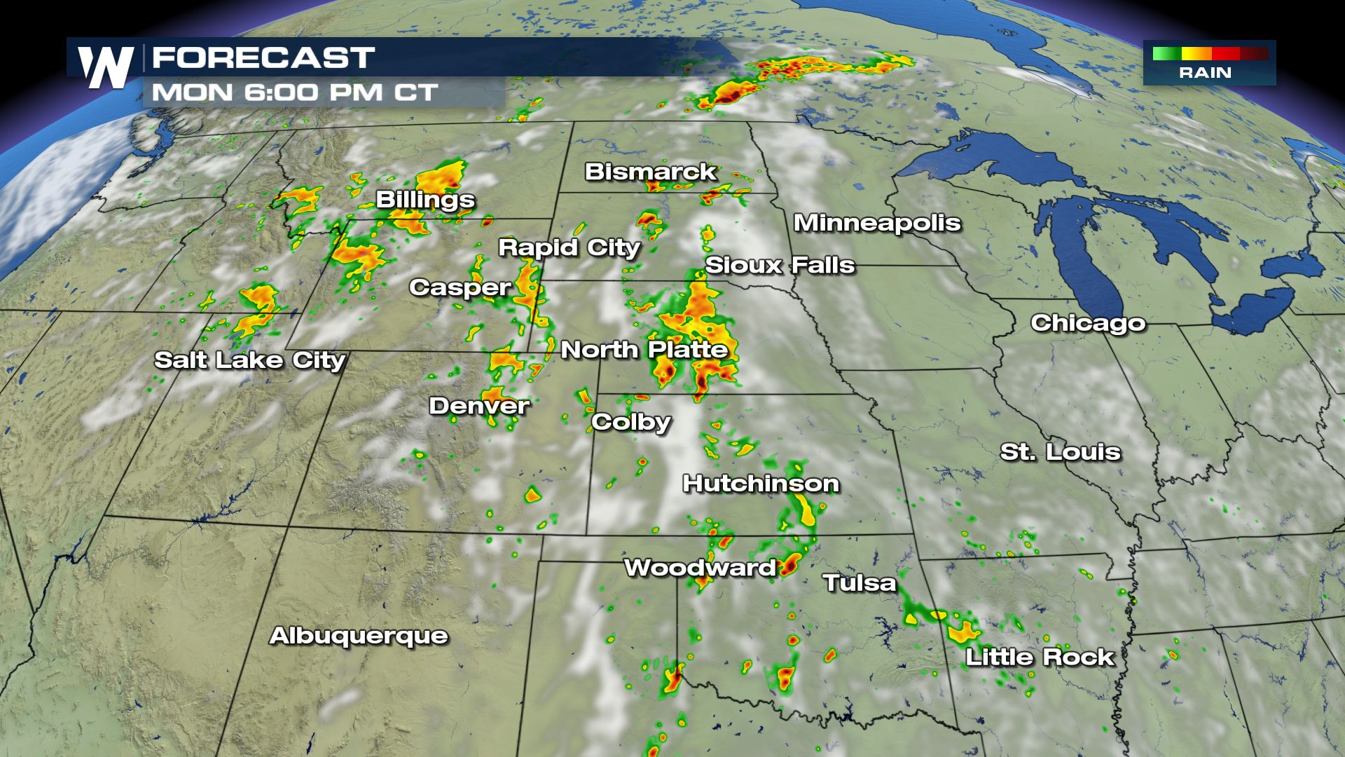
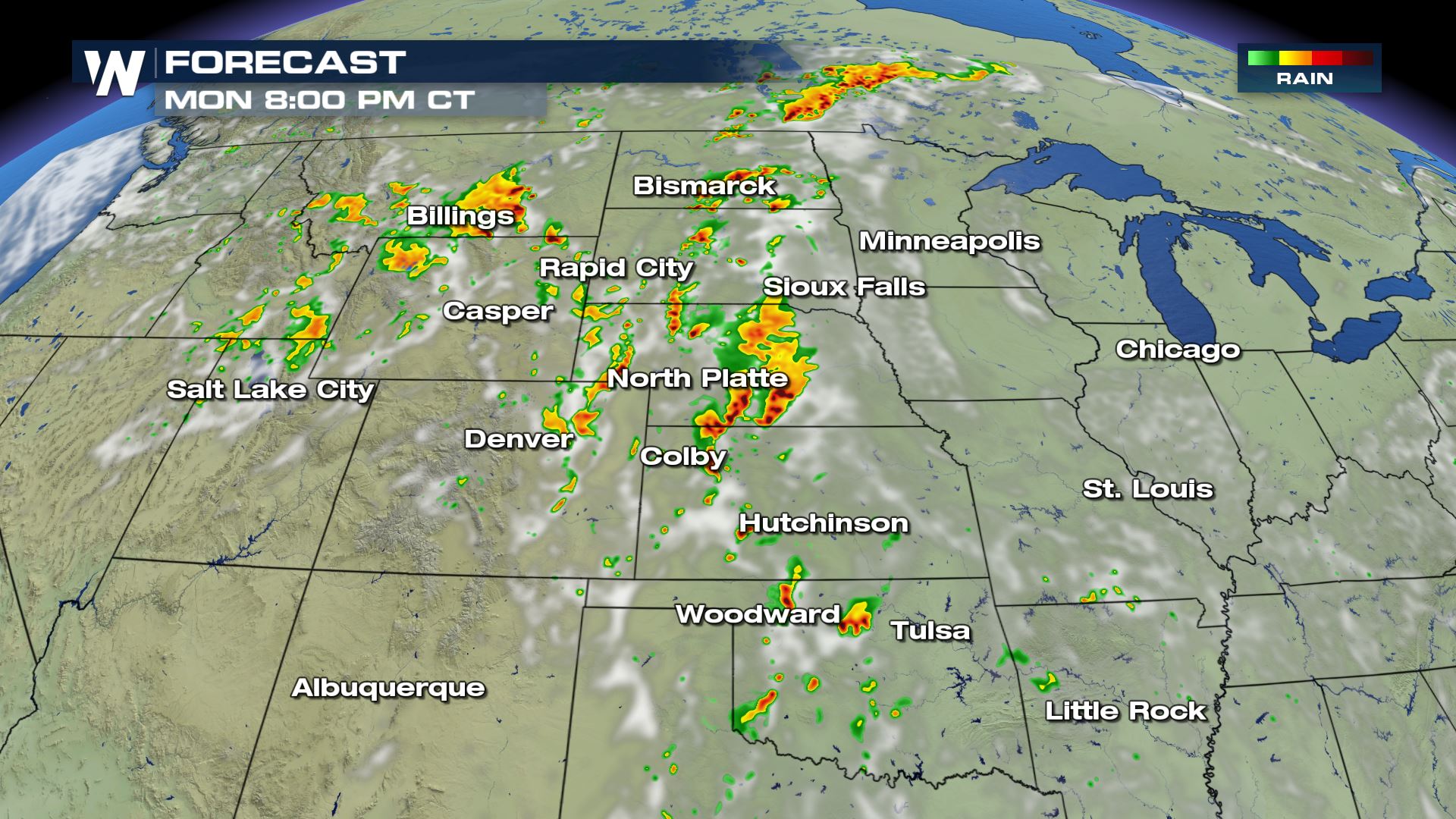
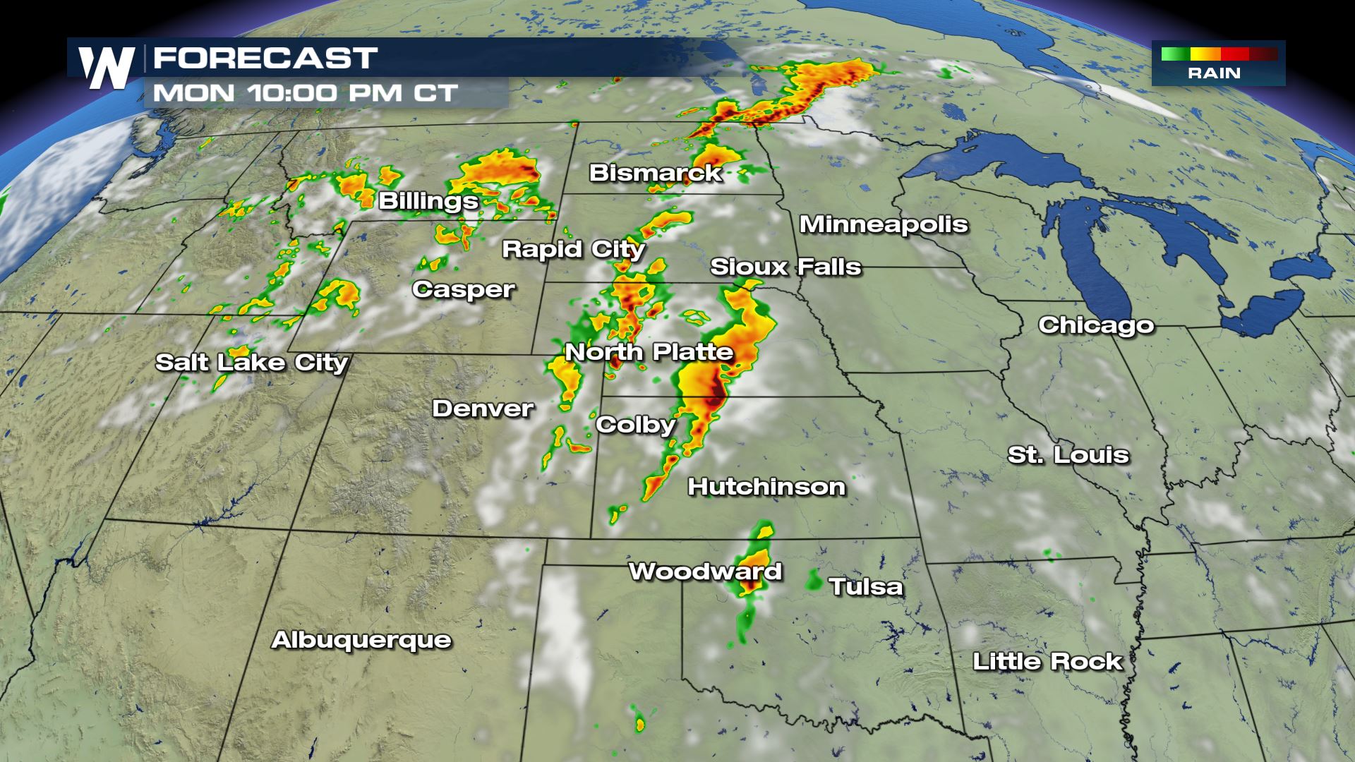
Forecast
Showers and storms will be firing up later today during the peak heating hours this afternoon. There will be the potential for some storms to linger in the the late night hours so you will want to have a way to get alerts to keep you safe. WeatherNation will have more updates on-air and online.
All Weather News
More


More Storms for the East Sunday and Monday
A low-pressure system crashing through the Mi
2 Aug 2026 2:20 AM

After Reaching Category 5, Genevieve Weakens in the Pacific
PacificGenevieve formed on last Friday south
2 Aug 2026 1:30 AM

Flooding, Severe Storms Target the Midwest Again
After an active week of storms across the nor
1 Aug 2026 1:40 AM

Flooding Risk Increases as Heavy Rain Targets the Tri-State Area
Tuesday, heavy rainfall moved across the Nort
30 Jul 2026 12:25 AM

Severe Weather: Energy From the Midwest Now in the Southeast
UPPER MIDWEST - Through Monday, dangerous tor
29 Jul 2026 10:30 PM