Monitoring Tropical Development in the Gulf for the Weekend
Special Stories
24 May 2018 8:19 AM
UPDATE: The National Hurricane Center upgraded the risk for tropical development to 90% over the next five days in the Gulf of Mexico. Stay with WeatherNation for the latest.
https://www.facebook.com/WeatherNation/videos/10156525484329874/
__________________________________________________
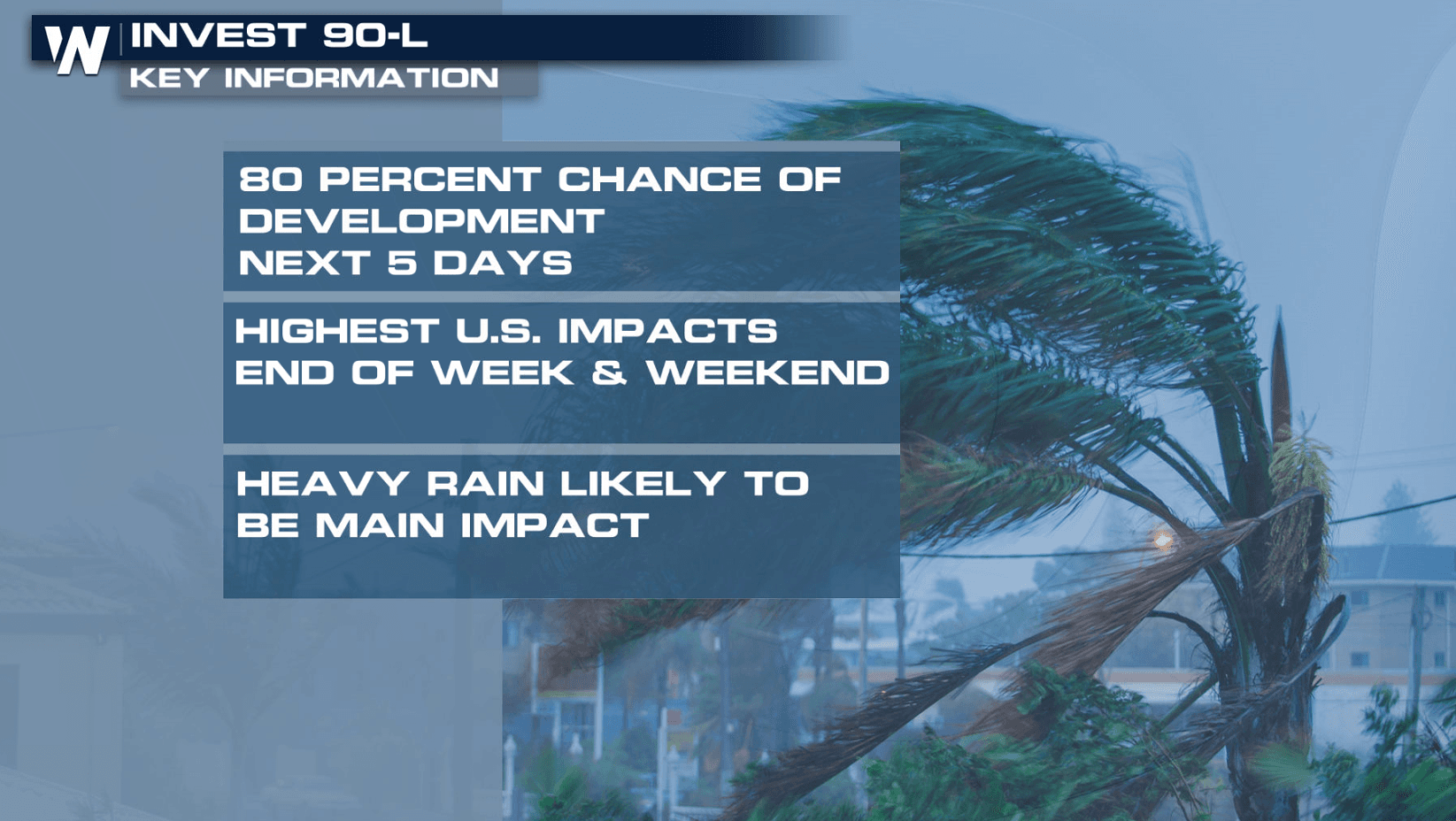
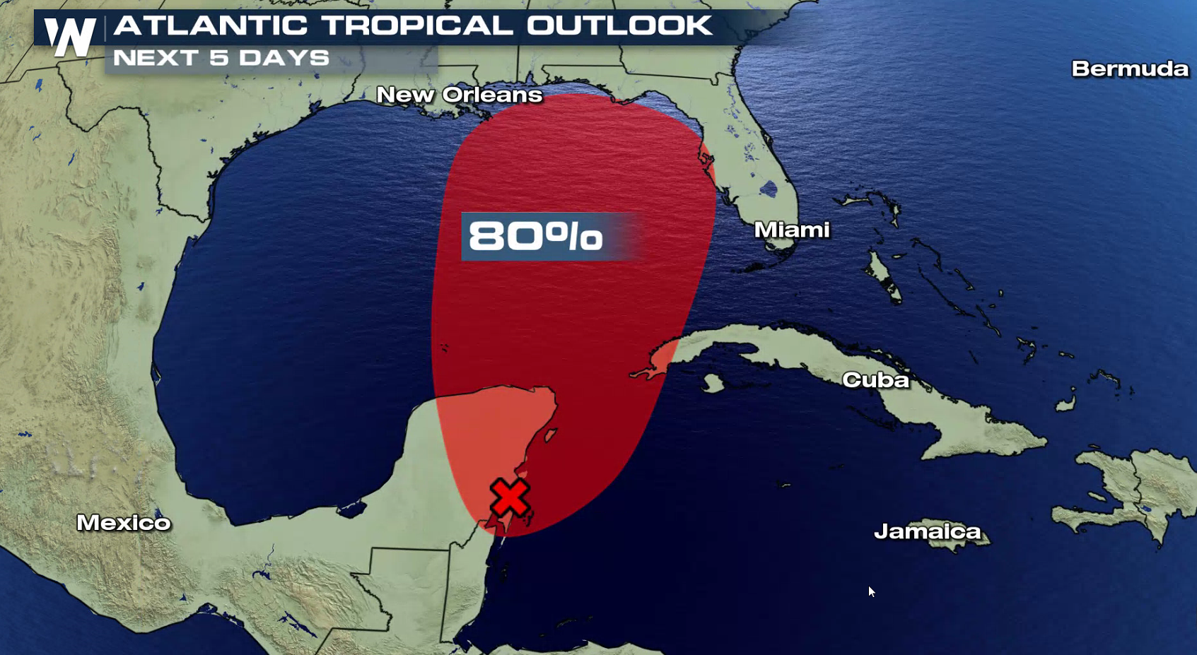
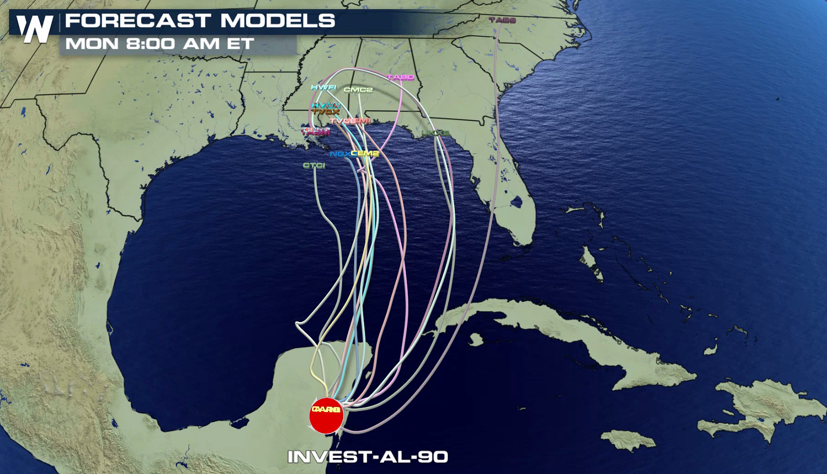
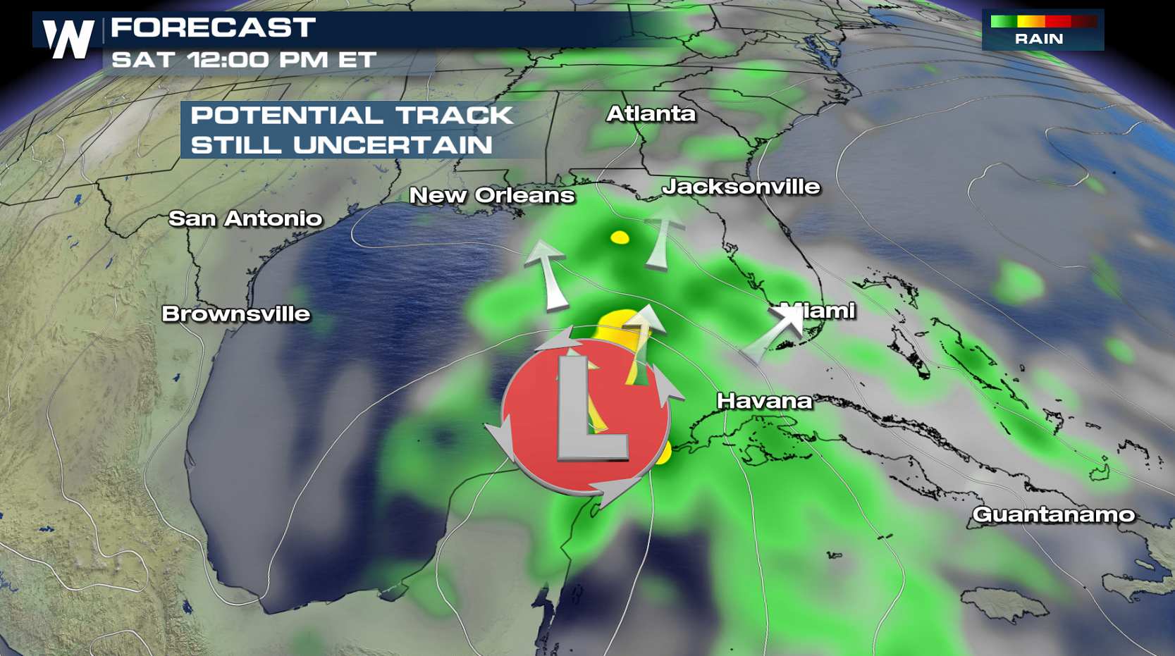
A wet holiday weekend is ahead along the Gulf Coast as the potential for tropical system to develop. The National Hurricane Center now has increased the chance of formation to 80% within the next 5 days.
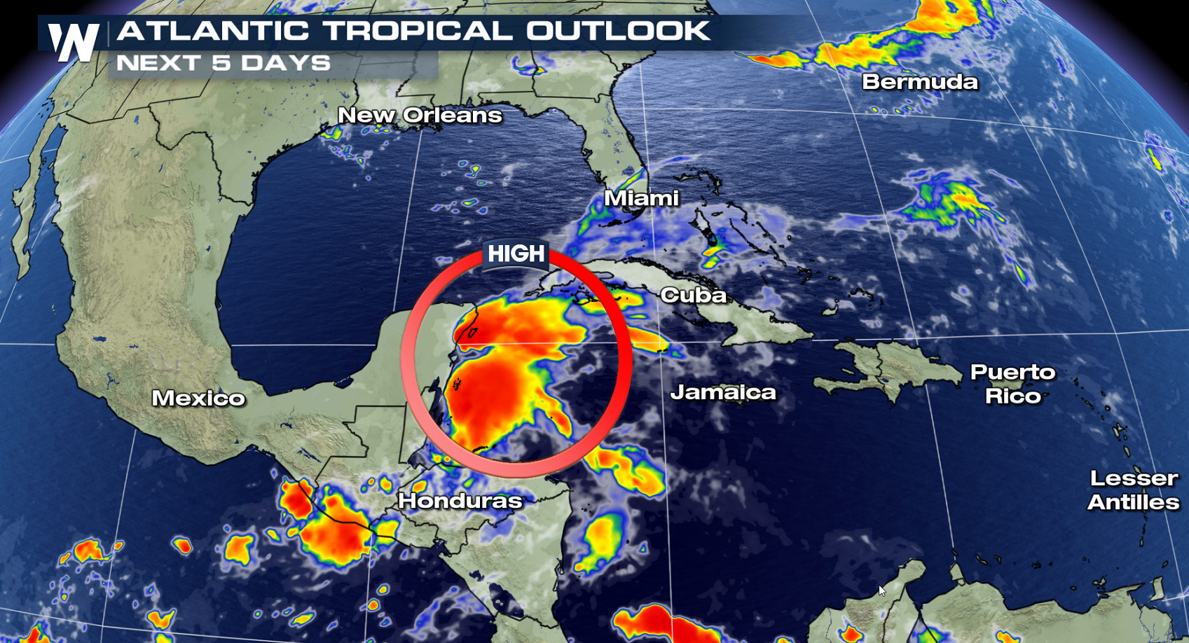
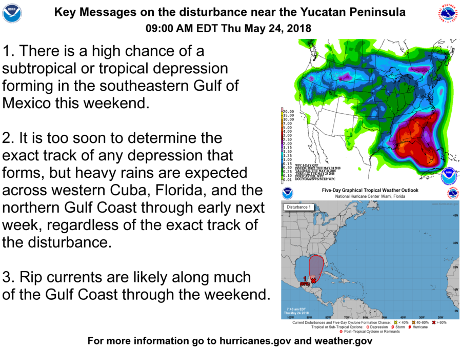 The broad, nearly stationary surface low pressure system is centered over the southeastern Yucatan Peninsula and is gradually becoming better defined. Showers and thunderstorms, along with strong gusty winds, are confined primarily to the adjacent waters of the northwestern Caribbean Sea. Over the next few days, gradual development of this system is expected as it drifts northward near the Yucatan Peninsula.
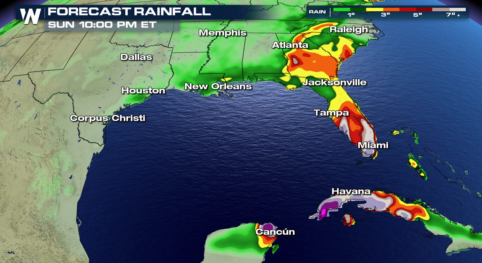
Environmental conditions are forecast to become more conducive for development through early next week, and a subtropical or tropical depression is likely to form by late Saturday over the southeastern Gulf of Mexico. Regardless of development, locally heavy rainfall is forecast across western Cuba and over much of Florida and the northern Gulf Coast into early next week. In addition, the threat of rip currents will steadily increase along the Gulf coast from Florida westward to Louisiana over Memorial Day weekend. Stay tuned to WeatherNation for updates on this potential tropical system.
The broad, nearly stationary surface low pressure system is centered over the southeastern Yucatan Peninsula and is gradually becoming better defined. Showers and thunderstorms, along with strong gusty winds, are confined primarily to the adjacent waters of the northwestern Caribbean Sea. Over the next few days, gradual development of this system is expected as it drifts northward near the Yucatan Peninsula.
Environmental conditions are forecast to become more conducive for development through early next week, and a subtropical or tropical depression is likely to form by late Saturday over the southeastern Gulf of Mexico. Regardless of development, locally heavy rainfall is forecast across western Cuba and over much of Florida and the northern Gulf Coast into early next week. In addition, the threat of rip currents will steadily increase along the Gulf coast from Florida westward to Louisiana over Memorial Day weekend. Stay tuned to WeatherNation for updates on this potential tropical system.
 For WeatherNation: Meteorologist Mace Michaels
The broad, nearly stationary surface low pressure system is centered over the southeastern Yucatan Peninsula and is gradually becoming better defined. Showers and thunderstorms, along with strong gusty winds, are confined primarily to the adjacent waters of the northwestern Caribbean Sea. Over the next few days, gradual development of this system is expected as it drifts northward near the Yucatan Peninsula.
Environmental conditions are forecast to become more conducive for development through early next week, and a subtropical or tropical depression is likely to form by late Saturday over the southeastern Gulf of Mexico. Regardless of development, locally heavy rainfall is forecast across western Cuba and over much of Florida and the northern Gulf Coast into early next week. In addition, the threat of rip currents will steadily increase along the Gulf coast from Florida westward to Louisiana over Memorial Day weekend. Stay tuned to WeatherNation for updates on this potential tropical system.
For WeatherNation: Meteorologist Mace MichaelsAll Weather News
More
Severe Storms Target the Midwest to the Northeast
UPPER MIDWEST - Dangerous tornadoes have alre
28 Jul 2026 1:45 AM

Tropics: Fausto Heads towards Hawaii; Genevieve Cat 4 Hurricane
PacificHurricane Fausto continues to track we
28 Jul 2026 1:45 AM


Southeast Flood Risk Lingers Near Stalled Front
A stalled boundary over the Southeast will ke
25 Jul 2026 10:55 AM

Another Round of Storms Targets the Northeast
Tuesday brought severe weather again across p
23 Jul 2026 1:15 AM

Another Round of Severe Weather for the Upper Midwest and Great Lakes
The upper-level low train continues to keep t
21 Jul 2026 1:45 AM