More Coastal Flooding for New England this Weekend

More heavy rain and coastal flooding will be possible in the Northeast this weekend as another area of low pressure slides through with rain and mountain snow. This comes on the heels of coastal flooding on Wednesday across New England. Coastal flood alerts are in effect from down east Maine, to coastal Mass including the Cape and the Islands, Long Island Sound, coastal New Jersey, and much of the Chesapeake region. These are in effect Friday night through Saturday afternoon for water levels of one to three feet above normal levels, causing minor to moderate flooding at the immediate shoreline.
In addition to the coastal flood threat we have the risk of heavy rainfall, especially from southern New England to North Carolina. Flood alerts are in effect for the region through Saturday for additional flooding from rainfall. The amount of rain doesn't look as widespread compared to earlier in the week, on the order of 1-2" but on top of saturated soils it could be dangerous for urban flooding and high running rivers, creeks and streams.
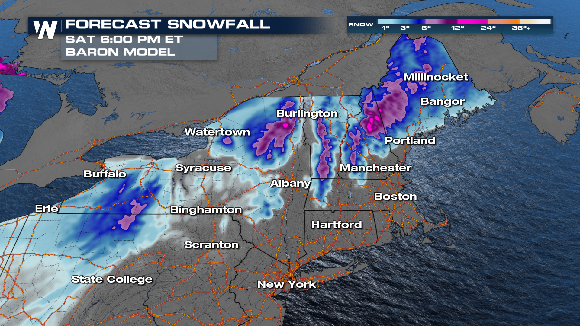
 The low pressure system responsible for rain and snow will bring heaviest snow into eastern Canada but we will also see heavy snow for the northern New England mountains. Upwards of 6" are possible with locally higher totals for the Tug Hill Plateau of northern New York.
 Our storm systems arrives this afternoon and evening. We will see mostly rain along and south of I-90 through New York and New England with snow further north. A couple pockets of icing are possible for the Berkshires of Massachusetts and the southern tier of New York. Most of the rain, snow and ice will wrap up by Saturday afternoon and evening.
The other factor is damaging winds. Our strongest will be overnight Friday into Saturday as the area of low pressure wraps up and passes north of New England. Air will rush into the storms system, gusting upwards of 70 mph for some locations along the coast and lakeshores of Ontario and Erie. This will contribute to the coastal flood threat.


